Mont Blanc is the highest mountain in the Alps and Western Europe, and the highest mountain in Europe outside the Caucasus mountains, rising 4,805.59 m (15,766 ft) above sea level, located on the French-Italian border. It is the second-most prominent mountain in Europe, after Mount Elbrus, and it is the eleventh most prominent mountain summit in the world.

The Cottian Alps are a mountain range in the southwestern part of the Alps. They form the border between France and Italy (Piedmont). The Fréjus Road Tunnel and Fréjus Rail Tunnel between Modane and Susa are important transportation arteries between France and Italy (Turin).
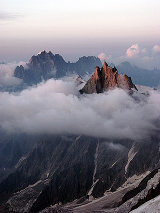
The Aiguille du Midi is a 3,842-metre-tall (12,605 ft) mountain in the Mont Blanc massif within the French Alps. It is a popular tourist destination and can be directly accessed by cable car from Chamonix that takes visitors close to Mont Blanc.

Monte Rosa is a mountain massif in the eastern part of the Pennine Alps, on the border between Italy and Switzerland (Valais). The highest peak of the massif, amongst several peaks of over 4.000 m, is the Dufourspitze, the second highest mountain in the Alps and western Europe, after Mont Blanc. The east face of the Monte Rosa towards Italy has a height of about 2.400 meters and is the highest mountain wall of the Alps.

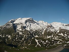
Mont Cenis is a massif in Savoie (France), which forms the limit between the Cottian and Graian Alps.

The Susa Valley is a valley in the Metropolitan City of Turin, Piedmont region of northern Italy, located between the Graian Alps in the north and the Cottian Alps in the south. It is one of the longest valleys of the Italian Alps. It extends over 50 kilometres (31 mi) in an east-west direction from the French border to the outskirts of Turin. The valley takes its name from the city of Susa which lies in the valley. The Dora Riparia river, a tributary of the Po, flows through the valley.

Mont Blanc de Courmayeur is a point on the south-east ridge of Mont Blanc that forms the peak of the massive south-east face of the mountain. It is connected to the main summit via the Col Major.

Mont d'Ambin or Rocca d'Ambin is a mountain on the border of Savoie, France and of the Province of Turin, Italy. It lies in the Ambin group of the Cottian Alps. On the Italian side, it commands the view of the Val di Susa. It has an elevation of 3,378 metres (11,083 ft) above sea level. The Mont d'Ambin base tunnel of the Lyon–Turin rail link is being dug at its base.

Aiguille de Scolette or Pierre Menue is a mountain of Savoie (F) and of the province of Turin (I). It lies in the Cottian Alps and has an elevation of 3,506 metres above sea level.
Pointe de Paumont or Cima del Vallone is a mountain of Savoie, France and of the Province of Turin, Italy. It lies in the Cottian Alps range. It has an elevation of 3,171 metres above sea level.

Punta Bagnà or Cime du Grand Vallon is a mountain of Savoie, France and of the Province of Turin, Italy. It lies in the Cottian Alps range. It has an elevation of 3,129 metres above sea level.

Punta Sommeiller or Pointe Sommeiller is a mountain of the Province of Turin, Italy and of Savoie, France. It lies in the Cottian Alps range. It has an elevation of 3,333 metres (10,935 ft) above sea level.

Rognosa d'Etiache or Rognosa d'Étache is a mountain in the Cottian Alps on the border of Turin, Italy, and Savoie, France. It has an elevation of 3,382 metres above sea level.

The Cima Mongioia or simply Mongioia or Bric de Rubren is a 3,340 metres high mountain of the Cottian Alps.

The Punta Nera is a mountain of Savoie (France) and of the Province of Turin (Italy). It lies in the Cottian Alps range. It has an elevation of 3,047 metres above sea level.

Le Grand Argentier is a mountain of Savoie (France). It lies in the Cottian Alps range at an elevation of 3,042 metres (9,980 ft) above sea level.

The Mount Chenaillet is a 2,650 metres high mountain of the Cottian Alps, located on the Main chain of the Alps South of the Col de Montgenèvre.
The Signal du Petit Mont-Cenis is a 3,162 m high mountain of the Cottian Alps.

The Pointe de Bellecombe is a 2,775 m high mountain of the northern Cottian Alps.
The Testa di Comagna is a 2,106 metres high peak on the Italian side of the Pennine Alps.