Monte Pietra Ardena

Last updated
Monte Pietra Ardena
Pietra Ardena vista da sud.png
View from the south
Highest point
Elevation 1,103 m (3,619 ft)
Prominence 128 m (420 ft)
Coordinates 44°11′25″N8°01′18″E / 44.190187°N 8.021618°E / 44.190187; 8.021618
Geography
Italy relief location map.jpg
Red triangle with thick white border.svg
Monte Pietra Ardena
Country Italy
Province Province of Cuneo
Region Piedmont

Mount Pietra Ardena is a mountain in the Ligurian Prealps with a height of 1103 m. [1]

Contents

Toponym

The mountain was also once called Pietra Degna. [2]

Description

The antennas of Pietra Ardena, in the background the houses of Garessio Pietra Ardena antenne.png
The antennas of Pietra Ardena, in the background the houses of Garessio

The mountain is located in the Upper Tanaro Valley, on the Po Valley side of the main Alpine chain. It falls within the territory of the municipality of Garessio, of which it dominates the main town. [3] From the mountain rises southward a ridge that, after losing altitude with the Colletto del Pennino (969 m), rises with two unnamed reliefs at 1049 m and 1025 m, [1] and then joins the main chain at Monte Pennino (1272 m). The topographic prominence of Pietra Ardena is 128 m, and its lowest point is located at the Colletto di Pennino. [4] Just north of the summit are some telecommunication antennas. [5] A metal summit cross stands on the summit point.

Geology

The mountain from the valley floor Pietra Ardena da fondovalle.png
The mountain from the valley floor

Pietra Ardena consists of rocks of Triassic origin. [6]

At the base of the mountain is a cave, long known among scholars for its entomofauna, [7] and particularly for beetles. [8] Also known as "Grotta del Falconiere" [7] or "Garbo del Pare," it is located at an elevation of 680 meters and is around 20 meters long. [9]

History

The wooded area around the Pietra Ardena in the Middle Ages is said to have given refuge to Adelasia (or Alasia), daughter of Emperor Otto I of Saxony, and Aleramo, founder of the lineage of the March of Montferrat. [10] The two, whose love was initially opposed by the girl's father, are said to have lived in those wild places working as charcoal burners until, thanks to the mediation of the bishop of Albenga, Aleramo was reconciled with his father-in-law. [11] Historian Leandro Alberti, referring to the mountain by its ancient toponym Pietra Degna, brings in support of this legend the remains of a cistern that were located near the summit. [12] In 1871 librettist Leopoldo Marenco titled his opera Il falconiere di Pietra Ardena after the story.

Near the top of the mountain the remains of trenches that the Savoy army built in preparation for the Battle of Loano in 1795 are still visible. [13]

Access to the summit

The summit cross and, in the background, Mount Galero Pietra Ardena croce di vetta sfondo monte Galero.png
The summit cross and, in the background, Mount Galero
Pietra Ardena and, in the background, the Bric Mindino Pietra Ardena da Poggio Coppa d'Oro sfondo MIndino.png
Pietra Ardena and, in the background, the Bric Mindino

The summit of Pietra Ardena can be reached by trail from various locations. [1] One of the routes starts from the historic center of Garessio, reaching the summit after passing through the "Colletto di Pennino"; [13] it is also possible to ascend from Colle San Bernardo. [14]

Mountaineering

While the ascent to the summit of Pietra Ardena is not of mountaineering interest, there are several rocky spires not far from it that offer climbing opportunities. The best known one is known locally as La Madonnina (or also as Madonna di Pietra Ardena); the first known ascent dates back to 1928 and was carried out by some members of the "Alpine Club" of Garessio. The pinnacle rises from the slopes of the mountain by about 30 meters and is made of solid rock of a calcareous nature. [15]

Other images

See also

Related Research Articles

<span class="mw-page-title-main">Ligurian Alps</span> Mountain range in Italy and France

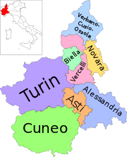
The Ligurian Alps are a mountain range in northwestern Italy. A small part is located in France. They form the south-western extremity of the Alps, separated from the Apennines by the Colle di Cadibona. The Col de Tende and the Vermenagna valley separate them from the Maritime Alps. They form the border between Piedmont in the north and Liguria in the south.

<span class="mw-page-title-main">Monte Settepani</span> Mountain in Italy

Monte Settepani is 1,386 metres high mountain in Liguria, northern Italy, part of the Ligurian Prealps.

<span class="mw-page-title-main">Colle San Bernardo</span> Mountain pass in Italy

Colle San Bernardo (957 m) is a mountain pass in the Province of Cuneo (Italy).

<span class="mw-page-title-main">Monte Monega</span> Mountain in Italy

Monte Monega is a 1,882-metre (6,175 ft) mountain of the Ligurian Alps, in Italy.

<span class="mw-page-title-main">Carmo di Brocchi</span> Mountain in Italy

Carmo di Brocchi is a 1,610-metre (5,282 ft) mountain of the Ligurian Alps, in Italy.

<span class="mw-page-title-main">Monte Spinarda</span> Mountain in Italy

Monte Spinarda is a 1,357-metre (4,452 ft) mountain of the Ligurian Prealps in Italy.

<span class="mw-page-title-main">Cime de Missun</span> Mountain in Italy

The Cime de Mussun (French) or Cima Missun (Italian) is a mountain of the Ligurian Alps.

<span class="mw-page-title-main">Bric Costa Rossa</span> Mountain in Italy

The Bric Costa Rossa is a mountain of the Ligurian Alps located in Piedmont.

<span class="mw-page-title-main">Cima della Fascia</span> Mountain in Italy

The Cima della Fascia is a mountain of the Ligurian Alps located in Piedmont.

<span class="mw-page-title-main">Monte Mongioie</span> Mountain in Italy

The Monte Mongioie is a mountain of the Ligurian Alps located in Piedmont.

<span class="mw-page-title-main">Monte Antoroto</span> Mountain in Italy

The Monte Antoroto is a mountain of the Ligurian Alps located in Piedmont.

<span class="mw-page-title-main">Cima delle Saline</span> Mountain in Italy

The Cima delle Saline is a mountain of the Ligurian Alps located in Piedmont.

<span class="mw-page-title-main">Punta Mirauda</span> Mountain in Italy

The Punta Mirauda is a mountain of the Ligurian Alps located in Piedmont.

<span class="mw-page-title-main">Monte Cianea</span> Mountain in Italy

Monte Cianea is a 1,226-metre (4,022 ft) mountain of the Ligurian Prealps, in Italy.

<span class="mw-page-title-main">Cima Cars</span> Mountain in Italy

The Cima Cars is a mountain of the Ligurian Alps located in Piedmont.

<span class="mw-page-title-main">Monte Peso Grande</span> Mountain in Italy

Monte Peso Grande o Castell'Ermo (1.092 m) is a mountain of the Ligurian Prealps, the eastern section of the Ligurian Alps.

<span class="mw-page-title-main">Monte Camulera</span> Mountain in Italy

The Monte Camulera is a mountain of the Ligurian Prealps, the eastern section of the Ligurian Alps.

<span class="mw-page-title-main">Monte Alpe</span> Mountain in Italy

The Monte Alpe is a mountain of the Ligurian Prealps, the eastern section of the Ligurian Alps.

The Ligurian Prealps are a mountain range in northwestern Italy. They belong to the Ligurian Alps and are located between the regions of Piemonte and Liguria. Their highest summit is the monte Armetta, at an elevation of 1,739 metres (5,705 ft).

<span class="mw-page-title-main">Monte Pietraborga</span> Mountain in Italy

Monte Pietraborga is a mountain in the Cottian Alps, Metropolitan City of Turin in Piedmont, north-western Italy. It is located between the comuni of Trana and Sangano.

References

  1. 1 2 3 Fraternali , 1:25.000 map).
  2. Luigi De Bartolomeis (1847). "Mandamento di Garessio". Notizie topografiche e statistiche sugli Stati Sardi opera preceduta dalle teorie generali sulla statistiche e speciali alle riconoscenze militari. Vol. 1–3. Tipografia Chirio e Mina. p. 35. Retrieved 2023-04-20.
  3. "7 Le valli di Albenga". Liguria. 1981. p. 441. Retrieved 5 April 2023.
  4. "Monte Pietra Ardena, Italy". Peakbagger.com. Retrieved 8 April 2023.
  5. "Gli impianti della provincia di Cuneo". OTG Tv - Tutto sulle TV italiane. Retrieved 8 April 2023.
  6. AA.VV. (Comitato geologico) (1909). Bollettino del Servizio geologico d'Italia. Vol. 40. Tipografia nazionale - Servizio geologico. p. 32. Retrieved 10 April 2023.
  7. 1 2 AA.VV. (1900). Bollettino - Numero 66. Vol. 33. Club alpino italiano. p. 87. Retrieved 9 April 2023.
  8. Müller, Giuseppe (1930). I coleotteri cavernicoli italiani (PDF). Istituto italiano di speleologia. Retrieved 10 April 2023.
  9. "Catasto Speleologico del Piemonte e della Valle d'Aosta - Foglio 1" . Retrieved 2023-04-09.
  10. Ferrarone, Nico (1968). Il Piemonte e la Valle d'Aosta - panorama storico-georafico-artistico e turistico delle regioni. Cappelli. p. 131. Retrieved 9 April 2023.
  11. Delfino Muletti (1829). Memorie storico-diplomatiche appartenenti alla cittá ed ai marchesi di Saluzzo. Vol. tomo 1. note di Carlo. Domenico Lobetti-Bodoni. p. 284. Retrieved 9 April 2023.
  12. Alberti, Leandro (1588). Descrittione di tutta l'Italia. Venezia: Presso Altobello Salicato. p. 371.
  13. 1 2 "Colletto Pennino - Fontana delle Meraviglie". Città di Garessio. Retrieved 30 March 2023.
  14. Istituto Geografico Militare , 1:25.000 map).
  15. CAI-TCI , Alpi liguri, pp. 248-249).

Bibliography

Cartography