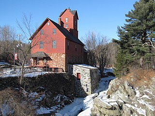
The Taftsville Historic District encompasses a historic 19th-century industrial village that is mostly in Woodstock, Vermont. Flanking the Ottauquechee River and extending up Happy Valley Road, the area developed around a metal tool factory established by members of the Taft family in 1793. Important elements from its early history include the Taftsville Store, built by the Taft family in 1840, and the Taftsville Covered Bridge, built in 1836. The district was listed on the National Register of Historic Places in 2001.

The Waterville Village Historic District encompasses most of the history 19th and early 20th-century village center of Waterville, Vermont. The village grew from beginnings late in the 18th century to serve as a modest civic, commercial, and residential hub for the rural community. It was added to the National Register of Historic Places in 2007.

The Moore's Corner Historic District of Leverett, Massachusetts, encompasses the historic rural mill village of Moore's Corner. Centered on the intersection of North Leverett Road with Dudleyville Road, Church Hill Road, and Rattlesnake Gutter Road, it includes 15 houses and several other buildings, mainly from the village's mid-19th century peak as a modest rural village center. The district was listed on the National Register of Historic Places in 2014.

The Lower Village District encompasses a historic industrial area down the Sugar River a short way from the historic center of Claremont, New Hampshire. The area was developed beginning in the 1830s by the Claremont Mill Company, and extends on either side of the river roughly from the Main Street crossing in the west to the junction of Main and Central Streets.

The Wiswall Falls Mill Site is a historic archaeological industrial site in Durham, New Hampshire. It is located in John Hatch Park, a small public park just south of Wiswall Road on the eastern bank of the Lamprey River. The 3-acre (1.2 ha) site encompasses the remains of a small 19th-century mill complex that was one of Durham's major industrial sites of the 19th century until it burned in 1883. The site, which includes remains of the waterworks and foundations, was listed on the National Register of Historic Places in 1988.

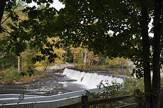
The Green River Crib Dam is a historic 19th-century dam on the Green River in western Guilford, Vermont. Built about 1811, it is a reminder of the modest industrial enterprises once conducted in the area using the water power it provided, and is one of the state's few surviving crib dams. It was listed on the National Register of Historic Places in 1995.

The Parker Hill Rural Historic District encompasses a large rural agricultural landscape in eastern Windham and Windsor counties in the US state of Vermont. Roughly centered on Parker Hill Road in northern Rockingham and southern Springfield, the district exhibits a history of 200 years of farming, including a collection of Federal period farm housing. The district was listed on the National Register of Historic Places in 1993.

The Rockingham Village Historic District encompasses the traditional village center of the town of Rockingham, Vermont. Settled in the 18th century, the district, located mainly on Meeting House Road off Vermont Route 103, includes a variety of 18th and 19th-century houses, and has been little altered since a fire in 1908. It notably includes the 18th-century National Historic Landmark Rockingham Meeting House. The district was listed on the National Register of Historic Places in 2008.

The Whitingham Village Historic District encompasses much of the current village center of Whitingham, Vermont. It was developed mainly in the second half of the 19th century around industries powered by local water sources, and includes well-preserved architecture from that period. It was listed on the National Register of Historic Places in 2006.

The Bethel Village Historic District encompasses the historic core of the village of Bethel in the town of Bethel, Vermont, USA. The L-shaped district extends along Main and Church Streets, including many of the village's commercial and civic buildings, as well as a significant number of 19th and early 20th-century residences. The district was listed on the National Register of Historic Places in 1976, and was slightly enlarged in 1990.

The Bridgewater Woolen Mill, now more commonly the Bridgewater Mill Mall, is a historic textile mill complex on United States Route 4 in Bridgewater and Woodstock, Vermont. With a textile processing history dating from 1828 to 1975, it was one of the state's longest-lived textile operations, and was a mainstay of the local economy during that period. It has since been repurposed into a shopping center. It was listed on the National Register of Historic Places in 1976.

The Quechee Historic Mill District encompasses the historic heart of the village of Quechee, Vermont, a well-preserved 19th-century mill village. Extending along Quechee Main Street between the Old Quechee Road and the Quechee-West Hartford Road, the village was settled in the 1760s, and has an industrial history extending into the 20th century. It was listed on the National Register of Historic Places in 1997.

The Springfield Downtown Historic District encompasses the historic central business district of the town of Springfield, Vermont. Located in a narrow valley on the banks of the Black River, the town's architecture is primarily reflective of its importance as a manufacturing center in the late 19th and early-to-mid 20th centuries, with a cluster of commercial buildings surrounded by residential and industrial areas. It was listed on the National Register of Historic Places in 1983, and enlarged slightly in 1986.

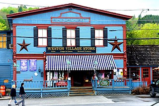
The Weston Village Historic District encompasses the town center and principal village of Weston, Vermont. Centered on Farrar Park, which serves as the town green, it includes a diversity of architectural styles from the late 18th century to about 1935, and includes residential, civic, commercial, industrial and religious buildings. It was listed on the National Register of Historic Places in 1985.

The Thetford Center Historic District encompasses the village of Thetford Center in Thetford, Vermont. The village contains a well-preserved collection of early to mid-19th century architecture, a legacy of its period of greatest prosperity as an agricultural and industrial center. It was listed on the National Register of Historic Places in 1998.

The Tunbridge Village Historic District encompasses the early 19th-century village center of Tunbridge, Vermont. Stretched linearly along Vermont Route 110, the largely agricultural village reached its peak population around 1820, and was bypassed by the railroads, limiting later development. It was listed on the National Register of Historic Places in 1994.

The Kents Corner Historic District encompasses a well-preserved 19th-century crossroads hamlet in Calais, Vermont. Centered on the junction of Kent Hill Road, Old West Church Road, and Robinson Cemetery Road, it developed as a stagecoach stop with a small industrial presence. It was listed on the National Register of Historic Places in 1973, and substantially enlarged in 2006.

The Downtown Richford Historic District encompasses a cluster of commercial and industrial buildings at the center of Richford, Vermont. Centered on the junction of Main and River Streets are a cluster of mainly brick buildings, built between 1880 and 1920, with several industrial properties just across the Missisquoi River to the south, whose waters provided the power for the industries that fueled the town's growth. The district was listed on the National Register of Historic Places in 1980.

The Jericho Village Historic District encompasses the historic industrial and commercial center of the village of Jericho, Vermont. Stretched along Vermont Route 15 south of Browns River, which powered the village's industries for many years, the village center includes a well-preserved array of 19th and early 20th-century buildings. The district was listed on the National Register of Historic Places in 1992.

The Thresher Mill is a historic industrial facility on West Barnet Road in Barnet, Vermont. First developed in 1836, it was the last water-powered mill to operate on the Stevens River, lasting into the late 20th century. The property, which includes an original mill dam and a surviving 1872 mill building, as well as archaeological sites of other industrial buildings, was listed on the National Register of Historic Places in 1996. It is now styled Ben's Mill, and is a local museum.


