
Bradford is a census-designated places in the town of Bradford, Orange County, Vermont, United States. The population was 907 at the 2020 census. The village disincorporated on December 1, 2004. The village became a census-designated place in 2008. The central commercial and residential portion of the village is listed on the National Register of Historic Places as the Bradford Village Historic District.

The Cambridge Meetinghouse, also known locally as the Old Brick Church is a historic meetinghouse at 85 Church Street in Jeffersonville, the main village of Cambridge, Vermont. Built in 1826 as a union church for several denominations, it began use as the local town hall in 1866, a use that continued to 1958. It was listed on the National Register of Historic Places in 1981. It presently houses the local post office.

The Waterville Village Historic District encompasses most of the history 19th and early 20th-century village center of Waterville, Vermont. The village grew from beginnings late in the 18th century to serve as a modest civic, commercial, and residential hub for the rural community. It was added to the National Register of Historic Places in 2007.
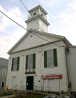
The Putney Village Historic District encompasses most of the main village and town center of Putney, Vermont. Settled in the 1760s, the village saw its major growth in the late 18th and early 19th century, and includes a cohesive collection with Federal and Greek Revival buildings, with a more modest number of important later additions, including the Italianate town hall. The district was listed on the National Register of Historic Places in 1986.
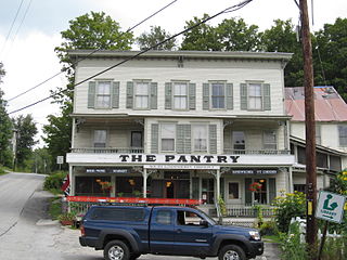
The South Londonderry Village Historic District encompasses a significant portion of the historic developed area of the village of South Londonderry, Vermont. The village has a well-preserved mid-19th century core, with most of its major development history taking place between about 1806 and 1860. The district was listed on the National Register of Historic Places in 1986.

The Dorset Village Historic District encompasses a significant portion of the village center of Dorset, Vermont. Centered at the junction of Church Street, Kent Hill Road, and Vermont Route 30, the village was developed between the late 18th and early 20th centuries, and has a number of well-preserved unusual features, including sidewalks of marble from local quarries. The district was listed on the National Register of Historic Places in 1985, and was enlarged to the west in 1997.

The East Arlington Village Historic District encompasses the historic core of a 19th-century village in Arlington and Sunderland, Vermont, United States. It is centered on Old Mill Road, and developed as a mill village beginning in the 18th century. It was listed on the National Register of Historic Places in 1996.

The Danby Village Historic District encompasses much of the town center of Danby, Vermont. It is centered on a stretch of Main Street, roughly between Depot Street and Brook Road. The village has a cohesive collection of mid-19th century architecture, mostly residential, with a modest number of later additions. The district was listed on the National Register of Historic Places in 1983.

The Middletown Springs Historic District encompasses most of the village center of Middletown Springs, Vermont. Oriented around the crossroads junction of Vermont Routes 140 and 133, the village has a well-preserved collection of mainly mid-19th century architecture, including a significant number of Italianate buildings. The district was listed on the National Register of Historic Places in 1985.
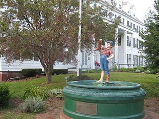
The Wallingford Main Street Historic District encompasses the historic portions of the village of Wallingford, Vermont. An essentially linear district extending along Main Street on either side of School Street, it has a well-preserved array of 19th and early-20th century residential, commercial, and civic buildings. It was listed on the National Register of Historic Places in 1984.

The Bethel Village Historic District encompasses the historic core of the village of Bethel in the town of Bethel, Vermont, USA. The L-shaped district extends along Main and Church Streets, including many of the village's commercial and civic buildings, as well as a significant number of 19th and early 20th-century residences. The district was listed on the National Register of Historic Places in 1976, and was slightly enlarged in 1990.

The Chelsea Village Historic District encompasses the historic village center of Chelsea, Vermont, the shire town of Orange County. Developed in the first half of the 19th century as a regional service and transportation hub, the village exhibits a significant number of Greek Revival buildings, augmented with primarily later civic and commercial buildings. It was listed on the National Register of Historic Places in 1983.

The Randolph Center Historic District encompasses the historic early town center of Randolph, Vermont. Established in 1783, it was later eclipsed by Randolph Village, which developed around the town's main railroad depot. The village now has a distinguished array of late 18th and early 19th-century architecture, and is home to an academic campus now housing the Vermont Technical College. It was listed on the National Register of Historic Places in 1974.
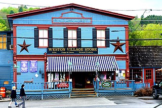
The Weston Village Historic District encompasses the town center and principal village of Weston, Vermont. Centered on Farrar Park, which serves as the town green, it includes a diversity of architectural styles from the late 18th century to about 1935, and includes residential, civic, commercial, industrial and religious buildings. It was listed on the National Register of Historic Places in 1985.
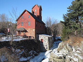
The Jericho Village Historic District encompasses the historic industrial and commercial center of the village of Jericho, Vermont. Stretched along Vermont Route 15 south of Browns River, which powered the village's industries for many years, the village center includes a well-preserved array of 19th and early 20th-century buildings. The district was listed on the National Register of Historic Places in 1992.

The Plainfield Village Historic District encompasses a significant portion of the village of Plainfield, Vermont. Located in northernmost Plainfield on United States Route 2, the village grew in the 19th century as a mill town and service community for the surround agricultural areas, and has a well-preserved collection of Greek Revival and Italianate architecture. It was listed on the National Register of Historic Places in 1983.

The Downtown Hardwick Village Historic District encompasses a significant portion of the downtown area of Hardwick, Vermont. The town developed in the 19th century first as a small industrial center, and later became one of the world's leading processors of granite. The district was listed on the National Register of Historic Places in 1982.

The Morrisville Historic District encompasses most of the historic commercial downtown area of the village of Morrisville in Morristown, Vermont. Developed in the early 19th century as a service town for the surrounding agricultural areas, it was transformed into a major service regional commercial center by the arrive of the railroad in 1872. Its surviving architecture is largely reflective of these two time periods. It was listed on the National Register of Historic Places in 1983, and enlarged in 2007.

The Stowe Village Historic District encompasses most of the village center of Stowe, Vermont. The village has since the 19th century been one of Vermont's major resort centers, and its center is architecturally reflective of this history, It was listed on the National Register of Historic Places in 1978.
East Hardwick is an unincorporated village in the town of Hardwick, Caledonia County, Vermont, United States. It is part of what is known as the Northeast Kingdom (NEK) of Vermont. The community is located on the Lamoille River and along Vermont Route 16, 16 miles (26 km) west-northwest of St. Johnsbury. East Hardwick has a post office with ZIP code 05836, which opened on October 10, 1810. According to a 1937 WPA Federal Writers Project Guidebook, East Hardwick is a "side hill village spilling from the level of a plateau down a sharp incline in the valley of the Lamoille. It is surrounded by rich farm lands, Maple groves and forests."


