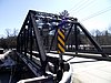
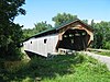
This is intended to be a complete list of the properties and districts on the National Register of Historic Places in Lamoille County, Vermont, United States. Latitude and longitude coordinates are provided for many National Register properties and districts; these locations may be seen together in a map.[1]
There are 30 properties and districts listed on the National Register in the county.
This is a list of the National Register of Historic Places listings in Addison County, Vermont.
This is a list of the National Register of Historic Places listings in Bennington County, Vermont.
This is a list of the National Register of Historic Places listings in Chittenden County, Vermont.
This is a list of the National Register of Historic Places listings in Rutland County, Vermont.
This is a list of the National Register of Historic Places listings in Orange County, Vermont.
This is a list of the National Register of Historic Places listings in Orleans County, Vermont.
This is a list of the National Register of Historic Places listings in Franklin County, Vermont.
This is a list of the National Register of Historic Places listings in Grand Isle County, Vermont.
This is a list of the National Register of Historic Places listings in Essex County, Vermont.
This is a list of the National Register of Historic Places listings in Caledonia County, Vermont.
This is a list of the National Register of Historic Places listings in Windsor County, Vermont.
This is a list of the National Register of Historic Places listings in Washington County, Vermont.
This is a list of the National Register of Historic Places listings in Windham County, Vermont.
This is a list of sites listed on the National Register of Historic Places in Cambridge, Massachusetts. This is intended to be a complete list of the properties and districts on the National Register of Historic Places in Cambridge, Massachusetts, United States. Latitude and longitude coordinates are provided for many National Register properties and districts; these locations may be seen together in an online map.
This is a list of the National Register of Historic Places listings in Tulare County, California.
This is a list of the National Register of Historic Places listings in Colusa County, California.
This is a list of the National Register of Historic Places listings in Madera County, California.
This is a list of the National Register of Historic Places listings in Anne Arundel County, Maryland.
This is a list of the National Register of Historic Places listings in Carroll County, Maryland.
This is a list of the National Register of Historic Places listings in Washington County, Maryland.
References
↑ The latitude and longitude information provided in this table was derived originally from the National Register Information System, which has been found to be fairly accurate for about 99% of listings. Some locations in this table may have been corrected to current GPS standards.
↑ Numbers represent an alphabetical ordering by significant words. Various colorings, defined here, differentiate National Historic Landmarks and historic districts from other NRHP buildings, structures, sites or objects.
↑ The eight-digit number below each date is the number assigned to each location in the National Register Information System database, which can be viewed by clicking the number.
↑ Address based on USPS website. Accessed April 11, 2016.
This page is based on this Wikipedia article Text is available under the CC BY-SA 4.0 license; additional terms may apply. Images, videos and audio are available under their respective licenses.