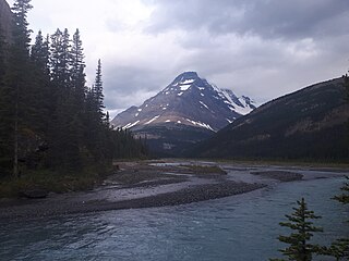
Mount Alberta is a mountain located in the upper Athabasca River Valley of Jasper National Park, Alberta, Canada. J. Norman Collie named the mountain in 1898 after Princess Louise Caroline Alberta. It is the most difficult of the 11,000ers from a climbing point of view.

Mount Bryce is a mountain at the southwestern corner of the Columbia Icefield, in British Columbia, Canada, near the border with Alberta. It can be seen from the Icefields Parkway.
Mount Palmer is a mountain located in the Athabasca River Valley of Jasper National Park in Alberta, Canada.

Mount Brazeau is a mountain in Alberta, Canada.

Mount Joffre is a mountain located on the Continental Divide, in Peter Lougheed Provincial Park, Alberta, and Elk Lakes and Height of the Rockies Provincial Parks in British Columbia. The mountain was named in 1918 by the Interprovincial Boundary Survey after Marshal Joseph Joffre, commander-in-chief of the French Army during World War I.

Mount Cornwell is located on the Continental Divide on the boundary between British Columbia and Alberta along the spine of the Front Ranges of the Canadian Rockies. The mountain was named in 1918 after "boy hero" John Cornwell, a sixteen-year-old crewman aboard HMS Chester, which was severely damaged in the Battle of Jutland. Cornwell was posthumously awarded the Victoria Cross for his bravery during the battle. Mount Chester was also named after his ship.

The Sawback Range is a mountain range of the Canadian Rockies that stretches from the Bow Valley in Alberta into southeastern Banff National Park.

The Blue Range is a mountain range of the Canadian Rockies, located on the Continental Divide in Banff National Park, Canada. The range was so named on account of its blueish colour when viewed from afar. Mount Alcantara is the highest point in the range.

The Park Ranges, also known as the Main Ranges, are a group of mountain ranges in the Canadian Rockies of southeastern British Columbia and southwestern Alberta, Canada. It is one of the three main subranges and the most central of the Continental Ranges, extending from southeast of Mount McGregor to the Fernie Basin.
Mount Ulysses, is the highest mountain in the Muskwa Ranges of the Northern Canadian Rockies in British Columbia. It and neighbouring peaks are part of a group of names drawing on the epic poem The Odyssey, in which here Ulysses wanders for 10 years before being able to return home to Ithaca.
Mount Talbot is located on the northern side of Shale Pass on the Alberta-British Columbia border. It was officially named on 4 November 1925 after Senator Peter Talbot (1854-1919), an early pioneer of the Lacombe region of central Alberta. A teacher and farmer, he turned to politics and became an elected representative of the Northwest Territories and later the province of Alberta. In 1906, Sir Wilfrid Laurier appointed him to the Senate of Canada.

Mount Bess is located on the border of Alberta and British Columbia. It is the 83rd highest peak in Alberta. It was named in 1910 by J. Norman Collie after Bessie Gunn, who accompanied Collie's expedition.
Mount Bulyea is located in Banff National Park on the border of Alberta and British Columbia. It was named in 1920 after Hon. George H. V. Bulyea, a Canadian Pacific Railway employee and first Lieutenant Governor of Alberta.
Mount Barlow is located on the Continental Divide along the border of Alberta and British Columbia at the southern edge of the Freshfield Icefield in Banff National Park. It was named in 1916 by D.B. Dowling after Dr. Alfred Ernest Barlow, a cartographer with the Geological Survey of Canada who died in the 1914 Empress of Ireland disaster.

Mount Olive is located N of the head of the Yoho River on the Continental Divide, on the Alberta-British Columbia border, in both Banff National Park and Yoho National Park. It lies on the eastern edge of the Wapta Icefield, and is part of the Waputik Mountains. It was named in 1898 by H.B. Dixon after his wife Dixon, Olive.

Mount Beatty is a mountain located on the border of Alberta and British Columbia on the Continental Divide. It was named in 1924 after David Beatty, a British naval officer of Irish ancestry who commanded ships in the First World War.
A mountain formerly known as Mount Pétain, but with no current official name, is located on the border of the Canadian provinces of Alberta and British Columbia (BC) on the Continental Divide.

Mount Loomis is located on the border of Alberta and British Columbia on the Continental Divide. It was named in 1918 after Frederick Oscar Warren Loomis, a Canadian Army general who served in World War I.
Mount Bistre may refer to:
Mount Burstall is a summit in Alberta, Canada.


