
Yosemite National Park is an American national park in the western Sierra Nevada of Central California, bounded on the southeast by Sierra National Forest and on the northwest by Stanislaus National Forest. The park is managed by the National Park Service and covers an area of 748,436 acres and sits in four counties: centered in Tuolumne and Mariposa, extending north and east to Mono and south to Madera County. Designated a World Heritage Site in 1984, Yosemite is internationally recognized for its granite cliffs, waterfalls, clear streams, giant sequoia groves, lakes, mountains, meadows, glaciers, and biological diversity. Almost 95% of the park is designated wilderness.

The Sierra Nevada is a mountain range in the Western United States, between the Central Valley of California and the Great Basin. The vast majority of the range lies in the state of California, although the Carson Range spur lies primarily in Nevada. The Sierra Nevada is part of the American Cordillera, an almost continuous chain of mountain ranges that forms the western "backbone" of the Americas.

Half Dome is a granite dome at the eastern end of Yosemite Valley in Yosemite National Park, California. It is a well-known rock formation in the park, named for its distinct shape. One side is a sheer face while the other three sides are smooth and round, making it appear like a dome cut in half. The granite crest rises more than 4,737 ft (1,444 m) above the valley floor.

The John Muir Trail (JMT) is a long-distance trail in the Sierra Nevada mountain range of California, passing through Yosemite, Kings Canyon and Sequoia National Parks. From the northern terminus at Happy Isles in Yosemite Valley and the southern terminus located on the summit of Mount Whitney, the Trail's length is 213.7 miles (343.9 km), with an elevation change of approximately 47,000 feet (14,000 m). For almost all of its length, the trail is in the High Sierra backcountry and wilderness areas. For about 160 miles (260 km), the trail follows the same footpath as the longer Pacific Crest Trail. It is named after John Muir, a naturalist.

Mount Whitney is the tallest mountain in the contiguous United States and the Sierra Nevada, with an elevation of 14,505 feet (4,421 m). It is in East–Central California, on the boundary between California's Inyo and Tulare counties, 84.6 miles (136.2 km) west-northwest of North America's lowest point, Badwater Basin in Death Valley National Park, at 282 ft (86 m) below sea level. The mountain's west slope is in Sequoia National Park and the summit is the southern terminus of the John Muir Trail, which runs 211.9 mi (341.0 km) from Happy Isles in Yosemite Valley. The eastern slopes are in Inyo National Forest in Inyo County.

Mount Dana is a mountain in the U.S. state of California. Its summit marks the eastern boundary of Yosemite National Park and the western boundary of the Ansel Adams Wilderness. At an elevation of 13,061 feet (3,981 m), it is the second highest mountain in Yosemite, and the northernmost summit in the Sierra Nevada which is over 13,000 feet (3,962.4 m) in elevation. Mount Dana is the highest peak in Yosemite that is a simple hike to the summit. The mountain is named in honor of James Dwight Dana, who was a professor of natural history and geology at Yale.

Cathedral Peak is part of the Cathedral Range, a mountain range in the south-central portion of Yosemite National Park in eastern Mariposa and Tuolumne Counties. The range is an offshoot of the Sierra Nevada. The peak which lends its name to the range derives its name from its cathedral-shaped peak, which was formed by glacial activity: the peak remained uneroded above the glaciers in the Pleistocene.

Mount Gibbs is located in the Sierra Nevada of the U.S. state of California, 2.6 miles (4 km) south of Mount Dana. The mountain was named in honor of Oliver Gibbs, a professor at Harvard University and friend of Josiah Whitney. The summit marks the boundary between Yosemite National Park and the Ansel Adams Wilderness, and Mount Gibbs is the sixth-highest mountain, of Yosemite.
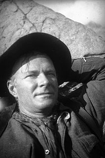
Norman Clyde was a mountaineer, mountain guide, freelance writer, nature photographer, and self trained naturalist. He is well known for achieving over 130 first ascents, many in California's Sierra Nevada and Montana's Glacier National Park. He also set a speed climbing record on California's Mount Shasta in 1923. The Bancroft Library at the University of California, Berkeley has 1467 articles written by Clyde in its archives.

Mount Lyell is the highest point in Yosemite National Park, at 13,114 feet (3,997 m). It is located at the southeast end of the Cathedral Range, 1.2 miles (1.9 km) northwest of Rodgers Peak. The peak as well as nearby Lyell Canyon is named after Charles Lyell, a well-known 19th century geologist. The peak had one of the last remaining glaciers in Yosemite, Lyell Glacier. The Lyell Glacier is currently considered to be a permanent ice field, not a living glacier. Mount Lyell divides the Tuolumne River watershed to the north, the Merced to the west, and the Rush Creek drainage in the Mono Lake Basin to the southeast.

Mount Ansel Adams is a peak in the Sierra Nevada of California. At an elevation of 11,766 ft. the summit is in Yosemite National Park near the park's eastern boundary. It lies 0.8 miles (1.3 km) northeast of Foerster Peak and 1.3 miles (2.1 km) west-southwest of Electra Peak at the head of the Lyell Fork of the Merced River. It was named in 1985 for Ansel Adams, the preeminent landscape photographer, conservationist, and member of the Board of Directors of the Sierra Club, a role he maintained for 37 years.

Mount Conness is a 12,590 foot (3,840 m) mountain in the Sierra Nevada range, to the west of the Hall Natural Area. Conness is on the boundary between the Inyo National Forest and Yosemite National Park. The Conness Glacier lies north of the summit.

Mount Hoffmann is a prominent peak in northeastern Mariposa County in the center of Yosemite National Park, California, United States. It rises above May Lake and is a day hike of 6.2 miles (10.0 km) (one-way) from Tioga Pass Road. The mountain is named for the cartographer Charles F. Hoffmann, who was part of the California Geological Survey of the Sierra Nevada.

Mount Maclure is the nearest neighbor to Mount Lyell, the highest point in Yosemite National Park. Mount Maclure is the fifth-highest mountain of Yosemite. Mount Maclure is located at the southeast end of the Cathedral Range, about 0.6 miles (0.97 km) northwest of Lyell. The summit is on the boundary between Madera and Tuolumne counties which is also the boundary between the park and the Ansel Adams Wilderness. It was named in honor of William Maclure, a pioneer in American geology who produced the first geological maps of the United States. Maclure Glacier, one of the last remaining glaciers in Yosemite, is situated on the mountain's northern flank.

Mount Starr King is a symmetrical granite dome in Yosemite National Park, whose highest point is 9,096 feet (2,772 m) above sea level.

Mount Clark is a 11,527-foot (3,513 m) granite peak in the Clark Range, a sub-range of the Sierra Nevada. It is a popular destination for mountaineers.

Mount Goddard is a mountain of California's Sierra Nevada, in the north section of Kings Canyon National Park. Goddard forms the southwest boundary of the Evolution Basin.
Mount Keith is a mountain on the crest of California's Sierra Nevada, between Mount Bradley to the north, and Junction Peak to the southwest. Its north and west facing slopes feed the Kings River watershed by way of Bubbs Creek, and its east and south slopes feed the Owens River via Shepherd Creek. By the same dividing line, Keith stands on the boundary of Kings Canyon National Park to the northwest, and the John Muir Wilderness to the southeast. It is a thirteener, a mountain which has a height over 13000 feet.

Jules Marquard Eichorn was an American mountaineer, environmentalist, and music teacher.
Rodgers Peak is the most northwestern peak in the Ritter Range in Madera County, California. The peak lies on the boundary between Yosemite National Park and the Ansel Adams Wilderness further east. Rodgers Peak is the fourth-highest mountain in Yosemite National Park.
