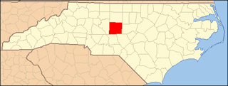
Person County is a county located in the U.S. state of North Carolina. The population was 39,097 as of the 2020 census. The county seat is Roxboro.

The National Register of Historic Places in the United States is a register including buildings, sites, structures, districts, and objects. The Register automatically includes all National Historic Landmarks as well as all historic areas administered by the U.S. National Park Service. Since its introduction in 1966, more than 97,000 separate listings have been added to the register.

This is a list of structures, sites, districts, and objects on the National Register of Historic Places in North Carolina:

Rocky Mount station, officially the Helen P. Gay Rocky Mount Historic Train Station, is an intermodal transit station in Rocky Mount, North Carolina, United States. It is served by four daily Amtrak round trips –the Carolinian, Floridian, Palmetto, and Silver Meteor – and is a bus station for Tar River Transit and Greyhound. The station is listed on the National Register of Historic Places as a contributing property to the Rocky Mount Central City Historic District.

The Mast General Store is a general store located in Historic Valle Crucis, North Carolina. It is recognized by the National Register of Historic Places as one of the best remaining examples of the type. It is still the center of the community housing the post office and offering coffee for 5¢ on the honor system. As of 2020 the business had expanded to eleven locations, including the original Store and annex, both located in Valle Crucis, North Carolina. The store sells commodities such as old-time hearth and home goods, outdoor clothing and gear, footwear, work clothes, old-fashioned wind-up toys, regional books and music, honey, and more than 500 varieties of old-fashioned candy.

College Hill is a neighborhood in the west central section of the United States city of Greensboro, North Carolina. College Hill was Greensboro's first neighborhood.

The Mount Pleasant Historic District encompasses the historic center of the village of Mount Pleasant, Ohio. Founded in 1803 by anti-slavery Quakers, the village was an early center of abolitionist activity and a well-known haven for fugitive slaves on the Underground Railroad. The village center is relatively little altered since the antebellum period. The district was listed on the National Register of Historic Districts in 1974, and was designated a National Historic Landmark in 2005.

This list includes properties and districts listed on the National Register of Historic Places in Buncombe County, North Carolina. Click the "Map of all coordinates" link to the right to view an online map of all properties and districts with latitude and longitude coordinates in the table below.

This list includes properties and districts listed on the National Register of Historic Places in Forsyth County, North Carolina. Click the "Map of all coordinates" link to the right to view an online map of all properties and districts with latitude and longitude coordinates in the table below.

This list includes properties and districts listed on the National Register of Historic Places in Durham County, North Carolina. Click the "Map of all coordinates" link to the right to view an online map of all properties and districts with latitude and longitude coordinates in the table below.

This list includes properties and districts listed on the National Register of Historic Places in Davidson County, North Carolina. Click the "Map of all coordinates" link to the right to view an online map of all properties and districts with latitude and longitude coordinates in the table below.

This list includes properties and districts listed on the National Register of Historic Places in Sampson County, North Carolina. Click the "Map of all coordinates" link to the right to view a Google map of all properties and districts with latitude and longitude coordinates in the table below.

This list includes properties and districts listed on the National Register of Historic Places in Gaston County, North Carolina. Click the "Map of all coordinates" link to the right to view an online map of all properties and districts with latitude and longitude coordinates in the table below.

This list includes properties and districts listed on the National Register of Historic Places in Jackson County, North Carolina. Click the "Map of all coordinates" link to the right to view an online map of all properties and districts with latitude and longitude coordinates in the table below.

This list includes properties and districts listed on the National Register of Historic Places in Duplin County, North Carolina. Click the "Map of all coordinates" link to the right to view a Google map of all properties and districts with latitude and longitude coordinates in the table below.
This list includes properties and districts listed on the National Register of Historic Places in Randolph County, North Carolina. Click the "Map of all coordinates" link to the right to view a Google map of all properties and districts with latitude and longitude coordinates in the table below.

This list includes properties and districts listed on the National Register of Historic Places in Alleghany County, North Carolina. Click the "Map of all coordinates" link to the right to view an online map of all properties and districts with latitude and longitude coordinates in the table below.

Halifax Historic District is a national historic district located at Halifax, Halifax County, North Carolina, US that was listed on the National Register of Historic Places in 1970. It includes several buildings that are individually listed on the National Register. Halifax was the site of the signing of the Halifax Resolves on April 12, 1776, a set of resolutions of the North Carolina Provincial Congress which led to the United States Declaration of Independence gaining the support of North Carolina's delegates to the Second Continental Congress in that year.

Mount Airy Historic District is a national historic district located at Mount Airy, Surry County, North Carolina. The district encompasses 187 contributing buildings in the central business district and surrounding industrial and residential sections of Mount Airy. They were primarily built between about 1880 and 1930 and include notable examples of Late Victorian and Bungalow / American Craftsman architecture. Located in the district are the separately listed W. F. Carter House and Trinity Episcopal Church. Other notable buildings include the Abram Haywood Merritt House (1902), William A. Estes House, Thomas Fawcett House, J. D. Sargent House (1919), Campbell A. Baird House (1913), T. Benton Ashby House, First Baptist Church (1906-1912), Mount Airy Friends (1904), Presbyterian Church (1907-1914), Merritt Building, Banner Building (1906), Prather Block, Midkiff Hardware Store, Welch Block, West Drug Store, Belk's Building, (former) Workman's Federal Savings and Loan, (former) First National Bank (1893), Bank of Mount Airy (1923), U.S. Post Office (1932-1933), and the Sparger Brothers Tobacco Factory.

The Sand Hills Historic District in Augusta, Georgia is a historic district which was listed on the National Register of Historic Places in 1997. The district included 334 contributing buildings and a contributing site in a 231 acres (0.93 km2) area roughly bounded by Monte Sano and North View Aves., Mount Auburn St., Johns Rd., and the Augusta Country Club.


