National Register of Historic Places listings in McDowell County, North Carolina

Last updated

Map of North Carolina with McDowell County highlighted North Carolina Map Highlighting McDowell County.PNG
Map of North Carolina with McDowell County highlighted

This list includes properties and districts listed on the National Register of Historic Places in McDowell County, North Carolina. Click the "Map of all coordinates" link to the right to view an online map of all properties and districts with latitude and longitude coordinates in the table below. [1]

Contents

Current listings


    This National Park Service list is complete through NPS recent listings posted April 26, 2024. [2]

[3] Name on the RegisterImageDate listed [4] Location City or townDescription
1 Welsford Parker Artz House
Welsford Parker Artz House Welsford Parker Artz House 2013-09-23 11-00-44.jpg
Welsford Parker Artz House
August 23, 1990
(#90001311)
205 Maple St.
35°37′54″N82°10′45″W / 35.631667°N 82.179167°W / 35.631667; -82.179167 (Welsford Parker Artz House)
Old Fort
2 Henry Seawell Brown and Mary Jane English Farmstead
Henry Seawell Brown and Mary Jane English Farmstead Henry Seawell Brown Mary Jane English Farmstead.jpg
Henry Seawell Brown and Mary Jane English Farmstead
September 3, 2009
(#09000685)
15956 U.S. Route 221 North
35°51′57″N81°57′13″W / 35.865833°N 81.953611°W / 35.865833; -81.953611 (Henry Seawell Brown and Mary Jane English Farmstead)
Ashford
3 Carson House
Carson House Carsonhouse.jpg
Carson House
September 15, 1970
(#70000843)
West of Marion on U.S. Route 70
35°41′27″N82°03′25″W / 35.690861°N 82.057014°W / 35.690861; -82.057014 (Carson House)
Marion
4 Carson-Young House
Carson-Young House Carson-Young House.jpg
Carson-Young House
July 28, 2011
(#11000483)
842 Major Conley Rd.
35°42′25″N82°03′16″W / 35.706944°N 82.054444°W / 35.706944; -82.054444 (Carson-Young House)
Marion
5 Clinchfield Manufacturing Company Mill No. 2 April 23, 2024
(#100010164)
56 Branch Street
35°41′38″N81°59′36″W / 35.6940°N 81.9932°W / 35.6940; -81.9932 (Clinchfield Manufacturing Company Mill No. 2)
Marion
6 Depot Historic District
Depot Historic District Marion depot from Railroad Street.jpg
Depot Historic District
March 28, 1991
(#91000293)
Southeastern end of Depot St., bounded on the south by the Southern railroad tracks, and 111 Railroad St., south of the tracks
35°40′52″N82°00′38″W / 35.681111°N 82.010556°W / 35.681111; -82.010556 (Depot Historic District)
Marion
7 First Presbyterian Church
First Presbyterian Church First Presbyterian Church, Marion, NC.jpg
First Presbyterian Church
March 28, 1991
(#91000291)
12 W. Fort St.
35°41′03″N82°00′46″W / 35.684167°N 82.012778°W / 35.684167; -82.012778 (First Presbyterian Church)
Marion
8 Albertus Ledbetter House
Albertus Ledbetter House Albertus Ledbetter House.jpg
Albertus Ledbetter House
January 4, 2001
(#00001616)
125 Haynes Rd.
35°32′08″N82°06′17″W / 35.535556°N 82.104722°W / 35.535556; -82.104722 (Albertus Ledbetter House)
Montford Cove
9 Linville Falls Tavern (former)
Linville Falls Tavern (former) Linville Falls Tavern.jpg
Linville Falls Tavern (former)
December 28, 2000
(#00001554)
25 Rock House Ln.
35°57′32″N81°56′34″W / 35.958889°N 81.942778°W / 35.958889; -81.942778 (Linville Falls Tavern (former))
Linville Falls Now Famous Louise's Rock House Restaurant. Extends into Avery County as well as Burke County.
10 Lone Beech
Lone Beech Lone Beach-Marion.jpg
Lone Beech
June 2, 1995
(#95000639)
206 Hillcrest Dr.
35°41′07″N82°00′47″W / 35.685278°N 82.013056°W / 35.685278; -82.013056 (Lone Beech)
Marion
11 Main Street Historic District
Main Street Historic District Fifth Third Bank-Former First National Bank.jpg
Main Street Historic District
March 28, 1991
(#91000292)
Roughly bounded by U.S. Route 70 and Garden, State, and Logan Sts.
35°41′04″N82°00′35″W / 35.684444°N 82.009722°W / 35.684444; -82.009722 (Main Street Historic District)
Marion
12 McDowell County Courthouse
McDowell County Courthouse McDowell County Courthouse, Marion, NC.jpg
McDowell County Courthouse
May 10, 1979
(#79003131)
Main and E. Court Sts.
35°41′02″N82°00′32″W / 35.683889°N 82.008889°W / 35.683889; -82.008889 (McDowell County Courthouse)
Marion
13 Old Fort Commercial Historic District
Old Fort Commercial Historic District Old Fort Railroad Depot.jpg
Old Fort Commercial Historic District
April 29, 2011
(#11000257)
Roughly bounded by E. Main, Spring, Commerce, and W. Main Sts.
35°37′45″N82°10′53″W / 35.629167°N 82.181389°W / 35.629167; -82.181389 (Old Fort Commercial Historic District)
Old Fort
14 St. John's Episcopal Church
St. John's Episcopal Church St. Johns Episcopal Church, Marion, NC.jpg
St. John's Episcopal Church
March 28, 1991
(#91000290)
315 S. Main St.
35°40′48″N82°00′25″W / 35.680000°N 82.006944°W / 35.680000; -82.006944 (St. John's Episcopal Church)
Marion
15 St. Matthew's Lutheran Church
St. Matthew's Lutheran Church St. Matthews Lutheran Church, Marion, NC.jpg
St. Matthew's Lutheran Church
March 28, 1991
(#91000289)
307 W. Court St.
35°40′57″N82°00′47″W / 35.682500°N 82.013056°W / 35.682500; -82.013056 (St. Matthew's Lutheran Church)
Marion

See also

Related Research Articles

<span class="mw-page-title-main">National Register of Historic Places listings in Catawba County, North Carolina</span>

This list includes properties and districts listed on the National Register of Historic Places in Catawba County, North Carolina. Click the "Map of all coordinates" link to the right to view an online map of all properties and districts with latitude and longitude coordinates in the table below.

<span class="mw-page-title-main">National Register of Historic Places listings in Halifax County, North Carolina</span>

This list includes properties and districts listed on the National Register of Historic Places in Halifax County, North Carolina. Click the "Map of all coordinates" link to the right to view an online map of all properties and districts with latitude and longitude coordinates in the table below.

<span class="mw-page-title-main">National Register of Historic Places listings in Johnston County, North Carolina</span>

This list includes properties and districts listed on the National Register of Historic Places in Johnston County, North Carolina. Click the "Map of all coordinates" link to the right to view an online map of all properties and districts with latitude and longitude coordinates in the table below.

<span class="mw-page-title-main">National Register of Historic Places listings in Ashe County, North Carolina</span>

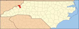
This list includes properties and districts listed on the National Register of Historic Places in Ashe County, North Carolina. Click the "Map of all coordinates" link to the right to view an online map of all properties and districts with latitude and longitude coordinates in the table below.

<span class="mw-page-title-main">National Register of Historic Places listings in Perquimans County, North Carolina</span>

This list includes properties and districts listed on the National Register of Historic Places in Perquimans County, North Carolina. Click the "Map of all coordinates" link to the right to view a Google map of all properties and districts with latitude and longitude coordinates in the table below.

<span class="mw-page-title-main">National Register of Historic Places listings in Surry County, North Carolina</span>

This list includes properties and districts listed on the National Register of Historic Places in Surry County, North Carolina, United States. Click the "Map of all coordinates" link to the right to view an online map of all properties and districts with latitude and longitude coordinates in the table below.

<span class="mw-page-title-main">National Register of Historic Places listings in Beaufort County, North Carolina</span>

This list includes properties and districts listed on the National Register of Historic Places in Beaufort County, North Carolina. Click the "Map of all coordinates" link to the right to view an online map of all properties and districts with latitude and longitude coordinates in the table below.

<span class="mw-page-title-main">National Register of Historic Places listings in Madison County, North Carolina</span>

This list includes properties and districts listed on the National Register of Historic Places in Madison County, North Carolina. Click the "Map of all coordinates" link to the right to view an online map of all properties and districts with latitude and longitude coordinates in the table below.

<span class="mw-page-title-main">National Register of Historic Places listings in Carteret County, North Carolina</span>

This list includes properties and districts listed on the National Register of Historic Places in Carteret County, North Carolina. Click the "Map of all coordinates" link to the right to view an online map of all properties and districts with latitude and longitude coordinates in the table below.

<span class="mw-page-title-main">National Register of Historic Places listings in Anson County, North Carolina</span>

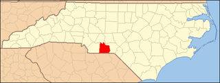
This list includes properties and districts listed on the National Register of Historic Places in Anson County, North Carolina. Click the "Map of all coordinates" link to the right to view a Google map of all properties and districts with latitude and longitude coordinates in the table below.

<span class="mw-page-title-main">National Register of Historic Places listings in Greene County, North Carolina</span>

This list includes properties and districts listed on the National Register of Historic Places in Greene County, North Carolina. Click the "Map of all coordinates" link to the right to view a Google map of all properties and districts with latitude and longitude coordinates in the table below.

<span class="mw-page-title-main">National Register of Historic Places listings in Mitchell County, North Carolina</span>

This list includes properties and districts listed on the National Register of Historic Places in Mitchell County, North Carolina. Click the "Map of all coordinates" link to the right to view a Google map of all properties and districts with latitude and longitude coordinates in the table below.

<span class="mw-page-title-main">National Register of Historic Places listings in Cherokee County, North Carolina</span>

This list includes properties and districts listed on the National Register of Historic Places in Cherokee County, North Carolina. Click the "Map of all coordinates" link to the right to view an online map of all properties and districts with latitude and longitude coordinates in the table below.

<span class="mw-page-title-main">National Register of Historic Places listings in Graham County, North Carolina</span>

This list includes properties and districts listed on the National Register of Historic Places in Graham County, North Carolina. Click the "Map of all coordinates" link to the right to view an online map of all properties and districts with latitude and longitude coordinates in the table below.

<span class="mw-page-title-main">National Register of Historic Places listings in Tyrrell County, North Carolina</span>

This list includes properties and districts listed on the National Register of Historic Places in Tyrrell County, North Carolina. Click the "Map of all coordinates" link to the right to view a Google map of all properties and districts with latitude and longitude coordinates in the table below.

<span class="mw-page-title-main">National Register of Historic Places listings in Columbus County, North Carolina</span>

This list includes properties and districts listed on the National Register of Historic Places in Columbus County, North Carolina. Click the "Map of all coordinates" link to the right to view an online map of all properties and districts with latitude and longitude coordinates in the table below.

<span class="mw-page-title-main">National Register of Historic Places listings in Hoke County, North Carolina</span>

This list includes properties and districts listed on the National Register of Historic Places in Hoke County, North Carolina. Click the "Map of all coordinates" link to the right to view a Google map of all properties and districts with latitude and longitude coordinates in the table below.

<span class="mw-page-title-main">National Register of Historic Places listings in Pamlico County, North Carolina</span>

This list includes properties and districts listed on the National Register of Historic Places in Pamlico County, North Carolina. Click the "Map of all coordinates" link to the right to view an online map of all properties and districts with latitude and longitude coordinates in the table below.

<span class="mw-page-title-main">National Register of Historic Places listings in Washington County, North Carolina</span>

This list includes properties and districts listed on the National Register of Historic Places in Washington County, North Carolina. Click the "Map of all coordinates" link to the right to view a Google map of all properties and districts with latitude and longitude coordinates in the table below.

<span class="mw-page-title-main">National Register of Historic Places listings in Yancey County, North Carolina</span>

This list includes properties and districts listed on the National Register of Historic Places in Yancey County, North Carolina. Click the "Map of all coordinates" link to the right to view a Google map of all properties and districts with latitude and longitude coordinates in the table below.

References

  1. The latitude and longitude information provided in this table was derived originally from the National Register Information System, which has been found to be fairly accurate for about 99% of listings. Some locations in this table may have been corrected to current GPS standards.
  2. National Park Service, United States Department of the Interior, "National Register of Historic Places: Weekly List Actions", retrieved April 26, 2024.
  3. Numbers represent an alphabetical ordering by significant words. Various colorings, defined here, differentiate National Historic Landmarks and historic districts from other NRHP buildings, structures, sites or objects.
  4. The eight-digit number below each date is the number assigned to each location in the National Register Information System database, which can be viewed by clicking the number.