National Register of Historic Places listings in Hyde County, North Carolina

Last updated

Map all coordinates using: OpenStreetMap  
Download coordinates as: KML
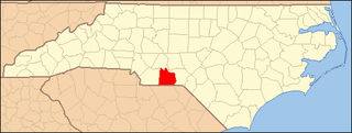
North Carolina Map Highlighting Hyde County.PNG

This list includes properties and districts listed on the National Register of Historic Places in Hyde County, North Carolina. Click the "Map of all coordinates" link to the right to view an online map of all properties and districts with latitude and longitude coordinates in the table below. [1]

Contents

Current listings


    This National Park Service list is complete through NPS recent listings posted April 28, 2023. [2]

[3] Name on the RegisterImageDate listed [4] Location City or townDescription
1 George V. Credle House and Cemetery
George V. Credle House and Cemetery George V. Credle House.jpg
George V. Credle House and Cemetery
July 29, 1985
(#85001670)
U.S. Route 264
35°27′16″N76°22′05″W / 35.454444°N 76.368056°W / 35.454444; -76.368056 (George V. Credle House and Cemetery)
Rose Bay
2 Davis School
Davis School DavisSchool1.jpg
Davis School
July 5, 1985
(#100008848)
33460, 33478 US 264
35°30′40″N76°01′23″W / 35.5112°N 76.0230°W / 35.5112; -76.0230 (Davis School)
Engelhard
3 Fairfield Historic District July 5, 1985
(#85001448)
SR 1308, 1309, 1305 and North Carolina Highway 94
35°32′29″N76°13′39″W / 35.541389°N 76.2275°W / 35.541389; -76.2275 (Fairfield Historic District)
Fairfield
4 Hyde County Courthouse
Hyde County Courthouse Hyde County Courthouse, Swan Quarter (former).jpg
Hyde County Courthouse
May 10, 1979
(#79001726)
20 Oyster Creek Rd.
35°24′22″N76°19′44″W / 35.406111°N 76.329017°W / 35.406111; -76.329017 (Hyde County Courthouse)
Swan Quarter
5 Inkwell
Inkwell OhWikpedia2.jpg
Inkwell
September 1, 1978
(#78001960)
East of Lake Landing on U.S. Route 264 in Lake Landing Township
35°29′05″N76°03′11″W / 35.484722°N 76.053056°W / 35.484722; -76.053056 (Inkwell)
Engelhard
6 Lake Landing Historic District
Lake Landing Historic District Lake Landing farmhouse.jpg
Lake Landing Historic District
March 10, 1986
(#86000786)
Roughly bounded by the Mattamuskeet Refuge, Middletown, Nebraska, SR 1110, and U.S. Route 264
35°27′41″N76°03′56″W / 35.461389°N 76.065556°W / 35.461389; -76.065556 (Lake Landing Historic District)
Lake Landing
7 Lake Mattamuskeet Pump Station
Lake Mattamuskeet Pump Station Pumping Station Mattamuskeet NWR Fairfield NC 8957 (23378630333).jpg
Lake Mattamuskeet Pump Station
May 28, 1980
(#80002849)
East of Swan Quarter
35°27′06″N76°10′30″W / 35.451667°N 76.175°W / 35.451667; -76.175 (Lake Mattamuskeet Pump Station)
Swan Quarter
8 Ocracoke Historic District
Ocracoke Historic District Ocracoke 13 (8152880532).jpg
Ocracoke Historic District
September 28, 1990
(#90001465)
Southwestern tip of Ocracoke Island, around Silver Lake
35°06′53″N75°59′02″W / 35.114722°N 75.983889°W / 35.114722; -75.983889 (Ocracoke Historic District)
Ocracoke
9 Ocracoke Light Station
Ocracoke Light Station Ocracoke island lighthouse img 0478.jpg
Ocracoke Light Station
November 25, 1977
(#77000110)
SR 1326
35°06′31″N75°59′11″W / 35.108611°N 75.986389°W / 35.108611; -75.986389 (Ocracoke Light Station)
Ocracoke
10 Albin B. Swindell House and Store August 14, 1986
(#86001641)
U.S. Route 264
35°26′10″N76°16′56″W / 35.436111°N 76.282222°W / 35.436111; -76.282222 (Albin B. Swindell House and Store)
Swindell Fork
11 Wynne's Folly
Wynne's Folly Wynne's Folly.jpg
Wynne's Folly
December 6, 1977
(#77001002)
West of Engelhard on U.S. Route 264
35°30′01″N76°01′41″W / 35.500278°N 76.028056°W / 35.500278; -76.028056 (Wynne's Folly)
Engelhard

See also

Related Research Articles

<span class="mw-page-title-main">National Register of Historic Places listings in Franklin County, North Carolina</span>

This list includes properties and districts listed on the National Register of Historic Places in Franklin County, North Carolina. Click the "Map of all coordinates" link to the right to view an online map of all properties and districts with latitude and longitude coordinates in the table below.

<span class="mw-page-title-main">National Register of Historic Places listings in Hertford County, North Carolina</span>

This list includes properties and districts listed on the National Register of Historic Places in Hertford County, North Carolina. Click the "Map of all coordinates" link to the right to view an online map of all properties and districts with latitude and longitude coordinates in the table below.

<span class="mw-page-title-main">National Register of Historic Places listings in Warren County, North Carolina</span>

This list includes properties and districts listed on the National Register of Historic Places in Warren County, North Carolina. Click the "Map of all coordinates" link to the right to view a Google map of all properties and districts with latitude and longitude coordinates in the table below.

<span class="mw-page-title-main">National Register of Historic Places listings in Rutherford County, North Carolina</span>

This list includes properties and districts listed on the National Register of Historic Places in Rutherford County, North Carolina. Click the "Map of all coordinates" link to the right to view a Google map of all properties and districts with latitude and longitude coordinates in the table below.

<span class="mw-page-title-main">National Register of Historic Places listings in Bertie County, North Carolina</span>

This list includes properties and districts listed on the National Register of Historic Places in Bertie County, North Carolina. Click the "Map of all coordinates" link to the right to view an online map of all properties and districts with latitude and longitude coordinates in the table below.

<span class="mw-page-title-main">National Register of Historic Places listings in Ashe County, North Carolina</span>

This list includes properties and districts listed on the National Register of Historic Places in Ashe County, North Carolina. Click the "Map of all coordinates" link to the right to view an online map of all properties and districts with latitude and longitude coordinates in the table below.

<span class="mw-page-title-main">National Register of Historic Places listings in Transylvania County, North Carolina</span>

This list includes properties and districts listed on the National Register of Historic Places in Transylvania County, North Carolina. Click the "Map of all coordinates" link to the right to view a Google map of all properties and districts with latitude and longitude coordinates in the table below.

<span class="mw-page-title-main">National Register of Historic Places listings in Polk County, North Carolina</span>

This list includes properties and districts listed on the National Register of Historic Places in Polk County, North Carolina. Click the "Map of all coordinates" link to the right to view an online map of all properties and districts with latitude and longitude coordinates in the table below.

<span class="mw-page-title-main">National Register of Historic Places listings in Perquimans County, North Carolina</span>

This list includes properties and districts listed on the National Register of Historic Places in Perquimans County, North Carolina. Click the "Map of all coordinates" link to the right to view a Google map of all properties and districts with latitude and longitude coordinates in the table below.

<span class="mw-page-title-main">National Register of Historic Places listings in Surry County, North Carolina</span>

This list includes properties and districts listed on the National Register of Historic Places in Surry County, North Carolina, United States. Click the "Map of all coordinates" link to the right to view an online map of all properties and districts with latitude and longitude coordinates in the table below.

<span class="mw-page-title-main">National Register of Historic Places listings in Davie County, North Carolina</span>

This list includes properties and districts listed on the National Register of Historic Places in Davie County, North Carolina. Click the "Map of all coordinates" link to the right to view a Google map of all properties and districts with latitude and longitude coordinates in the table below.
<span class="mw-page-title-main">National Register of Historic Places listings in Anson County, North Carolina</span>

This list includes properties and districts listed on the National Register of Historic Places in Anson County, North Carolina. Click the "Map of all coordinates" link to the right to view a Google map of all properties and districts with latitude and longitude coordinates in the table below.

<span class="mw-page-title-main">National Register of Historic Places listings in Jones County, North Carolina</span>

This list includes properties and districts listed on the National Register of Historic Places in Jones County, North Carolina. Click the "Map of all coordinates" link to the right to view a Google map of all properties and districts with latitude and longitude coordinates in the table below.

<span class="mw-page-title-main">National Register of Historic Places listings in Cherokee County, North Carolina</span>

This list includes properties and districts listed on the National Register of Historic Places in Cherokee County, North Carolina. Click the "Map of all coordinates" link to the right to view an online map of all properties and districts with latitude and longitude coordinates in the table below.

<span class="mw-page-title-main">National Register of Historic Places listings in Camden County, North Carolina</span>

This list includes properties and districts listed on the National Register of Historic Places in Camden County, North Carolina. Click the "Map of all coordinates" link to the right to view an online map of all properties and districts with latitude and longitude coordinates in the table below.

<span class="mw-page-title-main">National Register of Historic Places listings in Clay County, North Carolina</span>

This list includes properties and districts listed on the National Register of Historic Places in Clay County, North Carolina. Click the "Map of all coordinates" link to the right to view a Google map of all properties and districts with latitude and longitude coordinates in the table below.

<span class="mw-page-title-main">National Register of Historic Places listings in Hoke County, North Carolina</span>

This list includes properties and districts listed on the National Register of Historic Places in Hoke County, North Carolina. Click the "Map of all coordinates" link to the right to view a Google map of all properties and districts with latitude and longitude coordinates in the table below.

<span class="mw-page-title-main">National Register of Historic Places listings in Pamlico County, North Carolina</span>

This list includes properties and districts listed on the National Register of Historic Places in Pamlico County, North Carolina. Click the "Map of all coordinates" link to the right to view a Google map of all properties and districts with latitude and longitude coordinates in the table below.

<span class="mw-page-title-main">National Register of Historic Places listings in Washington County, North Carolina</span>

This list includes properties and districts listed on the National Register of Historic Places in Washington County, North Carolina. Click the "Map of all coordinates" link to the right to view a Google map of all properties and districts with latitude and longitude coordinates in the table below.

<span class="mw-page-title-main">National Register of Historic Places listings in Yancey County, North Carolina</span>

This list includes properties and districts listed on the National Register of Historic Places in Yancey County, North Carolina. Click the "Map of all coordinates" link to the right to view a Google map of all properties and districts with latitude and longitude coordinates in the table below.

References

  1. The latitude and longitude information provided in this table was derived originally from the National Register Information System, which has been found to be fairly accurate for about 99% of listings. Some locations in this table may have been corrected to current GPS standards.
  2. National Park Service, United States Department of the Interior, "National Register of Historic Places: Weekly List Actions", retrieved April 28, 2023.
  3. Numbers represent an alphabetical ordering by significant words. Various colorings, defined here, differentiate National Historic Landmarks and historic districts from other NRHP buildings, structures, sites or objects.
  4. The eight-digit number below each date is the number assigned to each location in the National Register Information System database, which can be viewed by clicking the number.