| Mount Poroshiri | |
|---|---|
| 幌尻岳 | |
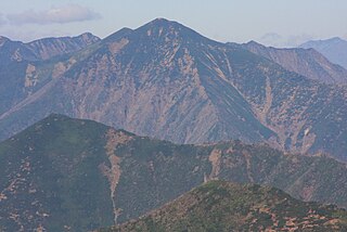
A view from Mount Tottabetsu(September 2006) | |
| Highest point | |
| Elevation | 2,052.8 m (6,735 ft) [1] |
| Listing | List of mountains and hills of Japan by height 100 Famous Japanese Mountains |
| Coordinates | 42°43′10″N142°40′58″E / 42.71944°N 142.68278°E Coordinates: 42°43′10″N142°40′58″E / 42.71944°N 142.68278°E [1] |
| Naming | |
| Translation | big mountain(Ainu) |
| Geography | |
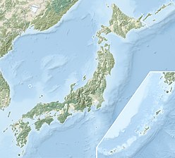 Mount Poroshiri Location of Mount Poroshiri in Japan. | |
| Location | Hokkaidō, Japan |
| Parent range | Hidaka Mountains |
| Topo map | Geospatial Information Authority (国土地理院Kokudochiriin) 25000:1 幌尻岳 50000:1 夕張岳 |
| Geology | |
| Mountain type | Fold |
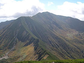
Mount Poroshiri(幌尻岳Poroshiri-dake) or sometimes Mount Horoshiri is located in the Hidaka Mountains, Hokkaidō, Japan. Its name was derived from a phonetic kanji transcription of the Ainu words for "great mountain", poro-shiri [2] . It is the highest mountain in the Hidaka range, and is one of the 100 famous mountains in Japan. [3]
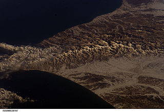
Hidaka Mountains is a mountain range in southeastern Hokkaido, Japan. It runs 150 km from Mount Sahoro or Karikachi Pass in central Hokkaidō south, running into the sea at Cape Erimo. It consists of folded mountains that range from 1,500 to 2,000 metres in height. Mount Poroshiri is the highest at 2,053 m. The Hidaka Mountains separate the subprefectures of Hidaka and Tokachi. Most of the range lies in the Hidaka-sanmyaku Erimo Quasi-National Park. Since the mountain range lies so far north, the alpine climate zone lies at a lower altitude.

Japan is an island country in East Asia. Located in the Pacific Ocean, it lies off the eastern coast of the Asian continent and stretches from the Sea of Okhotsk in the north to the East China Sea and the Philippine Sea in the south.
Kanji are the adopted logographic Chinese characters that are used in the Japanese writing system. They are used alongside the Japanese syllabic scripts hiragana and katakana. The Japanese term kanji for the Chinese characters literally means "Han characters". It is written with the same characters in the Chinese language to refer to the character writing system, hanzi (漢字).