Mount Sabyinyo

Last updated
Mount Sabyinyo
Sabyinyo.jpg
Sabyinyo from the south
Highest point
Elevation 3,669 m (12,037 ft)
Prominence 1,045 m (3,428 ft)
Coordinates 01°24′S29°36′E / 1.400°S 29.600°E / -1.400; 29.600
Geography
Rwanda relief location map.jpg
Red triangle with thick white border.svg
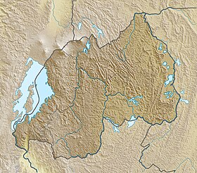
Mount Sabyinyo
Location in Rwanda, on the DRC/Rwanda/Uganda border
Uganda relief map.svg
Red triangle with thick white border.svg
Mount Sabyinyo
Mount Sabyinyo (Uganda)
Location Democratic Republic of the CongoRwandaUganda
Parent range Virunga Mountains
Geology
Mountain type Stratovolcano
Last eruption Pleistocene [1]

Mount Sabyinyo ("Sabyinyo" is derived from the Kinyarwanda word "Iryinyo", meaning "tooth"; also "Sabyinyo, Sabyinio") is an extinct volcano in eastern Africa in the Virunga Mountains. Mount Sabyinyo is the oldest volcano of the range. It is north-east of Lake Kivu, one of the African Great Lakes, and west of Lake Bunyonyi in Uganda. The summit of the mountain, at 3,669 metres (12,037 ft), [2] marks the intersection of the borders of the Democratic Republic of the Congo (DRC), Rwanda, and Uganda, and holds religious significance to local tribes. It also is within the adjoining national parks established by these countries: Virunga National Park in the DRC, the Volcanoes National Park in Rwanda, and Mgahinga Gorilla National Park in Uganda.

The slopes of Mt. Sabyinyo are a habitat for the critically endangered mountain gorilla. [3] [4] The mountain carries the local nickname "Old Man's Teeth," because its serrated summit resembles worn teeth in a gum line (in contrast to the perfect conical summits of the adjacent mountains in this range). [5]

The peaks of Mountain Sabyinyo, [6] can be easily done and accessed and trekked along the foothills from the side of Mgahinga National park. in Uganda.

The sign marking the border tripoint at the summit of Mount Sabyinyo. Mount Sabyinyo.JPG
The sign marking the border tripoint at the summit of Mount Sabyinyo.

Related Research Articles

<span class="mw-page-title-main">Geography of Rwanda</span>

Rwanda is located in East Africa, to the east of the Democratic Republic of the Congo, at the co-ordinates 2°00′S30°0′E.

<span class="mw-page-title-main">Virunga Mountains</span> Chain of volcanoes in East Africa

The Virunga Mountains are a chain of volcanoes in East Africa, in the area where Rwanda, the Democratic Republic of the Congo (DRC), and Uganda meet. The mountain range is a branch of the Albertine Rift Mountains, which border the western branch of the East African Rift. They are located between Lake Edward and Lake Kivu. The name "Virunga" is an English version of the Kinyarwanda word ibirunga, which means "volcanoes".

<span class="mw-page-title-main">Volcanoes National Park</span> National park in Rwanda

Volcanoes National Park is a national park in northwestern Rwanda. It covers 160 km2 (62 sq mi) of rainforest and encompasses five of the eight volcanoes in the Virunga Mountains, namely Karisimbi, Bisoke, Muhabura, Gahinga and Sabyinyo. It borders Virunga National Park in the Democratic Republic of Congo and Mgahinga Gorilla National Park in Uganda. It is home to the mountain gorilla and the golden monkey, and was the base for the primatologist Dian Fossey.

<span class="mw-page-title-main">Virunga National Park</span> National park in the Democratic Republic of the Congo

Virunga National Park is a national park in the Albertine Rift Valley in the eastern part of the Democratic Republic of the Congo. It was created in 1925. In elevation, it ranges from 680 m (2,230 ft) in the Semliki River valley to 5,109 m (16,762 ft) in the Rwenzori Mountains. From north to south it extends approximately 300 km (190 mi), largely along the international borders with Uganda and Rwanda in the east. It covers an area of 8,090 km2 (3,120 sq mi).

<span class="mw-page-title-main">Bwindi Impenetrable National Park</span> National park in Uganda

The Bwindi Impenetrable National Park is a national park in southwestern Uganda. It is part of the Bwindi Impenetrable Forest and is situated along the Democratic Republic of the Congo border next to the Virunga National Park and on the edge of the Albertine Rift. Composed of 321 km2 (124 sq mi) of both montane and lowland forest, it is accessible only on foot. It is a United Nations Educational, Scientific and Cultural Organization-designated World Heritage Site.

<span class="mw-page-title-main">Kisoro District</span> District in Western Region, Uganda

Kisoro District is a district in the Western Region of Uganda. The town of Kisoro is the site of the district headquarters.

Kisoro is a town in the Western Region of Uganda. It is the chief town of Kisoro District and the site of the district headquarters.

<span class="mw-page-title-main">Kigezi District</span> Former district in Uganda

Kigezi District once covered what are now Kabale District, Kanungu District, Kisoro District and Rukungiri District, in southwest Uganda. Its terraced fields are what gives this part of Uganda its distinctive character. Kigezi was popularly known as the Switzerland of Africa. The coordinates for the region are: Latitude:01 13 20S, 29 53 20E.

<span class="mw-page-title-main">Mount Muhabura</span>

Mount Muhabura, also known as Mount Muhavura, is an inactive volcano in the Virunga Mountains on the border between Rwanda and Uganda. At 4,127 metres (13,540 ft) Muhabura is the third highest of the eight major mountains of the mountain range, which is a part of the Albertine Rift, the western branch of the East African Rift. Its summit contains a small crater lake. The limited evidence for this volcano suggests that it last erupted some time in the Holocene, but the exact date is not known. Muhabura is partly in the Volcanoes National Park, Rwanda and partly in the Mgahinga Gorilla National Park, Uganda.

<span class="mw-page-title-main">Mgahinga Gorilla National Park</span> National Park in Uganda

Mgahinga Gorilla National Park is a national park in southwestern Uganda. It was created in 1991 and covers an area of 33.9 km2 (13.1 sq mi).

<span class="mw-page-title-main">Mount Gahinga</span>

Mount Gahinga is a dormant/extinct volcano in the Virunga Mountains on the border between Rwanda and Uganda. Gahinga lies between Muhabura and Sabyinyo, but is the smallest of these three. Mount Gahinga, also known in the local Kinyarwanda/Rufumbira dialect as "a small pile of stones", has a swampy caldera on its peak. The caldera is believed to be about 180 m (591 ft) wide. Mgahinga Gorilla National Park also got its name from this volcano. Mount Gahinga, whose elevation is 3,473 m (11,394 ft), is part of a chain of eight volcanic mountains of the Mufumbiro ranges. The volcano chain spans across Uganda, Rwanda and the Democratic Republic of Congo.

<span class="mw-page-title-main">Albertine Rift montane forests</span> Ecoregion in east-central Africa

The Albertine Rift montane forests is a tropical moist broadleaf forest ecoregion in east-central Africa. The ecoregion covers the mountains of the northern Albertine Rift, and is home to distinct Afromontane forests with high biodiversity.

Tourism in Rwanda is the largest source of foreign exchange earnings in Rwanda and was projected to grow at a rate of 25% every year from 2013-2018. The sector is the biggest contributor to the national export strategy. Total revenues generated from the sector in 2014 alone were USD 305 million. The sector has also attracted direct foreign investments with major international hotel brands setting up shop in the country including Marriot Hotels & Resorts, Radisson Blu, Park Inn by Radisson, Sheraton Hotels and Resorts, Protea Hotels by Marriott, Golden Tulip Hotels, and Zinc. With its new world-class convention center, Rwanda is set to become a regional and international conference hub owing to ever-improving conference facilities, an excellent and expanding transportation network, and straightforward immigration procedures such as the ability for online visa applications, visa-free for all Africans, and a one-tourist visa policy for the EAC.

<span class="mw-page-title-main">Mount Bisoke</span> Volcano in the Virunga mountains

Mount Bisoke is an active volcano in the Virunga Mountains of the Albertine Rift, the western branch of the East African Rift. It straddles the border of Rwanda and the Democratic Republic of the Congo, but the summit is located in Rwanda. It is located approximately 35 km northeast of the town of Goma and adjacent Lake Kivu.

<span class="mw-page-title-main">Tourism in Uganda</span>

Tourism in Uganda is focused on Uganda's landscape and wildlife. It is a major driver of employment, investment and foreign exchange, contributing USh 4.9 trillion to Uganda's GDP in the financial year 2012–2013.

The Institute of Tropical Forest Conservation (ITFC) is a post-graduate research institute based in the Bwindi Impenetrable Forest, in south-western Uganda. The institute is a semi-autonomous part of Mbarara University of Science and Technology and is focused on research, training, and monitoring for conservation management in the Albertine Rift ecoregion.

<span class="mw-page-title-main">Lake Mutanda</span>

Lake Mutanda is a small freshwater lake in Uganda.

<span class="mw-page-title-main">Tourism in the Democratic Republic of the Congo</span>

Tourism in the Democratic Republic of the Congo is uncommon. Tourists can see wildlife, indigenous cultures, and geological phenomena not found easily or anywhere else in Africa.

<span class="mw-page-title-main">Bwindi Impenetrable Forest</span> Forest of Uganda

The Bwindi Impenetrable Forest is a large primeval forest located in south-western Uganda in the Kanungu District. The Bwindi forest is on the edge of the Albertine Rift, the western branch of the East African Rift, at elevations ranging from 1,160 to 2,607 metres. The forest contains around 160 species of trees and over 100 species of ferns.

<span class="mw-page-title-main">International Gorilla Conservation Programme</span>

The International Gorilla Conservation Programme was formed in 1991 to ensure that the critically endangered mountain gorillas are conserved in their habitat in the mountain forests of the Virunga Massif in Rwanda, Uganda and the Democratic Republic of the Congo.

References

  1. "Sabinyo". Global Volcanism Program . Smithsonian Institution . Retrieved 2016-09-13.
  2. kawlaw (2019-02-15). "Mount Sabyinyo | Mgahinga Gorilla National Park | Hiking Mount Sabyinyo". Achieve Gorilla Tours. Retrieved 2023-03-04.
  3. "4 Days Uganda Gorilla Trekking and Mount Sabinyo hiking safari". Bwindi Impenetrable National Park. 2020-08-26. Retrieved 2022-03-02.
  4. "Mount Sabinyo | Mgahinga National Park" . Retrieved 2022-03-02.
  5. Briggs, Philip (2013). Uganda, Bradt Travel Guides. Bradt. p. 268. ISBN   9781841624679 . Retrieved 14 September 2016.
  6. "5 days Volcano hike, Mgahinga Muhabura and Sabyinyo". Sabyinyo Mountain Hike.