This article needs additional citations for verification .(August 2018) |
| Virunga Mountains | |
|---|---|
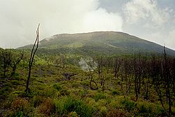
 The summit of Mount Mikeno | |
| Highest point | |
| Peak | Mount Karisimbi |
| Elevation | 4,507 m (14,787 ft) |
| Dimensions | |
| Length | 80 [1] km (50 mi) |
| Geography | |
 Virunga Mountains  Virunga Mountains 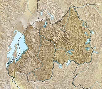 Virunga Mountains | |
 | |
| Countries | |

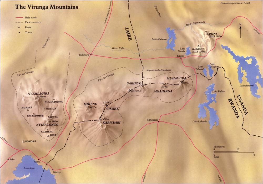
The Virunga Mountains (also known as Mufumbiro [1] ) are a chain of volcanoes in East Africa, in the area where Rwanda, the Democratic Republic of the Congo (DRC), and Uganda meet. The mountain range is a branch of the Albertine Rift Mountains, which border the western branch of the East African Rift. They are located between Lake Edward and Lake Kivu. The name "Virunga" is an English version of the Kinyarwanda word ibirunga, which means "volcanoes".
Contents
- List of mountain peaks in the Virunga Mountain Range
- National parks
- In culture
- See also
- References
- Bibliography
- External links
The mountain range consists of eight major volcanoes. Most of them are dormant, except Mount Nyiragongo 3,462 metres (11,358 ft) and Mount Nyamuragira 3,063 metres (10,049 ft), both in the DRC. Recent eruptions occurred in 2006, 2010 and May 2021. Mount Karisimbi is the highest volcano at 4,507 metres (14,787 ft). [2] The oldest mountain is Mount Sabyinyo, which rises 3,634 metres (11,923 ft) above sea level.
The Virunga Mountains are home of the endangered mountain gorilla, listed on the IUCN Red List of Endangered Species due to habitat loss, poaching, disease, and war (Butynski et al. 2003). However, there has been some recent improvement in the number of mountain gorillas owing to extreme conservation efforts. [3] The Karisoke Research Center, founded by Dian Fossey to observe gorillas in their native habitat, is located between Mount Karisimbi and Mount Bisoke.