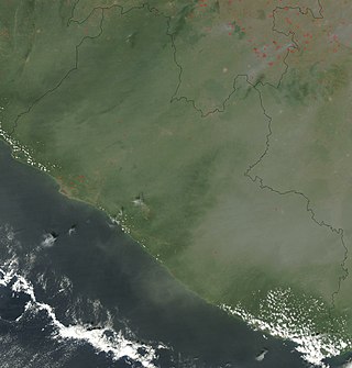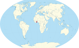
Liberia, officially the Republic of Liberia, is a country on the West African coast. It is bordered by Sierra Leone to its northwest, Guinea to its north, Ivory Coast to its east, and the Atlantic Ocean to its south and southwest. It has a population of around 5.5 million and covers an area of 43,000 square miles (111,369 km2). The official language is English. Over 20 indigenous languages are spoken, reflecting the country's ethnic and cultural diversity. The capital and largest city is Monrovia.

Liberia is a sub-Saharan nation in West Africa located at 6 °N, 9 °W.

The Kru languages are spoken by the Kru people from the southeast of Liberia to the west of Ivory Coast.

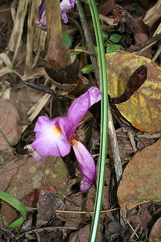
Grains of paradise is a species in the ginger family, Zingiberaceae, and closely related to cardamom. Its seeds are used as a spice ; it imparts a pungent, black-pepper-like flavor with hints of citrus. It is also known as melegueta pepper, Guinea grains, ossame, or fom wisa, and is sometimes confused with alligator pepper. The terms African pepper and Guinea pepper have also been used, but are ambiguous as they can apply to other spices such as grains of Selim.

Malagueta pepper, a variety of Capsicum frutescens, is a type of chili pepper widely used in the Portuguese-speaking world and the Caribbean. It got its name from the unrelated melegueta pepper, an African spice from Guinea which is a member of the ginger family.

Portuguese Guinea, called the Overseas Province of Guinea from 1951 until 1972 and then State of Guinea from 1972 until 1974, was a Portuguese overseas province in West Africa from 1588 until 10 September 1974, when it gained independence as Guinea-Bissau.
Cape Bojador is a headland on the west coast of Western Sahara, at 26° 07' 37"N, 14° 29' 57"W, as well as the name of the large nearby town with a population of 42,651. The name of the surrounding province also derives its name from the cape.

Guinea is a traditional name for the region of the coast of West Africa which lies along the Gulf of Guinea. It is a naturally moist tropical forest or savanna that stretches along the coast and borders the Sahel belt in the north.

Elmina is a town and the capital of the Komenda/Edina/Eguafo/Abirem District on the south coast of Ghana in the Central Region. It is situated on a bay on the Atlantic Ocean, 12.2 km (7.6 mi) west of Cape Coast. Elmina was the first European settlement in West Africa and it has a population of 33,576 people, as of 2013. The current Municipality chief of Elmina is Hon. Solomon Ebo Appiah.

Cape Palmas is a headland on the extreme southeast end of the coast of Liberia, Africa, at the extreme southwest corner of the northern half of the continent. The Cape itself consists of a small, rocky peninsula connected to the mainland by a sandy isthmus. Immediately to the west of the peninsula is the estuary of the Hoffman River. Approximately 21 km (15 mi) further along the coast to the east, the Cavalla River empties into the sea, marking the border between Liberia and the Côte d'Ivoire. It marks the western limit of the Gulf of Guinea, according to the International Hydrographic Organization (IHO).
African cuisine is an integral part of the continent's diverse cultures reflecting its long and complex history. The evolution of African cuisine is closely entwined with the lives of the native people. Influenced by their religious practices, climate and local agriculture. Early African societies were largely composed of hunter-gatherers who relied on foraging for wild fruits, vegetables, nuts, and hunting animals for sustenance. As agriculture developed across the continent there was a gradual shift to a more settled lifestyle with the cultivation of crops such as millet, sorghum, and later maize. Agriculture also brought about a change in diet leading to the development of a variety of culinary traditions vary by religion. Many African traditional dishes are based on plant- and seed-based diets.

Liberian nationality law is regulated by the Constitution of Liberia, as amended; the Aliens and Nationality Law, and its revisions; and various international agreements to which the country is a signatory. These laws determine who is, or is eligible to be, a national of Liberia. The legal means to acquire nationality, formal legal membership in a nation, differ from the domestic relationship of rights and obligations between a national and the nation, known as citizenship. Nationality describes the relationship of an individual to the state under international law, whereas citizenship is the domestic relationship of an individual within the nation. Liberian nationality is based on descent from a person who is "Negro", regardless of whether they were born on Liberian soil, jus soli, or abroad to Liberian parents, jus sanguinis. The Negro clause was inserted from the founding of the colony as a refuge for free people of color, and later former slaves, to prevent economically powerful communities from obtaining political power. It can be granted to persons with an affiliation to the country, or to a permanent resident who has lived in the country for a given period of time through naturalization.
Antoniotto Usodimare or Usus di Mare (1416–1462) was a Genoese trader and explorer in the service of the Portuguese Prince Henry the Navigator. Jointly with Alvise Cadamosto, Usodimare discovered a great stretch of the West African coast in two known voyages in 1455 and 1456. They notably discovered the Cape Verde islands, and the Guinea coast from the Gambia River to the Geba River

The Republic of Maryland was a country in West Africa that existed from 1834 to 1857, when it was merged into what is now Liberia. The area was first settled in 1834 by freed African-American slaves and freeborn African Americans primarily from the U.S. state of Maryland, under the auspices of the Maryland State Colonization Society.
African pepper is a name for several unrelated pepper-like spices traded from the general region of West Africa:

The Windward Coast is an area of West Africa located on the coast between Cape Mount and Assini, i.e. the coastlines of the modern states of Sierra Leone, Liberia and Ivory Coast, to the west of the Gold Coast. A related region is the Pepper Coast.

The Gold Coast was the name for a region on the Gulf of Guinea in West Africa that was rich in gold, petroleum, sweet crude oil and natural gas. This former region is now known as the country Ghana.

Alligator pepper is a West African spice made from the seeds and seed pods of Aframomum danielli, A. citratum or A. exscapum. It is a close relative of grains obtained from the closely related species, Aframomum melegueta or "grains of paradise". Unlike grains of paradise, which are generally sold as only the seeds of the plant, alligator pepper is sold as the entire pod containing the seeds.

West African cuisine encompasses a diverse range of foods that are split between its 16 countries. In West Africa, many families grow and raise their own food, and within each there is a division of labor. Indigenous foods consist of a number of plant species and animals, and are important to those whose lifestyle depends on farming and hunting.

Aframomum is a genus of flowering plants in the ginger family, Zingiberaceae. It is widespread across tropical Africa as well as on some islands of the Indian Ocean. It is represented by approximately 50 species. Its species are perennials and produce colorful flowers. Several aromatic species with essential oils present in fruits, seeds, leaves, stems, rhizomes, and other plant parts are either edible or used as medicine in Africa.


