Mount Sicker

Last updated • 5 min readFrom Wikipedia, The Free Encyclopedia
Mount Sicker
Canada British Columbia relief location map.jpg
Red triangle with thick white border.svg
Mount Sicker
Location in British Columbia
Mount Sicker
Location near North Cowichan
Highest point
Elevation 716 m (2,349 ft)
Listing Mountains of British Columbia
Coordinates 48°51′37″N123°45′25″W / 48.86028°N 123.75694°W / 48.86028; -123.75694 [1]
Geography
Location British Columbia, Canada
DistrictSomenos Land District
Topo map NTS   92B13 Duncan [1]

Mount Sicker is in southern Vancouver Island, British Columbia. The twin summits of Big Sicker Mountain, [2] at 716 metres (2,349 ft), and Little Sicker Mountain, [3] at 660 metres (2,170 ft), are near Crofton, Chemainus and Duncan. [1]

Contents

The name honours John J. Sicker, a homesteader in the area. [4] :243

Mining discovery

In fall 1895, prospectors Thomas L. Sullins, T. McKay and Henry Buzzard discovered traces of copper, gold and silver on Mt. Sicker and staked their claims. McKay died that winter. In spring 1896, Harry Smith became the new partner, but their copper claims proved unpromising. That August, when a forest fire devastated the western face of the mountain, they abandoned the shaft being dug and fled. The fire destroyed their cabin and gear. When Smith returned alone in spring 1897, the burned area revealed a 9.1-metre (30 ft) wide outcropping of copper at the mountain's 430-metre (1,400 ft) level. Within weeks of the discovery becoming public, prospectors had staked the entire mountain. [5] [6]

Lenora

Mining

Harry Smith named the new strike Lenora, after his married daughter. [5] In 1904, Lenora Richards (also part owner of Richard III), and Thomas Sullins' wife and children, drowned in the S.S. Clallam sinking. Thomas survived. [7] [8]

In fall 1897, Harry Smith established the Lenora, Mt. Sicker and BC Development Co. To provide investment capital, Henry Croft, brother-in-law of James Dunsmuir, bought a majority shareholding in spring 1898. Reorganized as Lenora, Mt. Sicker Copper Mining Co., Croft became the manager. [6] [9] By January 1900, the Lenora mine was the fourth largest shipper of ore in BC. [9] [10] Mining ceased in late 1902 when the company went into receivership. [11] During 1905, small scale operations resumed until the mine closure the following year. [12] In 1907, the mine was reactivated by the Vancouver Copper Co, which went bankrupt that year. [13]

Townsite

A townsite was laid out northwest of the mining tunnel, and by 1899, contained a general store, school, stable and home sites. [9] In 1900, lots in the townsite development were sold. [10] In early 1901, the 18-room Mt. Sicker Hotel [14] and 40-pupil schoolhouse opened. [15] In 1907, the hotel closed, and the contents sold by sheriff's sale over the following two years. [16] In due course, the townsite buildings were offered for sale at $8 for the hotel and $2 for the cottages. [17]

Roads & transportation

In 1900, a daily Lenora–Westholme stage commenced. [10] A wagon road, horse tramway, and then a narrow-gauge railway provided the initial link with the company siding on the Esquimalt and Nanaimo Railway (E&N), immediately southwest of the Westholme station. [9] The ore travelled by rail to Ladysmith, and by boat to the smelter at Vananda (now Van Anda) on Texada Island. [18] By 1901, the ore went to the Tacoma smelter. [19] In 1902, the company extended its railway line to Crofton for processing ore at its new smelter. [20] (see Lenora Mt. Sicker Railway).

Tyee

Mining

In spring 1897, Smith and Buzzard, also staked the Tyee claim, several hundred feet higher than Lenora. [5] [6] The most promising of several claims, the Tyee Development Co. was established, but acquired by the Tyee Copper Co in April 1900. [21] Production peaked in 1905, being the largest copper producer on the BC coast. By 1907, production had fallen dramatically, and the mine closed. [17]

Townsite

By 1901, the Tyee had its own townsite, [10] and Brenton Hotel by the fall. [14] The total Mt. Sicker population was reaching 2,000, making it the fourth largest on Vancouver Island. [15]

Roads & transportation

In October 1900, a 2.4-metre (8 ft) wide wagon road opened from Somenos. [14] From the E&N station, the ore went to Ladysmith, then Tacoma. In October 1902, the company opened a 5.3 kilometres (3.3 mi) aerial tramway to carry half-ton buckets of ore from the mine to a 200-ton capacity ore bin at its E&N siding [22] about 3.2 kilometres (2 mi) south of the Lenora mine one. [11]

Comprising the longest single section in the world, the tramway dropped 580 metres (1,900 ft), and had a 5,000-ton-monthly capacity. [23] In 1902, the company opened its own smelter west of Ladysmith, with the concentrate going to Tacoma for final processing. [11]

Richard III

Higher and to the east of the Tyee, the Richard III mine conducted development work in late 1902, and in 1903. The Tyee aerial tramway, and then E&N, transported ore to Ladysmith. [11] In 1905, the mined closed temporarily because the original ore seam appeared exhausted. [12] [17] Production peaked in 1906. [13] Final closure was in 1907. This mine and the Tyee experienced flooding problems, which had required installing expensive drainage pipes and pumps. [17]

Mt Sicker & Brenton

This company had a separate townsite to the west called Copper Canyon Camp, which never came to prominence. [24]

Later mining

Revivals of mining operations proved uneconomical and short-lived. In 1924, Lenora reopened under lease. In 1926, Ladysmith Tidewater Smelters took over the assets of Tyee mine and smelter and leased the Lenora. In 1928, the ventures changed hands again. In 1929, all work ceased and the lease dropped. In 1939, Lenora, Tyee, and Richard III, were optioned for development work, but dropped in 1940. In 1941, the Department of Mines conducted a comprehensive examination of mountain's geology. By 1943, Twin J Mines had rehabilitated all three, [25] operating intermittently until 1952. Lifetime recoveries have totalled 20,265,763 pounds of copper, 841,276 ounces of silver, and 39,052 ounces of gold, [26] the latter decades making only a small contribution. [27]

Remnants

Many houses were salvaged and moved to other communities in the Cowichan Valley, but some remained as a ghost town until weather, vandalism, and finally logging erased visible traces. [28]

Access

Mount Sicker can be reached from Mount Prevost Rd off Somenos Rd, or from Mt. Sicker Rd off Westholme Rd. The roads on Mt. Sicker are unpaved, unmaintained, not sign-posted, and designated for active logging. The mountain offers good views of the Gulf Islands and Chemainus River valley.

Towers

Opened in 2000, the weather radar installation on the south face covered a 256 kilometres (159 mi) radius. Access to the property is gated, under video surveillance, and fenced. A communication tower and cell tower also occupy the site. [29] After a 2017 hardware failure, the location became a decommissioned site of the Canadian weather radar network the next year. [30] [31]

Related Research Articles

<span class="mw-page-title-main">Britannia Beach</span> Village in British Columbia, Canada

Britannia Beach is a small unincorporated community in the Squamish-Lillooet Regional District located approximately 55 kilometres north of Vancouver, British Columbia on the Sea-to-Sky Highway on Howe Sound. It has a population of about 300. It includes the nearby Britannia Creek, a small to mid-sized stream that flows into Howe Sound that was historically one of North America's most polluted waterways.

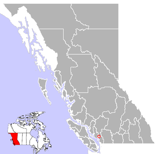
Crofton is a small west coast town within the District of North Cowichan of southern Vancouver Island in British Columbia, east of BC Highway 1 about 74 kilometres (46 mi) north of Victoria.

<span class="mw-page-title-main">Henry Croft</span> Lumber and mining magnate

Henry Croft was an Australian-born lumber and mining magnate on Vancouver Island from the 1880s to 1900s. Born in Australia, Croft moved to England at a young age and was educated there. He moved to Canada in 1883 and became involved in logging, purchasing the sawmill in Chemainus. Croft rose in prominence through his running of the mill, and further enhanced his standing by marrying a daughter of Robert Dunsmuir, a prominent industrialist on Vancouver Island. Croft was elected to the British Columbia Legislature in 1886, representing Cowichan, serving until 1894. He later became involved in mining on Mount Sicker, and founded the town of Crofton, British Columbia in 1902 as a place to house the smelter for mining. Croft is featured on the Netflix series Haunted wherein a family claims to have been haunted by his ghost.

Cassidy is an unincorporated community straddling Haslam Creek. near the east coast of southern Vancouver Island, British Columbia, Canada. The location on BC Highway 19 is about 98 kilometres (61 mi) by road north-west of Victoria, and 14 kilometres (9 mi) south of Nanaimo.

<span class="mw-page-title-main">Captains Flat</span> Town in New South Wales, Australia

Captains Flat is a town in the Southern Tablelands of rural New South Wales, Australia, in Queanbeyan-Palerang Regional Council. It is south of Queanbeyan. Captains Flat township is bounded by the non-urban parts of the locality of Captains Flat in the north, east and west, and Captains Flat Road, the Molonglo River and Foxlow Street in the south.

<span class="mw-page-title-main">Morden Colliery Historic Provincial Park</span> Historic provincial park in Nanaimo Regional District, British Columbia

Morden Colliery Historic Provincial Park is a 4-hectare (9.9-acre) historic provincial park near the east coast of southern Vancouver Island, British Columbia. The location off BC Highway 19 is about 102 kilometres (63 mi) by road northwest of Victoria, and 10 kilometres (6 mi) south of Nanaimo.

The Lenora Mt. Sicker Railway was a narrow-gauge railway which hauled copper ore from the Lenora mine on Mount Sicker to tidewater at Crofton on southern Vancouver Island, British Columbia.

Mount Isa Mines Limited ("MIM") operates the Mount Isa copper, lead, zinc and silver mines near Mount Isa, Queensland, Australia as part of the Glencore group of companies. For a brief period in 1980, MIM was Australia's largest company. It has pioneered several significant mining industry innovations, including the Isa Process copper refining technology, the Isasmelt smelting technology, and the IsaMill fine grinding technology, and it also commercialized the Jameson Cell column flotation technology.

Silver mining in Colorado has taken place since the 1860s. In the past, Colorado called itself the Silver State.

Wellington, formerly a separate district and town, is a neighbourhood of north Nanaimo, on the east coast of southern Vancouver Island, British Columbia.

<span class="mw-page-title-main">Iron Blow</span> Mine in Tasmania, Australia

Iron Blow was the site of the earliest major mining venture at Mount Lyell on the west coast of Tasmania, Australia in 1883.

Big Interior Mountain is in central Vancouver Island, British Columbia. This snow-covered mountain in Strathcona Provincial Park is about 42 km (26 mi) northeast of Tofino and 5 km (3 mi) southwest of Mount Rosseau.

Cody is at the confluence of Cody Creek into Carpenter Creek in the West Kootenay region of southeastern British Columbia. The ghost town, about one kilometre east of Sandon, lies off BC Highway 31A. By road, the former mining community is about 15 kilometres (9 mi) east of New Denver and 44 kilometres (27 mi) west of Kaslo.

Granby Consolidated Mining, Smelting and Power Co. was established by charter to operate in the Boundary region of southern British Columbia. Primarily involved in the mining and smelting of copper, the conglomerate became a publicly traded company. The various corporate operating names within the former group mostly specified the Granby identity.

<span class="mw-page-title-main">Bristol Wells Town Site</span> United States historic place

Bristol Wells, also known as National City, Bristol City and Tempest, is a ghost town in Lincoln County, Nevada. The mining town was located on the west side of Bristol Mountain, 14 miles (23 km) northwest of Pioche, Nevada.

Anaconda is an unincorporated community south of the confluence of Eholt and Boundary creeks in the Boundary Country region of south central British Columbia. About 43 kilometres (27 mi) west of Grand Forks, and 82 kilometres (51 mi) east of Osoyoos, on Highway 3, the neighbourhood is immediately south of Greenwood.

<span class="mw-page-title-main">Zincton, British Columbia</span> Place in British Columbia, Canada

Zincton is a ghost town in the West Kootenay region of southeastern British Columbia. This former mining community, on BC Highway 31A, is by road about 15 kilometres (9 mi) northeast of New Denver and 31 kilometres (19 mi) northwest of Kaslo.

Extension is an unincorporated community near the east coast of southern Vancouver Island, British Columbia. The location off BC Highway 19 is about 107 kilometres (66 mi) by road northwest of Victoria, and 10 kilometres (6 mi) south of Nanaimo.

<span class="mw-page-title-main">Britannia Mines Concentrator</span> Historic site in British Columbia, Canada

The Britannia Mines Concentrator is a National Historic Site of Canada. The large, inclined gravity mill was built on the northwest side of Mount Sheer to assist the transfer of copper ore through the chemical and mechanical processes of the plant. It is a landmark in Britannia Beach, British Columbia some forty-five kilometers north of Vancouver.

Air Marshal Sir Philip Clermont Livingston, was a physician, aviator, and a senior officer in the Royal Air Force who served as Director-General RAF Medical Services from 1948 to 1951.

References

  1. 1 2 3 "Mount Sicker". BC Geographical Names . Retrieved 2021-02-07.
  2. "Big Sicker Mountain (mountain)". BC Geographical Names .
  3. "Little Sicker Mountain". BC Geographical Names . Retrieved 2021-06-25.
  4. Akrigg, G.P.V.; Akrigg, Helen B. (1986), British Columbia Place Names (3rd, 1997 ed.), Vancouver: UBC Press, ISBN   0-7748-0636-2
  5. 1 2 3 White & Wilkie 1968, p. 5.
  6. 1 2 3 Paterson & Basque 1999, p. 17.
  7. "Daily Colonist, 10 Jan 1904". www.archive.org. 1904. p. 8.
  8. "Daily Colonist, 15 Jan 1904". www.archive.org. 1904. p. 2.
  9. 1 2 3 4 White & Wilkie 1968, p. 6.
  10. 1 2 3 4 Paterson & Basque 1999, p. 18.
  11. 1 2 3 4 White & Wilkie 1968, p. 25.
  12. 1 2 White & Wilkie 1968, p. 29.
  13. 1 2 White & Wilkie 1968, p. 30.
  14. 1 2 3 White & Wilkie 1968, p. 14.
  15. 1 2 Paterson & Basque 1999, p. 21.
  16. "Daily Colonist, 14 May 1908". www.archive.org. 1908. p. 16.
  17. 1 2 3 4 Paterson & Basque 1999, p. 23.
  18. White & Wilkie 1968, p. 9.
  19. White & Wilkie 1968, p. 10.
  20. White & Wilkie 1968, pp. 21–22.
  21. White & Wilkie 1968, p. 13.
  22. White & Wilkie 1968, p. 22.
  23. Paterson & Basque 1999, pp. 21–23.
  24. Paterson & Basque 1999, p. 24.
  25. White & Wilkie 1968, p. 34.
  26. White & Wilkie 1968, p. 38.
  27. "Province of British Columbia Mineral Inventory". www.gov.bc.ca.
  28. "Mount Sicker". www.geog.uvic.ca.
  29. "Mount Sicker Weather Radar". www.waymarking.com.
  30. "Radar outages and maintenance". www.canada.ca. 3 July 2014.
  31. Grimes (December 6, 2020). "NOCN01 CWAO 311434". Genot. Meteorological Service of Canada . Retrieved 2020-12-29.