Mount Tamborine, Queensland

Last updated

Mount Tamborine
Queensland
Australia Queensland location map.svg
Red pog.svg
Mount Tamborine
Coordinates 27°58′21″S153°11′52″E / 27.9725°S 153.1977°E / -27.9725; 153.1977 (Mount Tamborine (town centre))
Population1,184 (2006 census) [1]
Established1875
Postcode(s) 4272
Time zone AEST (UTC+10:00)
LGA(s) Scenic Rim Region
State electorate(s) Scenic Rim
Federal division(s) Wright

Mount Tamborine is a town within the locality of Tamborine Mountain in South East Queensland, Australia. [2] [3]

Contents

History

Mount Tamborine Post Office opened by March 1924 (a receiving office had been open from 1881, originally known as Tambourine Mountain), was renamed Mount Tamborine in 1926 and closed in 1977. [4]

The name "Tamborine" is taken from the Yugambeh language for "wild lime", after the finger lime trees in the area. Tamborine was sometimes spelt as "tchambreem", "jambreen" and "goombireen".

Formerly a suburb in its own right, in 1997, Mount Tamborine was merged with other former suburbs North Tamborine and Eagle Heights to create the larger locality of Tamborine Mountain. [5] All three suburbs now have the postcode 4272 and postal address of Tamborine Mountain. The postcode 4271 is reserved for the Post Office at Eagle Heights.

Demographics

In the 2006 census, Mount Tamborine had a population of 1,184 people. [1] There has not been any census data reported for the town of Mount Tamborine after 2006.

Sport and recreation

A number of well-known sporting teams represent the local area, including the Tamborine Mountain Bushrats, the rugby league club who play home games at Tamborine Mountain Sports Complex.

Heritage listings

Mount Tamborine has a number of heritage-listed sites, including:

See also

Related Research Articles

<span class="mw-page-title-main">Tamborine National Park</span> Protected area in Queensland, Australia

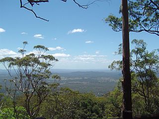
Tamborine National Park is a protected area split between the City of Gold Coast and the Scenic Rim Region in South East Queensland, Australia, 67.5 km (41.9 mi) by road south of Brisbane.

<span class="mw-page-title-main">Bedourie, Queensland</span> Town in Queensland, Australia

Bedourie is a town and a locality in the Shire of Diamantina, Queensland, Australia. It is on the border with the Northern Territory. In the 2021 census, the locality of Bedourie had a population of 150 people.

<span class="mw-page-title-main">Mount Garnet, Queensland</span> Town in Queensland, Australia

Mount Garnet is a rural town and locality in the Tablelands Region, Queensland, Australia. In the 2021 census, the locality of Mount Garnet had a population of 532 people.

<span class="mw-page-title-main">Baralaba, Queensland</span> Town in Queensland, Australia

Baralaba is a rural town and locality in the Shire of Banana in central Queensland, Australia. In the 2021 census, the locality of Baralaba had a population of 324 people.

<span class="mw-page-title-main">Mount Mulligan, Queensland</span> Town in Queensland, Australia

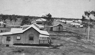
Mount Mulligan is a former mining town and now a rural locality in the Shire of Mareeba, Queensland, Australia. In the 2021 census, the locality of Mount Mulligan had "no people or a very low population".

<span class="mw-page-title-main">Tamborine Mountain</span> Suburb of Scenic Rim Region, Queensland, Australia

Tamborine Mountain is a plateau and locality in the Scenic Rim Region, Queensland, Australia. In the 2021 census, Tamborine Mountain had a population of 8,105 people.

<span class="mw-page-title-main">Beerburrum, Queensland</span> Town in Queensland, Australia

Beerburrum is a rural town and coastal locality in the Sunshine Coast Region, Queensland, Australia. In the 2021 census, the locality of Beerburrum had a population of 941 people.

<span class="mw-page-title-main">Mount Britton, Queensland</span> Suburb of Isaac Region, Queensland, Australia

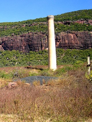
Mount Britton is a rural locality in the Isaac Region, Queensland, Australia. It contains the abandoned gold rush town of Mount Britton in the former Nebo Shire. In the 2021 census, Mount Britton had a population of 4 people.

<span class="mw-page-title-main">Linville, Queensland</span> Town in Queensland, Australia

Linville is a rural town and locality in the Somerset Region, Queensland, Australia. In the 2021 census, the locality of Linville had a population of 133 people.

<span class="mw-page-title-main">Inkerman, Queensland</span> Town in Australia

Inkerman is a rural town and locality in the Shire of Burdekin, Queensland, Australia. In the 2021 census, the locality of Inkerman had a population of 119 people.

Mount Burnett is a small country town and bounded locality located approximately 72 kilometres (45 mi) from Melbourne, in Victoria, Australia, located within the Shire of Cardinia local government area. Mount Burnett recorded a population of 180 at the 2021 census.

<span class="mw-page-title-main">Mount Surprise, Queensland</span> Town in Queensland, Australia

Mount Surprise is a rural town and locality in the Shire of Etheridge, Queensland, Australia. In the 2021 census, the locality of Mount Surprise had a population of 138 people.

<span class="mw-page-title-main">North Tamborine, Queensland</span> Town in Queensland, Australia

North Tamborine is a rural town in the locality of Tamborine Mountain in the Scenic Rim Region, Queensland, Australia.

Eagle Heights is a town within the locality of Tamborine Mountain in South East Queensland, Australia.

<span class="mw-page-title-main">Moore, Queensland</span> Town in Queensland, Australia

Moore is a rural town and locality in the Somerset Region, Queensland, Australia. In the 2021 census, the locality of Moore had a population of 286 people.

<span class="mw-page-title-main">Benarkin</span> Town in Queensland, Australia

Benarkin is a rural town and locality in the South Burnett Region, Queensland, Australia. The nearby town of Blackbutt is the origin of the town and the two towns are often referred to as the joint entity Blackbutt-Benarkin. In the 2021 census, the locality of Benarkin had a population of 61 people.

<span class="mw-page-title-main">Mount Coolon, Queensland</span> Town in Queensland, Australia

Mount Coolon is a rural town and locality in the Whitsunday Region, Queensland, Australia. In the 2021 census, the locality of Mount Coolon had a population of 172 people.

<span class="mw-page-title-main">Boyland, Queensland</span> Suburb of Scenic Rim Region, Queensland, Australia

Boyland is a rural locality in the Scenic Rim Region, Queensland, Australia. In the 2021 census, Boyland had a population of 855 people.

<span class="mw-page-title-main">Wongawallan, Queensland</span> Suburb of Gold Coast, Queensland, Australia

Wongawallan is a rural locality in the City of Gold Coast, Queensland, Australia. In the 2021 census, Wongawallan had a population of 1,415 people.

<span class="mw-page-title-main">Tamborine Mountain Road</span> Historic site in Queensland, Australia

Tamborine Mountain Road is a continuous 24.1 kilometres (15.0 mi) road route in the Scenic Rim local government area of Queensland, Australia. Part of the route is designated as State Route 95. It is a state-controlled district road, rated as a local road of regional significance (LRRS).

References

  1. 1 2 Australian Bureau of Statistics (25 October 2007). "Mount Tamborine (UCL)". 2006 Census QuickStats. Retrieved 27 January 2020.
  2. "Mount Tamborine – town in Scenic Rim Region (entry 23163)". Queensland Place Names. Queensland Government . Retrieved 27 January 2020.
  3. "Mount Tamborine – neighbourhood (entry 39794)". Queensland Place Names. Queensland Government . Retrieved 31 January 2016.
  4. Phoenix Auctions History. "Post Office List". Phoenix Auctions. Archived from the original on 7 June 2022. Retrieved 21 February 2021.
  5. "Eagle Heights". Queensland Places. Centre for the Government of Queensland, University of Queensland. Archived from the original on 2 March 2016. Retrieved 31 January 2016.
  6. "Tamborine Mountain Road/Geissmann Drive (entry 602365)". Queensland Heritage Register . Queensland Heritage Council. Retrieved 12 July 2013.