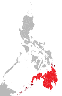
Mindanao is the second-largest island in the Philippines, after Luzon. Located in the southern region of the archipelago, the island is part of an island group of the same name that also includes its adjacent islands, notably the Sulu Archipelago. As of the 2010 census, Mindanao has 20,281,545 inhabitants, while the entire island group has an estimated population of 25,537,691 as of 2018.

The Philippines is an archipelago that comprises 7,641 islands with a total land area of 300,000 square kilometers (115,831 sq mi). It is the world's 5th largest island country. The eleven largest islands contain 95% of the total land area. The largest of these islands is Luzon at about 105,000 square kilometers (40,541 sq mi). The next largest island is Mindanao at about 95,000 square kilometers (36,680 sq mi). The archipelago is around 800 kilometers (500 mi) from the Asian mainland and is located between Taiwan and Borneo.

Zamboanga del Sur is a province in the Philippines located in the Zamboanga Peninsula region in Mindanao. Its capital is the city of Pagadian. Statistically grouped with Zamboanga del Sur is the highly urbanized city of Zamboanga, which is geographically separated and a chartered city and governed independently from the province.

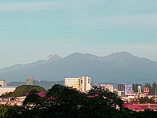
Mount Apo, also known locally as Apo Sandawa, is a large solfataric, dormant stratovolcano on the island of Mindanao, Philippines. With an elevation of 2,954 meters (9,692 ft) above sea level, it is the highest-mountain in the Philippine Archipelago and 24th-highest peak of an island on Earth. Located between Davao City and Davao del Sur province in Region XI and Cotabato in Region XII. Mount Apo is most-prominent mountain in the Philippines. The peak overlooks from Davao City 45 kilometers (28 mi) to the northeast, Digos 25 kilometers (16 mi) to the southeast, and Kidapawan 20 kilometers (12 mi) to the west. It is a protected area and a Natural Park of the Philippines.

Pagadian, officially the City of Pagadian, is a 2nd class component city and the capital of the province of Zamboanga del Sur, Philippines. It is the regional center of Zamboanga Peninsula and the second-largest city in the region, after the independent city of Zamboanga. According to the 2015 census, it has a population of 199,060 people.

Molave, officially known as the Municipality of Molave, is a 1st class municipality in the province of Zamboanga del Sur, Philippines. In the 2015 census, it had 52,006 people. It is in the eastern part of the province of Zamboanga del Sur, and has an area of 21,685 hectares. The name "Molave" refers to the tree that was common in the area. Its economy is focused on agricultural production, and 1,378.5 hectares of fertile land is irrigated and planted with rice. Corn, coconut, cassava, banana, camote and various vegetables are also grown. These are marketed to neighboring towns and cities, and reach Cebu. Due to its strategic location, Molave is becoming the commercial hub of the Salug Valley.

Tigbao, officially the Municipality of Tigbao, is a 5th class municipality in the province of Zamboanga del Sur, Philippines. According to the 2015 census, it has a population of 20,979 people.
The legislative districts of Zamboanga del Sur are the representations of the province of Zamboanga del Sur in the various national legislatures of the Philippines. The province is currently represented in the lower house of the Congress of the Philippines through its first and second congressional districts.

Mount Isarog, also known as Vulcan de Agua is a potentially active stratovolcano located in the province of Camarines Sur, Philippines, on the island of Luzon. The mountain has active fumaroles and hot springs. It has an elevation of 2,000 metres above mean sea level.

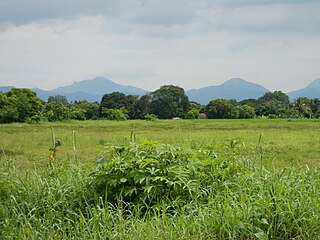
Kitanglad Mountain Range is a mountain range that dominates the northern central portion of the province of Bukidnon. It occupies portions of eight of the municipalities and cities in the province such as Talakag, Baungon, Libona, Manolo Fortich, Impasugong, Lantapan and Malaybalay. The range is one of the few remaining rainforests in the Philippines, hosting one of the most important diverse species of rare and endemic wildlife such as the Philippine eagle. Five of its peaks have very high elevations: Mount Dulang-dulang, the highest at 2,941 meters; Mount Kitanglad at 2,899 meters; Mount Maagnaw at 2,742 meters; Mount Lumuluyaw at 2,612 meters; and Mount Tuminungan at 2,400 meters.

Mount Malindang is a complex volcano located in the province of Misamis Occidental in the southern island of Mindanao, Philippines. It is the highest point in the province. The least studied mountain range was formed through several volcanic activities some of which could be historical, evident by the presence of two calderas, surrounded by high rock walls, cinder cones, dome volcano plugs, two sulfurous hot springs, and a crater lake named Lake Duminagat. The amphitheater structures have extensive distribution of volcanic rocks, carbonized wood that are found in pyroclastic deposits. The mountain range is dissected by several canyons and ravines.

Sibalom Natural Park is a 5,511.47-hectare (13,619.1-acre) protected area in the Philippines on the island of Panay in the municipality of Sibalom, Antique. It was proclaimed a natural park on 23 April 2000. It is considered as one of the last remaining lowland rainforests on Panay.

The Mount Inayawan Range Natural Park is a protected area of forested mountains in the Northern Mindanao region of the Philippines. The park encompasses the mountain range also known as Mount Iniaoan located in the landlocked municipality of Nunungan in Lanao del Norte and covers a total area of 3,632.74 hectares with a buffer zone of 889.04 hectares. The area was officially designated as a natural park on 30 July 2007 through Proclamation No. 1344 signed by President Gloria Arroyo. It is a critical watershed area and the largest remaining rainforest in Lanao del Norte.

The Mounts Palay-Palay–Mataas-na-Gulod Protected Landscape is a 3,973.13-hectare (9,817.8-acre) protected area encompassing the Palay-Palay Mountain Range in southwestern Luzon island near Manila in the Philippines. It was established on 26 October 1976 as a national park and game refuge and bird sanctuary covering an initial area of 4,000 hectares. In 2007, the national park was designated as a protected landscape area under the National Integrated Protected Areas System through Proclamation No. 1315 signed by President Gloria Arroyo. The park is the last remaining lowland rainforest in the province of Cavite and is well known for Mount Pico de Loro, a popular destination for mountaineers and hikers from Metro Manila.

The Aliwagwag Protected Landscape is a protected area that preserves a major drainage catchment in the southern Philippine island of Mindanao in the Davao Region. It contains the headwaters of the Cateel River in the southern Diuata Mountain Range which provides the water source and irrigation for surrounding rice fields and communities in Davao de Oro and Davao Oriental provinces. It was named after the remote rural village in the municipality of Cateel where Aliwagwag Falls, the country's highest waterfall, is located.

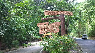
The Pasonanca Natural Park is a protected area that preserves a major watershed in the southern Philippine island of Mindanao in the Zamboanga Peninsula. It contains the headwaters of the Tumaga River in the southern Zamboanga Cordillera mountain range that serves the water requirements of some 800,000 residents in Zamboanga City. It was named after the village of Pasonanca located in the city's northern fringes where the Pasonanca Park, a public eco-park, and the Abong-Abong Park, a pilgrimage site, can also be found.

The Mainit Hot Springs Protected Landscape is a protected landscape area located in the province of Davao de Oro on the island of Mindanao in the Philippines. It preserves the sulfuric hot springs and surrounding forest in Nabunturan municipality which also contains the headwaters of the Manat River, a source of water supply for surrounding villages. First declared a national park in 1957 by virtue of Proclamation No. 466 by President Carlos P. Garcia, it had an initial area of 1,381 hectares. Under the National Integrated Protected Areas System, it was reclassified as a protected landscape through Proclamation No. 320 issued in 2000 by President Joseph Estrada. The hot springs are a popular ecotourist attraction in Davao de Oro. Its name "Mainit" is a Filipino word which means hot.

The Quezon Protected Landscape is a protected area in the Republic of the Philippines, spanning the municipalities of Pagbilao, Padre Burgos and Atimonan in Quezon province. The park is situated north of the narrowest section of Luzon in Quezon province, located about 164 km (102 mi) southeast of Metro Manila.

The Samar Island Natural Park, in Samar, is the largest contiguous tract of old-growth forest in the Philippines. It is the country's largest terrestrial protected area, with an area of 333,300 hectares. The buffer is spread north to south over the island's three provinces and totals 458,700 hectares, about a third of the entire island of Samar.

The Pamitinan Protected Landscape is a Philippine protected area of approximately 608 hectares in the Sierra Madre mountain range, just 34 kilometres (21 mi) northeast of Manila. It contains and protects the Montalban Gorge formed by the Marikina River that separates Mount Pamitinan and Mount Binacayan in the municipality of Rodriguez in Rizal. Established in 1996 through Proclamation No. 901 issued by President Fidel Ramos, the park is originally a component of the Mariquina Reserve founded in 1904 to protect the watershed of the Marikina River that supplied water to the city of Manila from the Wawa Dam located just above the Montalban Gorge in the early 1900s.


