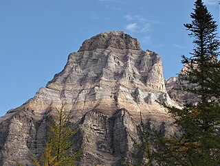
Mount Wilkie

Last updated
Mount Wilkie
Mountains above Trout Lake, British Columbia.jpg
Northeast aspect
Highest point
Elevation 2,699 m (8,855 ft) [1]
Prominence 797 m (2,615 ft) [1]
Parent peak Mount Cooper [2]
Isolation 11.52 km (7.16 mi) [1]
Listing Mountains of British Columbia
Coordinates 50°29′01″N117°25′43″W / 50.48361°N 117.42861°W / 50.48361; -117.42861 [3]
Naming
Etymology Octavius Bentley Neves Wilkie
Geography
Canada British Columbia relief location map.jpg
Red triangle with thick white border.svg
Mount Wilkie
Location in British Columbia
Canada relief map 2.svg
Red triangle with thick white border.svg
Mount Wilkie
Location in Canada
Mount Wilkie
Interactive map of Mount Wilkie
Country Canada
Province British Columbia
District Kootenay Land District [4]
Protected area Goat Range Provincial Park [2]
Parent range Selkirk Mountains
Lardeau Range [1]
Topo map NTS 82K6 Poplar Creek

Mount Wilkie is a 2,699-metre (8,855-foot) summit in British Columbia, Canada.

Contents

Description

Mount Wilkie is the highest point of the Lardeau Range which is a subrange of the Selkirk Mountains. [1] The true summit (2,699 m) lies less than 800 metres west of the 2,630-metre summit marked as Mount Wilkie on topographic maps. [1] [5] The mountain is located eight kilometres (5.0 mi) southeast of Trout Lake on the northern boundary of Goat Range Provincial Park. Precipitation runoff and glacial meltwater from this mountain's slopes drains to Trout Lake, thence Lardeau River. Mount Wilkie is more notable for its steep rise above local terrain than for its absolute elevation as topographic relief is significant with the summit rising 1,985 metres (6,512 ft) above Trout Lake in less than eight kilometres (5.0 mi) and 1,355 metres (4,445 ft) above Mobbs Creek in three kilometres (1.9 mi).

History

The mountain's name honors surveyor Octavius Bentley Neves Wilkie (1872–1942), who worked at Trout Lake for many years. [3] He worked on the Alaska Boundary Survey, surveyed the boundary country and in the Kootenays. He was also an original member of the Alpine Club of Canada. [6] The toponym was officially adopted March 31, 1924, by the Geographical Names Board of Canada. [4]

Climate

Based on the Köppen climate classification, Mount Wilkie is located in a Subarctic climate zone of western North America. [7] Winter temperatures can drop below −20 °C with wind chill factors below −30 °C. This climate supports an unnamed glacier on the north slope of the peak. The months of July through September offer the most favorable weather for climbing Mount Wilkie.

See also

Related Research Articles

<span class="mw-page-title-main">Mount Huber</span> Mountain in Canada

Mount Huber is a 3,348-metre (10,984-foot) summit located two kilometres east of Lake O'Hara in the Bow Range of Yoho National Park, in the Canadian Rockies of British Columbia, Canada. The nearest higher neighbor is Mount Victoria, 1.0 km (0.62 mi) to the north-northeast on the Continental Divide. Mount Huber is a secondary summit of Mount Victoria.

<span class="mw-page-title-main">Foster Peak</span> Mountain in British Columbia, Canada

Foster Peak is a 3,204-metre (10,512-foot) mountain summit located on the western border of Kootenay National Park. It is the highest point in the Vermilion Range, a sub-range of the Canadian Rockies of British Columbia, Canada. Its nearest higher peak is Mount Ball, 14.96 km (9.30 mi) to the northeast. The mountain is part of what is known as The Rockwall. Floe Lake, southeast of the peak, is one of the beauty spots of Kootenay National Park. The area is accessible via the Floe Lake Trail and Rockwall Trail. The Rockwall Trail is a scenic 55 kilometre traverse of alpine passes, subalpine meadows, hanging glaciers, and limestone cliffs, in some places in excess of 900 metres above the trail.
<span class="mw-page-title-main">Mount Carr</span> Mountain in the country of Canada

Mount Carr is a 2,590-metre (8,497-foot) mountain summit located in British Columbia, Canada.

<span class="mw-page-title-main">Nestor Peak</span> Mountain in the country of Canada

Nestor Peak is a 2,972-metre (9,751-foot) mountain summit located in Mount Assiniboine Provincial Park of British Columbia, Canada.

<span class="mw-page-title-main">Mount Shanks</span> Mountain in the country of Canada

Mount Shanks is a 2,838-metre (9,311-foot) mountain summit located in British Columbia, Canada.

<span class="mw-page-title-main">Mount Swiderski</span> Mountain in British Columbia, Canada

Mount Swiderski is a 3,133-metre (10,279-foot) mountain summit in British Columbia, Canada.

<span class="mw-page-title-main">Cloudraker Mountain</span> Mountain in British Columbia, Canada

Cloudraker Mountain is a 2,385-metre (7,825-foot) glaciated summit in British Columbia, Canada.

Whitecap Mountain is a 2,918-metre (9,573-foot) summit in British Columbia, Canada.

<span class="mw-page-title-main">Mount Sir Richard</span> Mountain in British Columbia, Canada

Mount Sir Richard is a 2,681-metre (8,796-foot) glaciated summit in British Columbia, Canada.

<span class="mw-page-title-main">In-SHUCK-ch Mountain</span> Mountain in British Columbia, Canada

In-SHUCK-ch Mountain is a 2,386-metre (7,828-foot) summit in British Columbia, Canada.

<span class="mw-page-title-main">The Lecture Cutters</span> Mountains in British Columbia, Canada

The Lecture Cutters are 2,524-metre (8,281-foot) mountain peaks in British Columbia, Canada.

<span class="mw-page-title-main">Outlier Peak</span> Mountain in British Columbia, Canada

Outlier Peak is a 2,422-metre (7,946-foot) mountain summit in British Columbia, Canada.

<span class="mw-page-title-main">Nivalis Mountain</span> Mountain in British Columbia, Canada

Nivalis Mountain is a 2,659-metre (8,724-foot) mountain summit in British Columbia, Canada.

<span class="mw-page-title-main">Mount Neal</span> Mountain in British Columbia, Canada

Mount Neal is a 2,552-metre (8,373-foot) glaciated summit in British Columbia, Canada.
<span class="mw-page-title-main">Carcajou Peak</span> Mountain in British Columbia, Canada

Carcajou Peak is a 2,239-metre (7,346-foot) mountain summit in British Columbia, Canada.

<span class="mw-page-title-main">Mount Moe</span> Mountain in British Columbia, Canada

Mount Moe is a 2,664-metre (8,740-foot) glaciated summit in British Columbia, Canada.

<span class="mw-page-title-main">Twin Goat Mountain</span> Mountain in British Columbia, Canada

Twin Goat Mountain is a 2,128-metre (6,982-foot) summit in British Columbia, Canada.

<span class="mw-page-title-main">Mount Roberts (Rossland Range)</span> Mountain in British Columbia, Canada

Mount Roberts is a 1,991-metre (6,532-foot) mountain summit in British Columbia, Canada.

<span class="mw-page-title-main">Mount Evans (British Columbia)</span> Mountain in British Columbia, Canada

Mount Evans is a 2,250-metre (7,382-foot) glaciated summit in British Columbia, Canada.

<span class="mw-page-title-main">Tzoonie Mountain</span> Mountain in British Columbia, Canada

Tzoonie Mountain is a 2,123-metre (6,965-foot) summit in British Columbia, Canada.

References

  1. 1 2 3 4 5 6 "Mount Wilkie, British Columbia". Peakbagger.com. Retrieved 2024-03-20.
  2. 1 2 "Mount Wilkie, Peakvisor.com" . Retrieved 2024-03-20.
  3. 1 2 "Mount Wilkie". BC Geographical Names .
  4. 1 2 "Mount Wilkie". Geographical Names Data Base . Natural Resources Canada . Retrieved 2024-03-20.
  5. BC Basemap, Retrieved 2024-03-20.
  6. The Mountain Legacy Project, Mary Sanseverino, October 27, 2017. Alpine Club of Canada, Retrieved 2024-03-20.
  7. Peel, M. C.; Finlayson, B. L.; McMahon, T. A. (2007). "Updated world map of the Köppen−Geiger climate classification". Hydrol. Earth Syst. Sci. 11 (5): 1633. Bibcode:2007HESS...11.1633P. doi: 10.5194/hess-11-1633-2007 . ISSN   1027-5606.