Mountain Rest | |
|---|---|
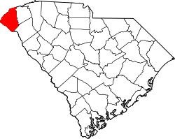
 Mountain Rest Location within the state of South Carolina | |
| Coordinates: 34°52′09″N83°09′17″W / 34.86917°N 83.15472°W [1] | |
| Country | United States |
| State | South Carolina |
| County | Oconee |
| Elevation | 1,713 ft (522 m) |
| Time zone | Eastern (EST) |
| • Summer (DST) | EDT |
| ZIP codes | 29664 |
| Area code | 864 |
| GNIS feature ID | 1938354 [1] |
Mountain Rest or Mountain Rest Division is an unincorporated community [1] near the Chattooga River in northwestern Oconee County, South Carolina. The community is on South Carolina Highway 28 adjacent to a lake on Taylor Creek. [2] The ZIP Code for Mountain Rest is 29664. [3]
The Oconee State Park Historic District and Russell House are listed on the National Register of Historic Places. [4]