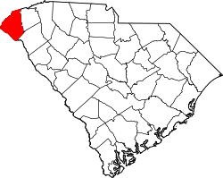
Keowee Key, South Carolina

Last updated
Keowee Key, South Carolina
USA South Carolina location map.svg
Red pog.svg
Keowee Key
Usa edcp location map.svg
Red pog.svg
Keowee Key
Coordinates: 34°49′34″N82°55′6″W / 34.82611°N 82.91833°W / 34.82611; -82.91833 Coordinates: 34°49′34″N82°55′6″W / 34.82611°N 82.91833°W / 34.82611; -82.91833
CountryUnited States
State South Carolina
County Oconee
Area
[1]
  Total6.12 sq mi (15.85 km2)
  Land3.47 sq mi (8.98 km2)
  Water2.65 sq mi (6.86 km2)
Elevation
[2]
948 ft (289 m)
Population
 (2020) [3]
  Total2,716
  Density783.16/sq mi (302.39/km2)
Time zone UTC-5 (Eastern (EST))
  Summer (DST) UTC-4 (EDT)
ZIP Code
29676 (Salem)
Area code 864
FIPS code 45-38058
GNIS feature ID2812981 [2]

Keowee Key is a lakeside community and census-designated place (CDP) in Oconee County, South Carolina, United States. It was first listed as a CDP prior to the 2020 census [2] with a population of 2,716. [4]

Contents

The CDP is on the eastern edge of Oconee County, on a peninsula extending into Lake Keowee, a reservoir on the Keowee River and Little River. The arm of the lake on the Little River borders the western side of the peninsula, while the Keowee River arm forms the eastern side and is the border with Pickens County. The two arms of the lake join via a small channel in the south part of the CDP; to the south, across the channel and outside the CDP, is the Oconee Nuclear Station power plant. The Keowee River is a south-flowing tributary of the Seneca River, a main tributary of the Savannah River.

South Carolina Highways 130 and 183 traverse the CDP. SC 130 (Stamp Creek Road) leads northwest 8 miles (13 km) to Salem, while SC 183 (Pickens Highway) leads west 11 miles (18 km) to Walhalla, the Oconee county seat. The two highways merge to form Rochester Highway, which leaves the CDP to the south. SC 130 continues south down Rochester Highway 10 miles (16 km) to Seneca, and SC 183 turns east and leads 15 miles (24 km) to Pickens.

Demographics

Historical population
CensusPop.
2020 2,716
U.S. Decennial Census [5]
2020 [6] [3]

2020 census

Keowee Key CDP, South Carolina – Demographic Profile
(NH = Non-Hispanic)
Race / EthnicityPop 2020 [6] % 2020
White alone (NH)2,60495.88%
Black or African American alone (NH)60.22%
Native American or Alaska Native alone (NH)00.00%
Asian alone (NH)130.48%
Pacific Islander alone (NH)00.00%
Some Other Race alone (NH)40.15%
Mixed Race/Multi-Racial (NH)582.14%
Hispanic or Latino (any race)311.14%
Total2,716100.00%

Note: the US Census treats Hispanic/Latino as an ethnic category. This table excludes Latinos from the racial categories and assigns them to a separate category. Hispanics/Latinos can be of any race.

Related Research Articles

<span class="mw-page-title-main">Pickens County, South Carolina</span> County in South Carolina, United States

Pickens County is located in the northwest part of the U.S. state of South Carolina. It is located in the upstate SC. As of the 2020 census, its population was 131,404. Its county seat is Pickens. The county was created in 1826. It is part of the Greenville-Anderson-Mauldin, SC Metropolitan Statistical Area.

<span class="mw-page-title-main">Oconee County, South Carolina</span> County in South Carolina, United States

Oconee County is the westernmost county in the U.S. state of South Carolina. As of the 2020 census, the population was 78,607. Its county seat is Walhalla and its largest city is Seneca. Oconee County is included in the Seneca, SC Micropolitan Statistical Area, which is also included in the Greenville-Spartanburg-Anderson, SC Combined Statistical Area. South Carolina Highway 11, the Cherokee Foothills National Scenic Highway, begins in southern Oconee County at Interstate Highway 85 at the Georgia state line.

<span class="mw-page-title-main">Anderson County, South Carolina</span> County in South Carolina, United States

Anderson County is a county located in the U.S. state of South Carolina. As of the 2020 census, its population was 203,718. Its county seat is Anderson. Named for Revolutionary War leader Robert Anderson, the county is located in northwestern South Carolina, along the state line of Georgia. Anderson County is included in the Greenville-Anderson-Mauldin, SC Metropolitan Statistical Area. Anderson County contains 55,950-acre (226 km2) Lake Hartwell, a U.S. Army Corps of Engineers lake with nearly 1,000 miles (2,000 km) of shoreline for residential and recreational use. The area is a growing industrial, commercial and tourist center. It is the home of Anderson University, a private, selective comprehensive university of approximately 3,000 undergraduate and graduate students.

<span class="mw-page-title-main">Seneca, South Carolina</span> City in South Carolina, United States

Seneca is a city in Oconee County, South Carolina, United States. The population was 8,102 at the 2010 census. It is the principal city of the Seneca Micropolitan Statistical Area, an (MSA) that includes all of Oconee County, and that is included within the greater Greenville-Spartanburg-Anderson, South Carolina Combined Statistical Area. Seneca was named for the nearby Cherokee town of Isunigu, which English colonists knew as "Seneca Town".

<span class="mw-page-title-main">Walhalla, South Carolina</span> City in South Carolina, United States

Walhalla is a city in the foothills of the Blue Ridge Mountains in Oconee County, South Carolina, United States. Designated in 1868 as the county seat, it lies within the area of the Blue Ridge Escarpment, an area of transition between mountains and piedmont, and contains numerous waterfalls. It is located 16 miles (26 km) from Clemson University in Clemson, South Carolina.

<span class="mw-page-title-main">U.S. Route 123</span>

U.S. Route 123 is a spur of US 23 in the U.S. states of Georgia and South Carolina. The U.S. Highway runs 75.12 miles (120.89 km) from US 23, US 441, SR 15 and SR 365 near Clarkesville, Georgia, north and east to Interstate 385 Business in Greenville, South Carolina. US 123 parallels I-85 to the north as it connects the Northeast Georgia cities of Clarkesville and Toccoa with the western Upstate South Carolina communities of Westminster, Seneca, Clemson, Easley, and Greenville.

<span class="mw-page-title-main">Lake Keowee</span> Man-made lake in South Carolina, United States

Lake Keowee is a man-made reservoir in the United States in the state of South Carolina. It was developed to serve the needs of power utility Duke Energy and public recreational purposes. It is approximately 26 miles (42 km) long, 3 miles (4.8 km) wide, with an average depth of 54 feet (16 m), and a shoreline measured at 300 miles (480 km) in total, and is approximately 800 feet (240 m) above sea level.

<span class="mw-page-title-main">South Carolina Highway 11</span>

South Carolina Highway 11 (SC 11), also known as the Cherokee Foothills Scenic Highway, is a 119.850-mile (192.880 km) state highway through the far northern part of the U.S. state of South Carolina, following the southernmost peaks of the Blue Ridge Mountains. The route is surrounded by peach orchards, quaint villages, and parks. It is an alternative to Interstate 85 (I-85) and has been featured by such publications as National Geographic, Rand McNally, and Southern Living.

<span class="mw-page-title-main">Tamassee, South Carolina</span> Human settlement in Oconee County, South Carolina, US

Tamassee is an unincorporated community and census-designated place (CDP) located in northwestern Oconee County, South Carolina, United States. It was first listed as a CDP in the 2020 census with a population of 60.

<span class="mw-page-title-main">South Carolina Highway 183</span>

South Carolina Highway 183 (SC 183) is a 53.712-mile (86.441 km) state highway that travels from Westminster to Greenville.

<span class="mw-page-title-main">South Carolina Highway 130</span>

South Carolina Highway 130 (SC 130) is a 30.072-mile (48.396 km) state highway in Oconee County, South Carolina, connecting Clemson and eastern Oconee County with access to Lake Keowee, Lake Jocassee, and the Blue Ridge Mountains.

<span class="mw-page-title-main">South Carolina Highway 188</span>

South Carolina Highway 188 (SC 188) is a 8.250-mile (13.277 km) state highway in the U.S. state of South Carolina. The highway travels through rural areas of Oconee County. It is known as Keowee School Road for its entire length.

Finklea is an unincorporated community and census-designated place (CDP) in Horry County, South Carolina, United States. As of the 2020 census it had a population of 291.

<span class="mw-page-title-main">Wisacky, South Carolina</span> Census-designated place in South Carolina, United States

Wisacky is an unincorporated community and census-designated place (CDP) in Lee County, South Carolina, United States. It was first listed as a CDP prior to the 2020 census with a population of 185.

Fairview Crossroads is an unincorporated community and census-designated place (CDP) in Lexington County, South Carolina, United States. It was first listed as a CDP prior to the 2020 census with a population of 540.

Chickasaw Point is a lakeside community and census-designated place (CDP) in Oconee County, South Carolina, United States. It was first listed as a CDP prior to the 2020 census. The population as of 2020 was 718.

South Union is an unincorporated community and census-designated place (CDP) in Oconee County, South Carolina, United States. It was first listed as a CDP prior to the 2020 census with a population of 341.

Cateechee is an unincorporated community and census-designated place (CDP) in Pickens County, South Carolina, United States. It was first listed as a CDP prior to the 2020 census. The population as of 2020 was 321.

Capitol View is an unincorporated part of Richland County, South Carolina, United States, consisting of several neighborhoods that are next to the city of Columbia, the state capital. The area was first listed as a census-designated place (CDP) prior to the 2020 census. In 2020 its population was 4,653.

Baxter Village is a planned community and census-designated place (CDP) in York County, South Carolina, United States. It was first listed as a CDP prior to the 2020 census which showed a population of 4,217.

References

  1. "ArcGIS REST Services Directory". United States Census Bureau. Retrieved October 15, 2022.
  2. 1 2 3 U.S. Geological Survey Geographic Names Information System: Keowee Key, South Carolina
  3. 1 2 "Census Population API". United States Census Bureau. Retrieved Oct 15, 2022.
  4. "Keowee Key CDP, South Carolina". United States Census Bureau . Retrieved April 7, 2022.
  5. "Decennial Census of Population and Housing by Decades". US Census Bureau.
  6. 1 2 "P2 HISPANIC OR LATINO, AND NOT HISPANIC OR LATINO BY RACE – 2020: DEC Redistricting Data (PL 94-171) – Keowee Key CDP, South Carolina". United States Census Bureau .