Muir, Pennsylvania | |
|---|---|
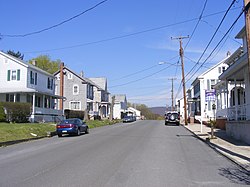 Photo along Wiconisco Avenue | |
 | |
| Country | United States |
| State | Pennsylvania |
| County | Schuylkill |
| Area | |
• Total | 0.50 sq mi (1.29 km2) |
| • Land | 0.50 sq mi (1.29 km2) |
| • Water | 0.00 sq mi (0.00 km2) |
| Population | |
• Total | 429 |
| • Density | 863.18/sq mi (333.55/km2) |
| Time zone | UTC-5 (Eastern (EST)) |
| • Summer (DST) | UTC-4 (EDT) |
| FIPS code | 42-52224 |
Muir is a census-designated place [3] located in Porter Township, Schuylkill County in the state of Pennsylvania, United States. Muir was part of the Reinerton-Orwin-Muir CDP at the 2000 census before splitting into three individual CDPs for the 2010 census. The other communities, along with Muir are Reinerton and Orwin. The community is located near the borough of Tower City along U.S. Route 209. As of the 2020 census, [4] the population was 429.
