Pitman, Pennsylvania

Last updated
Pitman
Mahantongo Fire Co, Pitman, Eldred Twp, Schuylkill Co PA.JPG
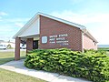
Mahantongo Fire Co. in Pitman.
USA Pennsylvania location map.svg
Red pog.svg
Pitman
Location within the state of Pennsylvania
Coordinates: 40°42′54″N76°31′15″W / 40.71500°N 76.52083°W / 40.71500; -76.52083 Coordinates: 40°42′54″N76°31′15″W / 40.71500°N 76.52083°W / 40.71500; -76.52083
Country United States
State Pennsylvania
County Schuylkill
Elevation
928 ft (283 m)
Time zone UTC-5 (Eastern (EST))
  Summer (DST) UTC-4 (EDT)
ZIP codes
17964
Area code 570
GNIS feature ID1183975 [1]

Pitman is a small, unincorporated community that is located in Eldred Township, Schuylkill County, Pennsylvania, United States.

Contents

The village center lies on state route 4022 and includes approximately twenty-five residences.

History

The earliest settlements in the vicinity of Pitman were established circa 1800. The village was originally known as Zimmermanstown. [2]

Geography

Pitman is located in the far eastern end of the Mahantongo valley where Mahantango Mountain and Line Mountain meet. The Little Mahantango Creek, a tributary within the Susquehanna River basin, begins in the vicinity of Pitman and flows westward into Mahantango Creek.

Notable features

Agriculture is the primary industry.

A U.S. Post Office is located in the village. Because the 17964 postal code extends over nearly all of Eldred Township, area residents refer to the entire township as Pitman.

Related Research Articles

<span class="mw-page-title-main">Schuylkill County, Pennsylvania</span> County in Pennsylvania, United States

Schuylkill County is a county in the Commonwealth of Pennsylvania. It is located in the heart of Pennsylvania's Coal Region and is part of Northeastern Pennsylvania. As of the 2020 census, the population was 143,049. The county seat is Pottsville.

<span class="mw-page-title-main">Lykens Township, Dauphin County, Pennsylvania</span> Township in Pennsylvania, United States

Lykens Township is a township which is located in Dauphin County, Pennsylvania, United States. The population was 1,558 at the time of the 2020 census, a decline from the figure of 1,618 tabulated in 2010.

<span class="mw-page-title-main">Eldred Township, Lycoming County, Pennsylvania</span> Township in Pennsylvania, United States

Eldred Township is a township in Lycoming County, Pennsylvania, United States. The population was 1,996 at the 2020 census. It is part of the Williamsport Metropolitan Statistical Area. The unincorporated village of Warrensville is located in Eldred Township.

<span class="mw-page-title-main">Eldred Township, Schuylkill County, Pennsylvania</span> Township in Pennsylvania, United States

Eldred Township is a township in Schuylkill County, Pennsylvania, United States. Settled in 1805 and incorporated in 1849 from part of Upper Mahantongo Township, it is named for Judge Nathaniel Eldred. The population was 709 at the 2020 census.

<span class="mw-page-title-main">Mahantongo</span>

"Mahantongo" is a Lenape word, translated "where we had plenty of meat to eat" or "good hunting grounds." The name is shared by a creek, a valley, and a mountain in central Pennsylvania, and is a common street name in the area. The alternate spelling "Mahantango" is often found in early publications, e.g.,.

Rough and Ready is a cross-roads located in Upper Mahantongo Township, Schuylkill County, Pennsylvania, United States, west of Hepler, near the confluence of Little Mahantango Creek and Mahantango Creek, which flows west into the Susquehanna River. It uses the Klingerstown, Pennsylvania ZIP Code of 17941. The place, which consists of two homes and a church, was named for the gold-rush town of Rough and Ready, California, which in turn was named by a mining company also named in honor of Zachary Taylor's nickname, "Old Rough and Ready."

Pine Creek is a tributary of Mahantango Creek in Schuylkill and Dauphin counties, Pennsylvania, in the United States. It is approximately 23.7 miles (38.1 km) long. The creek flows through Foster Township, Hegins Township, Hubley Township, and Upper Mahantango Township in Schuylkill County and Lykens Township in Dauphin County. The creek's watershed has an area of 76.8 square miles (199 km2) and its tributaries include Rausch Creek and Deep Creek. Pine Creek is considered by the Pennsylvania Department of Environmental Protection to be impaired by abandoned mine drainage and resource extraction. However, it is designated as a coldwater fishery.

<span class="mw-page-title-main">Wiconisco Creek</span>

Wiconisco Creek is a tributary of the Susquehanna River in Schuylkill and Dauphin counties, Pennsylvania, in the United States. It is approximately 45.5 miles (73.2 km) long.

<span class="mw-page-title-main">Mont Clare, Pennsylvania</span> Village in Pennsylvania, United States

Mont Clare is a village in Upper Providence Township, Montgomery County, Pennsylvania. The village is located on the left bank of the Schuylkill River opposite Phoenixville and Chester County. Mont Clare is at the site of the former Jacobs' ford. Mont Clare hosts the only functional lock and one of only two remaining watered stretches of the Schuylkill Canal. Mont Clare was the birthplace of the infamous outlaw Sundance Kid.

Deep Creek is a tributary of Pine Creek in Schuylkill County, Pennsylvania, in the United States. It is approximately 22.9 miles (36.9 km) long and flows through Barry Township, Hegins Township, and Hubley Township. Its watershed has an area of 31.80 square miles (82.4 km2). Major tributaries of the creek include Hans Yost Creek.

Mahantango Creek is a 36.2-mile-long (58.3 km) tributary of the Susquehanna River in Dauphin, Northumberland, Schuylkill, and Snyder County counties, Pennsylvania in the United States.

<span class="mw-page-title-main">Pennsylvania Route 125</span> State highway in Pennsylvania, US

Pennsylvania Route 125 is a 32.0-mile-long (51.5 km) state highway located in Schuylkill and Northumberland Counties in Pennsylvania. The southern terminus is at PA 443 in Pine Grove. The northern terminus is at PA 61 in Shamokin. The route follows a winding alignment through mountains and valleys in the western part of the Coal Region. PA 125 does not directly access Interstate 81 (I-81); however, north of Pine Grove, there is an interchange with SR 3013 just yards from the highway in Ravine. The route has a concurrency with U.S. Route 209 in Tremont and crosses PA 25 in Hegins. PA 125 was designated in 1928 between PA 25 in Hegins and US 209 in Newtown while the present alignment between Pine Grove and Hegins was a part of PA 25 and the section between Line Mountain and Shamokin was part of PA 225. PA 125 was realigned to its current alignment between PA 443 in Pine Grove and US 122 in Shamokin in the 1930s, with the former section between Hegins and Newtown becoming a realigned PA 25.

Mahantango Creek is a 2.1-mile-long (3.4 km) tributary of the Susquehanna River in Snyder and Juniata counties, Pennsylvania, in the United States. Its name comes from a Delaware Indian word meaning "where we had plenty to eat". The creek flows along the border between Snyder County and Juniata County.

<span class="mw-page-title-main">Sacramento, Pennsylvania</span>

Sacramento is an unincorporated community in southeastern Hubley Township, Schuylkill County, Pennsylvania, United States, situated on Route 25. It is located on the Pine Creek, which drains it westward into the Mahantango Creek. It has a post office with the zip code of 17968.

West Branch Mahantango Creek is a tributary of Mahantango Creek in Snyder County and Juniata County, in Pennsylvania, in the United States. It is approximately 18 miles (29 km) in length. The creek starts on Shade Mountain in Snyder County. It ends at its confluence with Mahantango Creek. Most of the land in the watershed is devoted to forest or agriculture. Trout and minnows have been observed in the creek, which is stocked with trout. A covered bridge was built over it in 1908.

<span class="mw-page-title-main">Catawissa Mountain</span>

Catawissa Mountain is a mountain in Columbia County, Pennsylvania, in the United States. Its peak height is 1,873 feet (571 m) above sea level, making it the fifth-highest mountain in Columbia County. Streams that flow near the mountain include Roaring Creek, Catawissa Creek, and some of its tributaries. The mountain is near Nescopeck Mountain and Little Mountain. Sandstones and rock formations such as the Pocono Formation occur on Catawissa Mountain.

Boyers Run is a tributary of the Susquehanna River in Juniata County and Perry County, in Pennsylvania, in the United States. It is approximately 2.8 miles (4.5 km) long and flows through Susquehanna Township in Juniata County and Liverpool Township in Perry County. The watershed of the stream has an area of 1.63 square miles (4.2 km2). The stream has one unnamed tributary and is not designated as an impaired waterbody. The drainage basin of Boyers Run is designated as a Warmwater Fishery and a Migratory Fishery.

Snow Creek is a tributary of Mahantango Creek in Northumberland County, Pennsylvania, in the United States. It is approximately 3.8 miles (6.1 km) long and flows through Upper Mahanoy Township and Jordan Township. The watershed of the creek has an area of 4.72 square miles (12.2 km2). The creek has no named tributaries and is not designated as an impaired waterbody in any stream segment.

Hans Yost Creek is a tributary of Deep Creek in Schuylkill County, Pennsylvania, in the United States. It is approximately 3.4 miles (5.5 km) long and flows through Foster Township and Barry Township. The watershed of the creek has an area of 3.52 square miles (9.1 km2). The creek is designated as an impaired waterbody, with the causes being metals and pH and the probable source being abandoned mine drainage. It has no named tributaries, but two abandoned mine discharges flow into it. The creek's watershed was extensively mined in the late 1800s and early 1900s, but the only remaining active mining permits are for remining.

Little Mahantango Creek is a tributary of Mahantango Creek in Schuylkill County and Northumberland County, in Pennsylvania, in the United States. It is approximately 9.6 miles (15.4 km) long and flows through Eldred Township and Upper Mahantongo Township in Schuylkill County and Upper Mahanoy Township in Northumberland County. The watershed of the creek has an area of 15.1 square miles (39 km2). The creek has many unnamed tributaries and sub-tributaries; all of them, as well as the main stem, are impaired. The cause of impairment in Little Mahantango Creek is sedimentation/siltation and the probable source of impairment is agriculture.

References

  1. U.S. Geological Survey Geographic Names Information System: Pitman, Pennsylvania
  2. ”History of Schuylkill County”. W.W. Munsell and Co., 1881