Mount Carbon, Pennsylvania

Last updated
Mount Carbon, Pennsylvania
Borough
St Francis De Sales Church, Mount Carbon PA.JPG
St. Francis De Sales Church on Main St.
Schuylkill County Pennsylvania Incorporated and Unincorporated areas Mount Carbon Highlighted.svg
Location of Mount Carbon in Schuylkill County, Pennsylvania.
USA Pennsylvania location map.svg
Red pog.svg
Mount Carbon
Location in Pennsylvania
Usa edcp location map.svg
Red pog.svg
Mount Carbon
Mount Carbon (the United States)
Coordinates: 40°40′21″N76°11′15″W / 40.67250°N 76.18750°W / 40.67250; -76.18750
CountryUnited States
State Pennsylvania
County Schuylkill
Settled1828
Incorporated1864
Government
  TypeBorough Council
  MayorJohn Raess
Area
[1]
  Total0.07 sq mi (0.18 km2)
  Land0.07 sq mi (0.18 km2)
  Water0.00 sq mi (0.00 km2)
Population
 (2020) [2]
  Total91
  Density1,318.84/sq mi (509.20/km2)
Time zone UTC-5 (Eastern (EST))
  Summer (DST) UTC-4 (EDT)
ZIP Code
17901
Area code 570
FIPS code 42-51488

Mount Carbon is a borough in Schuylkill County, Pennsylvania, United States, two miles south of Pottsville. It was formed from North Manheim Township in 1864. The population was 88 in the 2020 census. [3] The borough is the smallest municipality in Schuylkill County.

Contents

The old Mount Carbon Brewery

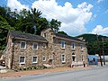
The borough was home for many years to the Mount Carbon Brewery, which closed in the late 1970s. D.G. Yuengling & Son bought the rights to use the Mount Carbon (Bavarian) name and label when Mount Carbon Brewery went out of business in 1977. Yuengling brewed Mount Carbon for a short time but eventually abandoned it. 7up bottling Co. then took over the building for years as a distribution and shipping point.

Government

Mount Carbon has also had one of the youngest mayors in history; Mayor Jeffrey Dunkel was sworn in as mayor when he was only 18-years-old. [4] On July 16, 2015, The Pottsville Republican Herald reported that Mayor Dunkel will resign after 13 years for a job opportunity in another state. He was succeeded by Donna Porter, who also resigned after moving outside the borough. [5]

The borough was considering a merger with the City of Pottsville. The merger was shot down by the residents, and the borough has been making financial progress since a new council took the helm. In 2019, the borough had no functioning government after the borough secretary resigned and three borough council members quit. That year, John Raess was elected mayor by two write-in votes and borough council member by five write-in votes. Raess was the only person to show up to the borough council reorganization meeting, meaning there would be no functioning government in 2020. As a result, Mount Carbon may have to merge with Pottsville, which would need to be approved by voters in both municipalities. Another option would be to merge with North Manheim Township, though that would force the borough to change school districts. [5]

Transportation

Mount Carbon was the terminus of the original Philadelphia and Reading Railway, opened in 1842. Mount Carbon was a very active location along the Canal. The Hotel which was located at the present Pottsville Pizzeria, was rumored to have royalty stay there on their travels.

South Centre Street, Main Street, Sherwood Drive and the Mt. Carbon Arch are the only streets of the borough. Pennsylvania Route 61 passes to the east of Mount Carbon and access is provided by a bridge over the Schuylkill River. The Reading Blue Mountain and Northern Railroad operates along the former tracks of the Philadelphia and Reading Railway, later known as the Reading Company.

Geography

Mount Carbon is located at 40°40′21″N76°11′15″W / 40.67250°N 76.18750°W / 40.67250; -76.18750 (40.672364, -76.187494). [6]

According to the United States Census Bureau, the borough has a total area of 0.1 square miles (0.2 km2), all land.

Demographics

Historical population
CensusPop.Note
1870 364
1880 327−10.2%
1890 3331.8%
1900 252−24.3%
1910 33532.9%
1920 331−1.2%
1930 311−6.0%
1940 3357.7%
1950 302−9.9%
1960 3082.0%
1970 184−40.3%
1980 157−14.7%
1990 132−15.9%
2000 87−34.1%
2010 914.6%
2020 88−3.3%
2021 (est.)88 [3] 0.0%
Sources: [7] [8] [9] [2]

As of the census [8] of 2000, there were 87 people, 39 households, and 23 families residing in the borough. The population density was 1,414.1 inhabitants per square mile (546.0/km2). There were 47 housing units at an average density of 763.9 per square mile (294.9/km2). The racial makeup of the borough was 100.00% White.

There were 39 households, out of which 23.1% had children under the age of 18 living with them, 41.0% were married couples living together, 12.8% had a female householder with no husband present, and 41.0% were non-families. 35.9% of all households were made up of individuals, and 17.9% had someone living alone who was 65 years of age or older. The average household size was 2.23 and the average family size was 2.87.

In the borough the population was spread out, with 19.5% under the age of 18, 8.0% from 18 to 24, 33.3% from 25 to 44, 26.4% from 45 to 64, and 12.6% who were 65 years of age or older. The median age was 40 years. For every 100 females there were 102.3 males. For every 100 females age 18 and over, there were 100.0 males.

The median income for a household in the borough was $34,688, and the median income for a family was $46,875. Males had a median income of $24,000 versus $23,125 for females. The per capita income for the borough was $18,355. There were no families and 7.1% of the population living below the poverty line, including no under eighteens and 40.0% of those over 64.

Early Mt. Carbon History

Among the first inhabitants of the settlement of Mt. Carbon were Lewis Murphy and Joseph Porter. [10] The first dam for the Schuylkill Canal was built at Mount Carbon on the Schuylkill River in the spring of 1817. [11] The entire canal was in operation by 1824. [12]

By 1818, Necho Allen resided here, engaged in lumbering, and built a saw-mill. [13] Although coal was to become the principal commodity transported on the canal, the company conveyed lumber and merchandise as well. [14] By 1828 the village consisted of six homes, one store, an office building and a large stone warehouse, used to store produce, which was brought in wagons from surrounding counties to be sent to market in Philadelphia. [15]

In 1829 John White (President of the Mt. Carbon Railroad) began the Mansion House construction here. [16] During this same year, the Norwegian and Mount Carbon Railroad was incorporated and by April 1831, coal was being conveyed through Mt. Carbon from the rich coalfields north and west of present day Pottsville to Philadelphia. [17]

In 1842, the Philadelphia and Reading Railway Company had made Mt. Carbon the termination point of its railroad line from Philadelphia in direct competition with the Schuylkill Canal. [18] The canal company was leased by the railroad in 1870 and the canal north of Port Clinton was abandoned at the signing of the lease. [19] The Philadelphia and Reading Company leased the Mt. Carbon Railroad on May 16, 1862, and merged the line into the parent organization on June 13, 1872. [20]

In 1849, geologist Isaac Lea discovered fossilized footprints of Sauropus in red sandstone in Mount Carbon. [21] Lea contended the tracks were reptilian and that due to the level of strata where the footprints were found, they were from the Devonian Period between 360 and 408 million years old and constituted a new species that he named Sauropus primaevus. The footprints have since been identified as coming from an amphibian now known as Palaeosauropus primaevus from the Mississippian Age over 330 million years ago. [22]

Related Research Articles

<span class="mw-page-title-main">Schuylkill County, Pennsylvania</span> County in Pennsylvania, United States

Schuylkill County is a county in the Commonwealth of Pennsylvania. It is located in the heart of Pennsylvania's Coal Region and is part of Northeastern Pennsylvania. As of the 2020 census, the population was 143,049. The county seat is Pottsville.

<span class="mw-page-title-main">Hamburg, Pennsylvania</span> Borough in Pennsylvania, United States

Hamburg is a borough in Berks County, Pennsylvania, United States. The population was 4,270 at the 2020 census. The town is thought to have been named after Hamburg, Germany, but this is likely to have been a corruption of Bad Homburg.

<span class="mw-page-title-main">Shoemakersville, Pennsylvania</span> Borough in Pennsylvania, United States

Shoemakersville is a borough in Berks County, Pennsylvania, United States. The population was 1,360 at the 2020 census, a decline from the figure of 1,378 tabulated in 2010.

<span class="mw-page-title-main">Pottstown, Pennsylvania</span> Borough in Pennsylvania, United States

Pottstown is a borough in Montgomery County, Pennsylvania, United States. Pottstown was laid out in 1752–53 and named Pottsgrove in honor of its founder, John Potts. The old name was abandoned at the time of the incorporation as a borough in 1815. In 1888, the limits of the borough were considerably extended. Pottstown is the center of a productive farming and dairying region.

<span class="mw-page-title-main">Upper Providence Township, Montgomery County, Pennsylvania</span> Township in Pennsylvania, United States

Upper Providence Township is a township in Montgomery County, Pennsylvania, United States. As of the 2010 census, the township population was 21,219.

<span class="mw-page-title-main">Mount Carmel, Pennsylvania</span> Borough in Pennsylvania, United States

Mount Carmel is a borough in Northumberland County, located in the Coal Heritage Region of Central Pennsylvania's Susquehanna River Valley, United States. The population was 5,725 at the 2020 census. It is located 88 miles (141 km) northwest of Philadelphia and 71 miles (114 km) northeast of Harrisburg, in the Coal Region. It is completely encircled by Mount Carmel Township.

<span class="mw-page-title-main">Coaldale, Schuylkill County, Pennsylvania</span> Borough in Pennsylvania, United States

Coaldale is a borough in Schuylkill County, Pennsylvania, United States. Initially settled in 1827, it was incorporated in 1906 from part of the former Rahn Township; it is named for the coal industry—wherein, it was one of the principal early mining centers. Coaldale is in the southern Anthracite Coal region in the Panther Creek Valley, a tributary of the Little Schuylkill River, along which U.S. Route 209 was eventually built between the steep climb up Pisgah Mountain from Nesquehoning (easterly) and its outlet in Tamaqua, approximately five miles to the west.

<span class="mw-page-title-main">Cressona, Pennsylvania</span> Borough in Pennsylvania, United States

Cressona is a borough in Schuylkill County, Pennsylvania. Formed in 1857 from part of North Manheim Township, it was founded by and named for John Chapman Cresson, a Philadelphia civil engineer and manager of the Schuylkill Navigation Company, president of the Mine Hill and Schuylkill Haven Railroad, and the chief engineer of Fairmount Park in Philadelphia.

<span class="mw-page-title-main">Frackville, Pennsylvania</span> City in Pennsylvania, United States

Frackville is a borough in Schuylkill County, Pennsylvania. Incorporated in 1876, Frackville is located at the intersection of Interstate 81 and Pennsylvania State Route 61 is located near the borough, which is approximately 102 miles (164 km) northwest of Philadelphia and 60 miles (97 km) southwest of Scranton. Frackville is named for Daniel Frack, an early Anglo-American settler.

<span class="mw-page-title-main">Minersville, Pennsylvania</span> Borough in Pennsylvania, United States

Minersville is a borough in Schuylkill County, Pennsylvania, United States. Anthracite coal deposits are plentiful in the region. The population was 4,388 at the 2020 census.

<span class="mw-page-title-main">Palo Alto, Pennsylvania</span> Borough in Pennsylvania, United States

Palo Alto is a borough in Schuylkill County, Pennsylvania, United States. Bacon Street is the main street of town.

<span class="mw-page-title-main">Port Carbon, Pennsylvania</span> Borough in Pennsylvania, United States

Port Carbon is a borough of Schuylkill County, Pennsylvania, United States, located two miles (3 km) northeast of Pottsville. It is in a coal-mining area. In the past, ironworks had been a feature of the borough. In 1900, 2,168 people lived here and, in 1910, 2,678. The population was 1,815 at the 2020 census.

<span class="mw-page-title-main">Pottsville, Pennsylvania</span> City in Pennsylvania, United States

Pottsville is the county seat of Schuylkill County, Pennsylvania, United States. The population was 13,346 at the 2020 census, and is the principal city of the Pottsville, PA Micropolitan Statistical Area. The city lies along the west bank of the Schuylkill River, 52 miles (84 km) south of Wilkes-Barre. It is located in Pennsylvania's Coal Region.

<span class="mw-page-title-main">Schuylkill Haven, Pennsylvania</span> Borough in Pennsylvania, United States

Schuylkill Haven is a borough in Schuylkill County, Pennsylvania, United States. The borough's population was 5,253 as of the 2020 census. Schuylkill Haven is situated along the Schuylkill River, for which it is named. Schuylkill Haven is a focal point of activity in southern Schuylkill County.

<span class="mw-page-title-main">Shenandoah, Pennsylvania</span> Borough in Pennsylvania, United States

Shenandoah is a borough in Schuylkill County in the Coal Region of Pennsylvania. It is distinct from Shenandoah Heights, which is part of West Mahanoy Township immediately to the north. As of 2021, the borough's population was 4,247.

<span class="mw-page-title-main">Tamaqua, Pennsylvania</span> Borough in Pennsylvania, United States

Tamaqua is a borough in eastern Schuylkill County in the Coal Region of Pennsylvania, United States. It had a population of 6,934 as of the 2020 U.S. census.

<span class="mw-page-title-main">Tuscarora, Pennsylvania</span> CDP in Pennsylvania, United States

Tuscarora is a census-designated place (CDP) that is located in Schuylkill County, Pennsylvania, United States. The population was 980 at the time of the 2010 census.

<span class="mw-page-title-main">Pottsville Area School District</span> School district in Pennsylvania

Pottsville Area School District is a midsized, rural/suburban public school district located in Pottsville, Pennsylvania, serving students in central Schuylkill County. It encompasses approximately 12 square miles (31 km2). The district serves the City of Pottsville and five additional municipalities: the boroughs of Mechanicsville, Mount Carbon, Port Carbon, Palo Alto, and Norwegian Township.

The Mine Hill & Schuylkill Haven Railroad (MH&SH) was operating by April 1831 in Schuylkill County, Pennsylvania, from above Mine Hill Gap to Schuylkill Haven on the Schuylkill Canal. This railroad was developed by the New York and Schuylkill Coal Co., and was one of the important early "lateral" railroads of Schuylkill County which were constructed to accommodate the Schuylkill canal with coal tonnage from the more remote areas where mines were operating. In 1862 the MH&SH was leased by the Philadelphia and Reading Railroad Company (P&RR) and became part of its operation system.

The Mt. Carbon Railroad (MC) was one of what was known as lateral railroads built in Schuylkill County, Pennsylvania in the 1820s and 1830s, and which were first constructed to accommodate the Schuylkill Canal with coal produced from the coal district south of the Mine Hill and east of the West Branch Schuylkill River, covering an area of between sixty and seventy square miles. The MC opened on April 19, 1831, between the settlement of Mount Carbon, Pennsylvania, on the Schuylkill Canal, north to the Norwegian Creek confluence, and following that tributary to beyond both the East and West Norwegian Creeks. In 1842, the Philadelphia and Reading Railway Company (P&RR) made Mt. Carbon a termination point for its railroad line from Philadelphia in direct competition with the Schuylkill Canal. The P&RR leased the MC on May 16, 1862, and merged it into the parent organization on June 13, 1872.

References

  1. "ArcGIS REST Services Directory". United States Census Bureau. Retrieved October 12, 2022.
  2. 1 2 "Census Population API". United States Census Bureau. Retrieved Oct 12, 2022.
  3. 1 2 Bureau, US Census. "City and Town Population Totals: 2020—2021". Census.gov. US Census Bureau. Retrieved August 1, 2022.
  4. "Go-getter," 18, ousts mayor in Michigan, by Wendy Koch, USA TODAY, November 9, 2005
  5. 1 2 Sheehan, Daniel Patrick (January 17, 2020). "Why the borough of Mount Carbon might vanish from the map". The Morning Call. Allentown, PA. Retrieved March 19, 2020.
  6. "US Gazetteer files: 2010, 2000, and 1990". United States Census Bureau. 2011-02-12. Retrieved 2011-04-23.
  7. "Census of Population and Housing". U.S. Census Bureau. Retrieved 11 December 2013.
  8. 1 2 "U.S. Census website". United States Census Bureau . Retrieved 2008-01-31.
  9. "Incorporated Places and Minor Civil Divisions Datasets: Subcounty Resident Population Estimates: April 1, 2010 to July 1, 2012". Population Estimates. U.S. Census Bureau. Archived from the original on 11 June 2013. Retrieved 11 December 2013.
  10. History of Schuylkill County, Pa: W. W. Munsell, Mcnamara Press: New York, 1881, p. 250
  11. SCHUYLKILL CANAL BOOSTED KING COAL by WALTER KRAUS, The Morning Call, Allentown, Pa., February 2, 1984
  12. Kraus, Morning Call, 1982
  13. Munsell, 1881, p. 250
  14. Kraus, Morning Call, 1982
  15. Munsell, 1881, p. 250
  16. Munsell 1881, p. 250
  17. GROUP V, The Mt. Carbon Railroad, THE DANVILLE & POTTSVILLE R. R., by EARL J. HEYDINGER, The Railway and Locomotive Historical Society Bulletin, No. 107 (OCTOBER 1962), pp. 34-39
  18. Kraus, Morning Call, 1982
  19. Kraus, Morning Call, 1982
  20. Heydinger, October 1962, P. 34
  21. Youmans, William Jay (1896). Pioneers of Science in America. D. Appleton and Company. p. 264. Retrieved 30 September 2022.
  22. Fillmore, David; Simpson, Edward; Sullivan, Robert; Lucas, Spencer. "Following in the Footsteps of Isaac Lea's Historic Footprints". www.paheritage.wpengine.com. Pennsylvania Heritage. Retrieved 27 September 2022.