Mulinja

Last updated

Mulinja
village
India Kerala location map.svg
Red pog.svg
Mulinja
Location in Kerala, India
India location map.svg
Red pog.svg
Mulinja
Mulinja (India)
Coordinates: 12°41′0″N74°55′0″E / 12.68333°N 74.91667°E / 12.68333; 74.91667
CountryFlag of India.svg  India
State Kerala
District Kasaragod
Taluk Manjeshwaram
Area
  Total2.24 km2 (0.86 sq mi)
Population
 (2011)
  Total3,841
  Density1,700/km2 (4,400/sq mi)
Languages
  Official Malayalam, English
Time zone UTC+5:30 (IST)
PIN
6XXXXX
Vehicle registration KL-14

Mulinja is a locality part of Uppala town, Kasaragod district, Kerala, India. [1]

Contents

Demographics

As of 2011 India census, Mulinja village had total population of 3,841 which constitutes 1,803 males and 2,038 females. Mulinja village spreads over an area of 2.24 km2 with 751 families residing in it. Population in the age group 0-6 was 506 (13.2%) where 255 are males and 251 are females. Mulinja village had overall literacy of 91.2% where male literacy was 95.9% and female literacy of 87.1%. [2]

Transportation

Local roads have access to National Highway No.66 which connects to Mangalore in the north and Calicut in the south. The nearest railway station is Manjeshwar on Mangalore-Palakkad line. There is an airport at Mangalore.

Languages

This locality is an essentially multi-lingual region. The people speak Malayalam, Tulu, Beary bashe and Konkani. Migrant workers also speak Hindi and Tamil languages.

Administration

This village is part of Manjeswaram assembly constituency which is again part of Kasaragod (Lok Sabha constituency)

Related Research Articles

Bangramanjeshwar (Bangramanjeshwaram) is a census town in Kasaragod district in the state of Kerala, India.

<span class="mw-page-title-main">Udma</span> Census Town in Kerala, India

Udma is a census town in Kasaragod district in the Indian state of Kerala.

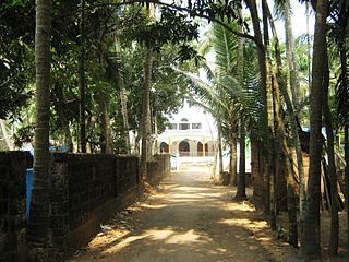
Bayar is a village in Kasaragod district in the state of Kerala, India. Bayar is 12 km (7.5 mi) far from the Uppala town.

<span class="mw-page-title-main">Karadka</span> Village in Kerala, India

Karadka is a village, block panchayat and grama panchayat in Kasaragod district in the state of Kerala, India.

Karindalam is a village in Kasaragod district in the state of Kerala, India.

<span class="mw-page-title-main">Kunjathur</span> Census Town in Kerala, India

Kunjathur is a census town in Kasaragod district in the state of Kerala, India. It is 22 km (14 mi) south of Mangalore.

<span class="mw-page-title-main">Mangalpady</span> Panchayat in Kerala, India

Mangalpady is a Grama Panchayat in Kasaragod district, Kerala. Uppala is the major town in this panchayat.

<span class="mw-page-title-main">Paivalike</span> Village in Kerala, India

Paivalike is a village in Kasaragod district in the state of Kerala, India. Paivalike is 11 km (6.8 mi) east of Uppala town and 40 km (25 mi) south of Mangalore city.

Pavoor is a village in Kasaragod district in the state of Kerala, India.

<span class="mw-page-title-main">Vorkady</span> Gram Panchayat in Kerala, India

Vorkady is a Gram Panchayat in Kasaragod district in the state of Kerala, India.

Chippar is a village in Kasaragod district in the state of Kerala, India.

Ichilangod is a village in Kasaragod district in the state of Kerala, India.

Kadambar is a village in Kasaragod district in the state of Kerala, India.

Katukukke is a village in Kasaragod district in the state of Kerala, India..The famous Shri Subraya Deva Temple present in this village so the village got the name Katukukke.

Kidoor is a village in Kasaragod district in the state of Kerala, India.

Meenja is a grama Panchayat in Manjeshwaram Taluk of Kasaragod district in the state of Kerala, India. It consists of 7 revenue villages. Kaliyoor, Koliyoor, Talakala, Meenja, Kadambar, Moodambail and [Kuloor]

<span class="mw-page-title-main">Perla, Kasaragod</span> Town in Kerala, India

Perla is an administrative capital of Enmakaje Panchayat, which is in Kasaragod district, Kerala, India.

Adoor is a village in Kasaragod district in the Indian state of Kerala. Adoor is located 38 km east of Kasaragod town and 7 km away from State Highway 55 or Cherkala-Jalsoor road.

<span class="mw-page-title-main">Kallar (Kasaragod)</span> Village in Kerala, India

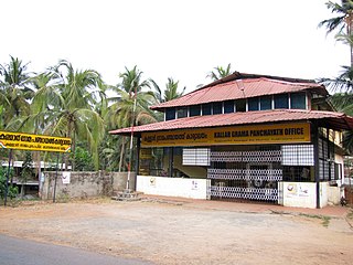
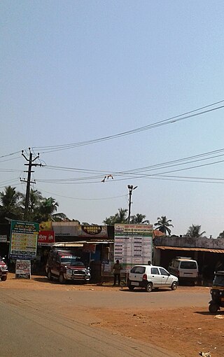
Kallar is a village in Kasaragod district in the Indian state of Kerala. Kallar is located on Kanhangad-Panathur road of 40 km south east of Kasaragod town and 27 km north east of Kanhangad.

Thimiri is a village in Hosdurg taluk of Kasaragod district in Kerala state, India. Thimiri is located 3 km east of Cheruvathur on Cheruvathur-Cheemeni road.

References

  1. "Census of India : List of villages by Alphabetical : Kerala". Registrar General & Census Commissioner, India. Archived from the original on 27 September 2012. Retrieved 10 December 2008.
  2. https://censusindia.gov.in  › 3...PDF Kasaragod - DISTRICT CENSUS HANDBOOK (ref page no:80,81)