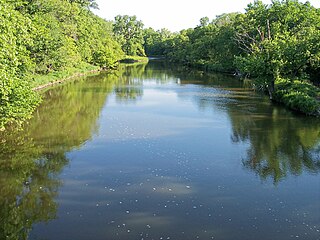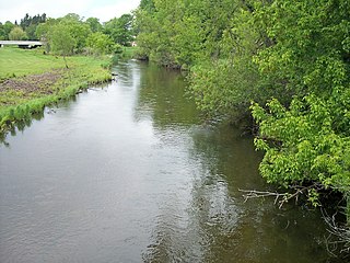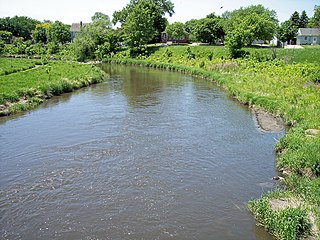
The Clark Fork, or the Clark Fork of the Columbia River, is a river in the U.S. states of Montana and Idaho, approximately 310 miles (500 km) long. The largest river by volume in Montana, it drains an extensive region of the Rocky Mountains in western Montana and northern Idaho in the watershed of the Columbia River. The river flows northwest through a long valley at the base of the Cabinet Mountains and empties into Lake Pend Oreille in the Idaho Panhandle. The Pend Oreille River in Idaho, Washington, and British Columbia, Canada which drains the lake to the Columbia in Washington, is sometimes included as part of the Clark Fork, giving it a total length of 479 miles (771 km), with a drainage area of 25,820 square miles (66,900 km2). In its upper 20 miles (32 km) in Montana near Butte, it is known as Silver Bow Creek. Interstate 90 follows much of the upper course of the river from Butte to Saint Regis. The highest point within the river's watershed is Mount Evans at 10,641 feet (3,243 m) in Deer Lodge County, Montana along the Continental Divide.

The Middle Santiam River is a tributary of the South Santiam River, 38.5 miles (62.0 km) long, in western Oregon in the United States. It drains a remote area of the Cascade Range east of Sweet Home in the watershed of the Willamette River.

Popple River is a tributary of the Pine River in the northeastern portion of the U.S. state of Wisconsin. The river is part of the Menominee River watershed and flows for 47 miles (76 km) in Forest and Florence counties, draining an area of 148,000 acres (60,000 ha).

The Yellow Medicine River is a tributary of the Minnesota River, 107 miles (173 km) long, in southwestern Minnesota in the United States. Via the Minnesota River, it is part of the watershed of the Mississippi River, draining an area of 665 square miles (1,722 km²) in an agricultural region. Its name is a translation of the Dakota name for the river, pajutazee,,

The Lac qui Parle River is a tributary of the Minnesota River, 118 miles (190 km) long, in southwestern Minnesota in the United States. A number of tributaries of the river, including its largest, the West Branch Lac qui Parle River, also flow in eastern South Dakota. Via the Minnesota River, the Lac qui Parle River is part of the watershed of the Mississippi River, draining an area of 1,156 square miles (2,990 km2) in an agricultural region. Slightly more than two-thirds of the Lac qui Parle watershed is in Minnesota. Lac qui parle means "the lake which speaks" in the French language, and was a translation of the Sioux name for Lac qui Parle, a lake on the Minnesota River upstream of the mouth of the Lac qui Parle River.

The Eagle River is a tributary of the Wisconsin River in northeastern Wisconsin in the United States. Via the Wisconsin River, it is part of the watershed of the Mississippi River, draining an area of 181.7 square miles (470.6 km²) in the state's Northern Highland region. The river flows for much of its length through a series of lakes; the network of 28 lakes in the Eagle River's watershed is locally claimed to be the "world's largest chain of inland freshwater lakes."

The Shade River is a tributary of the Ohio River in southeastern Ohio in the United States. Via the Ohio River, it is part of the watershed of the Mississippi River, draining an area of 221 square miles (570 km2) on the unglaciated portion of the Allegheny Plateau. The Shade River is 17.4 miles (28.0 km) long, or 38.2 miles (61.5 km) including its west branch.

The Blue Earth River is a tributary of the Minnesota River, 108 miles (174 km) long, in southern Minnesota in the United States. Two of its headwaters tributaries, the Middle Branch Blue Earth River and the West Branch Blue Earth River, also flow for short distances in northern Iowa. By volume, it is the Minnesota River's largest tributary, accounting for 46% of the Minnesota's flow at the rivers' confluence in Mankato. Via the Minnesota River, the Blue Earth River is part of the watershed of the Mississippi River, draining an area of 3,486 square miles (9,029 km²) in an agricultural region. Ninety percent of the river's watershed is in Minnesota. It is a Minnesota Department of Natural Resources designated Water Trail.

The Sheboygan River is a river flowing to Lake Michigan in eastern Wisconsin in the United States. It is about 81 mi (130 km) long and enters the lake at the city of Sheboygan. The name of the river is Chippewa in origin, Shawb-wa-way-gun, meaning 'hollow bone', 'noise underground' or 'river disappearing underground'.
The Onion River is a 36.8-mile-long (59.2 km) tributary of the Sheboygan River in eastern Wisconsin in the United States. Via the Sheboygan, it is part of the watershed of Lake Michigan.

The Redeye River is a tributary of the Leaf River, 73 miles (117 km) long, in central Minnesota in the United States. Via the Leaf and Crow Wing Rivers, it is part of the watershed of the Mississippi River, draining an area of 222 square miles (575 km²) in a rural region. The river's name comes from the Native Americans of the area, who saw many red-eye fish in the river.

The Le Sueur River (lay-SEWER) is a tributary of the Blue Earth River, 111 miles (178 km) long, in southern Minnesota in the United States. Via the Blue Earth and Minnesota Rivers, it is part of the watershed of the Mississippi River, draining an area of 1,089 square miles (2,280 km²). It is the largest tributary of the Blue Earth River, draining 31% of its watershed.

The Watonwan River is a tributary of the Blue Earth River, 113 miles (182 km) long, in southern Minnesota in the United States. Via the Blue Earth and Minnesota rivers, it is part of the watershed of the Mississippi River, draining an area of 878 square miles (2,270 km2) in an agricultural region. The Watonwan drains about a quarter of the Blue Earth River's watershed.

Wheeling Creek is a tributary of the Ohio River, 30.2 miles (48.6 km) long, in eastern Ohio in the United States. Via the Ohio River, it is part of the watershed of the Mississippi River, draining an area of 108 square miles (280 km2) on the unglaciated portion of the Allegheny Plateau. It flows for its entire length in Belmont County; its tributaries also drain small areas of south-eastern Harrison County and south-western Jefferson County.

The Chiwawa River is a tributary of the Wenatchee River, in the U.S. state of Washington. It is completely contained within Chelan County.

The Little Cottonwood River is a tributary of the Minnesota River, 83 miles (133 km) long, in southwestern Minnesota in the United States. Via the Minnesota River, it is part of the watershed of the Mississippi River, draining an area of 230 square miles (596 km²) in an agricultural region.

The Pomme de Terre River is a 125-mile-long (201 km) tributary of the Minnesota River in western Minnesota in the United States. Via the Minnesota River, it is part of the watershed of the Mississippi River, draining an area of 875 square miles (2,270 km2) in an agricultural region. The headwaters region of the Pomme de Terre River is the northernmost extremity of the Minnesota River's watershed.

The Credit River is a small tributary of the Minnesota River, 22 miles (35 km) long, in the southwestern Minneapolis-St. Paul metropolitan area in Minnesota in the United States. Via the Minnesota River, it is part of the watershed of the Mississippi River, draining an area of 46 square miles (120 km²) in a suburban area. The stream flows for its entire length in eastern Scott County; its tributaries also drain a portion of western Dakota County.

The Straight River is a tributary of the Fish Hook River, 23 miles (37 km) long, in north-central Minnesota in the United States. Via the Fish Hook, Shell, and Crow Wing Rivers, it is part of the watershed of the Mississippi River, draining an area of approximately 60 square miles (160 km2) in a rural region. The river is known as one of Minnesota's best trout fishing streams.

The Blueberry River is a tributary of the Shell River, approximately twenty miles (30 km) long, in north-central Minnesota in the United States. Via the Shell and Crow Wing Rivers, it is part of the watershed of the Mississippi River, draining a rural area.


