
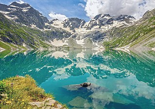
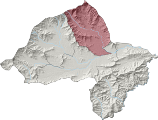
Dir is a region in northwestern Pakistan in the Khyber Pakhtunkhwa, in the foothills of the Himalayas. Before the independence of Pakistan, Dir was a princely state, and it remained so until 1969 when it was abolished by a presidential declaration, and the Dir District was created the following year. The area covers 5,280 square kilometres. In 1996 Dir district was officially divided into Lower Dir District and Upper Dir District.
Lower Dir District is a district in the Khyber Pakhtunkhwa province of Pakistan. Timergara is the district's headquarters and largest city. The Lower Dir district was formed in 1996, when Dir District was divided into Upper Dir and Lower Dir districts. On 22 January 2023, both Lower Dir and Upper Dir districts were further bifurcated to create a new Central Dir District. Lower Dir is famous for its beautiful snow-capped mountains, valleys, and pleasant weather. The primary industry in Lower Dir is tourism, which is now rapidly growing.

Upper Dir District is a district located in the Malakand Division of Khyber Pakhtunkhwa province of Pakistan. The city of Dir is its district headquarter. Geographically, it is located in the northern part of Pakistan. It borders with the Chitral district on the north, Afghanistan on the northwest, the Swat district on the east, and the Lower Dir district on the south. It shares 40 to 50 kilometers border with Afghanistan.
Lal Qilla is an administrative subdivision (Tehsil) of Lower Dir District in the Khyber Pakhtunkhwa province of Pakistan. The other tehsils of the district include:
- Adenzai Tehsil
- Balambat Tehsil
- Khall Tehsil
- Munda Tehsil
- Samar Bagh Tehsil
- Timergara Tehsil
Samar Bagh is an administrative subdivision (Tehsil) of Lower Dir District in the Khyber Pakhtunkhwa province of Pakistan. The other tehsils of the district include:
- Adenzai Tehsil
- Balambat Tehsil
- Khall Tehsil
- Lal Qilla Tehsil
- Munda Tehsil`
- Timergara Tehsil

Timergara is an administrative subdivision (Tehsil) of Lower Dir District in the Khyber Pakhtunkhwa province of Pakistan. The other tehsils of the district include:
- Adenzai Tehsil
- Balambat Tehsil
- Khal Tehsil
- Lal Qilla Tehsil
- Munda Tehsil
- Samar Bagh Tehsil
Samar Bagh (barwa) is a Tehsil of Lower Dir District in Khyber Pakhtunkhwa, Pakistan.
Timergara is a union council of Lower Dir District in Khyber Pakhtunkhwa, Pakistan.
Rabat is a union council of Lower Dir District in Khyber Pakhtunkhwa, Pakistan.Located 15 km away from District Headquarter Timergara. The people of rabat is Yousafzai. Some prominent peronalities of Rabat are Ex-Chief Conservator Department of Forestry Khyber Pakhtunkhwa Saad Ullah khan, Muhammad Azam khan Ex MPA of the provincial constituency PK-13. An internationally recognized researcher and of the finest surgeon across the nation Cardiac Surgeon Dr Fareed Ullah khan also belongs to Rabat. Historically the Rulling class remained with Khanates of Rabat who ruled the area for centuries from Namseer stream to Dan Doki stream and Laram top a famous tourist spot to River Panjkora .Rabat currently holds importance in regard of Elite Political figures, Prominent families and Tourist spots.

Bagh Dushkhel is a union council in Lower Dir District, Khyber Pakhtunkhwa, Pakistan.
Adenzai is a tehsil located in Lower Dir District, Khyber Pakhtunkhwa, Pakistan. The tehsil includes the town of Chakdara.The name Adenzai is derived from the Adenzai clan of Yousafzai Pashtoon tribe. It is listed among:
- Adenzai Tehsil
- Balambat Tehsil
- Khall Tehsil
- Lal Qilla Tehsil
- Munda Tehsil
- Samar Bagh Tehsil
- Timergara Tehsil
Shalpin is an administrative unit, known as Union council, of Swat District in the Khyber Pakhtunkhwa province of Pakistan. Union council Shalpin has 3 village councils i.e. Shalpin, Faqira and Bawrai. Village council Faqira includes the following villages: Faqira, Banda, Sholgara and Karal etc. Shalpin is a village of Swat District situated 32 kilometres away from Mingaora. Elevation of the area is 4,300 ft. The most cultivated crops of the area are Wheat and Maize. Shalpin is also famous for its fruits like Peaches locally named is Shaltaloo, Apricots and Persimons. The Shalpin valley is diverse in vegetation. Pashtu is the most common language although few families in the mountain areas maybe speaking kohistani and gujri. Shalpin has a public high School for boys and girls and two private middle Schools. Shalpin also has a basic health Unit. People of Shalpin are highly educated and several alumni of high school are serving at different key positions in the country and abroad.
Balambat is an administrative subdivision (Tehsil) of Lower Dir District in the Khyber Pakhtunkhwa province of Pakistan. It is listed among: The main Balambat village has archeological value and Zoroastrian remains.
- Adenzai Tehsil
- Balambat Tehsil
- Khall Tehsil
- Lal Qilla Tehsil
- Munda Tehsil
- Samar Bagh Tehsil
- Timergara Tehsil
Salarzai Tehsil is an administrative subdivision (tehsil) of Bajaur District in Khyber Pakhtunkhwa Province, Pakistan. Salarzai is the third largest of Bajaur District's seven tehsils.

Khall is an administrative subdivision (Tehsil) of Lower Dir District in the Khyber Pakhtunkhwa province of Pakistan. It is named after Khal (Bindi), a decorative dot worn by women on the centre of the forehead, as it is located in the centre of Dir. The other tehsils of the district include:
- Adenzai Tehsil
- Balambat Tehsil
- Lal Qilla Tehsil
- Munda Tehsil
- Samar Bagh Tehsil
- Timergara Tehsil

Barang Tehsil is an administrative subdivision (tehsil) of Bajaur District in Khyber Pakhtunkhwa, Pakistan. Barang is the sixth largest of Bajaur District's seven tehsils.

Utman Khel Tehsil is an administrative subdivision (tehsil) of Bajaur District in Khyber Pakhtunkhwa Province, Pakistan. Utman Khel is the fifth largest of Bajaur District's seven tehsils.

Osakai is a village in Lower Dir District of the Khyber Pakhtunkhwa province of Pakistan. Osakai is divided into Osakai Bala and Osakai Payeen. It comes under Union Council Kotigram and under Adenzai Tehsil.
This page is based on this
Wikipedia article Text is available under the
CC BY-SA 4.0 license; additional terms may apply.
Images, videos and audio are available under their respective licenses.