Nanikhir

Last updated

Nanikhir
Village
Nanikhir High School.jpg
Bangladesh adm location map.svg
Red pog.svg
Nanikhir
Location in Bangladesh
Coordinates: 23°14′N89°57′E / 23.233°N 89.950°E / 23.233; 89.950
CountryFlag of Bangladesh.svg  Bangladesh
Division Dhaka Division
District Gopalganj District
Upazilas of Bangladesh Muksudpur Upazila
  Urban density840/km2 (2,200/sq mi)
Time zone UTC+6 (Bangladesh Time)

Nanikhir is a village in Gopalganj District, Bangladesh, part of Muksudpur Upazila. It is part of the Nanikhir union, which consists of the villages of Nanikhir, Baro Vatra, Mohishtoli, Pathorghata, Goalgram, Bongram and Kazipara, and which is bordered by the unions of Jalirpar, Kasalia, Mosna and Gohala. locally known Nanikhir Khall flows through the village to the Bil Rout canal at Jalirpar, and then the Padma River.

Contents

History

The village was established in 1634. In May 1971, during the Bangladesh Liberation War, the village was attacked by several aircraft of the Pakistani Air Force, supported by a number of Razakars Etc.). Several of the inhabitants were killed and a motor launch was damaged. On 9 August 1971 about 200 members of the Bangladesh Liberation Army, in collaboration with local people, liberated Muksudpur. On 12 October 1971, local guerillas clashed with forces of the Pakistani army, in which 22 Razakars and Pakistani soldiers were killed. In a later encounter, near Diknagar Bridge 30 Pakistani soldiers and three Liberation Army members were killed. A number of former members of the Liberation Army continue to live in Nanikhir.

Demographics

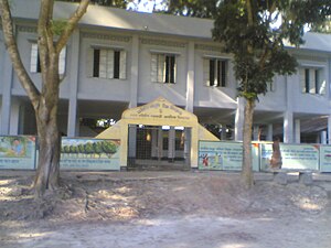
Nanikhir consists of three wards and seven mahallas. The village has a population of 5000; with 56.42% being male and 47.58% female. The population density is 840 per km2. The literacy rate is 91.72%. The village has nine mosques and two temples.

Education and recreation

Overall literacy in the village is 91.72%; 51.95% of those literate are males, while females make up 39.77%. The village has a state high school, Nanikhir High School, three state primary schools, one Alia Madrasa, five community schools and twelve satellite schools.

The village is home to the Shahed Zinnah Smrity Jubo Shango & Cultural organization. There are three cultural clubs, three rural public libraries, three local theatre groups and a number of women's organisations.

Economy

The main occupation in the village is agriculture (43.09%), with 23.45% employed as agricultural labourers 23.45%. Other occupations are as general waged labourer (2.21%), commerce (10.10%), service (7.69%), fishing (1.71%), industry (1.11%), hawking (2.32%), construction (1.39%), with another 6.93% engaged in 'other' activities.

The main crops grown in the village are rice, wheat, jute, sugarcane, onions, garlic, betel leaf, vegetables and sweet potatoes. Linseed, sesame, indigo, china and kaun used to be grown, but have largely died out. Fruit is also grown, including mangoes, jackfruit, papayas, palms, lemons, lychee, coconuts, guava and bananas. There are also a number of poultries, fisheries, dairies and hatcheries.

The village is connected by road to Dhaka via Muksudpur Upazila, though few roads pass through the village. There are some peat and coal deposits, and a number of fairs and bazaars take place in the village. The main exports are jute, onions, wheat, rice and potatoes.

Non-governmental organizations

A number of non-governmental organizations (NGOs) are active in the area, including the Bangladesh Development Acceleration Organisation (BDAO), BRAC, Proshika, Grameen Bank, Caritas, CCDB, ASA, World Vision and HCCB.

Medical

The village is home to the Nanikhir Union health complex, four family planning centres, three satellite clinics and the Nanikhir Government Hospital.

Heritage

The Nanikhir Nava-Ratna Temple, an example of terracotta art in Bangladesh, was built during the period of Mughal rule.

Related Research Articles

<span class="mw-page-title-main">Jamalpur District</span> District of Bangladesh in Mymensingh Division

Jamalpur is a district in Bangladesh, part of the Mymensingh Division. It was established in 1978.

Dewanganj is an Upazila of Jamalpur District, Mymensingh Division, Bangladesh. It covers an area of 266.59 km2 (102.93 sq mi), and is bounded by Char Rajibpur Upazila to the north, Islampur Upazila to the south, Baksiganj Upazila and Meghalaya, India to the east, and Gaibandha Sadar Upazila and Phulchhari Upazila to the west. Its main river is the Jamuna River.

Bajitpur is an upazila of Kishoreganj District in Bangladesh. Bajitpur was created by Baizid Kha.

Ghatail is an upazila located in Tangail District, Bangladesh. The upazila is bounded by Gopalpur and Madhupur upazilas on the north, Fulbaria and Bhaluka upazilas on the east, Kalihati and Sakhipur upazilas on the south, Bhuapur and Gopalpur upazilas on the west. Main rivers are Bangshai, Jhinai, Toak.

<span class="mw-page-title-main">Bagerhat Sadar Upazila</span> Upazila in Khulna Division, Bangladesh

Bagerhat Sadar is an upazila of Bagerhat District in the Division of Khulna, Bangladesh. The municipality was established in 1958. It consists of 9 wards and 31 mahallas.

Fakirhat is a Upazila (sub-district) of Bagerhat District in the Division of Khulna, Bangladesh. The medieval "Sixty Dome Mosque" and the Khan Jahan Ali Mazar is situated here.

Abhaynagar is an upazila of Jessore District in the Division of Khulna, Bangladesh.

Dhamoirhat is an upazila of Naogaon District in the Division of Rajshahi, Bangladesh. The main river of the Dhamoirhat Upazila is the Atrai.

Sujanagar is an upazila of the Pabna District of northern Bangladesh's Rajshahi Division. It is the home of agriculture across the district, and the Onion Capital of the country.

Mohanpur is an Upazila of Rajshahi District in the Division of Rajshahi, Bangladesh.

Bhangura or Bhangoora is an upazila of Pabna District in the Division of Rajshahi, Bangladesh.

<span class="mw-page-title-main">Baro Vatra</span> Village in Dhaka Division, Bangladesh

Baro Vatra is a village in Gopalganj District, Bangladesh, part of Muksudpur Upazila. The village covers an area of 3.43 km2, and is bordered by the villages of Nanikhir, Nawkhanda, Pathorgatha and Banagram. Baro Vatra's main canal is the Nawkhanda Khall or Nanikhir Khall. The Bil Rout Canal at Jalirpar joins with the main canal, flowing into the river Padma.

Nawkhanda is a village in Gopalganj District, Bangladesh, part of Muksudpur Upazila. The village covers an area of 3 km2, and is bordered by the villages of Nanikhir, Barovatra, Pathorgatha and Kasalia, Goinary. Nawkhanda's main canal is the Hatashe Channel, locally called Nawkhanda Khall or Nanikhir Khall. The Bil Rout Canal at Jalirpar joins with the Hatashe Canal to the river Padma

Pathorghata is a village in Gopalganj District, Bangladesh, part of Muksudpur Upazila. The village covers an area of 3 km2, and is bordered by the villages of Nanikhir, Barovatra, Nawkhanda and Kasalia, Goinary. Pathorghata's main canal is the Hatashe Channel, locally called Nawkhanda Khall or Nanikhir Khall. The Bil Rout Canal at Jalirpar joins with the Hatashe Canal to the river Padma

Bongram is a village in Gopalganj District, Bangladesh, part of Muksudpur Upazila. The village covers an area of 4 km2, and is bordered by the villages of Jalirpar, Barovatra and others two.

Mohishtoli is a village in Gopalganj District, Bangladesh, part of Muksudpur Upazila. The village covers an area of 2.5 km2, and is bordered by the villages of Nanikhir, Barovatra, Goalgram, Kasalia.

Goalgram is a village in Gopalganj District, Bangladesh, part of Muksudpur Upazila. The village covers an area of 2.5 km2, and is bordered by the villages of Nanikhir, Barovatra, Mohistoli, Jalirpar.

Kasalia is a village in Gopalganj District, Bangladesh, part of Muksudpur Upazila. The village covers an area of 4 km2, and is bordered by the villages of Nanikhir, Gunohar, Nawkhanda and Mosna, Goinary. Pathorghata's main canal is the Hatashe Channel and flow up to Kasalia. The Bil Rout Canal at Jalirpar joins with the Hatashe Canal to the river Padma

<span class="mw-page-title-main">Puthia Temple Complex</span> Cluster of notable old Hindu temples in Bangladesh

The Puthia Temple Complex consists of a cluster of notable old Hindu temples in Puthia Upazila, Rajshahi District, Bangladesh. Located 23 km to the east of Rajshahi city, it has the largest number of historic temples in Bangladesh. The temples were built by Hindu Zamindars Rajas of the Puthia Raj family who were noted philanthropists of Rajshahi. The temples have been built in terracotta in a variety of styles combining the typical Jor-bangla architecture with other influences. The Rajbari or Palace of the Raja of Puthia and the Dol Mancha are part of the complex. The temples are laid out around a lake with a sprawling lawn.

Bhabrasur is a village in Gopalganj District, Bangladesh, part of Muksudpur Upazila and Bhabrasur Union.

References

Coordinates: 23°14′N89°57′E / 23.233°N 89.950°E / 23.233; 89.950