National Register of Historic Places listings in Edmunds County, South Dakota

Last updated

Location of Edmunds County in South Dakota Map of South Dakota highlighting Edmunds County.svg
Location of Edmunds County in South Dakota

This is a list of the National Register of Historic Places listings in Edmunds County, South Dakota.

Contents

This is intended to be a complete list of the properties on the National Register of Historic Places in Edmunds County, South Dakota, United States. The locations of National Register properties and districts for which the latitude and longitude coordinates are included below, may be seen in a map. [1]

There are 12 properties listed on the National Register in the county. Another 2 properties were once listed but have been removed.


    This National Park Service list is complete through NPS recent listings posted June 23, 2023. [2]

Map all coordinates using: OpenStreetMap
Download coordinates as: KML

Current listings

[3] Name on the Register [4] ImageDate listed [5] Location City or townDescription
1 Bank of Bowdle
Bank of Bowdle Bank Of Bowdle NRHP 85000183 Edmunds County, SD.jpg
Bank of Bowdle
January 31, 1985
(#85000183)
3026 Main Street
45°27′19″N99°39′13″W / 45.4553°N 99.6536°W / 45.4553; -99.6536 (Bank of Bowdle)
Bowdle
2 Marcus P. Beebe Library November 16, 1977
(#77001243)
Main Street and Second Avenue
45°26′15″N99°01′31″W / 45.4375°N 99.0253°W / 45.4375; -99.0253 (Marcus P. Beebe Library)
Ipswich
3 Marcus Beebe House December 12, 1976
(#76001733)
4th Street and 5th Avenue
45°26′56″N99°01′45″W / 45.4489°N 99.0292°W / 45.4489; -99.0292 (Marcus Beebe House)
Ipswich
4 Bierman Barn October 7, 1998
(#96001230)
14315 372nd Avenue
45°16′16″N98°45′19″W / 45.2711°N 98.7553°W / 45.2711; -98.7553 (Bierman Barn)
Mansfield
5 Edmunds County Courthouse August 16, 2000
(#00000997)
Second Avenue between Second and Third Streets
45°26′45″N99°01′32″W / 45.4458°N 99.0256°W / 45.4458; -99.0256 (Edmunds County Courthouse)
Ipswich
6 Ipswich Baptist Church January 30, 1978
(#78002550)
Main Street and Third Avenue
45°26′41″N99°01′32″W / 45.4447°N 99.0256°W / 45.4447; -99.0256 (Ipswich Baptist Church)
Ipswich
7 Ipswich Masonic Temple June 30, 2020
(#100005320)
318 2nd Ave.
45°26′43″N99°01′39″W / 45.4454°N 99.0275°W / 45.4454; -99.0275 (Ipswich Masonic Temple)
Ipswich
8 Ipswich State Bank
Ipswich State Bank PostcardBankIpswichSD.jpg
Ipswich State Bank
May 22, 1978
(#78002551)
First Avenue and Main Street
45°26′12″N99°01′30″W / 45.4367°N 99.025°W / 45.4367; -99.025 (Ipswich State Bank)
Ipswich
9 William C. and Anna Krueger Barn June 20, 2023
(#100009043)
0.25 miles (0.40 km) south of jct. of 371st Ave. and 125th St.
45°34′33″N98°45′32″W / 45.5757°N 98.7590°W / 45.5757; -98.7590 (William C. and Anna Krueger Barn)
Wetonka vicinity
10 Parmley Land Office March 26, 1979
(#79002402)
119 Main Street
45°26′42″N99°01′40″W / 45.4451°N 99.0279°W / 45.4451; -99.0279 (Parmley Land Office)
Ipswich
11 J.W. Parmley House June 4, 1980
(#80003720)
4th Street and 4th Avenue
45°26′38″N99°01′48″W / 45.4439°N 99.03°W / 45.4439; -99.03 (J.W. Parmley House)
Ipswich
12 John Strouckel House November 28, 1984
(#84001268)
Northeastern corner of the eastern half of Section 33, T122N, R72W, west of Loyalton
Address Restricted

Loyalton

Former listings

[3] Name on the RegisterImageDate listedDate removedLocationCity or townDescription
1 John Eisenbeis House August 13, 1984
(#84003283)
October 30, 2017West of Highway 47 in the southern half of the southwestern quadrant of Section 17, T124N, R73W [6]
Bowdle
2 Roscoe Community Hall August 1, 1984 [7]
(#84003284)
August 16, 2013202 Mitchell Street
45°27′00″N99°20′15″W / 45.45°N 99.3375°W / 45.45; -99.3375 (Roscoe Community Hall)
Roscoe Demolished [8]

See also

Related Research Articles

<span class="mw-page-title-main">National Register of Historic Places listings in Bon Homme County, South Dakota</span>

This is a list of the National Register of Historic Places listings in Bon Homme County, South Dakota.

<span class="mw-page-title-main">National Register of Historic Places listings in Fall River County, South Dakota</span>

This is a list of the National Register of Historic Places listings in Fall River County, South Dakota.

<span class="mw-page-title-main">National Register of Historic Places listings in Buffalo County, South Dakota</span>

This is a list of the National Register of Historic Places listings in Buffalo County, South Dakota.

<span class="mw-page-title-main">National Register of Historic Places listings in Campbell County, South Dakota</span>

This is a list of the National Register of Historic Places listings in Campbell County, South Dakota.

<span class="mw-page-title-main">National Register of Historic Places listings in Codington County, South Dakota</span>

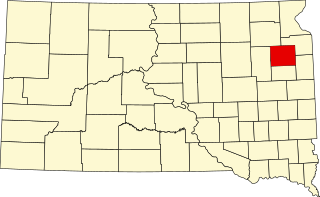
This is a list of the National Register of Historic Places listings in Codington County, South Dakota.

<span class="mw-page-title-main">National Register of Historic Places listings in Corson County, South Dakota</span>

This is a list of the National Register of Historic Places listings in Corson County, South Dakota.

<span class="mw-page-title-main">National Register of Historic Places listings in Davison County, South Dakota</span>

This is a list of the National Register of Historic Places listings in Davison County, South Dakota.

<span class="mw-page-title-main">National Register of Historic Places listings in Day County, South Dakota</span>

This is a list of the National Register of Historic Places listings in Day County, South Dakota.

<span class="mw-page-title-main">National Register of Historic Places listings in Deuel County, South Dakota</span>

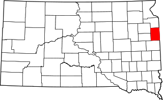
This is a list of the National Register of Historic Places listings in Deuel County, South Dakota.

<span class="mw-page-title-main">National Register of Historic Places listings in Hamlin County, South Dakota</span>

This is a list of the National Register of Historic Places listings in Hamlin County, South Dakota.

<span class="mw-page-title-main">National Register of Historic Places listings in Hand County, South Dakota</span>

This is a list of the National Register of Historic Places listings in Hand County, South Dakota.

<span class="mw-page-title-main">National Register of Historic Places listings in Hanson County, South Dakota</span>

This is a list of the National Register of Historic Places listings in Hanson County, South Dakota.

<span class="mw-page-title-main">National Register of Historic Places listings in Hutchinson County, South Dakota</span>

This is a list of the National Register of Historic Places listings in Hutchinson County, South Dakota.

<span class="mw-page-title-main">National Register of Historic Places listings in Hyde County, South Dakota</span>

This is a list of the National Register of Historic Places listings in Hyde County, South Dakota.

<span class="mw-page-title-main">National Register of Historic Places listings in Walworth County, South Dakota</span>

This is a list of the National Register of Historic Places listings in Walworth County, South Dakota.

<span class="mw-page-title-main">National Register of Historic Places listings in Lyman County, South Dakota</span>

This is a list of the National Register of Historic Places listings in Lyman County, South Dakota.

<span class="mw-page-title-main">National Register of Historic Places listings in McPherson County, South Dakota</span>

This is a list of the National Register of Historic Places listings in McPherson County, South Dakota.

<span class="mw-page-title-main">National Register of Historic Places listings in Perkins County, South Dakota</span>

This is a list of the National Register of Historic Places listings in Perkins County, South Dakota.

<span class="mw-page-title-main">National Register of Historic Places listings in Stanley County, South Dakota</span>

This is a list of the National Register of Historic Places listings in Stanley County, South Dakota.

<span class="mw-page-title-main">National Register of Historic Places listings in Turner County, South Dakota</span>

This is a list of the National Register of Historic Places listings in Turner County, South Dakota.

References

  1. The latitude and longitude information provided in this table was derived originally from the National Register Information System, which has been found to be fairly accurate for about 99% of listings. Some locations in this table may have been corrected to current GPS standards.
  2. National Park Service, United States Department of the Interior, "National Register of Historic Places: Weekly List Actions", retrieved June 23, 2023.
  3. 1 2 Numbers represent an alphabetical ordering by significant words. Various colorings, defined here, differentiate National Historic Landmarks and historic districts from other NRHP buildings, structures, sites or objects.
  4. "National Register Information System". National Register of Historic Places . National Park Service. April 24, 2008.
  5. The eight-digit number below each date is the number assigned to each location in the National Register Information System database, which can be viewed by clicking the number.
  6. Location derived from its NRHP nomination form; the NRIS lists it as "Address Restricted"
  7. "National Register of Historic Places Program: Weekly List". National Park Service. Retrieved August 20, 2013.
  8. "National Register of Historic Places Evaluation/Return Sheet" (PDF). National Park Service. Retrieved August 20, 2013.