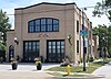
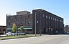
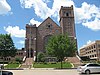
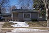
[3] Name on the Register [4] Image Date listed [5] Location City or town Description 1 All Saints Historic District All Saints Historic District February 23, 1984 (# 84003349 Roughly Main to 2nd Ave. from 14th to 23rd Sts., and 18th to 21st Sts. to 5th Ave. 43°32′11″N 96°43′30″W / 43.5364°N 96.725°W / 43.5364; -96.725 (All Saints Historic District ) Sioux Falls 2 All Saints School Main Building All Saints School Main Building March 14, 1973 (# 73001748 101 W. 17th St. 43°32′14″N 96°43′40″W / 43.5372°N 96.7278°W / 43.5372; -96.7278 (All Saints School Main Building ) Sioux Falls 3 Archaeological Site 39MH0005 Upload image December 15, 2023 (# 100008359 Address Restricted Sioux Falls vicinity 4 Augustana College Historic Buildings Augustana College Historic Buildings March 25, 1977 (# 77001250 29th and S. Summit Sts. 43°31′34″N 96°44′12″W / 43.5261°N 96.7367°W / 43.5261; -96.7367 (Augustana College Historic Buildings ) Sioux Falls 5 Austin-Olson Farm Upload image December 14, 1995 (# 95001474 24993 465th Ave. 43°45′46″N 96°54′42″W / 43.7628°N 96.9117°W / 43.7628; -96.9117 (Austin-Olson Farm ) Colton 6 Berdahl-Rolvaag House Berdahl-Rolvaag House January 23, 1979 (# 79002405 1009 W. 33rd St. 43°31′14″N 96°44′21″W / 43.5206°N 96.7392°W / 43.5206; -96.7392 (Berdahl-Rolvaag House ) Sioux Falls 7 Berg and Estensen Store Berg and Estensen Store November 8, 2001 (# 01001224 110 Zeliff Ave. 43°45′29″N 96°28′33″W / 43.7581°N 96.4758°W / 43.7581; -96.4758 (Berg and Estensen Store ) Sherman 8 Marion E. Bowen House Marion E. Bowen House May 28, 1976 (# 76001748 840 W. 9th St. 43°32′50″N 96°44′16″W / 43.5472°N 96.7378°W / 43.5472; -96.7378 (Marion E. Bowen House ) Sioux Falls 9 Brandon Village Upload image June 14, 2001 (# 01000664 Address Restricted Brandon 10 Bridge at Iverson Crossing Bridge at Iverson Crossing July 17, 1996 (# 96000746 48054 266th St. 43°31′44″N 96°36′02″W / 43.5289°N 96.6006°W / 43.5289; -96.6006 (Bridge at Iverson Crossing ) Brandon 11 Brooks Brothers Home Brooks Brothers Home October 24, 1996 (# 96001225 1006-1008 South Dakota Ave. 43°32′10″N 96°43′45″W / 43.5361°N 96.7292°W / 43.5361; -96.7292 (Brooks Brothers Home ) Sioux Falls 12 Margaret Burger Apartment House Upload image January 4, 2021 (# 100005893 619 South Main Ave. 43°32′26″N 96°43′42″W / 43.5406°N 96.7283°W / 43.5406; -96.7283 (Margaret Burger Apartment House ) Sioux Falls 13 Building at 330 South 1st Avenue Building at 330 South 1st Avenue January 23, 2013 (# 12001217 330 S. 1st Avenue [6] 43°32′38″N 96°43′30″W / 43.5438°N 96.7251°W / 43.5438; -96.7251 (Building at 330 South 1st Avenue ) Sioux Falls 14 Building at 529 North Main Building at 529 North Main January 14, 2005 (# 04001489 529 N. Main Ave. 43°43′04″N 96°30′11″W / 43.7178°N 96.5031°W / 43.7178; -96.5031 (Building at 529 North Main ) Garretson 15 Gina Smith Campbell Bathhouse Gina Smith Campbell Bathhouse February 13, 1986 (# 86000246 City Park, Beach Ave. extension 43°49′12″N 96°42′06″W / 43.82°N 96.7017°W / 43.82; -96.7017 (Gina Smith Campbell Bathhouse ) Dell Rapids 16 Carnegie Free Public Library Carnegie Free Public Library March 14, 1973 (# 73001750 235 W. 10th St. 43°32′45″N 96°43′46″W / 43.5459°N 96.7294°W / 43.5459; -96.7294 (Carnegie Free Public Library ) Sioux Falls 17 Carnegie Public Library Carnegie Public Library February 13, 1986 (# 86000247 513 N. Orleans 43°49′30″N 96°42′36″W / 43.825°N 96.71°W / 43.825; -96.71 (Carnegie Public Library ) Dell Rapids 18 Carpenter Hotel Carpenter Hotel August 13, 1986 (# 86001499 221 S. Phillips Ave. 43°32′43″N 96°43′36″W / 43.5453°N 96.7267°W / 43.5453; -96.7267 (Carpenter Hotel ) Sioux Falls 19 Cathedral Historic District Cathedral Historic District June 5, 1974 (# 74001896 Bounded by W. 4th and 10th Sts., Spring, Prairie, and Summit Aves.; also roughly bounded by West 9th and West 10th Sts., South Prairie, North Trapp, and South Menlo Aves. 43°33′00″N 96°44′06″W / 43.55°N 96.735°W / 43.55; -96.735 (Cathedral Historic District ) Sioux Falls Known as the Sioux Falls Historic District until 2011; boundary increase approved June 29, 2023 20 Central Fire Station Central Fire Station May 27, 1980 (# 80003730 100 S. Minnesota Ave. 43°32′49″N 96°43′51″W / 43.5469°N 96.7308°W / 43.5469; -96.7308 (Central Fire Station ) Sioux Falls 21 Cherry Rock Park Bridge Cherry Rock Park Bridge May 30, 2003 (# 03000499 Cherry Rock Park 43°32′16″N 96°42′17″W / 43.5378°N 96.7047°W / 43.5378; -96.7047 (Cherry Rock Park Bridge ) Sioux Falls 22 Edward Coughran House Edward Coughran House May 28, 1976 (# 76001749 1203 S. 1st Ave. 43°32′04″N 96°43′31″W / 43.5344°N 96.7253°W / 43.5344; -96.7253 (Edward Coughran House ) Sioux Falls 23 E.J. and Alice Daniels House E.J. and Alice Daniels House October 19, 1989 (# 89001724 3901 S. Hawthorne 43°30′34″N 96°44′56″W / 43.509444°N 96.748889°W / 43.509444; -96.748889 (E.J. and Alice Daniels House ) Sioux Falls 24 Dell Rapids Amphitheater Dell Rapids Amphitheater February 15, 2002 (# 02000020 City park 43°49′15″N 96°42′11″W / 43.820833°N 96.703056°W / 43.820833; -96.703056 (Dell Rapids Amphitheater ) Dell Rapids 25 Dell Rapids Bridge Dell Rapids Bridge August 5, 1999 (# 99000952 Local road over the Big Sioux River 43°49′12″N 96°42′35″W / 43.82°N 96.709722°W / 43.82; -96.709722 (Dell Rapids Bridge ) Dell Rapids Also known as the South Dakota Department of Transportation Bridge 50-210-018. Bridge was added again in January 2000 under a separate duplicate NRHP listing, ID#00000021. Entire bridge replaced in 2014. 26 Dell Rapids Historic District Dell Rapids Historic District February 23, 1978 (# 78002563 335-536 E. 4th St. 43°49′24″N 96°42′36″W / 43.823333°N 96.71°W / 43.823333; -96.71 (Dell Rapids Historic District ) Dell Rapids 27 Dell Rapids Residential Historic District Dell Rapids Residential Historic District October 12, 2000 (# 00001224 Roughly bounded by Orleans Ave., 4th St., and 7th St. 43°49′30″N 96°42′17″W / 43.825°N 96.704722°W / 43.825; -96.704722 (Dell Rapids Residential Historic District ) Dell Rapids 28 Dell Rapids Warming House Upload image February 27, 2017 (# 100000691 State Ave. 43°49′16″N 96°42′30″W / 43.821063°N 96.708406°W / 43.821063; -96.708406 (Dell Rapids Warming House ) Dell Rapids Warming hut used by ice skaters on the Big Sioux River 29 Dell Rapids Water Tower Dell Rapids Water Tower February 23, 1984 (# 84003356 10th and Orleans 43°49′47″N 96°42′32″W / 43.829722°N 96.708889°W / 43.829722; -96.708889 (Dell Rapids Water Tower ) Dell Rapids 30 Harrison DeLong House Harrison DeLong House October 12, 2000 (# 00001221 621 S. Main 43°32′27″N 96°43′41″W / 43.540833°N 96.728056°W / 43.540833; -96.728056 (Harrison DeLong House ) Sioux Falls 31 East Site Fire Station and Branch Library East Site Fire Station and Branch Library June 26, 2019 (# 100004124 600 E. 7th St. 43°33′00″N 96°43′10″W / 43.5499°N 96.7195°W / 43.5499; -96.7195 (East Site Fire Station and Branch Library ) Sioux Falls 32 Eighth Street Bridge Eighth Street Bridge December 9, 1993 (# 93001308 S. 8th St. over the Big Sioux River 43°32′55″N 96°43′31″W / 43.548611°N 96.725278°W / 43.548611; -96.725278 (Eighth Street Bridge ) Sioux Falls 33 Farley-Loetscher Company Building Farley-Loetscher Company Building January 26, 2001 (# 01000020 701-705 E. 8th St. 43°32′54″N 96°43′05″W / 43.548333°N 96.718056°W / 43.548333; -96.718056 (Farley-Loetscher Company Building ) Sioux Falls 34 Farley-Loetscher Company Building I Farley-Loetscher Company Building I February 5, 2003 (# 02001766 322 and 324 E. 8th St. 43°32′55″N 96°43′51″W / 43.548611°N 96.730833°W / 43.548611; -96.730833 (Farley-Loetscher Company Building I ) Sioux Falls 35 Ole E. Fauske House Upload image October 29, 2021 (# 100007110 26003 482nd Ave. 43°36′58″N 96°34′19″W / 43.6161°N 96.5720°W / 43.6161; -96.5720 (Ole E. Fauske House ) Corson 36 Federal Building and U.S. Courthouse Federal Building and U.S. Courthouse May 2, 1974 (# 74001894 400 S. Phillips Ave. 43°32′36″N 96°43′33″W / 43.543333°N 96.725833°W / 43.543333; -96.725833 (Federal Building and U.S. Courthouse ) Sioux Falls 37 First Congregational Church First Congregational Church August 18, 1983 (# 83003012 303 S. Dakota Ave. 43°32′40″N 96°43′48″W / 43.544444°N 96.73°W / 43.544444; -96.73 (First Congregational Church ) Sioux Falls 38 First National Bank of Garretson Upload image November 2, 2011 (# 11000787 605 Main St. 43°42′59″N 96°30′10″W / 43.716389°N 96.502778°W / 43.716389; -96.502778 (First National Bank of Garretson ) Garretson 39 Josephine Martin Glidden Memorial Chapel Josephine Martin Glidden Memorial Chapel September 25, 1987 (# 87001732 2121 E. 12th St. 43°32′37″N 96°41′58″W / 43.543611°N 96.699444°W / 43.543611; -96.699444 (Josephine Martin Glidden Memorial Chapel ) Sioux Falls 40 Glidden-Martin Hall Glidden-Martin Hall November 8, 2000 (# 00001350 1101 W. 22nd Ave. 43°31′58″N 96°44′19″W / 43.532778°N 96.738611°W / 43.532778; -96.738611 (Glidden-Martin Hall ) Sioux Falls 41 The Gloria House The Gloria House July 20, 2000 (# 00000828 1216 S. Center Ave. 43°32′03″N 96°43′42″W / 43.534167°N 96.728333°W / 43.534167; -96.728333 (The Gloria House ) Sioux Falls 42 Grand Lodge and Library of the Ancient Free and Accepted Masons Grand Lodge and Library of the Ancient Free and Accepted Masons May 28, 1976 (# 76001750 415 S. Main Ave. 43°32′34″N 96°43′42″W / 43.542778°N 96.728333°W / 43.542778; -96.728333 (Grand Lodge and Library of the Ancient Free and Accepted Masons ) Sioux Falls 43 Hayes Historic District Hayes Historic District February 14, 2006 (# 06000049 Roughly bounded by W. 22nd St. to W. 26th St. and by South Dakota Ave. to S. Phillips Ave. 43°32′04″N 96°43′43″W / 43.534444°N 96.728611°W / 43.534444; -96.728611 (Hayes Historic District ) Sioux Falls 44 Orlan A. Hayward House Orlan A. Hayward House December 2, 1998 (# 98001406 1509 S. Glendale 43°32′27″N 96°44′42″W / 43.540833°N 96.745°W / 43.540833; -96.745 (Orlan A. Hayward House ) Sioux Falls 45 Hans J. Hilmoe Barn Upload image June 28, 2010 (# 10000410 47170 Homestead St. 43°46′06″N 96°46′35″W / 43.768333°N 96.776389°W / 43.768333; -96.776389 (Hans J. Hilmoe Barn ) Baltic vicinity Built in 1911 by Norwegian immigrants [7] 46 Andrew O. Huseboe House Andrew O. Huseboe House July 13, 1988 (# 88000569 223 S. Prairie Ave. 43°32′44″N 96°44′14″W / 43.545556°N 96.737222°W / 43.545556; -96.737222 (Andrew O. Huseboe House ) Sioux Falls 47 Illinois Central Passenger Depot Illinois Central Passenger Depot August 18, 1983 (# 83003013 Big Sioux River at 8th St. 43°32′58″N 96°43′24″W / 43.549444°N 96.723333°W / 43.549444; -96.723333 (Illinois Central Passenger Depot ) Sioux Falls 48 Jorden Hall Jorden Hall November 8, 2000 (# 00001349 1101 W. 22nd St. 43°31′56″N 96°44′19″W / 43.532222°N 96.738611°W / 43.532222; -96.738611 (Jorden Hall ) Sioux Falls 49 Andrew Kuehn Warehouse Andrew Kuehn Warehouse February 25, 1982 (# 82003933 401 N. Phillips Ave. 43°33′05″N 96°43′37″W / 43.551389°N 96.726944°W / 43.551389; -96.726944 (Andrew Kuehn Warehouse ) Sioux Falls 50 L & A Baking Company L & A Baking Company November 20, 2007 (# 07001214 910 N. Main Ave. 43°33′29″N 96°43′39″W / 43.558056°N 96.7275°W / 43.558056; -96.7275 (L & A Baking Company ) Sioux Falls 51 LaSalle Apartments LaSalle Apartments September 14, 1998 (# 98001125 703 S. Summit 43°32′38″N 96°44′09″W / 43.543889°N 96.735833°W / 43.543889; -96.735833 (LaSalle Apartments ) Sioux Falls 52 Daniel Lund House Daniel Lund House February 18, 2000 (# 00000123 628 W. 20th 43°32′07″N 96°43′59″W / 43.535278°N 96.733056°W / 43.535278; -96.733056 (Daniel Lund House ) Sioux Falls 53 McKennan Park Historic District McKennan Park Historic District June 6, 1984 (# 84003359 McKennan Park, 2nd and 4th Aves. from 21st to 26th Sts., and 21st St. from Phillips to 7th Aves.; also roughly bounded by 1st Ave., S., Phillips Ave., 24th St., E., and 26th St. 43°31′56″N 96°43′17″W / 43.532222°N 96.721389°W / 43.532222; -96.721389 (McKennan Park Historic District ) Sioux Falls Second set of boundaries represents a boundary increase 54 L.D. Miller Funeral Home L.D. Miller Funeral Home August 18, 1983 (# 83003014 507 S. Main Ave. 43°32′33″N 96°43′42″W / 43.5425°N 96.728333°W / 43.5425; -96.728333 (L.D. Miller Funeral Home ) Sioux Falls 55 William G. Milne House William G. Milne House December 1, 1994 (# 94001391 508 E. 9th St. 43°49′42″N 96°42′30″W / 43.828333°N 96.708333°W / 43.828333; -96.708333 (William G. Milne House ) Dell Rapids 56 John Mundt Building John Mundt Building February 17, 1981 (# 81000575 103 N. Main Ave. 43°37′20″N 96°56′44″W / 43.622222°N 96.945556°W / 43.622222; -96.945556 (John Mundt Building ) Hartford 57 Odd Fellows Home of Dell Rapids Odd Fellows Home of Dell Rapids February 21, 2012 (# 12000037 100 W. 10th St. 43°49′45″N 96°43′06″W / 43.829181°N 96.718204°W / 43.829181; -96.718204 (Odd Fellows Home of Dell Rapids ) Dell Rapids 58 Old Courthouse and Warehouse Historic District Old Courthouse and Warehouse Historic District August 18, 1983 (# 83003015 Roughly bounded by the Big Sioux River , 4th and 6th Sts., and Dakota Ave.; also roughly bounded by North Dakota Ave., 4th St., the Big Sioux River , and 7th St. 43°33′06″N 96°43′37″W / 43.551667°N 96.726944°W / 43.551667; -96.726944 (Old Courthouse and Warehouse Historic District ) Sioux Falls Second set of boundaries represents a boundary increase 59 Old Minnehaha County Courthouse Old Minnehaha County Courthouse May 10, 1973 (# 73001749 Main Ave. at 6th St. 43°33′06″N 96°43′43″W / 43.551667°N 96.728611°W / 43.551667; -96.728611 (Old Minnehaha County Courthouse ) Sioux Falls 60 Old Yankton Bridge Old Yankton Bridge August 5, 1999 (# 99000955 Old Yankton Rd. over the Big Sioux River 43°30′05″N 96°45′03″W / 43.501389°N 96.750833°W / 43.501389; -96.750833 (Old Yankton Bridge ) Sioux Falls 61 Orpheum Theatre Orpheum Theatre June 23, 1983 (# 83003016 315 N. Phillips Ave. 43°33′03″N 96°43′37″W / 43.550833°N 96.726944°W / 43.550833; -96.726944 (Orpheum Theatre ) Sioux Falls 62 Palisades Bridge Palisades Bridge June 3, 1999 (# 99000687 25495 485th Ave. 43°41′20″N 96°31′05″W / 43.688889°N 96.518056°W / 43.688889; -96.518056 (Palisades Bridge ) Garretson 63 Parmley-Pankow House Parmley-Pankow House January 28, 2004 (# 03001528 613 S. Main 43°32′27″N 96°43′41″W / 43.540833°N 96.728056°W / 43.540833; -96.728056 (Parmley-Pankow House ) Sioux Falls 64 R.F. Pettigrew and S.L. Tate Building R.F. Pettigrew and S.L. Tate Building November 6, 1986 (# 86002991 121-123 S. Main Ave. 43°33′01″N 96°43′39″W / 43.550278°N 96.7275°W / 43.550278; -96.7275 (R.F. Pettigrew and S.L. Tate Building ) Sioux Falls 65 Phillips Block Phillips Block January 18, 1978 (# 78002564 333-335 N. Main Ave. 43°33′03″N 96°43′43″W / 43.550833°N 96.728611°W / 43.550833; -96.728611 (Phillips Block ) Sioux Falls 66 Plumbing Supply Company Plumbing Supply Company January 14, 2005 (# 04001488 326 E. 8th St. 43°33′03″N 96°43′24″W / 43.550833°N 96.723333°W / 43.550833; -96.723333 (Plumbing Supply Company ) Sioux Falls 67 Presentation Children's Home Presentation Children's Home February 10, 1993 (# 92001852 701 S. Western Ave. 43°32′23″N 96°45′04″W / 43.539722°N 96.751111°W / 43.539722; -96.751111 (Presentation Children's Home ) Sioux Falls 68 Queen Bee Mill Queen Bee Mill August 1, 1984 (# 84003362 N. Weber Ave., Falls Park 43°33′25″N 96°43′19″W / 43.556944°N 96.721944°W / 43.556944; -96.721944 (Queen Bee Mill ) Sioux Falls 69 Dr. Fredrich A. Randolph Block Dr. Fredrich A. Randolph Block March 17, 1994 (# 94000195 320 N. Main 43°33′11″N 96°43′59″W / 43.553056°N 96.733056°W / 43.553056; -96.733056 (Dr. Fredrich A. Randolph Block ) Sioux Falls 70 Renner Ball Park Renner Ball Park November 8, 2006 (# 06001007 0.75 miles (1.21 km) west of the intersection of 258th St. and Highway 115 43°38′49″N 96°43′38″W / 43.646944°N 96.727222°W / 43.646944; -96.727222 (Renner Ball Park ) Renner 71 Renner Lutheran Sanctuary Renner Lutheran Sanctuary May 7, 1980 (# 80003729 West of South Dakota Highway 115 43°38′44″N 96°42′58″W / 43.645556°N 96.716111°W / 43.645556; -96.716111 (Renner Lutheran Sanctuary ) Renner 72 Grant J. Reynolds House Grant J. Reynolds House December 2, 1998 (# 98001400 800 S. Hawthorne St. 43°32′10″N 96°44′47″W / 43.536111°N 96.746389°W / 43.536111; -96.746389 (Grant J. Reynolds House ) Sioux Falls 73 Rock Island Depot Rock Island Depot February 15, 1974 (# 74001895 201 E. 10th St. 43°32′45″N 96°43′29″W / 43.545833°N 96.724722°W / 43.545833; -96.724722 (Rock Island Depot ) Sioux Falls 74 Security Bank Building Security Bank Building February 23, 1984 (# 84003366 101 S. Main Ave. 43°32′50″N 96°43′42″W / 43.547222°N 96.728333°W / 43.547222; -96.728333 (Security Bank Building ) Sioux Falls 75 Shafer Round Barn Shafer Round Barn December 14, 1995 (# 95001470 1600 S. Powder House Rd. 43°32′31″N 96°38′58″W / 43.541944°N 96.649444°W / 43.541944; -96.649444 (Shafer Round Barn ) Sioux Falls 76 Sherman Historic District Sherman Historic District January 28, 2004 (# 03001529 Roughly bounded by W. 18th St. to W. 22nd St., and S. Dakota Ave. to S. Main St. 43°32′05″N 96°43′43″W / 43.534722°N 96.728611°W / 43.534722; -96.728611 (Sherman Historic District ) Sioux Falls 77 Shriver-Johnson Building Shriver-Johnson Building June 17, 1982 (# 82003934 230 S. Phillips Ave. 43°32′41″N 96°43′34″W / 43.544722°N 96.726111°W / 43.544722; -96.726111 (Shriver-Johnson Building ) Sioux Falls 78 Sioux Falls Downtown Historic District Sioux Falls Downtown Historic District December 1, 1994 (# 94001393 Roughly bounded by S. Dakota and S. 1st Aves., W. 9th and W. 14th Sts. 43°32′49″N 96°43′43″W / 43.546944°N 96.728611°W / 43.546944; -96.728611 (Sioux Falls Downtown Historic District ) Sioux Falls 79 Sioux Falls Light and Power Hydro Electric Plant Sioux Falls Light and Power Hydro Electric Plant February 3, 1993 (# 92001854 N. Weber Ave. on the eastern bank of the Big Sioux River 43°33′25″N 96°43′15″W / 43.556944°N 96.720833°W / 43.556944; -96.720833 (Sioux Falls Light and Power Hydro Electric Plant ) Sioux Falls 80 Sioux Falls National Bank Building Sioux Falls National Bank Building March 26, 1979 (# 79002406 100 N. Phillips Ave. 43°32′51″N 96°43′35″W / 43.5475°N 96.726389°W / 43.5475; -96.726389 (Sioux Falls National Bank Building ) Sioux Falls 81 Slip Up Creek Homestead Upload image August 15, 2003 (# 03000761 25359 478th Ave. 43°42′42″N 96°39′10″W / 43.711667°N 96.652778°W / 43.711667; -96.652778 (Slip Up Creek Homestead ) Garretson 82 South Dakota Department of Transportation Bridge No. 50-122-155 Upload image January 28, 2000 (# 00000022 Local road over Skunk Creek 43°37′25″N 96°53′08″W / 43.623611°N 96.885556°W / 43.623611; -96.885556 (South Dakota Department of Transportation Bridge No. 50-122-155 ) Brandon Township Replaced in 2000 [8] 83 South Dakota Department of Transportation Bridge No. 50-193-086 Upload image January 14, 2000 (# 99001695 Local road over the Big Sioux River near Midway 43°43′12″N 96°44′54″W / 43.72°N 96.748333°W / 43.72; -96.748333 (South Dakota Department of Transportation Bridge No. 50-193-086 ) Sverdrup Township Bridge removed in 2013 84 South Dakota Dept. of Trans. Bridge No. 50-196-104 Upload image February 10, 2000 (# 00000098 Local road over the Big Sioux River 43°41′45″N 96°44′15″W / 43.695833°N 96.7375°W / 43.695833; -96.7375 (South Dakota Dept. of Trans. Bridge No. 50-196-104 ) Sverdrup Township 85 South Dakota School for the Deaf South Dakota School for the Deaf June 14, 1981 (# 81000576 1800 E. 10th St. 43°32′51″N 96°42′10″W / 43.5475°N 96.702778°W / 43.5475; -96.702778 (South Dakota School for the Deaf ) Sioux Falls 86 South Dakota State Penitentiary Historic Buildings South Dakota State Penitentiary Historic Buildings April 20, 1978 (# 78002565 1600 North Dr. 43°34′03″N 96°43′29″W / 43.5675°N 96.724722°W / 43.5675; -96.724722 (South Dakota State Penitentiary Historic Buildings ) Sioux Falls 87 South Side Fire Station No. 3 South Side Fire Station No. 3 February 23, 1984 (# 84003369 1324 S. Minnesota Ave. 43°32′00″N 96°43′51″W / 43.533333°N 96.730833°W / 43.533333; -96.730833 (South Side Fire Station No. 3 ) Sioux Falls 88 Split Rock Creek Park Historic District Split Rock Creek Park Historic District July 20, 2000 (# 00000827 Roughly 1 mile (1.6 km) north of Garretson in Split Rock Park 43°43′14″N 96°30′07″W / 43.720556°N 96.501944°W / 43.720556; -96.501944 (Split Rock Creek Park Historic District ) Garretson 89 Split Rock Park Bridge Split Rock Park Bridge December 9, 1993 (# 93001309 Split Rock Park Rd. over Devils Creek Gulch 43°43′20″N 96°30′02″W / 43.722222°N 96.500556°W / 43.722222; -96.500556 (Split Rock Park Bridge ) Garretson 90 R.D. and Mary Springer House R.D. and Mary Springer House December 13, 1995 (# 95001436 201 W. 19th St. 43°32′09″N 96°43′37″W / 43.535833°N 96.726944°W / 43.535833; -96.726944 (R.D. and Mary Springer House ) Sioux Falls 91 St. Peter's Lutheran Church St. Peter's Lutheran Church February 15, 2002 (# 02000018 701 North Orleans 43°49′34″N 96°42′37″W / 43.826111°N 96.710278°W / 43.826111; -96.710278 (St. Peter's Lutheran Church ) Dell Rapids 92 Stadum-Green House Stadum-Green House July 31, 2017 (# 100001401 2101 S. Pendar Ln. 43°31′34″N 96°43′24″W / 43.526177°N 96.723301°W / 43.526177; -96.723301 (Stadum-Green House ) Sioux Falls 93 Dr. Steven's House Dr. Steven's House October 31, 2002 (# 02001286 21 S. Riverview Heights 43°31′59″N 96°45′27″W / 43.533056°N 96.7575°W / 43.533056; -96.7575 (Dr. Steven's House ) Sioux Falls 94 Stock Yards State Bank and Tri-State Wholesale Grocery Co. Stock Yards State Bank and Tri-State Wholesale Grocery Co. January 28, 2004 (# 03001530 201/207/211 N. Weber Ave. 43°32′55″N 96°43′11″W / 43.548611°N 96.719722°W / 43.548611; -96.719722 (Stock Yards State Bank and Tri-State Wholesale Grocery Co. ) Sioux Falls 95 Terrace Park and Japanese Gardens Terrace Park and Japanese Gardens September 1, 2015 (# 15000566 1100 W. 4th St. 43°33′15″N 96°44′30″W / 43.5542°N 96.7417°W / 43.5542; -96.7417 (Terrace Park and Japanese Gardens ) Sioux Falls 96 Texaco Super Service Station Texaco Super Service Station January 23, 2013 (# 12001218 330 S. 1st Avenue [6] 43°32′37″N 96°43′30″W / 43.543719°N 96.724976°W / 43.543719; -96.724976 (Texaco Super Service Station ) Sioux Falls 97 Charles A. Thomas House Charles A. Thomas House October 31, 1985 (# 85003450 620 S. Dakota Ave. 43°32′27″N 96°43′43″W / 43.540833°N 96.728611°W / 43.540833; -96.728611 (Charles A. Thomas House ) Sioux Falls 98 Thompson Farmstead Upload image February 18, 1999 (# 99000239 47339 248th St. 43°47′03″N 96°44′27″W / 43.784167°N 96.740833°W / 43.784167; -96.740833 (Thompson Farmstead ) Dell Rapids 99 Tolefsons Beef Stock Farm Upload image February 14, 2002 (# 02000019 24450 458th Ave. 43°50′36″N 97°02′39″W / 43.843333°N 97.044167°W / 43.843333; -97.044167 (Tolefsons Beef Stock Farm ) Colton 100 John W. Tuthill Lumber Company John W. Tuthill Lumber Company August 24, 2006 (# 06000459 311 E. 8th St. 43°33′01″N 96°43′24″W / 43.550278°N 96.723333°W / 43.550278; -96.723333 (John W. Tuthill Lumber Company ) Sioux Falls 101 Valley Springs Rest Stop Tipi Valley Springs Rest Stop Tipi January 20, 2015 (# 14001183 Mi. 412.1 on I-90 West 43°36′37″N 96°27′37″W / 43.6104°N 96.4602°W / 43.6104; -96.4602 (Valley Springs Rest Stop Tipi ) Valley Springs vicinity 102 Washington High School Washington High School February 13, 1986 (# 86000248 315 S. Main 43°32′38″N 96°43′43″W / 43.543889°N 96.728611°W / 43.543889; -96.728611 (Washington High School ) Sioux Falls 103 Laura M. Welch House Laura M. Welch House March 7, 2000 (# 00000122 1218 S. Willow Ave. 43°32′06″N 96°45′00″W / 43.535°N 96.75°W / 43.535; -96.75 (Laura M. Welch House ) Sioux Falls 104 Williams Piano Company House Williams Piano Company House October 12, 2000 (# 00001223 1019 S. Norton 43°32′09″N 96°44′06″W / 43.535833°N 96.735°W / 43.535833; -96.735 (Williams Piano Company House ) Sioux Falls 105 Willow Grove Farm Willow Grove Farm May 30, 2003 (# 03000497 47480 258th Ave. 43°40′24″N 96°43′36″W / 43.673333°N 96.726667°W / 43.673333; -96.726667 (Willow Grove Farm ) Renner