National Register of Historic Places listings in Codington County, South Dakota

Last updated

Location of Codington County in South Dakota Map of South Dakota highlighting Codington County.svg
Location of Codington County in South Dakota

This is a list of the National Register of Historic Places listings in Codington County, South Dakota.

Contents

This is intended to be a complete list of the properties and districts on the National Register of Historic Places in Codington County, South Dakota, United States. The locations of National Register properties and districts for which the latitude and longitude coordinates are included below, may be seen in a map. [1]

There are 43 properties and districts listed on the National Register in the county. One property that was once listed on the Register has been removed.


    This National Park Service list is complete through NPS recent listings posted March 4, 2022. [2]

Map all coordinates using: OpenStreetMap  
Download coordinates as: KML

Current listings

[3] Name on the Register [4] ImageDate listed [5] Location City or townDescription
1 E.C. Adams House January 3, 1989
(#88003032)
604 N. Maple
44°54′30″N97°06′39″W / 44.908333°N 97.110833°W / 44.908333; -97.110833 (E.C. Adams House)
Watertown
2 Barr Farmstead August 4, 2005
(#05000831)
15539 444th Ave.
45°08′00″N97°19′55″W / 45.133333°N 97.331944°W / 45.133333; -97.331944 (Barr Farmstead)
Florence
3 Beskow Barn October 24, 2003
(#03001072)
15689 456th Ave.
45°06′33″N97°05′13″W / 45.109167°N 97.086944°W / 45.109167; -97.086944 (Beskow Barn)
South Shore
4 Carnegie Free Public Library
Carnegie Free Public Library CARNEGIE FREE PUBLIC LIBRARY, CODINGTON COUNTY, SD.JPG
Carnegie Free Public Library
June 18, 1976
(#76001724)
27 1st Ave., SE.
44°53′57″N97°06′47″W / 44.899167°N 97.113056°W / 44.899167; -97.113056 (Carnegie Free Public Library)
Watertown
5 Benjamin H. Cartford House January 3, 1989
(#88003025)
803 N. Maple
44°54′37″N97°06′40″W / 44.910278°N 97.111111°W / 44.910278; -97.111111 (Benjamin H. Cartford House)
Watertown
6 Citizens State Bank of Henry
Citizens State Bank of Henry View of the front which is now the Henry Post Office.jpg
Citizens State Bank of Henry
November 7, 1997
(#97001391)
Junction of Main and 2nd Sts.
44°52′41″N97°28′06″W / 44.878056°N 97.468333°W / 44.878056; -97.468333 (Citizens State Bank of Henry)
Henry
7 Codington County Courthouse
Codington County Courthouse CODINGTON COUNTY COURTHOUSE, WATERTOWN, SD.jpg
Codington County Courthouse
July 24, 1978
(#78002545)
1st Ave., SE.
44°53′55″N97°06′51″W / 44.898611°N 97.114167°W / 44.898611; -97.114167 (Codington County Courthouse)
Watertown
8 Amy A. Davis House
Amy A. Davis House Amy Davis House NRHP 88003030 Codington County, SD.jpg
Amy A. Davis House
January 3, 1989
(#88003030)
20 4th Ave., NW.
44°54′21″N97°06′55″W / 44.905833°N 97.115278°W / 44.905833; -97.115278 (Amy A. Davis House)
Watertown
9 Curt E. DeGraff House
Curt E. DeGraff House DeGraff House NRHP 88003033 Codington County,SD.jpg
Curt E. DeGraff House
January 3, 1989
(#88003033)
603 N. Park
44°54′30″N97°06′52″W / 44.908333°N 97.114444°W / 44.908333; -97.114444 (Curt E. DeGraff House)
Watertown
10 Corson Emminger Round Barn
Corson Emminger Round Barn CORSON EMMINGER ROUND BARN, CODINGTON COUNTY, SD.JPG
Corson Emminger Round Barn
March 30, 1978
(#78002546)
South of Watertown on U.S. Route 81
44°51′41″N97°06′34″W / 44.86128°N 97.10946°W / 44.86128; -97.10946 (Corson Emminger Round Barn)
Watertown Tall round barn built by farmer Corson Emminger during 1909-10, made of concrete blocks with a two-tier roof and a cupola
11 Evangelical United Brethren Church
Evangelical United Brethren Church Evangelical United Brethren Church, Watertown, South Dakota.jpg
Evangelical United Brethren Church
January 3, 1989
(#88003026)
409 N. Maple
44°54′22″N97°06′41″W / 44.906111°N 97.111389°W / 44.906111; -97.111389 (Evangelical United Brethren Church)
Watertown
12 James W. Ferris House
James W. Ferris House Ferris House2 NRHP 88003034 Codington County, SD.jpg
James W. Ferris House
January 3, 1989
(#88003034)
619 N. Park
44°54′31″N97°06′52″W / 44.908611°N 97.114444°W / 44.908611; -97.114444 (James W. Ferris House)
Watertown
13 Florence Methodist Church June 28, 1991
(#91000848)
Junction of 5th St. and Dolly Ave.
45°03′20″N97°19′46″W / 45.055556°N 97.329444°W / 45.055556; -97.329444 (Florence Methodist Church)
Florence
14 C.E. and Bertha Fowler House
C.E. and Bertha Fowler House Fowler House NRHP 01000096 Codington County, SD.jpg
C.E. and Bertha Fowler House
February 9, 2001
(#01000096)
316 1st Ave., SE.
44°53′53″N97°06′34″W / 44.898056°N 97.109444°W / 44.898056; -97.109444 (C.E. and Bertha Fowler House)
Watertown
15 Dr. H.M. Freeburg House
Dr. H.M. Freeburg House Freeburg House NRHP 88003035 Codington County, SD.jpg
Dr. H.M. Freeburg House
January 3, 1989
(#88003035)
501 N. Park
44°54′26″N97°06′52″W / 44.907222°N 97.114444°W / 44.907222; -97.114444 (Dr. H.M. Freeburg House)
Watertown
16 A.C. Gilruth House
A.C. Gilruth House Gilruth House NRHP88003031 Codington County, SD.jpg
A.C. Gilruth House
January 3, 1989
(#88003031)
218 2nd Ave., NE.
44°54′14″N97°06′31″W / 44.903889°N 97.108611°W / 44.903889; -97.108611 (A.C. Gilruth House)
Watertown
17 Goodhue Lutheran Church July 17, 1996
(#96000745)
15555 441st Ave.
45°07′47″N97°23′33″W / 45.129722°N 97.3925°W / 45.129722; -97.3925 (Goodhue Lutheran Church)
Florence
18 Nels M. Hanson Farmstead July 13, 1989
(#89000831)
4 miles (6.4 km) north of Henry
44°57′20″N97°27′06″W / 44.955556°N 97.451667°W / 44.955556; -97.451667 (Nels M. Hanson Farmstead)
Henry
19 John B. Hanten House
John B. Hanten House Hanten House2 NRHP 89002337 Codington County, SD.jpg
John B. Hanten House
January 26, 1990
(#89002337)
518 E. Kemp Ave.
44°53′54″N97°06′19″W / 44.898333°N 97.105278°W / 44.898333; -97.105278 (John B. Hanten House)
Watertown
20 Dr. Harry Henningson House
Dr. Harry Henningson House Dr. Harry Henningson House NRHP 88003036 Codington County, SD.jpg
Dr. Harry Henningson House
January 3, 1989
(#88003036)
802 1st St., NW.
44°54′37″N97°06′55″W / 44.910278°N 97.115278°W / 44.910278; -97.115278 (Dr. Harry Henningson House)
Watertown
21 Holy Rosary Church June 6, 1986
(#86001227)
Minnesota Ave.
44°53′35″N96°55′01″W / 44.893056°N 96.916944°W / 44.893056; -96.916944 (Holy Rosary Church)
Kranzburg
22 A. Einar Johnson House
A. Einar Johnson House A. Einar Johnson House2 NRHP 88003029 Codington Coounty, SD.jpg
A. Einar Johnson House
January 3, 1989
(#88003029)
803 1st St., NW.
44°54′37″N97°06′57″W / 44.910278°N 97.115833°W / 44.910278; -97.115833 (A. Einar Johnson House)
Watertown
23 Mabel and David Jones House November 8, 2001
(#01001221)
425 N. Park
44°54′23″N97°06′51″W / 44.906389°N 97.114167°W / 44.906389; -97.114167 (Mabel and David Jones House)
Watertown
24 Kemp Avenue Bridge
Kemp Avenue Bridge Kemp Avenue Bridge, Watertown South Dakota, May 2017.jpg
Kemp Avenue Bridge
December 9, 1993
(#93001264)
Kemp Ave. over the Big Sioux River
44°54′10″N97°07′33″W / 44.90271°N 97.12573°W / 44.90271; -97.12573 (Kemp Avenue Bridge)
Watertown
25 Kranzburg School District No. 5 June 28, 1991
(#91000847)
Hasting St.
44°53′33″N96°55′07″W / 44.8925°N 96.918611°W / 44.8925; -96.918611 (Kranzburg School District No. 5)
Kranzburg
26 Mathiesen House
Mathiesen House MATHIESEN HOUSE, WATERTOWN, CODINGTON COUNTY, SD.jpg
Mathiesen House
February 1, 1982
(#82003923)
914 N. Maple
44°54′42″N97°06′38″W / 44.911667°N 97.110556°W / 44.911667; -97.110556 (Mathiesen House)
Watertown
27 Peter Mauseth House January 3, 1989
(#88003028)
703 N. Maple
44°54′32″N97°06′41″W / 44.908889°N 97.111389°W / 44.908889; -97.111389 (Peter Mauseth House)
Watertown
28 Andrew and Lulu Melham House July 28, 2011
(#11000485)
721 1st. St., NW
44°54′33″N97°06′56″W / 44.909167°N 97.115556°W / 44.909167; -97.115556 (Andrew and Lulu Melham House)
Watertown North End Neighborhood MPS
29 Mellette House
Mellette House MELLETTE HOUSE, WATERTOWN, CODINGTON COUNTY, SD.jpg
Mellette House
August 13, 1976
(#76001725)
421 5th Ave., NW.
44°54′26″N97°07′16″W / 44.907222°N 97.121111°W / 44.907222; -97.121111 (Mellette House)
Watertown
30 Minneapolis and St. Louis Railroad Depot
Minneapolis and St. Louis Railroad Depot MINNEAPOLIS AND ST. LOUIS RAILROAD DEPOT; WATERTOWN, CODINGTON COUNTY.JPG
Minneapolis and St. Louis Railroad Depot
October 31, 1985
(#85003477)
168 N. Broadway
44°54′12″N97°06′43″W / 44.903333°N 97.111944°W / 44.903333; -97.111944 (Minneapolis and St. Louis Railroad Depot)
Watertown
31 Mount Hope Cemetery Mausoleum
Mount Hope Cemetery Mausoleum Mount Hope Cemetery Mausoleum.jpg
Mount Hope Cemetery Mausoleum
August 13, 1986
(#86001500)
Mt. Hope Cemetery off U.S. Route 81
44°54′59″N97°05′56″W / 44.91635°N 97.09899°W / 44.91635; -97.09899 (Mount Hope Cemetery Mausoleum)
Watertown
32 Olive Place May 23, 1978
(#78002547)
North of Watertown off U.S. Route 81
44°56′00″N97°06′28″W / 44.933333°N 97.107778°W / 44.933333; -97.107778 (Olive Place)
Watertown
33 Puhlman Farm October 24, 2003
(#03001075)
44350 176th St.
44°50′08″N97°20′28″W / 44.835556°N 97.341111°W / 44.835556; -97.341111 (Puhlman Farm)
Hazel
34 Reeve's Resort October 19, 1989
(#89001726)
6 miles (9.7 km) south of Florence
44°58′41″N97°21′18″W / 44.978056°N 97.355°W / 44.978056; -97.355 (Reeve's Resort)
Florence
35 Nicholas T. Ries Farmstead February 11, 1988
(#88000047)
Off Codington County Highway 3
44°51′43″N96°55′35″W / 44.861944°N 96.926389°W / 44.861944; -96.926389 (Nicholas T. Ries Farmstead)
Kranzburg
36 Gen. Mark W. Sheafe House
Gen. Mark W. Sheafe House General Sheafe House NRHP 87000222 Codington County, SD.jpg
Gen. Mark W. Sheafe House
February 26, 1987
(#87000222)
57 4th Ave., NW.
44°54′24″N97°06′51″W / 44.906667°N 97.114167°W / 44.906667; -97.114167 (Gen. Mark W. Sheafe House)
Watertown
37 South Dakota Dept. of Transportation Bridge No. 15-210-136 December 9, 1993
(#93001265)
Local road over an unnamed creek
44°57′11″N97°03′55″W / 44.953056°N 97.065278°W / 44.953056; -97.065278 (South Dakota Dept. of Transportation Bridge No. 15-210-136)
Watertown
38 Dr. Tarbell House
Dr. Tarbell House Dr. Tarbell House NRHP 01000634 Codington County, SD.jpg
Dr. Tarbell House
June 6, 2001
(#01000634)
304 2nd Ave., SE.
44°53′49″N97°06′36″W / 44.896944°N 97.11°W / 44.896944; -97.11 (Dr. Tarbell House)
Watertown
39 Watertown Commercial Historic District
Watertown Commercial Historic District Watertown Commercial HD3 NRHP 89000834 Codington County, SD.jpg
Watertown Commercial Historic District
July 13, 1989
(#89000834)
Roughly bounded by 1st Ave., N., 3rd St., E., 2nd Ave., S., and 1st St., W.; also roughly bounded by 1st St. West, 3rd St. East, 1st Ave. North, 2nd Ave. South
44°54′00″N97°06′49″W / 44.9°N 97.113611°W / 44.9; -97.113611 (Watertown Commercial Historic District)
Watertown Second set of addresses represent a boundary decrease approved January 29, 2021.
40 Watertown Post Office
Watertown Post Office WATERTOWN POST OFFICE, CODINGTON COUNTY, SD.jpg
Watertown Post Office
December 12, 1976
(#76001726)
26 S. Broadway
44°53′58″N97°06′51″W / 44.899444°N 97.114167°W / 44.899444; -97.114167 (Watertown Post Office)
Watertown
41 Watertown Stadium
Watertown Stadium Watertown Stadium May 2017 pano.jpg
Watertown Stadium
July 5, 2000
(#00000721)
1600 W. Kemp Ave.
44°54′07″N97°08′22″W / 44.901958°N 97.139558°W / 44.901958; -97.139558 (Watertown Stadium)
Watertown
42 Walter Willson House
Walter Willson House Willson House NRHP 88003027 Codington County, SD.jpg
Walter Willson House
January 3, 1989
(#88003027)
702 2nd St., NE.
44°54′33″N97°06′33″W / 44.909167°N 97.109167°W / 44.909167; -97.109167 (Walter Willson House)
Watertown
43 Zech Farmstead March 31, 2005
(#04001360)
16676 456th Ave.
44°58′04″N97°05′05″W / 44.967778°N 97.084722°W / 44.967778; -97.084722 (Zech Farmstead)
Watertown

Former listings

[3] Name on the RegisterImageDate listedDate removedLocationCity or townDescription
1 Appleby Atlas Elevator June 21, 1990
(#90000957)
August 1, 20126 miles (9.7 km) south of the junction of Interstate 29 and U.S. Route 212
44°48′56″N97°02′59″W / 44.815556°N 97.049722°W / 44.815556; -97.049722 (Appleby Atlas Elevator)
Watertown Torn down [6]
2 Halse Halfway House June 5, 1975
(#75001715)
June 9, 19876 mi. N of Florence
Florence vicinity
2 Larson Bridge December 9, 1993
(#93001266)
December 15, 1999Local rd. over Willow Cr.
Watertown vicinity
3 Watertown Light and Power Company Plant July 30, 1989
(#89000830)
May 1, 2001524 W. Kemp Street
Watertown

See also

Related Research Articles

National Register of Historic Places listings in Fall River County, South Dakota

This is a list of the National Register of Historic Places listings in Fall River County, South Dakota.

National Register of Historic Places listings in Lawrence County, South Dakota

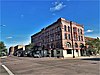
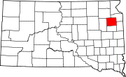
This is a list of the National Register of Historic Places listings in Lawrence County, South Dakota.

National Register of Historic Places listings in Buffalo County, South Dakota

This is a list of the National Register of Historic Places listings in Buffalo County, South Dakota.

National Register of Historic Places listings in Butte County, South Dakota

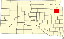
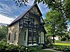
This is a list of the National Register of Historic Places listings in Butte County, South Dakota.

National Register of Historic Places listings in Campbell County, South Dakota

This is a list of the National Register of Historic Places listings in Campbell County, South Dakota.

National Register of Historic Places listings in Davison County, South Dakota

This is a list of the National Register of Historic Places listings in Davison County, South Dakota.

National Register of Historic Places listings in Day County, South Dakota

This is a list of the National Register of Historic Places listings in Day County, South Dakota.

National Register of Historic Places listings in Deuel County, South Dakota

This is a list of the National Register of Historic Places listings in Deuel County, South Dakota.

National Register of Historic Places listings in Douglas County, South Dakota

This is a list of the National Register of Historic Places listings in Douglas County, South Dakota.

National Register of Historic Places listings in Gregory County, South Dakota Wikimedia list article

This is a list of the National Register of Historic Places listings in Gregory County, South Dakota.

National Register of Historic Places listings in Jackson County, South Dakota

This is a list of the National Register of Historic Places listings in Jackson County, South Dakota.

National Register of Historic Places listings in Kingsbury County, South Dakota

This is a list of the National Register of Historic Places listings in Kingsbury County, South Dakota.

National Register of Historic Places listings in Lyman County, South Dakota

This is a list of the National Register of Historic Places listings in Lyman County, South Dakota.

National Register of Historic Places listings in Marshall County, South Dakota

This is a list of the National Register of Historic Places listings in Marshall County, South Dakota.

National Register of Historic Places listings in McCook County, South Dakota

This is a list of the National Register of Historic Places listings in McCook County, South Dakota.

National Register of Historic Places listings in Meade County, South Dakota

This is a list of the National Register of Historic Places listings in Meade County, South Dakota.

National Register of Historic Places listings in Perkins County, South Dakota

This is a list of the National Register of Historic Places listings in Perkins County, South Dakota.

National Register of Historic Places listings in Roberts County, South Dakota

This is a list of the National Register of Historic Places listings in Roberts County, South Dakota.

National Register of Historic Places listings in Stanley County, South Dakota

This is a list of the National Register of Historic Places listings in Stanley County, South Dakota.

National Register of Historic Places listings in Todd County, South Dakota

This is a list of the National Register of Historic Places listings in Todd County, South Dakota.

References

  1. The latitude and longitude information provided in this table was derived originally from the National Register Information System, which has been found to be fairly accurate for about 99% of listings. Some locations in this table may have been corrected to current GPS standards.
  2. National Park Service, United States Department of the Interior, "National Register of Historic Places: Weekly List Actions", retrieved March 4, 2022.
  3. 1 2 Numbers represent an alphabetical ordering by significant words. Various colorings, defined here, differentiate National Historic Landmarks and historic districts from other NRHP buildings, structures, sites or objects.
  4. "National Register Information System". National Register of Historic Places . National Park Service. April 24, 2008.
  5. The eight-digit number below each date is the number assigned to each location in the National Register Information System database, which can be viewed by clicking the number.
  6. Preserve South Dakota