Corson | |
|---|---|
 South Dakota Highway 11 running northbound through Corson | |
 | |
| Coordinates: 43°36′59″N96°34′18″W / 43.6163628°N 96.5717118°W [1] | |
| Country | United States |
| State | South Dakota |
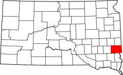
| County | Minnehaha |
| Township | Brandon |
| Elevation | 415 m (1,362 ft) |
| Population (2010) | |
• Total | 70 |
Corson is an unincorporated community in Brandon Township, Minnehaha County, South Dakota, United States [1] with a population of 70. It lies immediately north of Interstate 90 and Brandon on South Dakota Highway 11. Once mainly a railroad and farming community, it is becoming an industrial area supporting the county. Sioux Falls is located 12 miles (19 km) west-southwest of the community. It is served by the BNSF Railway Company. [2]