
Minnehaha County is a county on the eastern border of the state of South Dakota. As of the 2020 census, the population was 197,214, making it the state's most populous county. It contains over 20% of the state's population. Its county seat is Sioux Falls, South Dakota's largest city. The county was created in 1862 and organized in 1868. Its name was derived from the Sioux word Mnihaha, meaning "rapid water," or "waterfall".
Prior Lake is an exurban city 20 miles (32 km) southwest of Minneapolis seated next to Savage and Shakopee in Scott County in the state of Minnesota. Surrounding the shores of Lower and Upper Prior Lake, the city lies south of the Minnesota River in an area known as RiverSouth and establishes the urban fringe of the south-southwest portion of Minneapolis-St. Paul, the sixteenth largest metropolitan area in the United States. The population of Prior Lake was 22,796 at the 2010 census.

Canton is a city in and the county seat of Lincoln County, South Dakota, United States. Canton is located 20 minutes south of Sioux Falls in southeastern South Dakota. Canton is nestled in the rolling hills of the Sioux Valley, providing an abundance of recreational activities with the Big Sioux River bordering the eastern side, Newton Hills State Park to the south, and Lake Alvin to the north. The city was named by Norwegian settler and former legislator James M. Wahl. The population was 3,066 as of the 2020 census.

Brandon is a city in Minnehaha County, South Dakota, United States. Brandon is located five miles east of Sioux Falls. The population was 11,048 as of the 2020 census.

Dell Rapids is a city in Minnehaha County, South Dakota, United States. The population was 3,996 at the 2020 census. It is known as "The Little City with the Big Attractions."

Sioux Falls is the most populous city in the U.S. state of South Dakota and the 130th-most populous city in the United States. It is the county seat of Minnehaha County and also extends into Lincoln County to the south, which continues up to the Iowa state line. As of 2020, Sioux Falls had a population of 192,517. The Sioux Falls metro area accounts for more than 30% of the state's population. Chartered in 1856 on the banks of the Big Sioux River, the city is situated in the rolling hills at the junction of interstates 29 and 90.

Scenic is an unincorporated community in Pennington County, South Dakota, United States. It is located within Scenic Township, which had a 2010 census population of 58 inhabitants. The community is located adjacent to the Badlands National Park, about 50 miles (80 km) southeast of Rapid City, or about one hour by car, along Highway 44.

Corson is an unincorporated community in Brandon Township, Minnehaha County, South Dakota, United States with a population of 70. It lies immediately north of Interstate 90 and Brandon on South Dakota Highway 11. Once mainly a railroad and farming community, it is becoming an industrial area supporting the county. Sioux Falls is located twelve miles west-southwest of the community. It is served by the BNSF Railway Company.

Omemee is a ghost town in Bottineau County in the U.S. state of North Dakota. It was a railroad hub in the early 1910s, located at the junction of two major railroads, the Soo Line Railroad and the Great Northern Railway. Incorporated as a city in 1902, Omemee has been abandoned since 2003.
Booge is an unincorporated community in Red Rock Township, Minnehaha County, South Dakota, United States. The community sits on a major route of the Burlington Northern and Santa Fe Railway, and it is a half-way point between Garretson, South Dakota and Manley, Minnesota.

South Dakota is the 46th-most populous U.S. state; in 2019, the U.S. Census Bureau estimated a population of about 884,659. The majority of South Dakotans are White, and the largest religion is Christianity. In 2010, 93.46% of the population spoke English as their primary language.

The Sioux Falls Metropolitan Statistical Area, as defined by the United States Census Bureau, is an area consisting of four counties in South Dakota, anchored by the city of Sioux Falls. The metro area is referred to locally as the Sioux Empire. Despite the name, it is considered a part of the larger area known as Siouxland as it is within the Big Sioux River basin. As of the 2020 census, the MSA had a population of 276,730.

Cecil Township is a civil township in Bottineau County in the U.S. state of North Dakota. As of the 2000 census, its population was 28.
Thingvalla Township is a township in Pembina County, North Dakota, United States. The 2000 census reported a population of 121, and an estimated population of 103 as of 2009. President Ólafur Grímsson of Iceland visited the area in 1999 to dedicate a monument to poet K. N. Julius at Thingvalla Church, and Prime Minister Geir Haarde visited in 2007 to dedicate a memorial to the church, which burned to the ground in 2003.

Renner Lutheran Church, also known as Nidaros Norwegian Evangelical Lutheran Church, is a historic church located in Renner, South Dakota. The church is listed on the National Register of Historic Places as Renner Lutheran Sanctuary. It is reportedly the oldest church in operation in South Dakota.
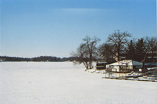
East Sioux Falls was a city located in southeastern Minnehaha County, South Dakota located about 6 miles east of Sioux Falls along South Dakota Highway 42 on the Big Sioux River.

Lindy is an unincorporated community and census-designated place located on the Santee Sioux Reservation in Knox County, in the northeastern part of the state of Nebraska in the Midwestern United States. As of the 2010 census it had a population of 13.
The following is a timeline of the history of the city of Sioux Falls, South Dakota, USA.
Zeona is an extinct town in Perkins County, in the U.S. state of South Dakota. The GNIS classifies it as a populated place.
Renner Corner is an unincorporated community and census-designated place in Minnehaha County, South Dakota, United States. Its population was 347 as of the 2020 census. The community is located along South Dakota Highway 115, north of Sioux Falls.


