This is intended to be a complete list of the properties and districts on the National Register of Historic Places in Windsor, Connecticut, United States. The locations of National Register properties and districts for which the latitude and longitude coordinates are included below, may be seen in various online maps.[1]
The National Register of Historic Places (NRHP) is the United States federal government's official list of districts, sites, buildings, structures, and objects deemed worthy of preservation for their historical significance. A property listed in the National Register, or located within a National Register Historic District, may qualify for tax incentives derived from the total value of expenses incurred preserving the property.
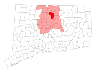
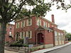
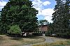
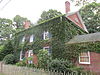
Windsor is a town in Hartford County, Connecticut, United States, and was the first English settlement in the state. It lies on the northern border of Connecticut's capital, Hartford. The population of Windsor was 29,044 at the 2010 census.
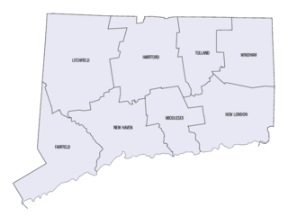
Connecticut is the southernmost state in the New England region of the United States. As of the 2010 Census, it has the highest per-capita income, Human Development Index (0.962), and median household income in the United States. It is bordered by Rhode Island to the east, Massachusetts to the north, New York to the west, and Long Island Sound to the south. Its capital is Hartford and its most populous city is Bridgeport. It is part of New England, although portions of it are often grouped with New York and New Jersey as the Tri-state area. The state is named for the Connecticut River which approximately bisects the state. The word "Connecticut" is derived from various anglicized spellings of an Algonquian word for "long tidal river".
There are more than 400 properties and districts listed on the National Register in Hartford County, including 21 National Historic Landmarks. The 41 properties and districts located in the town of Windsor include one National Historic Landmark and are listed below. The properties and districts in the remaining parts of the county are listed separately.
A National Historic Landmark (NHL) is a building, district, object, site, or structure that is officially recognized by the United States government for its outstanding historical significance. Of over 90,000 places listed on the country's National Register of Historic Places, only some 2,500 are recognized as National Historic Landmarks.
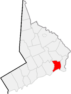
This is a list of the National Register of Historic Places listings in Hartford County, Connecticut.
Contents: Counties and municipalities in Connecticut
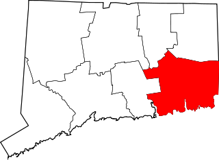
This is intended to be a complete list of the properties and districts on the National Register of Historic Places in Fairfield County, Connecticut, United States. The locations of National Register properties and districts for which the latitude and longitude coordinates are included below, may be seen in an online map.
This is a list of the National Register of Historic Places listings in Bridgeport, Connecticut.
This is a list of the National Register of Historic Places listings in Greenwich, Connecticut.
This is a list of properties and districts listed on the National Register of Historic Places in Connecticut. There are more than 1,500 listed sites in Connecticut. All 8 counties in Connecticut have listings on the National Register.
Related Research Articles
This is a list of the National Register of Historic Places listings in Litchfield County, Connecticut.
This is a list of the National Register of Historic Places listings in Middlesex County, Connecticut.
This is a list of the National Register of Historic Places listings in New Haven County, Connecticut.
This is a list of the National Register of Historic Places listings in New London County, Connecticut.
This is a list of the National Register of Historic Places listings in Tolland County, Connecticut.
This is a list of the National Register of Historic Places listings in Windham County, Connecticut.
This is a list of the National Register of Historic Places listings in Grafton County, New Hampshire.
This is a list of the National Register of Historic Places listings in Windsor County, Vermont.
List of the National Register of Historic Places listings in Oneida County, New York
List of the National Register of Historic Places listings in Madison County, New York
This is a list of the National Register of Historic Places listings in York County, Pennsylvania.
This is a list of properties and historic districts in Somerville, Massachusetts, that have been listed on the National Register of Historic Places.
This is a list of properties and historic districts in Milton, Massachusetts, that are listed on the National Register of Historic Places.
This is a list of the National Register of Historic Places listings in Hartford, Connecticut.
This is a list of the National Register of Historic Places listings in Caroline County, Virginia.
This is a list of the National Register of Historic Places listings in Pittsylvania County, Virginia.
This is a list of the National Register of Historic Places listings in Northampton County, Virginia.
This is a list of the National Register of Historic Places listings in Salem, Massachusetts.
This is a list of the National Register of Historic Places listings in West Hartford, Connecticut.
References
↑ The latitude and longitude information provided in this table was derived originally from the National Register Information System, which has been found to be fairly accurate for about 99% of listings. For about 1% of NRIS original coordinates, experience has shown that one or both coordinates are typos or otherwise extremely far off; some corrections may have been made. A more subtle problem causes many locations to be off by up to 150 yards, depending on location in the country: most NRIS coordinates were derived from tracing out latitude and longitudes from USGS topographical quadrant maps created under the North American Datum of 1927, which differs from the current, highly accurate WGS84 GPS system used by most on-line maps. Chicago is about right, but NRIS longitudes in Washington are higher by about 4.5 seconds, and are lower by about 2.0 seconds in Maine. Latitudes differ by about 1.0 second in Florida. Some locations in this table may have been corrected to current GPS standards.
↑ Numbers represent an ordering by significant words. Various colorings, defined here, differentiate National Historic Landmarks and historic districts from other NRHP buildings, structures, sites or objects.
↑ The eight-digit number below each date is the number assigned to each location in the National Register Information System database, which can be viewed by clicking the number.
This page is based on this Wikipedia article Text is available under the CC BY-SA 4.0 license; additional terms may apply. Images, videos and audio are available under their respective licenses.