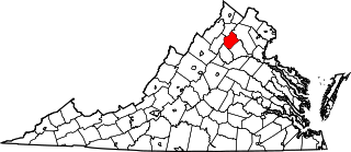
[3] Name on the Register [4] Image Date listed [5] Location City or town Description 1 Abington Congregational Church Abington Congregational Church September 19, 1977 (# 77001413 CT 97 41°51′27″N 72°00′29″W / 41.8575°N 72.008056°W / 41.8575; -72.008056 (Abington Congregational Church ) Pomfret 2 Aldrich Free Public Library Aldrich Free Public Library July 27, 1994 (# 94000768 299 Main St. 41°43′08″N 71°52′32″W / 41.718889°N 71.875556°W / 41.718889; -71.875556 (Aldrich Free Public Library ) Plainfield 3 American Thread Company American Thread Company July 30, 2014 (# 14000434 322, 440, 480, 560 Main & 157 Union Sts. 41°42′39″N 72°12′19″W / 41.7107°N 72.2052°W / 41.7107; -72.2052 (American Thread Company ) Windham In the Willimantic section of Windham 4 Ashford Academy Ashford Academy December 29, 1988 (# 88002649 Fitts Rd. 41°52′22″N 72°07′25″W / 41.872778°N 72.123611°W / 41.872778; -72.123611 (Ashford Academy ) Ashford 5 Benjamin Bosworth House Benjamin Bosworth House February 17, 1978 (# 78002857 John Perry Rd. 41°53′59″N 72°05′03″W / 41.899722°N 72.084167°W / 41.899722; -72.084167 (Benjamin Bosworth House ) Eastford 6 Henry C. Bowen House Henry C. Bowen House August 24, 1977 (# 77001414 CT 169 41°56′57″N 71°58′37″W / 41.949167°N 71.976944°W / 41.949167; -71.976944 (Henry C. Bowen House ) Woodstock Gothic revival summer cottage visited by three U.S. presidents. Also known as Roseland Cottage. 7 Mathew Bowen Homestead Mathew Bowen Homestead September 10, 1987 (# 87000859 94 Plaine Hill Rd. 41°56′33″N 71°58′25″W / 41.9425°N 71.973611°W / 41.9425; -71.973611 (Mathew Bowen Homestead ) Woodstock Now the Inn at Woodstock. 8 Brayton Grist Mill Brayton Grist Mill June 13, 1986 (# 86001257 U.S. Route 44 41°51′39″N 71°58′57″W / 41.86074°N 71.982404°W / 41.86074; -71.982404 (Brayton Grist Mill ) Pomfret At the entrance to Mashamoquet Brook State Park 9 Broad Street – Davis Park Historic District Broad Street – Davis Park Historic District December 31, 1998 (# 98001556 Roughly along Broad St. from Dorrane St. to Winter St. 41°48′27″N 71°52′50″W / 41.8075°N 71.880556°W / 41.8075; -71.880556 (Broad Street – Davis Park Historic District ) Killingly 10 Brooklyn Green Historic District Brooklyn Green Historic District September 23, 1982 (# 82004401 CT 169 , 205 , and US 6 , Wolf Den, Brown, Prince Hill, and Hyde Rds. 41°47′18″N 71°56′57″W / 41.788333°N 71.949167°W / 41.788333; -71.949167 (Brooklyn Green Historic District ) Brooklyn 11 Bush Hill Historic District Bush Hill Historic District February 10, 1987 (# 87000012 Parts of Bush Hill Rd., CT 169 , and Wolf Den Rd. 41°48′43″N 71°57′52″W / 41.811944°N 71.964444°W / 41.811944; -71.964444 (Bush Hill Historic District ) Brooklyn 12 Butts Bridge Butts Bridge May 24, 2010 (# 10000272 Butts Bridge Rd. over Quinebaug River 41°39′05″N 71°58′15″W / 41.651364°N 71.970789°W / 41.651364; -71.970789 (Butts Bridge ) Canterbury 13 Cady-Copp House Cady-Copp House September 3, 2001 (# 01000939 115 Liberty Highway 41°53′27″N 71°51′56″W / 41.890833°N 71.865556°W / 41.890833; -71.865556 (Cady-Copp House ) Putnam 14 Canterbury Center Historic District Canterbury Center Historic District April 10, 1998 (# 97001446 Roughly along Elmdale, Library, N. Canterbury, S. Canterbury, and Westminster Rds. 41°42′06″N 71°58′22″W / 41.701667°N 71.972778°W / 41.701667; -71.972778 (Canterbury Center Historic District ) Canterbury 15 Cargill Falls Mill (Wilkinson Mill) Cargill Falls Mill (Wilkinson Mill) July 29, 2014 (# 14000435 52-58 Pomfret St. 41°54′54″N 71°54′42″W / 41.9150°N 71.9116°W / 41.9150; -71.9116 (Cargill Falls Mill (Wilkinson Mill) ) Putnam 16 Central Village Historic District Central Village Historic District August 9, 1991 (# 91000949 Roughly, School, Main and Water Sts., and Putnam Rd., north to Plainfield High School 41°43′06″N 71°54′21″W / 41.718333°N 71.905833°W / 41.718333; -71.905833 (Central Village Historic District ) Plainfield 17 Capt. Seth Chandler House Capt. Seth Chandler House December 15, 1993 (# 93001380 55 Converse St. 42°00′49″N 71°58′07″W / 42.013611°N 71.968611°W / 42.013611; -71.968611 (Capt. Seth Chandler House ) Woodstock 18 Chaplin Historic District Chaplin Historic District October 11, 1978 (# 78002856 Chaplin St. 41°47′38″N 72°07′40″W / 41.793889°N 72.127778°W / 41.793889; -72.127778 (Chaplin Historic District ) Chaplin 19 Church Farm Church Farm November 17, 1988 (# 88002650 396 Mansfield Rd. 41°50′21″N 72°10′11″W / 41.839167°N 72.169722°W / 41.839167; -72.169722 (Church Farm ) Ashford Now the Church Center of Eastern Connecticut State University. 20 Capt. John Clark House Capt. John Clark House October 6, 1970 (# 70000699 Route 169 , south of Canterbury 41°39′46″N 71°58′25″W / 41.662778°N 71.973611°W / 41.662778; -71.973611 (Capt. John Clark House ) Canterbury 21 Prudence Crandall House Prudence Crandall House October 22, 1970 (# 70000696 Canterbury village green, junction of CT 14 and CT 169 41°41′52″N 71°58′19″W / 41.697778°N 71.971944°W / 41.697778; -71.971944 (Prudence Crandall House ) Canterbury Site of Prudence Crandall 's Canterbury Female Boarding School , which in 1833–1834 offered schooling to black girls. Forced to close by fierce town resistance, culminating in violence. Crandall, now Connecticut's state heroine, left Connecticut immediately, never to return. 22 Daniel's Village Archeological Site Daniel's Village Archeological Site March 30, 1978 (# 78002861 north side of Five Mile River near Stone Road [6] 41°52′58″N 71°51′03″W / 41.8829°N 71.8507°W / 41.8829; -71.8507 (Daniel's Village Archeological Site ) Killingly 23 Danielson Main Street Historic District Danielson Main Street Historic District April 8, 1992 (# 92000265 Main St. from Water St. to Spring St. 41°48′18″N 71°53′04″W / 41.805°N 71.884444°W / 41.805; -71.884444 (Danielson Main Street Historic District ) Killingly 24 Dayville Historic District Upload image August 25, 1988 (# 88001422 Main and Pleasant Sts. 41°50′45″N 71°53′08″W / 41.845833°N 71.885556°W / 41.845833; -71.885556 (Dayville Historic District ) Killingly 25 Dorrance Inn Dorrance Inn August 23, 2002 (# 02000867 748 Plainfield Pike 41°41′28″N 71°50′48″W / 41.691111°N 71.846667°W / 41.691111; -71.846667 (Dorrance Inn ) Sterling 26 Elliottville Lower Mill Elliottville Lower Mill April 15, 1982 (# 82004406 Peep Toad Rd. 41°50′21″N 71°50′33″W / 41.839167°N 71.8425°W / 41.839167; -71.8425 (Elliottville Lower Mill ) Killingly 27 First Congregational Church of Plainfield First Congregational Church of Plainfield July 31, 1986 (# 86002116 CT 12 41°41′06″N 71°54′55″W / 41.685°N 71.915278°W / 41.685; -71.915278 (First Congregational Church of Plainfield ) Plainfield 28 Forty-Seventh Camp of Rochambeau's Army Forty-Seventh Camp of Rochambeau's Army January 23, 2003 (# 02001732 Bolton Farm, Rt 14 near Mullen Hill Road [7] 41°42′09″N 72°09′00″W / 41.7025°N 72.15°W / 41.7025; -72.15 (Forty-Seventh Camp of Rochambeau's Army ) Windham 29 Fourth Camp of Rochambeau's Army Fourth Camp of Rochambeau's Army January 8, 2003 (# 02001680 Plains Road near Lovers Lane [7] 41°42′00″N 72°10′52″W / 41.7°N 72.181°W / 41.7; -72.181 (Fourth Camp of Rochambeau's Army ) Windham 30 Glen Falls Bridge Glen Falls Bridge April 1, 1999 (# 99000408 Brunswick Ave. over the Moosup River 41°43′01″N 71°51′43″W / 41.716944°N 71.861944°W / 41.716944; -71.861944 (Glen Falls Bridge ) Plainfield 31 Gwyn Careg Gwyn Careg April 8, 1994 (# 94000336 Wolf Den Rd. 41°51′20″N 71°59′52″W / 41.855556°N 71.997778°W / 41.855556; -71.997778 (Gwyn Careg ) Pomfret 32 Hampton Hill Historic District Hampton Hill Historic District September 23, 1982 (# 82004408 Main St., Old Route 6, Cedar Swamp Rd. 41°46′57″N 72°03′19″W / 41.7825°N 72.055278°W / 41.7825; -72.055278 (Hampton Hill Historic District ) Hampton 33 Hemlock Glen Industrial Archeological District Hemlock Glen Industrial Archeological District June 5, 2007 (# 07000508 Address Restricted Hampton 34 Dr. Chester Hunt Office Dr. Chester Hunt Office October 6, 1970 (# 70000708 Windham Center Rd. 41°42′00″N 72°09′30″W / 41.7°N 72.158333°W / 41.7; -72.158333 (Dr. Chester Hunt Office ) Windham 35 Samuel Huntington Birthplace Samuel Huntington Birthplace November 11, 1971 (# 71001009 CT 14 , 2 mi (3.2 km) west of CT 97 41°41′57″N 72°05′10″W / 41.699167°N 72.086111°W / 41.699167; -72.086111 (Samuel Huntington Birthplace ) Scotland Boyhood saltbox home of the American statesman, a signer of the Declaration of Independence , Governor of Connecticut and first presiding officer of the Congress of the Confederation 36 Israel Putnam School Israel Putnam School December 13, 1984 (# 84000788 School and Oak Sts. 41°54′57″N 71°54′23″W / 41.915833°N 71.906389°W / 41.915833; -71.906389 (Israel Putnam School ) Putnam 37 William Jillson Stone House William Jillson Stone House August 5, 1971 (# 71000912 561 Main St. 41°42′40″N 72°12′38″W / 41.711111°N 72.210556°W / 41.711111; -72.210556 (William Jillson Stone House ) Windham In the Willimantic section of the town 38 Old Killingly High School Old Killingly High School March 26, 1992 (# 92000266 185 Broad St. 41°48′13″N 71°53′08″W / 41.803611°N 71.885556°W / 41.803611; -71.885556 (Old Killingly High School ) Killingly 39 Knowlton Memorial Hall Knowlton Memorial Hall March 17, 1994 (# 94000252 5 Town Hall Rd. 41°51′49″N 72°09′42″W / 41.863489°N 72.161782°W / 41.863489; -72.161782 (Knowlton Memorial Hall ) Ashford 40 Lawton Mills Historic District Lawton Mills Historic District February 16, 1996 (# 96000028 Roughly bounded by 2nd St., Railroad Ave., Norwich Rd., and 5th and 9th Sts. 41°40′32″N 71°55′13″W / 41.675556°N 71.920278°W / 41.675556; -71.920278 (Lawton Mills Historic District ) Plainfield 41 Main Street Historic District Main Street Historic District June 28, 1982 (# 82004410 21-65 Church St., 667-1009 Main St., 24-28 N. St., and 20-22 Walnut St.; also 32, 50, and 54 North St. 41°42′44″N 72°12′54″W / 41.712222°N 72.215°W / 41.712222; -72.215 (Main Street Historic District ) Windham In the Willimantic section of the town. Second set of boundaries represents a boundary increase of July 29, 1992 42 Mansfield Hollow Dam Mansfield Hollow Dam April 12, 2009 (# 03000194 141 Mansfield Hollow Rd. 41°45′20″N 72°10′54″W / 41.75569°N 72.18163°W / 41.75569; -72.18163 (Mansfield Hollow Dam ) Windham Extends into Tolland County 43 March Route of Rochambeau's Army: Manship Road-Barstow Road March Route of Rochambeau's Army: Manship Road-Barstow Road January 8, 2003 (# 02001678 Manship Rd., Barstow Rd. from its junction with Manship Rd. to Westminster Rd. 41°42′07″N 72°00′13″W / 41.702012°N 72.003665°W / 41.702012; -72.003665 (March Route of Rochambeau's Army: Manship Road-Barstow Road ) Canterbury 44 March Route of Rochambeau's Army: Old Canterbury Road March Route of Rochambeau's Army: Old Canterbury Road June 6, 2003 (# 03000310 Old Canterbury Rd: Canterbury Rd. from its junction with Old Canterbury Rd. 41°41′22″N 71°57′04″W / 41.689444°N 71.951111°W / 41.689444; -71.951111 (March Route of Rochambeau's Army: Old Canterbury Road ) Plainfield 45 March Route of Rochambeau's Army: Palmer Road March Route of Rochambeau's Army: Palmer Road June 6, 2003 (# 03000311 Palmer Rd, from intersection with Miller Rd. to east of its junction with Pudding Hill Rd. 41°41′57″N 72°03′47″W / 41.699167°N 72.063056°W / 41.699167; -72.063056 (March Route of Rochambeau's Army: Palmer Road ) Scotland 46 March Route of Rochambeau's Army: Plainfield Pike March Route of Rochambeau's Army: Plainfield Pike June 6, 2003 (# 03000312 Plainfield Pike from intersection with Industrial Dr., east to its junction with Ledge Hill Rd. 41°40′55″N 71°53′53″W / 41.682015°N 71.897964°W / 41.682015; -71.897964 (March Route of Rochambeau's Army: Plainfield Pike ) Plainfield 47 March Route of Rochambeau's Army: Scotland Road March Route of Rochambeau's Army: Scotland Road June 6, 2003 (# 03000314 Scotland Rd., from intersection with Back Rd. to 80 Scotland Rd. 41°42′03″N 72°08′43″W / 41.700833°N 72.145278°W / 41.700833; -72.145278 (March Route of Rochambeau's Army: Scotland Road ) Windham 48 Mixer Tavern Mixer Tavern March 17, 1994 (# 94000253 14 Westford Rd. 41°51′56″N 72°09′33″W / 41.865556°N 72.159167°W / 41.865556; -72.159167 (Mixer Tavern ) Ashford 49 Natchaug Forest Lumber Shed Natchaug Forest Lumber Shed September 4, 1986 (# 86001732 Kingsbury Rd., Natchaug State Forest 41°50′21″N 72°05′04″W / 41.839167°N 72.084444°W / 41.839167; -72.084444 (Natchaug Forest Lumber Shed ) Eastford 50 New Roxbury Ironworks Site Upload image February 23, 1996 (# 96000130 Address Restricted Woodstock 51 George Pickering Nichols House George Pickering Nichols House July 31, 1991 (# 91000990 42 Thompson Rd. 41°56′51″N 71°53′04″W / 41.9475°N 71.884444°W / 41.9475; -71.884444 (George Pickering Nichols House ) Thompson 52 North Grosvenordale Mill Historic District North Grosvenordale Mill Historic District April 16, 1993 (# 93000288 Riverside Dr. (CT 12), Buckley Hill Rd., Floral Ave., Market La., and Marshall, Central, River, and Holmes Sts. 41°59′09″N 71°53′53″W / 41.985833°N 71.898056°W / 41.985833; -71.898056 (North Grosvenordale Mill Historic District ) Thompson 53 Old Westfield Cemetery Old Westfield Cemetery August 26, 2010 (# 10000578 320 North St. 41°49′08″N 71°53′21″W / 41.818889°N 71.889167°W / 41.818889; -71.889167 (Old Westfield Cemetery ) Killingly 54 Packerville Bridge Packerville Bridge November 27, 1992 (# 92001565 Packerville Rd. over Mill Brook 41°40′01″N 71°56′56″W / 41.666944°N 71.948889°W / 41.666944; -71.948889 (Packerville Bridge ) Plainfield 55 Plainfield Street Historic District Plainfield Street Historic District April 11, 1991 (# 91000350 Roughly Norwich Rd. from Railroad Ave. to Academy Hill Rd. 41°41′09″N 71°54′54″W / 41.685833°N 71.915°W / 41.685833; -71.915 (Plainfield Street Historic District ) Plainfield 56 Plainfield Woolen Company Mill Plainfield Woolen Company Mill August 29, 1985 (# 85001919 Main St. 41°43′11″N 71°54′25″W / 41.719722°N 71.906944°W / 41.719722; -71.906944 (Plainfield Woolen Company Mill ) Plainfield 57 Pomfret Street Historic District Pomfret Street Historic District April 23, 1998 (# 98000372 Roughly along Pomfret St. and CT 169, from Bradley Rd. to Woodstock Rd. 41°53′19″N 71°57′51″W / 41.888611°N 71.964167°W / 41.888611; -71.964167 (Pomfret Street Historic District ) Pomfret 58 Pomfret Town House Pomfret Town House January 19, 1989 (# 88003221 Town House Rd. 41°51′53″N 71°57′50″W / 41.864722°N 71.963889°W / 41.864722; -71.963889 (Pomfret Town House ) Pomfret Home to the local historical society. 59 Prospect Hill Historic District Prospect Hill Historic District August 29, 2003 (# 03000814 Roughly bounded by Bolivia St., Jackson St., Valley St. and Birch St. 41°43′09″N 72°12′12″W / 41.719152°N 72.203264°W / 41.719152; -72.203264 (Prospect Hill Historic District ) Windham In the Willimantic section of the town 60 Putnam Farm Putnam Farm March 11, 1982 (# 82004399 Spaulding Rd. 41°49′24″N 71°57′03″W / 41.823333°N 71.950833°W / 41.823333; -71.950833 (Putnam Farm ) Brooklyn 61 Putnam High School Putnam High School December 10, 1993 (# 93001343 126 Church St. 41°55′06″N 71°54′47″W / 41.918333°N 71.913056°W / 41.918333; -71.913056 (Putnam High School ) Putnam Putnam's first high school, now Putnam Town Hall . 62 Putnam Railroad Station Putnam Railroad Station July 24, 2007 (# 07000742 35 and 45-47 Main St. 41°54′51″N 71°54′30″W / 41.914108°N 71.908296°W / 41.914108; -71.908296 (Putnam Railroad Station ) Putnam 63 Israel Putnam Wolf Den Israel Putnam Wolf Den May 2, 1985 (# 85000949 Off Wolf Den Rd. in Mashamoquet Brook State Park 41°50′36″N 71°59′04″W / 41.843333°N 71.984444°W / 41.843333; -71.984444 (Israel Putnam Wolf Den ) Pomfret 64 Quinebaug Mill-Quebec Square Historic District Quinebaug Mill-Quebec Square Historic District August 29, 1985 (# 85001921 Roughly bounded by the Quinebaug River , Quebec Square, and Elm and S. Main Sts. 41°47′54″N 71°53′21″W / 41.798333°N 71.889167°W / 41.798333; -71.889167 (Quinebaug Mill-Quebec Square Historic District ) Brooklyn and Killingly 65 Quinebaug River Prehistoric Archeological District Quinebaug River Prehistoric Archeological District September 7, 2009 (# 09000696 Between Connecticut Route 169 and the Quinebaug River 41°40′24″N 71°57′26″W / 41.6732°N 71.9571°W / 41.6732; -71.9571 (Quinebaug River Prehistoric Archeological District ) Canterbury 66 Hezekiah S. Ramsdell Farm Hezekiah S. Ramsdell Farm August 23, 1990 (# 90000442 Ramsdell Rd. 41°57′07″N 71°54′39″W / 41.951944°N 71.910833°W / 41.951944; -71.910833 (Hezekiah S. Ramsdell Farm ) Thompson 67 Sterling Hill Historic District Sterling Hill Historic District February 6, 1986 (# 86000152 Green Ln. and CT 14A 41°41′23″N 71°50′56″W / 41.689722°N 71.848889°W / 41.689722; -71.848889 (Sterling Hill Historic District ) Plainfield and Sterling 68 Sumner-Carpenter House Sumner-Carpenter House December 26, 1991 (# 91001854 333 Old Colony Rd. 41°54′11″N 72°04′01″W / 41.903056°N 72.066944°W / 41.903056; -72.066944 (Sumner-Carpenter House ) Eastford 69 Taylor's Corner Taylor's Corner January 19, 1989 (# 88003220 Route 171 41°56′57″N 72°00′43″W / 41.949261°N 72.011862°W / 41.949261; -72.011862 (Taylor's Corner ) Woodstock 70 Temple Beth Israel Temple Beth Israel April 16, 2013 (# 13000162 39 Killingly Dr. 41°48′14″N 71°52′40″W / 41.803832°N 71.877693°W / 41.803832; -71.877693 (Temple Beth Israel ) Killingly 71 Thompson Hill Historic District Thompson Hill Historic District December 31, 1987 (# 87002186 Chase and Quaddick Rds. and CT 193 and CT 200 41°57′27″N 71°52′06″W / 41.9575°N 71.868333°W / 41.9575; -71.868333 (Thompson Hill Historic District ) Thompson 72 Trinity Church Trinity Church October 15, 1970 (# 70000703 Church St. 41°48′00″N 71°55′28″W / 41.8°N 71.924444°W / 41.8; -71.924444 (Trinity Church ) Brooklyn 73 Union Society of Phoenixville House Union Society of Phoenixville House December 11, 2007 (# 07001247 4 Hartford Turnpike 41°52′37″N 72°05′12″W / 41.876944°N 72.086667°W / 41.876944; -72.086667 (Union Society of Phoenixville House ) Eastford 74 Unitarian Meetinghouse Unitarian Meetinghouse November 9, 1972 (# 72001335 Junction of CT 169 and US 6 41°47′16″N 71°57′01″W / 41.787679°N 71.950214°W / 41.787679; -71.950214 (Unitarian Meetinghouse ) Brooklyn 75 Edward Waldo House Edward Waldo House November 21, 1978 (# 78002879 South of Scotland on Waldo Rd. 41°39′33″N 72°06′05″W / 41.659167°N 72.101389°W / 41.659167; -72.101389 (Edward Waldo House ) Scotland 76 Wauregan Historic District Wauregan Historic District August 24, 1979 (# 79003789 Roughly bounded by CT 12 , CT 205 , 3rd St., the Quinebaug River , and Chestnut St. 41°44′38″N 71°54′38″W / 41.743889°N 71.910556°W / 41.743889; -71.910556 (Wauregan Historic District ) Plainfield 77 Jonathan Wheeler House Jonathan Wheeler House February 11, 1982 (# 82004405 N. Society Rd. 41°45′03″N 71°59′26″W / 41.750833°N 71.990556°W / 41.750833; -71.990556 (Jonathan Wheeler House ) Canterbury 78 Willimantic Armory Willimantic Armory September 12, 1985 (# 85002310 255 Pleasant St. 41°42′35″N 72°12′54″W / 41.709722°N 72.215°W / 41.709722; -72.215 (Willimantic Armory ) Windham In the Willimantic section of the town 79 Willimantic Elks Club Willimantic Elks Club September 21, 2005 (# 05001045 198 Pleasant St. 41°42′34″N 72°12′47″W / 41.709368°N 72.213036°W / 41.709368; -72.213036 (Willimantic Elks Club ) Windham In the Willimantic section of the town 80 Willimantic Footbridge Willimantic Footbridge April 19, 1979 (# 79002654 Railroad St. 41°42′42″N 72°12′49″W / 41.711667°N 72.213611°W / 41.711667; -72.213611 (Willimantic Footbridge ) Windham In the Willimantic section of the town 81 Willimantic Freight House and Office Willimantic Freight House and Office June 14, 1982 (# 82004414 Bridge St. 41°42′44″N 72°13′15″W / 41.712222°N 72.220833°W / 41.712222; -72.220833 (Willimantic Freight House and Office ) Windham In the Willimantic section of the town 82 Windham Center Historic District Windham Center Historic District June 4, 1979 (# 79002655 CT 14 and CT 203 41°42′08″N 72°09′40″W / 41.702222°N 72.161111°W / 41.702222; -72.161111 (Windham Center Historic District ) Windham 83 Witter House Witter House October 6, 1970 (# 70000704 Chaplin St. 41°47′47″N 72°07′46″W / 41.796389°N 72.129444°W / 41.796389; -72.129444 (Witter House ) Chaplin 84 Woodstock Academy Classroom Building Woodstock Academy Classroom Building February 16, 1984 (# 84001176 Academy Rd. 41°57′02″N 71°58′33″W / 41.950556°N 71.975833°W / 41.950556; -71.975833 (Woodstock Academy Classroom Building ) Woodstock Italianate building from 1873 topped by a two-stage belltower overlooking the Woodstock Green, at one of the oldest private schools in Connecticut. 85 Woodstock Hill Historic District Woodstock Hill Historic District January 6, 1999 (# 98001578 Roughly along Plain Hill Rd., and Academy Rd., including parts of Old Hall Rd. and Child Hill Rd. 41°57′04″N 71°58′32″W / 41.951111°N 71.975556°W / 41.951111; -71.975556 (Woodstock Hill Historic District ) Woodstock