New Hope, Wood County, Texas

Last updated

New Hope, Wood County, Texas
USA Texas location map.svg
Red pog.svg
New Hope
Usa edcp location map.svg
Red pog.svg
New Hope
Coordinates: 32°39′23″N95°25′06″W / 32.65639°N 95.41833°W / 32.65639; -95.41833
Country United States
State Texas
County Wood
Elevation
[1]
430 ft (130 m)
Time zone UTC-6 (Central (CST))
  Summer (DST) UTC-5 (CDT)
Area code(s) 430, 903
GNIS feature ID1378742 [1]

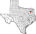
New Hope is an unincorporated community in Wood County, located in the U.S. state of Texas. [1] According to the Handbook of Texas,[ citation needed ] New Hope had a population of 15 in 2000.

Education

Today, the community is served by the Mineola Independent School District.

Related Research Articles

<span class="mw-page-title-main">Wood County, Texas</span> County in Texas, United States

Wood County is a county located in the U.S. state of Texas. As of the 2020 census, its population was 44,843. Its county seat is Quitman. The county was named for George T. Wood, governor of Texas from 1847 to 1849.

<span class="mw-page-title-main">Upshur County, Texas</span> County in Texas, United States

Upshur County is a county located in the eastern part of the U.S. state of Texas. As of the 2020 census, the population was 40,892. The county seat is Gilmer. The county is named for Abel P. Upshur, who was U.S. Secretary of State during President John Tyler's administration.

<span class="mw-page-title-main">Smith County, Texas</span> County in Texas, United States

Smith County is a county in the U.S. state of Texas. As of the 2020 census, its population was 233,479. Its county seat is Tyler. Smith County is named for James Smith, a general during the Texas Revolution.

<span class="mw-page-title-main">Real County, Texas</span> County in Texas, United States

Real County is a county located on the Edwards Plateau in the U.S. state of Texas. As of the 2020 census, its population was 2,758. The county seat is Leakey. The county is named for Julius Real (1860–1944), a former member of the Texas State Senate. The Alto Frio Baptist Encampment is located in an isolated area of Real County southeast of Leakey.

<span class="mw-page-title-main">Franklin County, Texas</span> County in Texas, United States

Franklin County is a county located in the U.S. state of Texas. As of the 2020 census, its population was 10,359. The county seat is Mount Vernon.

<span class="mw-page-title-main">Texarkana, Arkansas</span> City in Arkansas, United States

Texarkana is a city in the U.S. state of Arkansas and the county seat of Miller County, on the southwest border of the state. As of the 2020 census, it had a population of 29,387. It is the twin city of Texarkana, Texas, located just across the state line. The city was founded at a railroad intersection on December 8, 1873, and was incorporated in Arkansas on August 10, 1880. Texarkana and its Texas counterpart are the principal cities of the Texarkana metropolitan area, which in 2021 was ranked 289th in the United States with a population of 147,174, according to the United States Census Bureau.

<span class="mw-page-title-main">Crosby, Texas</span> Census-designated place in Texas, United States

Crosby is a census-designated place in Harris County, Texas, United States. The population was 3,417 at the 2020 census.

<span class="mw-page-title-main">Conroe, Texas</span> City in Texas, United States

Conroe is a city in and the county seat of Montgomery County, Texas, United States, about 40 miles (64 km) north of Houston. It is a principal city in the Houston–The Woodlands–Sugar Land metropolitan area.

<span class="mw-page-title-main">Mineola, Texas</span> City in Texas, United States

Mineola is a city in the U.S. state of Texas in Wood County. It lies 26 miles north of Tyler. Its population was 4,823 at the 2020 census.

Green wood is unseasoned wood.

<span class="mw-page-title-main">Katy, Texas</span> City in Texas, United States

Katy is a city in the U.S. state of Texas. It is in the Greater Katy area, itself forming the western part of the Greater Houston metropolitan area. Homes and businesses may have Katy postal addresses without being in the City of Katy. The city of Katy is approximately centered at the tripoint of Harris, Fort Bend, and Waller counties. Katy had a population of 21,894 at the 2020 U.S. census, up from 14,102 in 2010.

<span class="mw-page-title-main">Northeast Texas</span> Region in Texas, United States

Northeast Texas is a cultural and geographic region in the northeast corner of the U.S. state of Texas. Geographically centered on two metropolitan areas strung along Interstate 20—Tyler in the west and Longview/Marshall to the east, the areas of Greenville, Mount Pleasant, Sulphur Springs, Paris, and Texarkana in the north primarily along Interstate 30, and Jacksonville and Palestine to the south are also major cities within the region. Most of Northeast Texas is included in the interstate region of the Ark-La-Tex.

<span class="mw-page-title-main">Conroe Independent School District</span> School district in Texas

Conroe Independent School District (CISD) is a school district in Montgomery County, Texas. The current superintendent has been Dr. Curtis Null since June of 2018. As of April 2024, Conroe ISD was the 9th largest school district in Texas and 60th largest in the United States.

<span class="mw-page-title-main">Plato, Missouri</span> Village in Missouri, United States

Plato is an incorporated village in northwestern Texas County, Missouri, United States. It is located approximately 20 miles northwest of Houston and 10 miles south of Fort Leonard Wood on Route 32. The population was 82 at the 2020 census.

Orangefield is an unincorporated community located in the Beaumont-Port Arthur metropolitan area, approximately twelve miles east of Beaumont in Orange County, Texas, United States.. In 1913, the town began to develop around the oilfield just west of Orange, and its name was derived from being called the "Orange Oil Field", which was later shorted to "Orangefield". After a major producing well was discovered in August 1913, a post office was established for Orangefield in 1922.

<span class="mw-page-title-main">Settegast, Houston</span>

Settegast is a neighborhood in northeast Houston; it has an average population density between one and five. The community is bordered by the 610 Loop, the Union Pacific Railroad Settegast Yard, and the old Beaumont Highway. The community has many small, wood-framed houses and empty lots. Habitat for Humanity has a prominent stake in the area, and a community garden is underway. There are few commercial and industrial uses within Settegast. Also, contemporary housing has started to arise within new construction in the area. The City of Houston designated Settegast as a Houston HOPE neighborhood.

New Hope is an unincorporated community in Cherokee County, located in the U.S. state of Texas. According to the Handbook of Texas, the community had a population of 50 in 2000. It is located within the Tyler-Jacksonville combined statistical area.

<span class="mw-page-title-main">United States Courthouse (Austin, Texas, 1936)</span> Historic structure in Austin, Texas

The Austin United States Courthouse is a historic former federal courthouse in downtown Austin, Texas. Built between 1935 and 1936, the building exemplifies Depression-era Moderne architecture, while Art Moderne and Art Deco finishes characterize the interior. It housed the Austin division of the United States District Court for the Western District of Texas and other judicial offices until 2012, when a new federal courthouse building was completed. Since 2016 the building has been owned by Travis County, and it has housed the county probate courts since 2020. The structure was added to the National Register of Historic Places in 2001.

New Hope is an unincorporated community in Franklin County, Texas, United States.

Little Hope is an unincorporated community in Wood County, located in the U.S. state of Texas. According to the Handbook of Texas, Little Hope had a population of 25 in 2000.

References