
Great Ayton is a village and civil parish in North Yorkshire, England. The River Leven flows through the village, which lies just north of the North York Moors. According to the 2021 Census, the parish has a population of 4,346.

North Cowton is a village and civil parish, located in Richmondshire, North Yorkshire, England. It is 8 miles (13 km) north-west of the county town of Northallerton.

Brompton is a village and civil parish in the unitary area and county of North Yorkshire, England, about 1.6 miles (2.6 km) north of Northallerton. The village was near the site of a battle between English and Scots armies and was the location of mills producing linen goods from the 18th century onward.
Burrill with Cowling is a civil parish in the former Hambleton District of North Yorkshire, England, including the villages of Burrill and Cowling. It is only a 5-minute walk between the 2 small villages, which are 1 mile west of Bedale. It is a small parish surrounded by sparsely populated countryside and contains mainly detached and semi-detached houses. The closest city is Ripon 17 miles (27 km) and it is 234 miles from London. Burrill with Cowling is accessible by road from the A1(M) 3.1 miles to the east and the nearest railway station is 15 miles away in Northallerton.

Thormanby is a village and civil parish in the former Hambleton District of North Yorkshire, England. It lies on the A19 approximately halfway between Easingwold and Thirsk and about 14 miles (23 km) south east of the county town of Northallerton.

Husthwaite is a village and civil parish in the former Hambleton district of North Yorkshire, England. It is situated approximately 2.5 miles (4 km) north from Easingwold.

Hutton Sessay is a village and civil parish in the former Hambleton District of North Yorkshire, England. In 2013 the population of the civil parish was estimated at 100. The village is situated just west of the A19 between Thirsk and Easingwold.

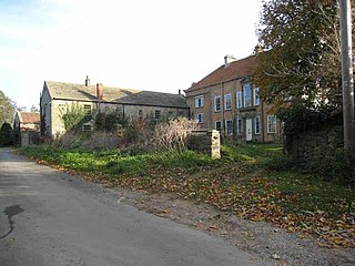
Newby Wiske is a village and civil parish in the former Hambleton District of North Yorkshire, England. It is situated on the River Wiske, about five miles north-west of Thirsk.
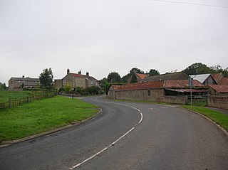
Morton-on-Swale is a large village and civil parish in North Yorkshire, England. It lies on the A684 road about 4 miles (6.4 km) west of the county town of Northallerton. It is less than 1 mile (1.6 km) to the village of Ainderby Steeple. As the name suggests it lies on the River Swale.

Hunsonby is a village and civil parish in the Eden district of Cumbria, England, 7 miles (11 km) north east of Penrith. The parish is located 28 miles (45 km) south east of the city of Carlisle. Within the parish is the ancient stone circle of Long Meg and Her Daughters but not the nearby standing stone of Little Meg which is located near Langwathby. In 2011 the Census reported the parish to have a total population of 388.

Gayles is a village and civil parish in the Richmondshire district of North Yorkshire, England. Gayles is established in the district ward of Gilling West. This small village consists of 80 households, with a total population of 180 according to the 2011 UK census. The area also includes two farms by the names of Gayles Hall Farm and Slip Farm. The village is roughly 10 miles (16 km) west of Darlington.

Thoralby is a village and civil parish in the Richmondshire district of North Yorkshire, England. It lies south of Aysgarth, is within a mile of both Newbiggin and West Burton and is in the Yorkshire Dales National Park. It is 23.5 miles (37.8 km) south-west of the county town of Northallerton.
Dalton is a village and civil parish in the former Hambleton District of North Yorkshire, England. It is about 4 miles (6.4 km) south of Thirsk and near the A168 road. It mainly consists of farmland as well as an industrial estate. It has a population of 518.

Kirkby is a village and civil parish in the former Hambleton District of North Yorkshire, England, near Great Busby and 2 miles (3.2 km) south of Stokesley. The village is mentioned in the Domesday Book as belonging to Uhtred. The name of the village derives from the Old Norse kirkju-býr, which means church with a village. At the 2001 Census, the population of the village was recorded at 313, dropping slightly to 309 at the 2011 Census. In 2015, North Yorkshire County Council estimated the population to be 310.
Nether Silton is a village and civil parish in the Hambleton District of North Yorkshire, England. It lies 6 miles (9.7 km) east of Northallerton, on the border of the North York Moors national park. During 1870–72 Nether Silton was described as, "a chapelry in Leake parish, N. R. Yorkshire; 6½ miles E of Northallerton r. station. Post town, Thirsk. Real property, £1,702. Pop. 178. Houses, 45." by John Marius Wilson, Imperial Gazetteer of England and Wales.

South Otterington is a village and civil parish in the former Hambleton District of North Yorkshire, England. It is located on the A167 road 5 miles (8 km) south of Northallerton and on the east bank of the River Wiske.

Leathley is a village and civil parish in the Harrogate district of North Yorkshire, England, the parish includes the townships of both Castley and Leathley. It is near the border with West Yorkshire and the River Wharfe, 1 mile north-east of Otley. The B6161 runs through the village, connecting Leathley with Killinghall in the North and Pool-in-Wharfedale in the south.
Little Ribston is a village and civil parish in the Harrogate district of North Yorkshire, England. Little Ribston is located on the River Nidd, 4 miles (6.4 km) north of Wetherby and 3 miles (4.8 km) south-east of Knaresborough. The Ribston Pippin apple originated here when Sir Henry Goodricke planted the first seed brought from Normandy in the 18th century and a stump of a later tree is still preserved in Ribston park. There were several inns or licensed premises in the village in previous times, though none remain today. The nearest pub to Little Ribston is The Bay Horse in Kirk Deighton. Little Ribston has two cricket teams in the Nidderdale league and Harrogate evening league. They are based in Ribston Park, Little Ribston, halfway between Knaresborough and Wetherby.

Harome is a small village and civil parish in the Ryedale district of North Yorkshire, England, around 2 miles (3.2 km) south-east of the market town of Helmsley, and 24 miles (39 km) north-east of York. The village has a population of 261 people according to the 2011 UK census, and a total land area of 9,539 sq metres. It is situated to the east of the River Riccal. The village has 109 households, with agriculture and retail trade being the two main employers for the residents. The name Harome simply means rocks/stones, and translates from old English meaning a heap of stones.

Great Broughton is a village in the Great and Little Broughton civil parish of the Hambleton District of North Yorkshire in northern England.


