Newmarracarra Limestone

Last updated

Newmarracarra Limestone
Stratigraphic range: Late Bajocian
~169–168.3  Ma
O
S
D
C
P
T
J
K
Pg
N
Type Geological formation
Unit of Champion Bay Group
Underlies Kojarena Sandstone
Overlies Colalura Sandstone, Bringo Shale
Lithology
Primary Limestone
Other Sandstone
Location
Coordinates 28°42′S114°48′E / 28.7°S 114.8°E / -28.7; 114.8
Approximate paleocoordinates 40°06′S57°30′E / 40.1°S 57.5°E / -40.1; 57.5
Region Western Australia
CountryFlag of Australia (converted).svg  Australia
Extent Perth Basin
Australia relief map.jpg
Blue pog.svg
Newmarracarra Limestone (Australia)
Australia Western Australia relief location map.png
Blue pog.svg
Newmarracarra Limestone (Western Australia)

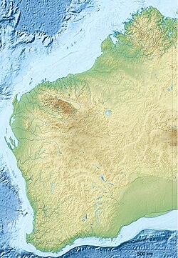
The Newmarracarra Limestone is a Bajocian geologic formation, in Western Australia. It consists of yellow grey sandy or clayey limestone, which occasionally grades into calcareous sandstone. [1] Fossils of the Rhynchonellida in the family Wellerellidae, Cirpa fromontae were reported from the formation. [2]

Related Research Articles

<span class="mw-page-title-main">Nullarbor Plain</span> Geographical feature in Western Australia and South Australia

The Nullarbor Plain is part of the area of flat, almost treeless, arid or semi-arid country of southern Australia, located on the Great Australian Bight coast with the Great Victoria Desert to its north. It is the world's largest single exposure of limestone bedrock, and occupies an area of about 200,000 square kilometres (77,000 sq mi). At its widest point, it stretches about 1,100 kilometres (684 mi) from east to west across the border between South Australia and Western Australia.

<span class="mw-page-title-main">Stalagmite</span> Elongate mineral formation found on a cave floor

A stalagmite is a type of rock formation that rises from the floor of a cave due to the accumulation of material deposited on the floor from ceiling drippings. Stalagmites are typically composed of calcium carbonate, but may consist of lava, mud, peat, pitch, sand, sinter, and amberat.

<span class="mw-page-title-main">The Pinnacles (Western Australia)</span> Australian limestone formation

The Pinnacles are limestone formations within Nambung National Park, near the town of Cervantes, Western Australia.

Type locality, also called type area, is the locality where a particular rock type, stratigraphic unit or mineral species is first identified. If the stratigraphic unit in a locality is layered, it is called a stratotype, whereas the standard of reference for unlayered rocks is the type locality.

<span class="mw-page-title-main">Geology of Antarctica</span> Geologic composition of Antarctica

The geology of Antarctica covers the geological development of the continent through the Archean, Proterozoic and Phanerozoic eons.

<i>Gravicalymene</i>

Gravicalymene Shirley, 1936, is a genus of trilobites belonging to the order Phacopida, suborder Calymenina and family Calymenidae. Species included in this genus have previously been allocated to Calymene Brongniart 1822,Flexicalymene Shirley, 1936. and Sthenarocalymene Siveter 1977.

<span class="mw-page-title-main">Madison Group</span> Geologic formation in the western United States

The Madison Limestone is a thick sequence of mostly carbonate rocks of Mississippian age in the Rocky Mountain and Great Plains areas of the western United States. The rocks serve as an important aquifer as well as an oil reservoir in places. The Madison and its equivalent strata extend from the Black Hills of western South Dakota to western Montana and eastern Idaho, and from the Canada–United States border to western Colorado and the Grand Canyon of Arizona.

<i>Onychodus</i> Extinct genus of fishes

Onychodus is a genus of prehistoric lobe-finned fish which lived during the Devonian Period. It is one of the best known of the group of onychodontiform fishes. Scattered fossil teeth of Onychodus were first described from Ohio in 1857 by John Strong Newberry. Other species were found in Australia, England, Norway and Germany showing that it had a widespread range.

<span class="mw-page-title-main">Gogo Formation</span> Lagerstätte formation in Kimberley, Australia

The Gogo Formation in the Kimberley region of Western Australia is a Lagerstätte that exhibits exceptional preservation of a Devonian reef community. The formation is named after Gogo Station, a cattle station where outcrops appear and fossils are often collected from, as is nearby Fossil Downs Station.

The Lias Group or Lias is a lithostratigraphic unit found in a large area of western Europe, including the British Isles, the North Sea, the Low Countries and the north of Germany. It consists of marine limestones, shales, marls and clays.

<span class="mw-page-title-main">Murray Hill, Christmas Island</span>

Murray Hill is the highest point of Christmas Island, at 357 metres (1,171 ft) above sea level. It was first scaled in 1857 even though the island had been located in 1615.

The Nambung River is a river in the Wheatbelt region of Western Australia, 170 kilometres (106 mi) north of Perth. The river drains an area between the towns of Cervantes and Badgingarra. In its lower reaches the Nambung River forms a chain of waterholes in the Nambung Wetlands where it disappears underground into a limestone karst system 5.5 kilometres (3 mi) from the Indian Ocean.

Deinodus is a form genus that includes two species: the form found in the Onondaga Formation of western New York, Deinodus bennetti, and the form found in the Columbus and Limestone of central Ohio, Deinodus ohioensis. Both species are limited to the Eifelian age of the middle Devonian Period, which occurred 398-391 million years ago.

<span class="mw-page-title-main">Burlington Limestone</span> Geologic formation in Iowa, Illinois and Missouri, United States.

The Burlington Limestone is a geologic formation in Missouri, Iowa and the Midwest region. It preserves fossils dating back to the Mississippian subperiod.

<span class="mw-page-title-main">Lulworth Formation</span>

The Lulworth Formation is a geologic formation in England. It dates from the late Tithonian to the mid Berriasian. It is a subunit of the Purbeck Group. In Dorset, it consists of three members, which are in ascending order, the Mupe Member, the Ridgway Member, and the Warbarrow Tout Member. The Mupe Member is typically 11 to 16 m thick and largely consists of marls and micrites with interbeds of calcareous mudstone. The Ridgeway Member is about 3 to 7 m thick and consists of in its western portion carbonaceous muds, marls and micrites, in the east the muds are replaced by micritic limestone. The Warbarrow Tout Member is 17 to 39 m thick and consists of limestone at the base and micrite and mudstone for the rest of the sequence, this member is the primary source of the vertebrate fossils within the formation. Elsewhere the unit is undifferentiated.

<span class="mw-page-title-main">Wetterstein Formation</span> Regional geologic formation in the Northern Limestone Alps and Western Carpathians

The Wetterstein Formation is a regional geologic formation of the Northern Limestone Alps and Western Carpathians extending from southern Bavaria, Germany in the west, through northern Austria to northern Hungary and western Slovakia in the east. The formation dates back to the Ladinian to Carnian stages of the Late Triassic. The formation is named after the Wetterstein Mountains in southern Germany and northwestern Austria. The center of its distribution, however, is in the Karwendel Mountains. It occurs in the Northern and Southern Limestone Alps and in the Western Carpathians.

The Champion Bay Group is a stratigraphic group in Australia, it was deposited in the Bajocian stage of the Middle Jurassic. The limestones of the group have provided ammonites.

Mary Seymour Conservation Park is a protected area in the Australian state of South Australia located in the south-east of the state in the gazetted locality of Bool Lagoon about 25 kilometres (16 mi) south-west of the town centre of Naracoorte.

References

  1. "Newmarracarra Limestone". Australian Stratigraphic Units Database. Geoscience Australia and Australian Stratigraphy Commission. Retrieved 21 August 2018.
  2. Craig, 2002

Bibliography