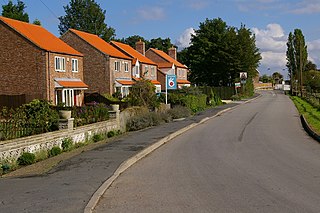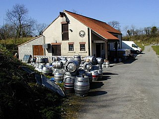
Tadcaster is a market town and civil parish in North Yorkshire, England, 12 miles (19 km) north-east of Leeds and 10 miles (16 km) south-west of York. Its historical importance from Roman times onward was largely as the lowest road crossing-point on the River Wharfe until the construction of the A64 Tadcaster by-pass some 660 yards (600 m) to the south, in 1978. There are two rail crossings downstream of the town before the Wharfe joins the River Ouse near Cawood.

Sherburn in Elmet is a town and civil parish in the district and county of North Yorkshire, England. It is to the west of Selby and south of Tadcaster.
The Ainsty or the Ainsty of York was a historic district of Yorkshire, England, west of the city of York. Originally a wapentake or subdivision of the West Riding of Yorkshire it later had a unique status as a rural area controlled by the corporation of the city.

Wressle is a village and civil parish in the East Riding of Yorkshire, England, lying on the eastern bank of the River Derwent approximately 3 miles (5 km) north-west of Howden.

Tadcaster Grammar School founded in 1557, is a coeducational secondary school and sixth form located near Tadcaster, North Yorkshire, England, educating children aged 11–18 years old, and has an on-site sixth form. The school is located in the hamlet of Toulston just outside the brewery town of Tadcaster. The school's catchment includes Tadcaster and its surrounding villages, while traditionally taking pupils from the York area, including villages such as Appleton Roebuck, Copmanthorpe, Bishopthorpe and Bilbrough.

Bramham is a village in the civil parish of Bramham cum Oglethorpe in the City of Leeds metropolitan borough, West Yorkshire, England.

Appleton Roebuck is a village and civil parish in the former Selby District of North Yorkshire, England. It had a population of 692 according to the 2001 census, increasing to 871 in the 2021 census and including Acaster Selby. The village is about 9 miles (14 km) south-west of York. It covers an area of around 2,900 acres (1,200 ha).

South Milford is a village and civil parish in the county of North Yorkshire, England. The civil parish includes the hamlet of Lumby, located south-west of the main village.
Barkston Ash was a parliamentary constituency centred on the village of Barkston Ash in the West Riding of Yorkshire. It was represented in the House of Commons of the Parliament of the United Kingdom from 1885 until 1983. It elected one Member of Parliament (MP) by the first past the post system of election.

Cropton is a village and civil parish in the Ryedale district of North Yorkshire, England. It is on the border of the North York Moors National Park, 3 miles (5 km) north-west of Pickering.

Kirklington is a village in the English county of North Yorkshire close to the A1(M) motorway. Kirklington forms the major part of the civil parish of Kirklington-cum-Upsland.

Ryther cum Ossendyke is a civil parish 6 miles (9.7 km) from Tadcaster and 6 miles (9.7 km) from Selby, North Yorkshire, England. It includes the village of Ryther. The civil parish population at the 2011 census was 241.

Ulleskelf is a village and civil parish in the Selby District of North Yorkshire, England, four miles from Tadcaster on the River Wharfe.

Cliffe is a small village and civil parish in North Yorkshire, England. It was historically part of the East Riding of Yorkshire until 1974, but from 1974 to 2023 was in the Selby District of the shire county of North Yorkshire. In 2023 the district was abolished and North Yorkshire became a unitary authority.

Catterton is a hamlet and civil parish in the Selby district of North Yorkshire, England. At the 2011 Census the population was less than 100. The population is included in the civil parish of Healaugh, Tadcaster.
Nicholas John F. Murphy was an English professional footballer who played as a defender in the Football League for York City, and in non-League football for Tadcaster Albion and Magnets.

National Cycle Network (NCN) Route 665 is a Sustrans route from Wetherby to South West York. Two sections of the route are open. As of summer 2020 the route is not fully signed. The central section between Tadcaster and Newton Kyme is still a proposal.

Saxton with Scarthingwell is a civil parish just south of Tadcaster in North Yorkshire, England. The parish contains the villages of Saxton and Scarthingwell, with two churches and the remains of a castle. Historically the area was a township, however it has been its own civil parish since 1866. Although the main part of the Battle of Towton was fought to the north out of the parish, some of the dead were interred in the parish, and at least one minor skirmish was fought within the parish boundaries.

St Andrew's Church is the parish church of Newton Kyme, a village west of Tadcaster, in North Yorkshire, in England.

Newton Kyme Hall is a historic building in the village of Newton Kyme, north-west of Tadcaster in North Yorkshire, in England.


