
The Islamabad Capital Territory is the only federal territory of Pakistan and contains Islamabad, the capital of Pakistan. Located on the northern edge of the Pothohar Plateau and at the foot of the Margalla Hills, The ICT shares borders with the province of Khyber Pakhtunkhwa in the west and with the province of Punjab in the remaining directions. It covers an area of 906.5 square kilometres and according to the 2023 national census, has a population of over 1 million in the city proper, while over 2 million in the whole territory. The territory is represented in the National Assembly by NA-52, NA-53, and NA-54 constituencies and by four seats in the Senate.
Islamabad is the capital city of the Islamic Republic of Pakistan. It is the country's ninth-most populous city with a population of over 1.2 million people and is federally administered by the Pakistani government as part of the Islamabad Capital Territory. Built as a planned city in the 1960s and established in 1967, it replaced Karachi as Pakistan's official national capital.
Sargodha is a city and capital of Sargodha Division, located in Punjab province, Pakistan. It is Pakistan's 12th largest city by population and one of the fastest-growing cities of the country. Sargodha is also known as the City of Eagles.

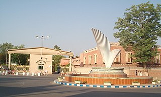
Blue Area is the central business district of Islamabad, Pakistan along the Jinnah Avenue. The area is a 2-kilometer (1.2 mi)-long corridor along Islamabad's Khayaban-e-Quaid-e-Azam, Islamabad's primary arterial road which leads up to the main government buildings. It is characterized by clean, wide roads and tall buildings among the panoramic greenery of the adjacent areas.
The Aiwan-e-Sadr, or Presidential Palace, is the official residence and workplace of the president of Pakistan. It is located in northeastern Islamabad on Constitution Avenue, between the Parliament Building and the Cabinet block of the Pakistan Secretariat. Residences for the presidential staff, known as the President's Colony, are also located behind the presidency, adjacent to 4th Avenue.

Fatima Jinnah Park, also known as Capital Park or F-9 Park, is a public recreational park that spans the whole of Sector F-9 of Islamabad, Pakistan. It is named after Mādar-e Millat Fatima Jinnah, the younger sister of the founder of Pakistan Muhammad Ali Jinnah.

Islamabad International Airport is the international airport serving Islamabad, the capital city of Pakistan and Rawalpindi. It is located 25 km (16 mi) south-west of the city, and is accessed via Srinagar Highway.

Bahria Town (Private) Limited is an Islamabad-based privately owned real-estate development company which owns, develops and manages properties across Pakistan.

Islamabad is located in the Pothohar Plateau in the northern part of Pakistan, within the Islamabad Capital Territory. It is a well-organized city divided into different sectors and zones. It was ranked as a Gamma + world city in 2020. The city is home to Pakistan Monument, which is built on top of a hill in Shakarparian, and the Faisal Mosque, one of the largest mosques in South Asia and the sixth -largest mosque as per area in the world. The Capital Development Authority is tasked with developing the city and its facilities.

Constitution Avenue, also known as Shahrah-e-Dastoor, is a major north-south avenue in Islamabad, Pakistan that passess through the Red Zone. Its north end meets with the Khayban-e-Iqbal intersection and south end with an intersection of Srinagar Highway.
The Islamabad Expressway, sometimes also referred to as Islamabad Highway, is a major north–south expressway in Islamabad, Capital Territory, Pakistan. The expressway provides quick access between the Islamabad and Rawalpindi, Punjab, connecting the national capital with the N-5 National Highway. It stretches from Zero Point Interchange with the Kashmir Highway in Islamabad to Rawat, Islamabad Capital Territory on the N-5 National Highway. The total length of the expressway is 28 kilometers (17 mi), with lanes varying from six to ten.
Seventh Avenue, also known as the Ahmed Nadeem Qasmi Avenue, is a signal free road located in Islamabad. It starts from the intersection on Khayaban-e-Iqbal near Islamabad Zoo, and ends at the intersection on Srinagar Highway.

B-17 is a sector of Islamabad, Pakistan., developed by Multi-Professional Cooperative Housing Society (MPCHS). The sector is bounded on the east by N-5 National Highway and with the M-1 motorway to the west. B-17 is a newly developing sector located in Zone II of Islamabad Capital Territory. CDA approved and issued no objection certification (NOC) to MPCHS for sector B-17 on 30 January 2008, besides NOC was issued by Federal Directorate of Education (FDE) for construction of schools in the society.

Peshawar Morr Interchange is Pakistan's biggest interchange in Islamabad, Pakistan. It is located at the intersection of Srinagar Highway and the Ninth Avenue, connecting the G and H sectors of Islamabad.

F-8 is a sector of Islamabad. The sector is bounded by Margalla Avenue and E-8 to the north, Faisal Avenue and F-7 to the east, Jinnah Avenue and G-8 to the south, and Ninth Avenue and F-9 to the west.
F-6 is a sector of Islamabad. The sector is located at the foothills of Margalla Hills of Islamabad.

The Margalla Avenue or Margalla Expressway is a 33-kilometer six-lane highway in the Margalla Hills area in the suburbs of Islamabad, Pakistan. It was planned in 1966, but work on it was stalled till 2021. The road is an alternative to the Srinagar Highway, and provides easy access of the tenth and eleventh sectors of Islamabad to the N-5 National Highway. This road is a crucial section of the larger Rawalpindi Ring Road project as it connects the town of Sangjani to the town of Barakahu.

H-8 is a sector of Islamabad. The sector is bounded by Srinagar Highway and G-8 to the north, Islamabad Expressway and Shakarparian to the east, I-8 to the south, and Ninth Avenue and H-9 to the west.

