
Sherwood Park is a large hamlet in Alberta, Canada within Strathcona County that is recognized as an urban service area. It is located adjacent to the City of Edmonton's eastern boundary, generally south of Highway 16, west of Highway 21 and north of Highway 630. Other portions of Sherwood Park extend beyond Yellowhead Trail and Wye Road, while Anthony Henday Drive (Highway 216) separates Refinery Row to the west from the balance of the hamlet to the east.

The Yellowhead Highway is a major interprovincial highway in Western Canada that runs from Winnipeg to Graham Island off the coast of British Columbia via Saskatoon and Edmonton. It stretches across the four western Canadian provinces of British Columbia, Alberta, Saskatchewan, and Manitoba and is part of the Trans-Canada Highway system and the larger National Highway System, but should not be confused with the more southerly, originally-designated Trans-Canada Highway. The highway was officially opened in 1970. Beginning in 1990, the green and white Trans-Canada logo was used to designate the roadway.
Jasper is a specialized municipality in western Alberta, Canada. It is the commercial centre of Jasper National Park, located in the Canadian Rockies within the Athabasca River valley. Jasper is approximately 362 kilometres (225 mi) west of Edmonton and 290 kilometres (180 mi) north of Banff, Alberta, at the intersection of Highway 16 and Highway 93.

Richdale is a hamlet in east-central Alberta, Canada within Special Area No. 2. It is located on Highway 9 approximately 24 kilometres (15 mi) east of the Town of Hanna, 29 kilometres (18 mi) west of the Village of Youngstown and 130 kilometres (81 mi) north of the City of Brooks. Previously an incorporated community, Richdale dissolved from village status on June 2, 1931.
Niton Junction is a hamlet in west-central Alberta, Canada, within Yellowhead County. It is located on the Yellowhead Highway approximately 45 kilometres (28 mi) east of Edson and 150 kilometres (93 mi) west of Edmonton. It is east of the Yellowhead Highway's junction with Highway 32 and west of Chip Lake. Niton Junction has an elevation of 845 metres (2,772 ft).
Robb is a hamlet in west-central Alberta, Canada within Yellowhead County. It is located on Highway 47, approximately 53 kilometres (33 mi) southwest of Edson. It has an elevation of 1,140 metres (3,740 ft).
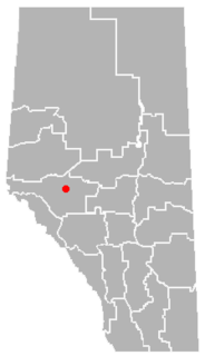
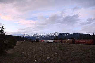
Marlboro is a hamlet in west-central Alberta, Canada within Yellowhead County. It is located on the Yellowhead Highway, approximately 25 kilometres (16 mi) west of Edson. Sundance Provincial Park is located northwest of the hamlet.
Cadomin is a hamlet in the west-central Alberta, Canada within Yellowhead County. It is located along the McLeod River in the foothills of the Rocky Mountains, approximately 50 kilometres (31 mi) south of Hinton near the Bighorn Highway. It is served by a spur of the Canadian National Railway.

Wildwood is a hamlet in west-central Alberta, Canada within Yellowhead County. It is located on the Yellowhead Highway, approximately 112 kilometres (70 mi) west of Edmonton and 82 kilometres (51 mi) east of Edson. The Yellowhead Highway's intersection with Cowboy Trail is 9 kilometres (5.6 mi) east of the hamlet. The Lobstick River, which flows from Chip Lake to the west, runs through the hamlet.
Cynthia is a hamlet in central Alberta, Canada within Brazeau County. It is located approximately 37 kilometres (23 mi) south of Highway 16 and 131 kilometres (81 mi) southwest of Edmonton.
Entrance is an unincorporated community in central Alberta in Yellowhead County, located on Highway 40, 61 kilometres (38 mi) northwest of Jasper.
Green Court is a hamlet in central Alberta, Canada within Lac Ste. Anne County. It is located at the intersection of Highway 43 and Highway 18, approximately 127 kilometres (79 mi) northwest of Edmonton.
Lodgepole is a hamlet in central Alberta, Canada within Brazeau County. It is located approximately 31 kilometres (19 mi) west of Highway 22 and 131 kilometres (81 mi) southwest of Edmonton.
Mulhurst Bay, or Mulhurst, is a hamlet in central Alberta, Canada within the County of Wetaskiwin No. 10. It is located 8 kilometres (5.0 mi) northwest of Highway 13A, approximately 38 kilometres (24 mi) southwest of Leduc.
Poplar Ridge is a hamlet in central Alberta, Canada within Brazeau County. It is located 1 kilometre (0.62 mi) northwest of Highway 22, approximately 107 kilometres (66 mi) southwest of Edmonton.
Violet Grove is a hamlet in central Alberta, Canada within Brazeau County. It is located 7 km (4.3 mi) southwest of Drayton Valley on Highway 620, approximately 110 km (68 mi) southwest of Edmonton.
Lobstick is an unincorporated community in central Alberta, Canada within Yellowhead County.
Acheson is a locality and an industrial area in Alberta, Canada, within Parkland County.


