In British Columbia, the Fraser River watershed covers one-fourth of the land and extends from Mount Robson to the Georgia Strait and Gulf Islands. This basin is the fifth largest drainage basin in Canada and contains thirteen main sub-watersheds, each consisting of small rivers, streams, creeks, marshes, bogs, and swamps. The largest lake in British Columbia is Williston Lake which covers 680 square miles (1,800km2).
Alaska contains abundant natural resources which include ground and surface water. The southwestern part of Alaska is drained by the Yukon River and its tributaries that include the Porcupine, Tanana, and Koyukuk Rivers. The Yukon River is the third longest river and fourth largest drainage basin in North America with a drainage area of 832,700 square kilometres (321,500sqmi). Alaska contains over three million lakes and the largest is Lake Iliamna which covers an area of 1,000 square miles (2,600km2).
Vegetative cover
Vegetative cover is extremely diverse within the northwestern forested mountain ecological region as the region can be broken down into different zones based on elevation, temperature, and mean annual rainfall.
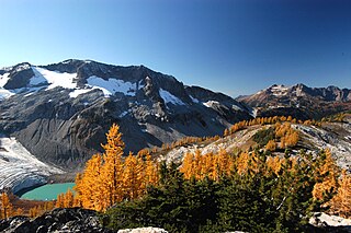
Subalpine communities; located below the alpine communities (6,500–8,200 feet (2,000–2,500m)) support the presence of lodgepole pine, subalpine fir, pacific silver fir, grand fir, and Engelmann spruce. The Engelmann spruce–subalpine fir forest association occupies the greatest water-yielding areas in the Rocky Mountains and the natural adaptations of these trees are important in maintaining stable vegetation.
The mountainous slopes and rolling plains slope from about 5,500 feet (1,700m) at the foot of the Rocky Mountains to about 2,000 feet (610m) in the lowest elevations. The dominant trees present in the region consist of ponderosa pine, Rocky Mountain Douglas fir, lodgepole pine, and quaking aspen in the drier southeast and central portions. Western hemlock, western red cedar, Douglas fir, and western white pine make up the majority of the moist west and southwest portions. White spruce is also found at this elevation and is a keystone tree species found in the Alaskan interior.
The dry southern interior grasslands and forests generally occur at low elevations (under 4,000 feet (1,200m)) and usually have a lower canopy closure than forests at higher elevations that receive more precipitation They are characterized by very warm to hot, dry summers, and moderately cool winters with little snowfall. Frequent low-severity, stand-maintaining fires are thought to have played a key historic role in shaping these ecosystems. Much of this area consists of small scrub-like ponderosa pine with bluebunch wheatgrass, bluegrass, June-grass, and big sagebrush dominating the understory.
Flora and fauna
This ecoregion is abundant with varying types of mammals, fish, and birds. Many dominant animal species, such as the bighorn sheep and hoary marmot, have adapted to the terrain of the region. The talus slopes provide burrowing shelters for the hoary marmot, and the bighorn sheep have adapted to climb the steep slopes to find shelter from predators.[1] Top carnivorous predators include coyotes, wolves, and cougars. The grizzly bear is a keystone species found in this region. As an "ecosystem engineer", they regulate the species they prey on, disperse plant seeds, aerate the soil as they dig, and bring salmon carcasses into the forest.[2] The dominant fish species of the region, in which the grizzly bear preys on, is pacific salmon. The typical bird species that can be found here include blue grouse, Steller's jay, and black-billed magpie.[3]
Endangered species
The northern spotted owl (Strix occidentalis caurina) is considered a species of utmost concern in the Northwestern Forested Mountains region. This small raptor was listed as threatened under the Endangered Species Act of 1973. The current population[when?] is 15,000 birds, all of which are located in North America. Over 70% of the species’ habitat was destroyed in the 19th and 20th centuries, and the timber industry is causing that number to increase. Both northern spotted owls and the timber industry prefer old-growth forests, so as demand for timber products increases, the spotted owl's habitat decreases. Forest management plans that stress limits on timber harvest and suggest alternative options are being formed, along with plans to prevent habitat fragmentation.
The barred owl is also causing a decrease in the population numbers of the northern spotted owl, as they are a larger, more competitive species that have begun to use the same habitat, however, no major plans have been formed to manage this situation.
Malheur wire-lettuce (Stephanomeria malheurensis) is also an endangered species in the region. Only one population of this plant survives in the wild, located in Harney, Oregon. The self-pollinating shrub is found at high elevations in volcanic soils. Because the range is so small, any disturbance in the habitat could be detrimental. One of the main threats is cheatgrass, which can expand to completely cover the ground and use up resources also needed by Malheur wire-lettuce. It is generally agreed that to protect the species, efforts must be focused on forming new populations, and more importantly, maintaining the condition of the current site in Oregon.
Natural resources
The Northwestern Forested Mountain ecoregion is rich in natural resources. Historically the most sought-after resources were the minerals found here. The presence of gold drove many of the early settlers to this ecoregion. These early settlers extracted gold from the streams, and timber for building, flora, and fauna. Today, many more resources are used by the economies of this area. Large-scale mining operations have become less common throughout the entirety of the region. There are a few prospective industrial mines lobbying for permits to dig in both Canada and Alaska.
Canada is the 6th-largest petroleum producer in the world. The largest point of extraction within this ecoregion is in Alberta, Canada. This area is abundant in tar sands, a crude form of petroleum. To begin this operation large tracts of boreal forest are removed. After the large pits are dug there is a constant risk of further environmental degradation through oil spillage.
Logging in the past was often conducted through large clear cuts. The environmental effects of large clear-cuts became apparent and are now less common. There are logging techniques that can benefit the ecological integrity of a system. Group selection can mimic natural processes and increase both the horizontal and vertical structures of a forest. As well as increase the biotic diversity of both flora and fauna.
Tourism generates a considerable amount of revenue for the different economies of this area. Tourists come to these areas for a multitude of outdoor activities. In the winter tourists travel from all across the globe to ski the Rocky Mountains, British Columbia, and Alaska ranges. In the summer the national parks draw in millions. Other summer activities include but are not limited to hunting, fishing, mountain biking, backpacking, rafting, kayaking, and wildlife viewing/photography. Resource use and extraction is sustainable when a system can replenish resources faster than they are being used. A practice is unsustainable when usage exceeds this threshold thereby damaging the ecological integrity of the ecoregion.
Climate
Extending from the lower Yukon of Canada all the way into northern California and Nevada, the northwestern-forested mountains range in different about three climate zones; moist maritime, arid dry, and sub-arctic.
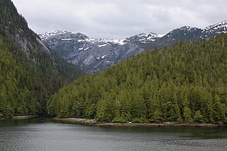
The moist maritime climate of the Northwestern Forested Mountains is found along a narrow strip of coastal Oregon, Washington, British Columbia, and southern Alaska in North America. It is formed by westerly winds coming off of the Pacific Ocean, which hit the mountains and rises to a cooler atmosphere. This causes rainy, cloudy, and moist atmospheric conditions where up to 100 inches (2,500mm) of rain per year can be seen, and is a temperate zone ranging from about 15°F (−9°C) in the winter to about 65°F (18°C) in the winter.
The arid dry zone is west of the mountain ranges and doesn't receive much rain due to the north-to-south orientation of the mountains, which blocks clouds and precipitation. It can range from the upper 80s (°F) in the summer to single digits in the winter. It generally only receives about 20 inches (510mm) of rain per year.
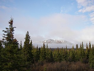
The sub-arctic region ranges from Fairbanks, Alaska to the Yukon of Canada and averages a mean of 50°F (10°C). in the summer and is often negative 13 in the winter. On the mountain tops, it can receive up to 100 inches (2,500mm) of precipitation per year, and is often considered the snowiest place on Earth.
The Northwestern Forested Mountains experience phenomena called decadal oscillations, the La Niña and El Niño. This is a shift in temperatures from warmer (La Niña) to colder (El Niño) and each phase generally last about a decade. These phases are caused by many factors including, jet streams, trade winds, precipitation, land surface, temperature, ocean surface temperature, and sea level pressure.
Environmental threats to the Northwestern Forested Mountains
The biggest threats to this region are fires and invasive pests. As fires occur, they alter the forest composition dramatically. Fire scars create an entry for heart rot and other fatal conditions. Burned soils repel water and the runoff creates sediment and ash polluting rivers and streams, and harming fish and wildlife that depend on these water sources. An especially troubling aspect of fires’ aftermath is the increased vulnerability of trees to non-native invasive pests. Burned stands create a perfect habitat for pests who will find shelter in the regrowth. These pests create tunneling galleries that further weaken a tree's ability to fend off pathogens that lead to mortality.
Preventing forest fires and controlling pest populations go hand-in-hand, which leaves room for any combination of treatment plans. Especially helpful is the use of prescribed burns, which consists of randomly dropping a match on a grid that has been divided and planted at scattered time periods. After the fire, workers must go in to peel bark off felled logs, and, if possible, remove dead, dying, and severely damaged/stressed trees as soon as possible.
Climate change in the Northwestern Forested Mountains
The effects of fossil fuel emissions, the largest contributor to climate change, cause rising CO2 levels in the Earth's atmosphere. This raises atmospheric temperatures and levels of precipitation in the Northwestern Forested Mountains. Being a very mountainous region, weather patterns contribute to higher levels of precipitation. This can cause landslides, channel erosion, and floods. The warmer air temperatures also create more rain and less snow, something dangerous for many animal and tree species; with less snowpack comes more vulnerability for trees and insects.
A large contributor to fire susceptible forests is past land use; the higher air temperatures make wildfires more common. Wildfires are extremely detrimental to species inhabiting the landscape; they destroy habitats and it takes many years to restore the land to how it used to be.
These effects caused by climate change can destroy animal habitats and species diversity. Not only will these climate catastrophes directly reduce animal populations, but they will indirectly disrupt trophic levels by reducing food sources for many keystone species. Climate change contributes to a worsening economy in this region as well by taking away valuable resources for recreational uses, like snow for skiing and fish for fishing.
The Great Basin Desert is part of the Great Basin between the Sierra Nevada and the Wasatch Range. The desert is a geographical region that largely overlaps the Great Basin shrub steppe defined by the World Wildlife Fund, and the Central Basin and Range ecoregion defined by the U.S. Environmental Protection Agency and United States Geological Survey. It is a temperate desert with hot, dry summers and snowy winters. The desert spans large portions of Nevada and Utah, and extends into eastern California. The desert is one of the four biologically defined deserts in North America, in addition to the Mojave, Sonoran, and Chihuahuan Deserts.
Temperate rainforests are rainforests with coniferous or broadleaf forests that occur in the temperate zone and receive heavy rain.
The ecology of the Sierra Nevada, located in the U.S. states of California and Nevada, is diverse and complex. The combination of climate, topography, moisture, and soils influences the distribution of ecological communities across an elevation gradient from 500 to 14,500 feet. Biotic zones range from scrub and chaparral communities at lower elevations, to subalpine forests and alpine meadows at the higher elevations. Particular ecoregions that follow elevation contours are often described as a series of belts that follow the length of the Sierra Nevada. There are many hiking trails, paved and unpaved roads, and vast public lands in the Sierra Nevada for exploring the many different biomes and ecosystems.
Yukon is in the northwestern corner of Canada and is bordered by Alaska and the Northwest Territories. The sparsely populated territory abounds with natural scenery, snowmelt lakes and perennial white-capped mountains, including many of Canada's highest mountains. The territory's climate is Arctic in territory north of Old Crow, subarctic in the region, between Whitehorse and Old Crow, and humid continental climate south of Whitehorse and in areas close to the British Columbia border. Most of the territory is boreal forest with tundra being the main vegetation zone only in the extreme north and at high elevations.
The Pacific Maritime Ecozone, as defined by the Commission for Environmental Cooperation (CEC), is a Canadian terrestrial ecozone, spanning a strip approximately 200 kilometres wide along the British Columbia Coast, then narrowing along the border with Alaska. It also includes all marine islands of British Columbia and a small portion of the southwestern corner of the Yukon. Fourteen ecoregions comprise the Ecozone, ranging from the Mount Logan Ecoregion in the north to the Cascade Ecoregion and Lower Mainland Ecoregion in the south.
The Cascades ecoregion is a Level III ecoregion designated by the United States Environmental Protection Agency (EPA) in the U.S. states of Washington, Oregon, and California. Somewhat smaller than the Cascade mountain range for which it is named, the ecoregion extends north to Snoqualmie Pass, near Seattle, and south to Hayden Pass, near the Oregon-California border, including the peaks and western slopes of most of the High Cascades. A discontiguous section is located on Mount Shasta in California.
The Eastern Cascades Slopes and Foothills ecoregion is a Level III ecoregion designated by the United States Environmental Protection Agency (EPA) in the U.S. states of Oregon, Washington, and California. In the rain shadow of the Cascade Range, the eastern side of the mountains experiences greater temperature extremes and receives less precipitation than the west side. Open forests of ponderosa pine and some lodgepole pine distinguish this region from the Cascades ecoregion, where hemlock and fir forests are more common, and from the lower, drier ecoregions to the east, where shrubs and grasslands are predominant. The vegetation is adapted to the prevailing dry, continental climate and frequent wildfire. Volcanic cones and buttes are common in much of the region.
The Blue Mountains ecoregion is a Level III ecoregion designated by the United States Environmental Protection Agency (EPA) in the Pacific Northwest, mainly in the state of Oregon, with small areas over the state border in Idaho and southeastern Washington. It is also contiguous with the World Wildlife Fund's Blue Mountain forests ecoregion.
The Klamath Mountains ecoregion of Oregon and California lies inland and north of the Coast Range ecoregion, extending from the Umpqua River in the north to the Sacramento Valley in the south. It encompasses the highly dissected ridges, foothills, and valleys of the Klamath and Siskiyou Mountains. It corresponds to the Level III ecoregion designated by the Environmental Protection Agency and to the Klamath-Siskiyou forests ecoregion designated by the World Wide Fund for Nature.
The Northern Basin and Range ecoregion is a Level III ecoregion designated by the United States Environmental Protection Agency (EPA) in the U.S. states of Oregon, Idaho, Nevada, Utah, and California. It contains dissected lava plains, rolling hills, alluvial fans, valleys, and scattered mountain ranges in the northern part of the Great Basin. Although arid, the ecoregion is higher and cooler than the Snake River Plain to the north and has more available moisture and a cooler climate than the Central Basin and Range to the south. Its southern boundary is determined by the highest shoreline of Pleistocene Lake Bonneville, which once inundated the Central Basin and Range. The western part of the region is internally drained; its eastern stream network drains to the Snake River system.
The Ecology of the North Cascades is heavily influenced by the high elevation and rain shadow effects of the mountain range. The North Cascades is a section of the Cascade Range from the South Fork of the Snoqualmie River in Washington, United States, to the confluence of the Thompson and Fraser Rivers in British Columbia, Canada, where the range is officially called the Cascade Mountains but is usually referred to as the Canadian Cascades. The North Cascades Ecoregion is a Level III ecoregion in the Commission for Environmental Cooperation's classification system.
The Alberta Mountain forests are a temperate coniferous forests ecoregion of Western Canada, as defined by the World Wildlife Fund (WWF) categorization system.
The ecology of the Rocky Mountains is diverse due to the effects of a variety of environmental factors. The Rocky Mountains are the major mountain range in western North America, running from the far north of British Columbia in Canada to New Mexico in the southwestern United States, climbing from the Great Plains at or below 1,800 feet (550 m) to peaks of over 14,000 feet (4,300 m). Temperature and rainfall varies greatly also and thus the Rockies are home to a mixture of habitats including the alpine, subalpine and boreal habitats of the Northern Rocky Mountains in British Columbia and Alberta, the coniferous forests of Montana and Idaho, the wetlands and prairie where the Rockies meet the plains, a different mix of conifers on the Yellowstone Plateau in Wyoming, the montane forests of Utah, and in the high Rockies of Colorado and New Mexico, and finally the alpine tundra of the highest elevations.
The North Central Rockies forests is a temperate coniferous forest ecoregion of Canada and the United States. This region overlaps in large part with the North American inland temperate rainforest and gets more rain on average than the South Central Rockies forests and is notable for containing the only inland populations of many species from the Pacific coast.
The Idaho Batholith ecoregion is a Level III ecoregion designated by the United States Environmental Protection Agency (EPA) in the U.S. states of Idaho and Montana. It is contained within the following biomes designated by the World Wild Fund for Nature (WWF): temperate coniferous forests; temperate grasslands, savannas, and shrublands; and deserts and xeric shrublands.
Okanagan dry forests is a temperate coniferous forest ecoregion in the Pacific Northwest of North America, as defined by the World Wildlife Fund (WWF) categorization system. It is closely associated with the Okanagan region of British Columbia and Washington. Only 20% of the ecosystem is still intact, and continues to be under threat for preservation due to land clearing and urban expansion, alongside the increasing threats of fire and extreme weather due to climate change.
Pacific Coastal Mountain icefields and tundra is a tundra ecoregion in Alaska, British Columbia, and Yukon, as defined by the World Wildlife Fund (WWF) categorization system.
The Interior Yukon-Alaska alpine tundra ecoregion covers alpine, sub-alpine, and boreal forest areas along the cordillera of Interior Alaska and south-central Yukon Territory. Geologically, they are the disjunct uplands of the Yukon-Tanana Terrane plus a southern extension of the Brooks Range. The cover is extensive 'dark taiga' of closed spruce forest, open forest of other species, and alpine vegetation at higher altitudes. The region is mostly wilderness and relatively untouched by human development.
The Marine West Coast Forest is a Level I ecoregion of North America designated by the Commission for Environmental Cooperation (CEC) in its North American Environmental Atlas. The region includes parts of Alaska, the Yukon, British Columbia, Washington, Oregon, and California.
The Taiga of North America is a Level I ecoregion of North America designated by the Commission for Environmental Cooperation (CEC) in its North American Environmental Atlas.
↑ "Grizzly bears". David Suzuki Foundation. 6 May 2013. Archived from the original on 6 May 2013. Retrieved 19 February 2013.
↑ Commission for Environmental Cooperation (CEC). (2008). Northwestern Forested Mountains Ecoregions. In M. McGinley (Ed.), Encyclopedia of Earth. Retrieved from http://www.eoearth.org
Bowman, W. D. United States Department of Agriculture, US Forest Service. (2011). Northwestern forested mountains. Retrieved from website: http://www.fort.usgs.gov/
Climate Impact Group (CIG). (2009). About Pacific Northwest climate. Retrieved from http://cses.washington.edu/
Francisco Jiménez Nava, and Glenn Griffith. 2011. North American Terrestrial Ecoregions—Level III. Commission for Environmental Cooperation (October 2008). Northwestern Forested Mountains ecoregion (CEC). The Encyclopedia of Earth. Retrieved 19 February 2013, from http://www.eoearth.org/article/Northwestern_Forested_Mountains_ecoregion_(CEC)
Graumlich, L. J.; Brubaker, L. B.; Grier, C. C. (1989). "Long-Term Trends in Forest Net Primary Productivity: Cascade Mountains, Washington". Ecology. 70 (2): 405–410. doi:10.2307/1937545. JSTOR1937545.
This page is based on this Wikipedia article Text is available under the CC BY-SA 4.0 license; additional terms may apply. Images, videos and audio are available under their respective licenses.