Cascades (ecoregion)

Last updated
Cascades
Abies lasiocarpa 0775.JPG
Scattered patches of subalpine fir grow below glaciers and permanent snowfields on the south slope of Mount Rainier in ecoregion 4d.
Level III ecoregions, Pacific Northwest.gif
Level III ecoregions of the Pacific Northwest. The Cascades ecoregion is marked with (4).
Ecology
Realm Nearctic
Biome Temperate coniferous forests
Borders
Geography
Area44,952 km2 (17,356 sq mi)
CountryUnited States
States
Coordinates 45°N122°W / 45°N 122°W / 45; -122

The Cascades ecoregion is a Level III ecoregion designated by the United States Environmental Protection Agency (EPA) in the U.S. states of Washington, Oregon, and California. Somewhat smaller than the Cascade mountain range for which it is named, the ecoregion extends north to Snoqualmie Pass, near Seattle, and south to Hayden Pass, near the Oregon-California border, including the peaks and western slopes of most of the High Cascades. A discontiguous section is located on Mount Shasta in California.

Contents

The mountainous region is underlain by Cenozoic volcanic rock that has been affected by alpine glaciations. The eastern part of the region contains active and dormant volcanoes in the Cascades Volcanic Arc, with elevations of up to 14,411 feet (4,392 m). The western Cascades are older, lower, and dissected by numerous, steep-sided stream valleys. The region has a moist, temperate climate, which supports an extensive and highly productive coniferous forest that is intensively managed for logging, as well as recreational use. Subalpine meadows occur at higher elevations.

Much of the region consists of public lands managed by the federal government, including the Mount Baker-Snoqualmie, Wenatchee, Gifford Pinchot, Mount Hood, Columbia River Gorge National Scenic Area, Willamette, Umpqua, and Rogue River National Forests; the Clearwater, Norse Peak, Tatoosh, William O. Douglas, Goat Rocks, Mount Adams, Indian Heaven, Trapper Creek, Salmon–Huckleberry, Mount Hood, Table Rock, Bull of the Woods, Opal Creek, Middle Santiam, Menagerie, Mount Jefferson, Mount Washington, Three Sisters, Diamond Peak, Boulder Creek, Mount Thielsen, Rogue–Umpqua Divide, Sky Lakes, and Mountain Lakes Wilderness Areas; Mount Rainier and Crater Lake National Parks; and the Mount St. Helens National Volcanic Monument. [1] [2]

The Cascades is bordered on the north by the North Cascades ecoregion, on the south by the Klamath Mountains ecoregion, on the east by the Eastern Cascades Slopes and Foothills, and on the west by the Willamette Valley and Puget Lowland ecoregions. It been subdivided into six Level IV ecoregions in Washington and Oregon, as described below. Level IV mapping is not yet complete in California. [1] [2]

Animals include black bears, deer, elk, bobcats, cougars, coyotes, skunks, raccoons, and chipmunks.

Level IV ecoregions

Level IV ecoregions in the Cascades in Oregon and Washington. A separate section on California's Mt. Shasta has not been mapped yet. (Full map). Level IV ecoregions, Cascades.gif
Level IV ecoregions in the Cascades in Oregon and Washington. A separate section on California's Mt. Shasta has not been mapped yet. (Full map).

Western Cascades Lowlands and Valleys (4a)

The Western Cascades Lowlands and Valleys ecoregion comprises a network of steep ridges and narrow valleys on the lower slopes of the Cascade Mountains. Elevation varies from 600 to 4,000 feet (180 to 1,220 m). Its mild, wet climate promotes lush forests dominated by western hemlock and Coast douglas-fir, with western redcedar, bigleaf maple, red alder, vine maple, salal, rhododendron, Oregon grape, huckleberry, thimbleberry, swordfern, oxalis, hazel, and blackberry. Soils are warmer here than in higher elevation ecoregions, and it is one of the most important timber producing areas in the Pacific Northwest. The steep valleys trending to the west contain high and medium gradient rivers and streams that support cold water salmonids, including the threatened Chinook salmon, steelhead, and bull trout. Notable river drainages in Oregon include the North Umpqua, North and Middle Forks of the Willamette, McKenzie, North Santiam, South Santiam, Clackamas, Salmon and Bull Run River watersheds; and in Washington, the Lewis, Cowlitz, Nisqually, Puyallup, White, and Green River watersheds. Reservoirs store winter snowmelt for irrigation and municipal water supply in the Willamette Valley. The Westerns Cascades Lowlands and Valleys is the largest of the Cascades subregions, covering 3,905 square miles (10,110 km2) in Oregon and 2,397 square miles (6,208 km2) in Washington. [1] [2]

Western Cascades Montane Highlands (4b)

The Western Cascades Montane Highlands ecoregion is characterized by steeply sloping, dissected mountains with high to medium gradient streams and glacial rock-basin lakes. Elevation varies from 3,000 and 6,500 feet (910 and 2,000 m). The western Cascades are older and more eroded than the lava plateau and prominent snow-covered cones of the High Cascades to the east. They are underlain by dark basalt in contrast to the gray andesite of the High Cascades. The region has lower temperatures and receives more winter snow than the lowlands and valleys to the west. Soils have a frigid or cryic temperature regimes. Abundant precipitation supports forests dominated by Douglas-fir and western hemlock, with mountain hemlock, noble fir, subalpine fir, grand fir, Pacific silver fir, red alder, and Pacific yew, and an understory of vine maple, rhododendron, Oregon grape, huckleberry, and thimbleberry. Today, the region is heavily managed for logging and recreation, and it is an important water source for lower elevation urban, suburban, and agricultural areas. It is the second-largest of the Cascades subregions, covering 2,729 square miles (7,070 km2) in Oregon and 1,828 square miles (4,734 km2) in Washington. [1] [2]

Cascade Crest Montane Forest (4c)

The Cascade Crest Montane Forest ecoregion consists of an undulating plateau punctuated by volcanic buttes and cones that reach a maximum elevation of about 6,500 feet (2,000 m). Volcanism in the Pliocene epoch overtopped the existing Miocene volcanics of the Western Cascades Montane Highlands. Later, Pleistocene glaciation left numerous rock-basin lakes throughout the plateau. Sinuous, medium gradient streams cross the subdued, glaciated terrain. The region is extensively forested with mountain hemlock, Pacific silver fir, and subalpine fir, with some grand fir, noble fir, Douglas-fir, Engelmann spruce, and lodgepole pine, and an understory of vine maple, huckleberry, rhododendron, beargrass, twinflower, and wintergreen. Mountain meadows support sedges, dwarf willows, and tufted hairgrass. The region covers 1,909 square miles (4,940 km2) in Oregon and 310 square miles (803 km2) in Washington, running along the spine of the Cascades; an isolated pocket of this ecoregion can be found on Newberry Volcano southeast of Bend. [1] [2]

Cascades Subalpine/Alpine (4d)

The Cascades Subalpine/Alpine ecoregion is an area of high, glaciated, volcanic peaks rising above subalpine meadows, with cascading streams, glacial cirques, and tarns. Pleistocene glaciation reshaped the mountains above 6,500 feet (2,000 m), leaving moraines, glacial lakes, and U-shaped glacial canyons. Glaciers and permanent snowfields still occur on the highest peaks, decreasing from north to south. The vegetation is adapted to high elevations, cold winter temperatures, a short growing season, and a deep winter snow pack. Herbaceous and shrubby subalpine meadow vegetation and scattered patches of mountain hemlock, subalpine fir, and whitebark pine occur near the timberline. Wet meadows support Brewer's sedge, Holm's sedge, black alpine sedge, tufted hairgrass, and alpine aster. Elsewhere, there is bare rock. The region covers 388 square miles (1,000 km2) in Washington and 331 square miles (860 km2) in Oregon and contains many of the prominent volcanic peaks of the high Cascades, including Mount Rainier, Mount Adams, Mount Hood, Mount Jefferson, Three Sisters, Mount Bachelor, Diamond Peak, Mount Scott, and Mount McLoughlin. [1] [2]

High Southern Cascades Montane Forest (4e)

The High Southern Cascades Montane Forest ecoregion is an undulating, glaciated, volcanic plateau punctuated by isolated buttes and cones. Many tarns occur. With an elevation that varies from 4,000 to 8,200 feet (1,200 to 2,500 m), it is an intermediate zone between the Southern Cascades and the Subalpine/Alpine zone. Cryic soils support mixed coniferous forests dominated by mountain hemlock, lodgepole pine, and Pacific silver fir; they are colder than the mesic and frigid soils of the Southern Cascades. Grand fir, white fir, and Shasta red fir also occur and become more common toward the south and east. Whitebark pine is found at high elevations. Understory plants include woodrush, Prince's pine, lupine, and sidebells shinleaf. At the highest elevations, open meadows support Shasta buckwheat, Newberry knotweed, and Brewer's sedge. The region tends to be drier than the Cascade Crest Montane Forest, with a longer summer drought and more intermittent streams. The region covers 915 square miles (2,370 km2) in Southern Oregon and includes the lower elevations of Crater Lake National Park. [1] [2]

Southern Cascades (4f)

The Southern Cascades ecoregion is lower in elevation and less rugged than the surrounding regions and is characterized by gently sloping mountains and broad valleys. Elevation varies from 1,400 to 5,300 feet (430 to 1,620 m). The climate is drier than other parts of the Cascades, and the vegetation reflects the long summer drought. River and stream discharge are also significantly lower than in systems to the north. Western hemlock and western red cedar, which are indicator species in the Western Cascades ecoregions, decline southward in the Southern Cascades, and are replaced by Sierra Nevada species such as California incense-cedar, white fir, Shasta red fir, and sugar pine, with an understory of snowberry, twinflower, Oregon grape, serviceberry, golden chinkapin, and oceanspray. At lower elevations, Douglas-fir and ponderosa pine are prevalent. The region covers 1,414 square miles (3,660 km2) in Southern Oregon, in the South Umpqua and Rogue River watersheds, separated from the Western Cascades by the Calapooya Divide. [1] [2]

Flora

Fauna

Landscapes

See also

Related Research Articles

<span class="mw-page-title-main">Cascade Range</span> Mountain range in western North America

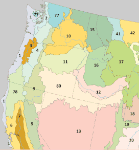
The Cascade Range or Cascades is a major mountain range of western North America, extending from southern British Columbia through Washington and Oregon to Northern California. It includes both non-volcanic mountains, such as many of those in the North Cascades, and the notable volcanoes known as the High Cascades. The small part of the range in British Columbia is referred to as the Canadian Cascades or, locally, as the Cascade Mountains. The highest peak in the range is Mount Rainier in Washington at 14,411 feet (4,392 m).

<span class="mw-page-title-main">Olympic Mountains</span> Mountain range in Washington, United States

The Olympic Mountains are a mountain range on the Olympic Peninsula of the Pacific Northwest of the United States. The mountains, part of the Pacific Coast Ranges, are not especially high – Mount Olympus is the highest summit at 7,980 ft (2,432 m); however, the eastern slopes rise precipitously out of Puget Sound from sea level, and the western slopes are separated from the Pacific Ocean by the low-lying 20 to 35 km wide Pacific Ocean coastal plain. These densely forested western slopes are the wettest place in the 48 contiguous states. Most of the mountains are protected within the bounds of Olympic National Park and adjoining segments of the Olympic National Forest.

<span class="mw-page-title-main">Mount Baker–Snoqualmie National Forest</span> Protected area in the United States

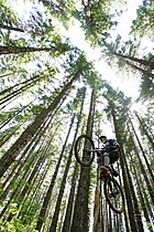
The Mount Baker–Snoqualmie National Forest in Washington is a National Forest extending more than 140 miles (230 km) along the western slopes of the Cascade Range from the Canada–US border to the northern boundary of Mount Rainier National Park. Administered by the United States Forest Service, the forest is headquartered in Everett. There are local ranger district offices in North Bend and Skykomish.

<span class="mw-page-title-main">North Cascades</span> Mountain range in Canada and the United States

The North Cascades are a section of the Cascade Range of western North America. They span the border between the Canadian province of British Columbia and the U.S. state of Washington and are officially named in the U.S. and Canada as the Cascade Mountains. The portion in Canada is known to Americans as the Canadian Cascades, a designation that also includes the mountains above the east bank of the Fraser Canyon as far north as the town of Lytton, at the confluence of the Thompson and Fraser Rivers.

<span class="mw-page-title-main">Alpine Lakes Wilderness</span> Wilderness area in Washington (state)

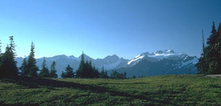
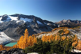
The Alpine Lakes Wilderness is a large wilderness area spanning the Central Cascades of Washington state in the United States. The wilderness is located in parts of Wenatchee National Forest and Snoqualmie National Forest, and is approximately bounded by Interstate 90 and Snoqualmie Pass to the south and U.S. Route 2 and Stevens Pass to the north. The Alpine Lakes is the largest wilderness area near the population centers of Puget Sound, counted at 414,161 acres (167,605 ha) following the 2014 expansion.

<span class="mw-page-title-main">Norse Peak Wilderness</span> Wilderness area in central Washington

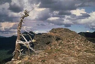
Norse Peak Wilderness is a 52,315-acre (21,171 ha) designated wilderness area located in central Washington in the United States. It protects the portion of the Cascade Range north of Chinook Pass, south of Naches Pass, and east of Mount Rainier National Park. It is bordered by the William O. Douglas Wilderness to the south. The wilderness is named for a prominent peak which overlooks Crystal Mountain Ski Area. Roughly triangular, it is about 10 miles (16 km) across and contains no roads.

<span class="mw-page-title-main">Three Sisters (Oregon)</span> Three volcanic peaks in Oregon, U.S.

The Three Sisters are closely spaced volcanic peaks in the U.S. state of Oregon. They are part of the Cascade Volcanic Arc, a segment of the Cascade Range in western North America extending from southern British Columbia through Washington and Oregon to Northern California. Each over 10,000 feet in elevation, they are the third-, fourth- and fifth-highest peaks in Oregon. Located in the Three Sisters Wilderness at the boundary of Lane and Deschutes counties and the Willamette and Deschutes national forests, they are about 10 miles south of the nearest town, Sisters. Diverse species of flora and fauna inhabit the area, which is subject to frequent snowfall, occasional rain, and extreme temperature variation between seasons. The mountains, particularly South Sister, are popular destinations for climbing and scrambling.

<span class="mw-page-title-main">Umpqua National Forest</span> United States national forest in Oregon

Umpqua National Forest, in southern Oregon's Cascade Range, covers an area of 983,129 acres (3,978.58 km2) in Douglas, Lane, and Jackson counties, and borders Crater Lake National Park. The four ranger districts for the forest are the Cottage Grove, Diamond Lake, North Umpqua, and Tiller ranger districts. The forest is managed by the United States Forest Service, headquartered in Roseburg.

<span class="mw-page-title-main">Rogue–Umpqua Divide Wilderness</span> Wilderness in the US

The Rogue–Umpqua Divide Wilderness is a wilderness area located in the Rogue River – Siskiyou and Umpqua National Forests in the Klamath Mountains of Oregon, United States. It was established by the United States Congress in 1984 and comprises 33,200 acres (13,400 ha).

<span class="mw-page-title-main">Mount Washington Wilderness</span>

The Mount Washington Wilderness is a wilderness area located on and around Mount Washington in the central Cascade Range of Oregon in the United States. The wilderness was established in 1964 and comprises 54,278 acres (219.66 km2) of the Willamette National Forest and Deschutes National Forest. It is administered by the U.S. Forest Service.

<span class="mw-page-title-main">Coast Range (EPA ecoregion)</span> Coastal ecoregion in the Western United States

The Coast Range ecoregion is a Level III ecoregion designated by the Environmental Protection Agency (EPA) in the U.S. states of Washington, Oregon, and California. It stretches along the Pacific Coast from the tip of the Olympic Peninsula in the north to the San Francisco Bay in the south, including Grays Harbor, Willapa Bay, and the Long Beach Peninsula in Washington, the entire length of the Oregon Coast, and the Northern California Coast. Named for the Coast Range mountains, it encompasses the lower elevations of the Olympic Mountains, the Oregon Coast Range, the Californian North Coast Ranges, and surrounding lowlands.

<span class="mw-page-title-main">Willamette Valley (ecoregion)</span> Temperate broadleaf and mixed forests ecoregion of the United States

The Willamette Valley ecoregion is a Level III ecoregion designated by the United States Environmental Protection Agency in the U.S. states of Oregon and Washington. Slightly larger than the Willamette Valley for which it is named, the ecoregion contains fluvial terraces and floodplains of the Willamette River system, scattered hills, buttes, and adjacent foothills. It is distinguished from the neighboring Coast Range, Cascades, and Klamath Mountains ecoregions by lower precipitation, lower elevation, less relief, and a different mosaic of vegetation. Mean annual rainfall is 37 to 60 inches, and summers are generally dry. Historically, the region was covered by rolling prairies, oak savanna, coniferous forests, extensive wetlands, and deciduous riparian forests. Today, it contains the bulk of Oregon's population, industry, commerce, and agriculture. Productive soils and a temperate climate make it one of the most important agricultural areas in Oregon.

<span class="mw-page-title-main">Eastern Cascades Slopes and Foothills</span> Temperate coniferous forests ecoregion of the United States

The Eastern Cascades Slopes and Foothills ecoregion is a Level III ecoregion designated by the United States Environmental Protection Agency (EPA) in the U.S. states of Oregon, Washington, and California. In the rain shadow of the Cascade Range, the eastern side of the mountains experiences greater temperature extremes and receives less precipitation than the west side. Open forests of ponderosa pine and some lodgepole pine distinguish this region from the Cascades ecoregion, where hemlock and fir forests are more common, and from the lower, drier ecoregions to the east, where shrubs and grasslands are predominant. The vegetation is adapted to the prevailing dry, continental climate and frequent wildfire. Volcanic cones and buttes are common in much of the region.

<span class="mw-page-title-main">Blue Mountains (ecoregion)</span> Temperate coniferous forests ecoregion of the United States

The Blue Mountains ecoregion is a Level III ecoregion designated by the United States Environmental Protection Agency (EPA) in the Pacific Northwest, mainly in the state of Oregon, with small areas over the state border in Idaho and southeastern Washington. It is also contiguous with the World Wildlife Fund's Blue Mountain forests ecoregion.

<span class="mw-page-title-main">Klamath Mountains (ecoregion)</span> Temperate coniferous forests ecoregion in northern California and southwestern Oregon

The Klamath Mountains ecoregion of Oregon and California lies inland and north of the Coast Range ecoregion, extending from the Umpqua River in the north to the Sacramento Valley in the south. It encompasses the highly dissected ridges, foothills, and valleys of the Klamath and Siskiyou Mountains. It corresponds to the Level III ecoregion designated by the Environmental Protection Agency and to the Klamath-Siskiyou forests ecoregion designated by the World Wide Fund for Nature.

<span class="mw-page-title-main">Northern Basin and Range ecoregion</span>

The Northern Basin and Range ecoregion is a Level III ecoregion designated by the United States Environmental Protection Agency (EPA) in the U.S. states of Oregon, Idaho, Nevada, Utah, and California. It contains dissected lava plains, rolling hills, alluvial fans, valleys, and scattered mountain ranges in the northern part of the Great Basin. Although arid, the ecoregion is higher and cooler than the Snake River Plain to the north and has more available moisture and a cooler climate than the Central Basin and Range to the south. Its southern boundary is determined by the highest shoreline of Pleistocene Lake Bonneville, which once inundated the Central Basin and Range. The western part of the region is internally drained; its eastern stream network drains to the Snake River system.

<span class="mw-page-title-main">Ecology of the North Cascades</span> Ecosystems of the Cascade mountain range in northern Washington state and southern British Columbia

The Ecology of the North Cascades is heavily influenced by the high elevation and rain shadow effects of the mountain range. The North Cascades is a section of the Cascade Range from the South Fork of the Snoqualmie River in Washington, United States, to the confluence of the Thompson and Fraser Rivers in British Columbia, Canada, where the range is officially called the Cascade Mountains but is usually referred to as the Canadian Cascades. The North Cascades Ecoregion is a Level III ecoregion in the Commission for Environmental Cooperation's classification system.

<span class="mw-page-title-main">Central Pacific coastal forests</span> Temperate coniferous forests ecoregion in Canada and the United States

The Central Pacific coastal forests is a temperate coniferous forest ecoregion located in the Canadian province of British Columbia and the U.S. states of Oregon and Washington, as defined by the World Wildlife Fund (WWF) categorization system.

<span class="mw-page-title-main">North Central Rockies forests</span> Temperate coniferous forest ecoregion in Canada and the United States

The North Central Rockies forests is a temperate coniferous forest ecoregion of Canada and the United States. This region overlaps in large part with the North American inland temperate rainforest and gets more rain on average than the South Central Rockies forests and is notable for containing the only inland populations of many species from the Pacific coast.

The Northwestern Forested Mountains is a Level I ecoregion of North America designated by the Commission for Environmental Cooperation (CEC) in its North American Environmental Atlas.

References

  1. 1 2 3 4 5 6 7 8 PD-icon.svg This article incorporates public domain material from Thorson, TD; Bryce, SA; Lammers, DA; et al. Ecoregions of Oregon (PDF). United States Geological Survey. (color poster with map, descriptive text, summary tables, and photographs; with a Reverse side ).
  2. 1 2 3 4 5 6 7 8 PD-icon.svg This article incorporates public domain material from Pater, D; Bryce, SA; Kagan, J; et al. Ecoregions of Western Washington and Oregon (PDF). United States Geological Survey. (color poster with map, descriptive text, summary tables, and photographs; with a Reverse side ).