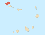
Paul is a concelho (municipality) of Cape Verde. Situated in the northeastern part of the island of Santo Antão, it covers 7% of the island area, and is home to 16% of its population. Its seat is the town Pombas.

Tarrafal is a concelho (municipality) of Cape Verde. It is situated in the northern part of the island of Santiago. Its seat is the town Tarrafal. Its population was 18,565 at the 2010 census, and its area is 120.8 km2.

Santa Catarina is a concelho (municipality) of Cape Verde. It is situated in the western part of the island of Santiago. Its seat is the city of Assomada. Its population was 45,920 in 2017 (estimate). Its area is 242.6 km2 (93.7 sq mi).

Mosteiros is a concelho (municipality) of Cape Verde. Situated in the northeastern part of the island of Fogo, it covers 19% of the island area, and is home to 26% of its population. Its seat is the city Mosteiros (Igreja). Its population was 9,524 at the 2010 census, and its area is 89.45 km2.

Ribeira Grande de Santiago is a concelho (municipality) of Cape Verde. It is situated in the southwestern part of the island of Santiago. Its seat is the city Cidade Velha. Its population was 8,325 at the 2010 census, and its area is 137.3 km².

São Lourenço dos Órgãos is a concelho (municipality) of Cape Verde. It is situated in the mountainous central part of the island of Santiago. Its seat is the city João Teves. Its population was 7,388 at the 2010 census, and its area is 36.9 km2. The municipality is bordered by Santa Cruz to the northeast, São Domingos to the south, Ribeira Grande de Santiago to the southwest and São Salvador do Mundo to the northwest. Pico de Antónia, the island's highest mountain, straddles the borders of São Lourenço dos Órgãos, São Salvador do Mundo and Ribeira Grande de Santiago.

São Salvador do Mundo is a concelho (municipality) of Cape Verde. It is situated in the central part of the island of Santiago. Its seat is the city Picos. Its population was 8,677 at the 2010 census, and its area is 26.5 km2, making it the smallest municipality of Cape Verde. The municipality borders Santa Cruz to the northeast, São Lourenço dos Órgãos to the southeast, Ribeira Grande de Santiago to the southwest and Santa Catarina to the northwest.

Tarrafal de São Nicolau is a concelho (municipality) of Cape Verde. Situated in the western part of the island of São Nicolau, it covers 35% of the island area (119.8 km²), and is home to 41% of its population. Its seat is the town Tarrafal de São Nicolau.

Nossa Senhora da Lapa is a freguesia of Cape Verde. It covers the smaller northwestern part of the municipality of Ribeira Brava, on the island of São Nicolau.

Nossa Senhora da Conceição is a freguesia of Cape Verde. It covers the southern part of the municipality of São Filipe, on the island of Fogo. The freguesia consists of the following settlements:

São Lourenço is a freguesia of Cape Verde. It covers the northern part of the municipality of São Filipe, on the island of Fogo. The parish has an area of 96 km². It is also a religious parish, its religious celebration is on August 10, day of Saint Lawrence.

Santíssimo Nome de Jesus is a freguesia of Cape Verde. It covers the eastern part of the municipality of Ribeira Grande de Santiago, on the island of Santiago.

São João Baptista is a freguesia of Cape Verde. It covers the western part of the municipality of Ribeira Grande de Santiago, on the island of Santiago.

Nossa Senhora do Livramento is a freguesia of Cape Verde. It covers the northern part of the municipality of Ribeira Grande, on the island of Santo Antão.

Santo Crucifixo is a freguesia of Cape Verde. It covers the southern part of the municipality of Ribeira Grande, on the island of Santo Antão. The seat of the parish is Coculi. The parish covers much of the Ribeira Grande valley.

Santo André is a freguesia of Cape Verde. It covers the smaller, northwestern part of the municipality of Porto Novo, on the island of Santo Antão.

São João Baptista is a freguesia of Cape Verde. It covers the larger, southern part of the municipality of Porto Novo, on the island of Santo Antão.

São Pedro Apóstolo is a freguesia of Cape Verde. It covers the western part of the municipality of Ribeira Grande, on the island of Santo Antão.

Nossa Senhora do Rosário is a freguesia of Cape Verde. It covers the larger eastern part of the municipality of Ribeira Brava, on the island of São Nicolau.

Ribeira Grande is the largest town of the Ribeira Grande Municipality on the island of Santo Antão, Cape Verde. It has become a city in 2010. In 2010 its population was 2,564. It is situated in the northeastern part of the island, near the outflow of the river Ribeira Grande and its tributary Ribeira da Torre into the Atlantic Ocean. Neighborhoods include Tarrafal, Rua de Agua, Rua d'Horta and Penha de França.


