Manistee County is a county located in the U.S. state of Michigan. As of the 2020 Census, the population was 25,032. The county seat is Manistee. The county is named for the Manistee River. Manistee County is part of Northern Michigan and has a shoreline on Lake Michigan.

Greilickville is an unincorporated community and census-designated place (CDP) in Leelanau County in the U.S. state of Michigan. At the 2020 census, the population was 1,634, up from 1,530 at the 2010 census. The community is located within Elmwood Charter Township, and is located in the extreme southeast of the Leelanau Peninsula.

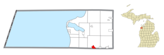
Eastlake is a village in the U.S. state of Michigan. The population was 415 at the 2020 census. Located within Manistee County, the village sits across Manistee Lake from the city of Manistee.
Filer Charter Township is a charter township of Manistee County in the U.S. state of Michigan. The population was 2,318 at the 2020 census.

Manistee is a city in the U.S. state of Michigan. Located in southwestern Manistee County, it is part of the northwestern Lower Peninsula. Manistee is the county seat of Manistee County, and its population was 6,259 at the 2020 census. This makes Manistee the fifth-largest city in Northern Michigan.
Manistee Township is a civil township of Manistee County in the U.S. state of Michigan. The population was 4,022 at the 2020 census.
Pleasant Hill is an unincorporated community and census-designated place (CDP) in Lebanon County, Pennsylvania, United States. The population was 2,643 at the 2010 census, up from 2,301 at the 2000 census.
Seven Oaks is a census-designated place (CDP) in Lexington County, South Carolina, United States, 8 miles (13 km) northwest of downtown Columbia, the state capital. The population of the CDP was 15,144 at the 2010 census. It is part of the Columbia Metropolitan Statistical Area.
Arcadia is an unincorporated community and census-designated place (CDP) in Arcadia Township, Manistee County, Michigan, United States. Its population was 309 as of the 2020 census. The community is located along M-22 and the Lake Michigan shore. Arcadia has a post office with ZIP code 49613.

Brethren is an unincorporated community and census-designated place (CDP) in the U.S. state of Michigan. The community is located within Dickson Township, Manistee County, and is in the Northern Lower Peninsula of Michigan. The community had a population of 331 at the 2020 census, down from 410 in 2010. The community is located in the Manistee National Forest, 18 miles (29 km) northeast of Manistee. Brethren has a post office with ZIP code 49619.

Elm Hall is an unincorporated community and census-designated place (CDP) in Gratiot County in the U.S. state of Michigan. The CDP had a population of 279 at the 2020 census. The community is located within Sumner Township.

Cedar is an unincorporated community and census-designated place in Leelanau County in the U.S. State of Michigan. The CDP had a population of 102 at the 2020 census. Cedar is located within Solon Township, and lies about 10 miles (16 km) northwest of Traverse City. The town is known for its Polish heritage, and is home to an annual polka festival.
Fivepointville is an unincorporated community and census-designated place (CDP) in Brecknock Township, Lancaster County, Pennsylvania, United States. As of the 2010 census, the population was 1,156. The town is named for its position at an intersection of five separate roads.

Ponshewaing is an unincorporated community and census-designated place (CDP) in Emmet County in the U.S. state of Michigan. As of the 2010 census, the CDP had a population of 69. It is located within Littlefield Township.

Oden is an unincorporated community and census-designated place (CDP) in Emmet County in the U.S. state of Michigan. As of the 2010 census, the CDP had a population of 363. It is located within Littlefield Township.
Crystal Mountain is an unincorporated community and census-designated place in Benzie County in the U.S. state of Michigan. The population was 59 at the 2020 census. Crystal Mountain is located within Weldon Township.
Filer City is an unincorporated community and census-designated place in Filer Charter Township, Manistee County, Michigan, United States. Its population was 136 as of the 2020 census. The community is located on Manistee Lake just south of Manistee. Filer City has a post office with ZIP code 49634. The post office opened March 10, 1868, was discontinued on April 12, 1871, and reopened on July 13, 1883.

Nessen City is an unincorporated community and census-designated place in Benzie County in the U.S. state of Michigan. The population was 97 at the 2010 census. Nessen City is located within Colfax Township.

Manistee Lake is an unincorporated community and census-designated place (CDP) in Kalkaska County in the U.S. state of Michigan. At the 2010 census, the CDP had a population of 456. Manistee Lake is located within Coldsprings Township to the north and a small portion extending south into Excelsior Township.

Salem Heights is an unincorporated community and census-designated place (CDP) in Columbiana County, Ohio, United States. It was first listed as a CDP prior to the 2020 census, in which its population was 336. Salem Heights sits on the 1,275-foot (389 m) Blackburn Hill, separated from the city of Salem by the valley of the Middle Fork of the Little Beaver Creek. It is part of the Salem micropolitan area.