Ocampo, Chihuahua

Last updated
Ocampo
Town
Calle en Melchor Ocampo, Chihuahua.jpg
Mexico States blank map.svg
Red pog.svg
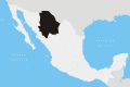
Ocampo
Location in Mexico
Coordinates: 28°11′36″N108°22′00″W / 28.19333°N 108.36667°W / 28.19333; -108.36667
CountryFlag of Mexico.svg  Mexico
State Chihuahua
Municipality Ocampo
Population
 (2010)
  Total527

Melchor Ocampo, more commonly simply Ocampo is a town and seat of the municipality of Ocampo, in the northern Mexican state of Chihuahua. [1] As of 2010, the town had a population of 527. [2]

Originally settled as Jesús María, in 1861 it changed its name to honour recently assassinated Melchor Ocampo.

Related Research Articles

Ocampo may refer to:

<span class="mw-page-title-main">Lázaro Cárdenas, Michoacán</span> City in Michoacán, Mexico

Lázaro Cárdenas is a port city in Michoacán bordered to the east by Guerrero. Lázaro Cárdenas is located in the southern part of the Mexican state of Michoacán. It was formerly known as Los Llanitos, but changed its name as a tribute to Lázaro Cárdenas del Río, a Michoacán-born politician who was president of Mexico from 1934 to 1940.

<span class="mw-page-title-main">Cerralvo Municipality</span> Municipality in Nuevo León, Mexico

Cerralvo, sometimes known as Ceralvo, is a municipality situated in the Mexican state of Nuevo León. Cerralvo is located in the northeastern region of Nuevo León, in the Gulf Coastal Plain and in the northeastern agricultural and ranching economic zone that also includes the municipalities of Agualeguas, General Treviño, Melchor Ocampo, and Parás. It borders the municipality of Agualeguas to the north, the municipality of Higueras to the west, the municipality of Doctor González to the southwest, the municipality of Los Ramones to the south, and the municipalities of Los Herreras, Melchor Ocampo, and General Treviño to the east.

Ciudad Ocampo in Ocampo Municipality in the Mexican state of Tamaulipas was founded on May 19, 1749 as Villa of Santa Bárbara; the town became known as Ocampo in 1869. The credit for the founding of Santa Barbara is given to Don José Escandón y Helguera. It is at the southern border of the state, among the Sierra Madre Oriental Mountains. Surrounded by green mountains and hundreds of farms, it is known as "El Vergel de Tamaulipas", the Orchard of Tamaulipas. The name Ocampo is so named in honor of the reformist Melchor Ocampo.

Los Aldamas is a municipality located in the northeast part of the Mexican state of Nuevo León. Its geographic coordinates are 26°03′N99°11′W. It is bordered to the north by the state of Tamaulipas, to the south with the municipalities of Doctor Coss and China, to the east with the municipality of Dr. Coss, N.L and the state of Tamaulipas and to the west with the municipalities of General Treviño, Melchor Ocampo and Los Herreras, N.L.

Melchor Ocampo is a municipality located in the Mexican state of Nuevo León. It is named after Don Melchor Ocampo, who was Foreign Minister during the government of Benito Juárez.

Melchor may refer to:

Ocampo is a city located in the northwest region of the Mexican state of Guanajuato. The municipality has an area of 1,019.49 square kilometres and is bordered and to the south and east by San Felipe, to the north by the state of San Luis Potosí, to the west by the state of Jalisco. The municipality had a population of 23,500 inhabitants according to the 2010 census.

<span class="mw-page-title-main">Tultepec</span> Municipality in Mexico State, Mexico

Tultepec is a city and municipality located in State of Mexico, Mexico. It lies directly north of Mexico City in the northeastern part of the State of Mexico, making it part of the Greater Mexico City urban area. The name comes from Náhuatl meaning 'hill of the 'tule'. The census of 2005 reported a population of 57,586 for the city and 110,145 for the municipality as a whole.

<span class="mw-page-title-main">Tetela de Ocampo</span> Town in Puebla, Mexico

Tetela de Ocampo is a town in Tetela de Ocampo Municipality in the Sierra Norte region of the Mexican state of Puebla. "Tetela" is a name of Nahuatl origin, containing the elements tetl (hill) and tla (many): it thus means "place of many hills". Nahuas still inhabit the area.

<span class="mw-page-title-main">Melchor Ocampo</span> 19th-century Mexican lawyer and Liberal politician

Melchor Ocampo was a Mexican lawyer, scientist, and politician. A mestizo and a radical liberal, he was fiercely anticlerical, perhaps an atheist, and his early writings against the Catholic Church in Mexico gained him a reputation as a leading liberal thinker. Ocampo has been considered the heir to José María Luis Mora, the premier liberal intellectual of the early republic. He served in the administration of Benito Juárez and negotiated a controversial agreement with the United States, the McLane-Ocampo Treaty. The Mexican state where his hometown of Maravatío is located was later renamed Michoacán de Ocampo in his honor.

<span class="mw-page-title-main">Lagunas de Chacahua National Park</span>

The Lagunas de Chacahuan National Park, created in 1937, is a national park located in the Municipality of Villa de Tututepec de Melchor Ocampo in the Mexican state of Oaxaca, about 54 km west of Puerto Escondido, near a village called Zapotalito. It can be reached via Federal Highway 200 or by boat from Puerto Escondido. It is located between the towns of Santiago Jamiltepec and Puerto Escondido. The park encompasses 132.73 square kilometres, about 30 km² of which is taken by various lagoons such as the ‘’’Laguna de Chacahua,’’’ ‘’’Laguna de La Pastoria,’’’ and Laguna Las Salinas. There are various smaller lagoons that are connected by narrow channels. The rest of the park consists of dry land. The park has 10 different types of vegetation: “selva espinosa", swampland, deciduous, sub tropical broadleaf, mangroves, savannah, “bosque de galleria”, “tular”, palm trees, and coastal dunes. 246 species of flowers and 189 species of animals have been documented so far in the park. Birds such as storks, herons, wild ducks, blue-winged teals, pelicans, and spoonbills can be found here. Three species of turtles also visit the park to lay their eggs.

<span class="mw-page-title-main">Bejucal de Ocampo</span> Municipality in Chiapas, Mexico

Bejucal de Ocampo is a town and municipality in the Mexican state of Chiapas, in southern Mexico. It covers an area of 82 km². It was named in honor of Mexican lawyer Melchor Ocampo.

Maravatío is a municipality in the Mexican state of Michoacán, representing 1.17% of its land area, or 691.55 km2.

Julio Castellanos González was a Mexican painter and engraver.

Melchor Ocampo is a town and municipality in State of Mexico, Mexico. The municipality covers an area of 32.48 km².

<span class="mw-page-title-main">Santos Degollado</span> Mexican politician

José Santos Degollado Sánchez was a Mexican Liberal politician and military leader. He was raised by a priest in Michoacán and worked twenty years in the cathedral in Morelia. He became a Federalist in 1836 and entered politics in 1845 when he was elected to the Michoacán legislature in 1845. He replaced his close associate Melchor Ocampo as governor of Michoacán 27 March - 6 July 1848. He joined the Revolution of Ayutla. He became governor of Jalisco when the liberals successfully ousted Antonio López de Santa Anna. As with a number of rising Liberals, Degollado was not formally trained as a soldier, but gained military experience in the Revolution of Ayutla. He later fought for Benito Juárez's government. During Benito Juárez's presidency he served as Secretary of War and Navy and as Secretary of External Affairs. Degollado was a close friend of Guillermo Prieto and of Melchor Ocampo and fought by his side in many battles. Degollado was a resilient military leader, experiencing defeat after defeat in the Reform War that pitted the constitutional liberal government of Juárez against the conservatives. The army fielded by the conservatives was larger and better trained than the liberals' forces, but the liberals managed to achieve a stalemate for over two years and in the end triumphed. The liberal victory was not achieved by Degollado, who was in disgrace at the end of the war. Degollado was known as the "hero of defeats" for his ability to raise yet another army after yet another defeat. An experienced general who joined the liberal cause, General López Uraga, gave President Juárez a scathing assessment of the liberal army and Degollados's command of it. He had given everything he could to achieve a liberal victory, but his record of defeats meant his men were demoralized although continued to be loyal to him.

<span class="mw-page-title-main">Juquila District</span> District in Oaxaca, Mexico

Juquila District is located in the center of the Costa Region of the State of Oaxaca, Mexico, on the Pacific coast. It has an area of 5,055 km2. As of 2005 it had a total population of 134,365 of whom 33,106 spoke an indigenous language. Economic activities include agriculture and tourism. The Santuario (Sanctuary) de Juquila is a major attraction.

<span class="mw-page-title-main">Colonia Verónica Anzures</span> Neighborhood of Mexico City in Miguel Hidalgo

Colonia Verónica Anzures is a colonia of Mexico City located in the Miguel Hidalgo borough. The neighborhood is a residential area but it also houses some office buildings, most importantly the Torre Ejecutiva Pemex.

<span class="mw-page-title-main">Melchor Ocampo Municipality, Zacatecas</span> Municipality in Zacatecas, Mexico

Melchor Ocampo is a municipality in the Mexican state of Zacatecas, located approximately 250 kilometres (160 mi) north of Zacatecas City, the state capital. It is named after Melchor Ocampo.

References

  1. Instituto Nacional de Estadística y Geografía. Principales resultados por localidad 2005 (ITER). Retrieved on October 19, 2008
  2. "Ocampo". Catálogo de Localidades. Secretaría de Desarrollo Social (SEDESOL). Retrieved 23 April 2014.