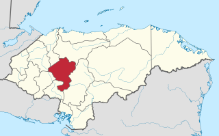
Comayagua is one of the 18 departments (departamentos) into which Honduras is divided. The departmental capital is Comayagua.

Candela is a city in the central region (Región Centro) of the northern Mexican state of Coahuila. It is the municipal seat of the surrounding municipality of Candela. There were 1,669 inhabitants in 2000. In 2011, according to Wolfram Alpha, it had a population of 1,672.

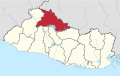
Chalatenango is a department of El Salvador, located in the northwest of the country. The capital is the city of Chalatenango. The Chalatenango Department encompasses 2,017 km² and contains more than 204,000 inhabitants. Las Matras Archaeological Ruins contains the relics of prehistoric populations and caves in which rock writing is found. The "5 de Noviembre" Hydroelectric Dam is found in Chalatenango Department, near the border with Cabañas. The highest point in the country, El Pital with an elevation of 2730.06 m, is also located in Chalatenango Department.

Las Vueltas is a municipality in the Chalatenango Department in the north of El Salvador. The municipality is bordered to the north by Ojos de Agua, to the east by Las Flores, to the south by Chalatenango, and to the northeast by Concepción Quezaltepeque. The territory covers 36.83 km² and the population was, as of 2005, of 2,101 inhabitants. For its administration, the municipality is divided into six cantones and 35 caseríos.
Agua Caliente is a municipality in the Chalatenango department of El Salvador.
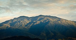
Cerro de la Muerte is the highest point in the Costa Rican section of the Inter-American Highway. Its name means "Mountain of Death" or "Summit of Death," since in the past crossing the mountains from the Valle Central meant a three- or four-day journey, on foot or on horseback, and many ill-prepared travelers succumbed to the cold and rain. However, the peak is now easily accessible since the highway runs close by.

Andalgalá is a central department of Catamarca Province in Argentina.
Access to drinking water and sanitation in El Salvador has been increased significantly. A 2015 conducted study by the University of North Carolina called El Salvador the country that has achieved the greatest progress in the world in terms of increased access to water supply and sanitation and the reduction of inequity in access between urban and rural areas. However, water resources are heavily polluted and the great majority of wastewater is discharged without any treatment into the environment. Institutionally a single public institution is both de facto in charge of setting sector policy and of being the main service provider. Attempts at reforming and modernizing the sector through new laws have not borne fruit over the past 20 years.
Ojo de Agua may refer to:

San Juan Bautista Tuxtepec, or simply referred to as Tuxtepec, is the head of the municipality by the same name and is the second most populous city of the Mexican state of Oaxaca. It is part of the Tuxtepec District of the Papaloapan Region. As of the 2005 census, the city is home to a population of 94,209 and 144,555 in the municipality, though census data are often under reported for various reasons. The municipality resides in the region called La Cuenca, is located 36 feet above sea level, and occupies an area of approximately 580 square miles (1,500 km2). The city itself is surrounded by the Papaloapan River, and lies a few kilometers south of the Cerro de Oro Dam on its tributary the Santo Domingo River. The municipality is bordered by the state of Veracruz in the north, the municipalities of Loma Bonita to the east and San José Chiltepec to the south. It is almost 100 miles (160 km) to the port of Veracruz, 130 miles (210 km) to Oaxaca City, the state capital, and 310 miles (500 km) to Mexico City.

Tlaxiaco is a city, and its surrounding municipality of the same name, in the Mexican state of Oaxaca. It is located in the Tlaxiaco District in the south of the Mixteca Region, with a population of about 17,450.

San Jose Ojos de Agua is a municipality is located in the department of Chalatenango in the North of El Salvador
Luvianos is a small town and municipality located in the southwest of the State of Mexico. It gained municipal status in 2000. People can access Luvianos by driving Federal Road 134 south from Toluca, and then take a detour about 25 minutes north of Tejupilco. The name is derived from a hacienda what was established during colonial times.
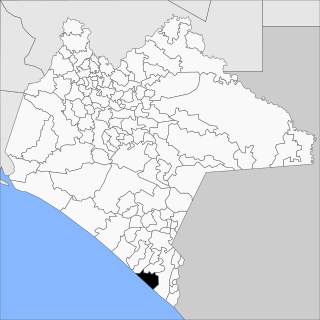
Villa Mazatán (Spanish pronunciation: [ˈβiʎa maθaˈtan] is one of the 122 municipalities in the state of Chiapas. It has an area of 386.6 km ² and is located in the southwestern Mexican state.

Atengo is both a small village and municipality of the region Sierra de Amula in the Mexican state Jalisco.

Ayotlán Municipality is a municipality, in Jalisco in central-western Mexico. The municipality covers an area of 518.57 km2.
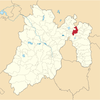
Tecámac is a municipality in State of Mexico in Mexico. The municipality covers an area of 157.34 km². The municipal seat lies in the town (locality) of Tecámac de Felipe Villanueva. Its largest town, Ojo de Agua, with a population of 242,283 inhabitants, is the largest locality in Mexico that is not a municipal seat.

Mexibús is a bus rapid transit (BRT) system that is located in the Greater Mexico City part of the State of Mexico, which surrounds Mexico City proper through 97 stations.
Events from the year 1915 in Mexico.

Queréndaro is one of the 113 municipalities that make up the state of Michoacán, Mexico. The word Queréndaro is of Chichimeca origin and means "place of rocks", from the great rock in the municipality known as "La Peña Rajada". It contains a cave with paintings that date from the pre-Hispanic era.