
The Derwent is a river in Derbyshire, England. It is 50 miles (80 km) long and is a tributary of the River Trent, which it joins south of Derby. Throughout its course, the river mostly flows through the Peak District and its foothills.

Bakewell is a market town and civil parish in the Derbyshire Dales district of Derbyshire, England, known also for its local Bakewell pudding. It lies on the River Wye, about 13 miles (21 km) south-west of Sheffield. In the 2011 census, the population of the civil parish appeared as 3,949. It was estimated at 3,695 in 2019. The town is close to the tourist attractions of Chatsworth House and Haddon Hall.

Matlock is the county town of Derbyshire, England. It is situated in the south-eastern part of the Peak District, with the National Park directly to the west. The town is twinned with the French town of Eaubonne. The former spa resort of Matlock Bath lies immediately south of the town on the A6. The civil parish of Matlock Town had a population in the 2011 UK census of 9,543. The population of the wider Matlock urban area is approximately 20,000.

Matlock Bath is a village and civil parish in Derbyshire, England. It lies in the Peak District, south of Matlock on the main A6 road, and approximately halfway between Buxton and Derby. The population of the civil parish as of the 2011 census was 753. Originally built at the head of a dead-end dirt road running alongside the valley of the River Derwent from Matlock itself, the locality developed in the 19th century as residential and a spa town and still thrives on tourism. Development is naturally very restricted owing to the steep hillsides, with the majority of buildings on one side of the valley with only footbridges across the river. The road was upgraded and made into a through-way, now designated A6, avoiding the previous old coaching road approach to Matlock from Cromford over very steep hills near to the Riber plateau area.

Derbyshire Dales is a local government district in Derbyshire, England. The population at the 2011 Census was 71,116. Much of it is in the Peak District, although most of its population lies along the River Derwent.

Darley Dale, also known simply as Darley, is a town and civil parish in the Derbyshire Dales district of Derbyshire, England, with a population of around 6,000. It lies north of Matlock, on the River Derwent and the A6 road. The town forms part of the urban area of Matlock and acts as a commuter town for workers there.

Cromford is a village and civil parish in Derbyshire, England, in the valley of the River Derwent between Wirksworth and Matlock. It is first mentioned in the 11th-century Domesday Book as Crumforde, a berewick of Wirksworth and this remained the case throughout the Middle Ages. The population at the 2011 Census was 1,433. It is principally known for its historical connection with Richard Arkwright, and the nearby Cromford Mill which he built outside the village in 1771. Cromford is in the Derwent Valley Mills World Heritage Site.
Peak Rail is a preserved railway in Derbyshire, England, which operates a steam and heritage diesel service for tourists and visitors to both the Peak District and the Derbyshire Dales.

Dethick, Lea and Holloway is a civil parish, in the Amber Valley borough of the English county of Derbyshire. The population of the civil parish taken at the 2011 census was 1,027.
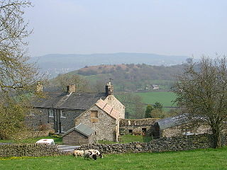
Wensley is a small village in South Darley parish in Derbyshire of limestone and gritstone properties mainly arranged along the single road which zig-zags through the village or around the square. The whole village, together with part of the adjacent Wensley Dale is a Conservation Area. Until fairly recently there was a Methodist Chapel, a village shop and two public houses, but these have all closed. The former school is now a village hall, Wensley Reading Room. Quite a few of the houses are holiday lets.

The Derwent Valley Heritage Way (DVHW) is a 55 miles (89 km) waymarked footpath along the Derwent Valley through the Peak District. The walk starts from Ladybower Reservoir in the Peak District National Park via Chatsworth, the scenery around the Derbyshire Dales, and through the Derwent Valley Mills World Heritage Site. It follows the Riverside Path through Derby and continues onwards to the historic inland port of Shardlow. Journey's end is at Derwent Mouth where the River Derwent flows into the River Trent.

Fenny Bentley is a small village and civil parish located close to Dovedale in the Derbyshire Dales district of Derbyshire, England. The population in 2009 was 305 reducing to 183 at the 2011 Census. It lies two miles north of Ashbourne, on the A515 Buxton to Ashbourne Road. It is one of the most southerly villages in the Peak District.

Darley Bridge is a village in Derbyshire, located in South Darley parish in the Derbyshire Dales, bordering the Peak District. The village lies at the bottom of the hill below Wensley where the road crosses the River Derwent. A grade II* listed stone bridge spans the river and links the village with Darley Dale. Close to the bridge, the road winds between terraced stone houses in the oldest part of the village. The only public house in the parish, The Three Stags Heads, is in this area.

South Darley is a civil parish in the Derbyshire Dales. It is a largely rural parish and covers the villages of Darley Bridge, Wensley and the hamlets of Oker and Snitterton. South Darley lies west of Matlock and east of Winster. The River Derwent forms the north-eastern boundary of South Darley parish with Darley Dale parish on the other bank. About two thirds of the parish lies within the Peak District.

Snitterton is a hamlet in Derbyshire, located in South Darley parish, of some fifteen properties including two working farms and Snitterton Hall, a late 16th century manor house which is Grade 1 listed. There are signs that it was once a larger village.

Northwood and Tinkersley is a civil parish within the Derbyshire Dales district, in the county of Derbyshire, England. Named for its main settlements, with a mix of rural and built up areas, it had a population of 665 residents in 2011. The parish is 126 miles (203 km) north west of London, 18 miles (29 km) north west of the county city of Derby, and 3+1⁄2 miles (5.6 km) south west of the nearest market town of Matlock. Northwood and Tinkersley is directly adjacent to the Peak District national park to the west, and shares a border with the parishes of Darley Dale, Rowsley and Stanton.

Holymoorside and Walton is a civil parish within the North East Derbyshire district, which is in the county of Derbyshire, England. Named for its main settlements, with a mix of a number of villages and hamlets amongst a large rural area, it had a population of 2,223 residents in 2011. The parish is 130 miles (210 km) north west of London, 20 miles (32 km) north of the county city of Derby, and 2 miles (3.2 km) south west of the nearest market town of Chesterfield. It is adjacent with the Peak District national park to the west, and shares a border with the district of Chesterfield, along with the parishes of Ashover, Beeley, Brampton as well as Wingerworth. The parish paradoxically does not include the majority of the nearby built-up suburb of Walton, Chesterfield which is now within an adjacent unparished area of the borough.

