Related Research Articles

Camden County is a county located in the U.S. state of Missouri. As of the 2010 Census, the population was 44,002. Its county seat is Camdenton. The county was organized on January 29, 1841 as Kinderhook County and renamed Camden County in 1843 after Charles Pratt, 1st Earl Camden, Lord Chancellor of the United Kingdom and leader of the British Whig Party.
Roach is an unincorporated community in southern Camden County, Missouri, United States. It is located north of U.S. Route 54 on Missouri Route AA, approximately five miles west of Camdenton and 2.5 miles west of the Niangua River arm of the Lake of the Ozarks.
Branch is an unincorporated community in southwestern Camden County, Missouri, United States. It is located on Route 73, approximately midway between U.S. Route 54 and Tunas. Branch formerly had a post office, but mail service is now provided from Macks Creek.

The Little Niangua River is a 64.4-mile-long (103.6 km) tributary of the Niangua River in the Ozarks region of central Missouri in the United States. Via the Niangua, Osage and Missouri rivers, it is part of the watershed of the Mississippi River. The Little Niangua was so named for its smaller size relative to the Niangua River.

Russell Township is one of eleven townships in Camden County, Missouri, USA. As of the 2000 census, its population was 2,495.
Bank Branch is a stream in Camden and Laclede counties in the U.S. state of Missouri. It is a tributary of the Niangua River within the Lake of the Ozarks. The stream passes through Ha Ha Tonka State Park just south of the lake.
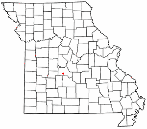
Hugo is an unincorporated community in southern Camden County, in the U.S. state of Missouri. The community is located approximately 3.5 miles east-southeast of Camdenton on Missouri Route V, just north of Missouri Route 7.
Neongwah is an unincorporated community in Camden County, in the U.S. state of Missouri. The community sits above the Niangua River arm of the Lake of the Ozarks. Missouri Route 5 passes just east of the community and Camdenton is three miles to the southeast.
Passover is an unincorporated community in Camden County, in the U.S. state of Missouri. The location is on a narrow peninsula, jutting north into the Grandglaize Creek Arm in the southeastern portion of the Lake of the Ozarks. The community is approximately three miles north of Missouri Route A on a county road.
Purvis is an unincorporated community in northern Camden County, in the U.S. state of Missouri. The community is located on the north shore of the Lake of the Ozarks. The Purvis cemetery is located to the southwest across the Brush Creek arm of the lake. The community of Laurie is located on Missouri Route 5 and is approximately two miles to the north, in Morgan County.
Wet Glaize is an unincorporated community in Camden County, in the Ozarks of central Missouri. The community is just east of Missouri Route 7 on Mill Creek, which is a tributary of the Wet Glaize Creek. Montreal is to the northwest on Route 7 and Richland is to the southeast. Mill Creek has a large fish hatchery in the vicinity of Wet Glaize.
Woolsey Creek is a stream in Camden and Laclede counties the Ozarks of south central Missouri. Woolsey Creek is a tributary to the Niangua River. The stream enters the Niangua just upstream (south) of Lake Niangua.
Corkery is an extinct town in Dallas and Laclede counties, in the U.S. state of Missouri. The GNIS classifies it as a populated place. The community area is located on a ridge surrounded on three sides by an entrenched meander of the Niangua River which is about 300 feet below the ridgetop. The location is only accessible by road from Laclede County.
Foose is an unincorporated community in western Dallas County, in the U.S. state of Missouri. The community lies on Missouri Route EE, just west of U.S. Route 65, approximately seven miles south-southwest of Buffalo. The Dallas-Polk county line is two miles west along Route EE. The community is at an elevation of 1207 feet and Greasy Creek, a tributary of the Niangua River, drains the area to the east of Route 65.
Jakes Creek is a stream in northeastern Dallas County in the U.S. state of Missouri. It is a tributary of the Niangua River.
Mill Creek is a stream in northern Dallas County in the Ozarks of southwest Missouri. It is a tributary of the Niangua River.
Thorpe is an unincorporated community in Dallas County, in the U.S. state of Missouri. The community lies just north of the Dallas-Webster county line, with Missouri Route W and the Niangua River passing about one mile to the east. The community lies approximately midway between Buffalo, eleven miles to the northwest and Marshfield, eleven miles to the southeast.
Spring Hollow Creek is a stream in Dallas and Laclede counties in the U.S. state of Missouri. It is a tributary of the Niangua River.
Susanna is an unincorporated community in northeastern Webster County, in the Ozarks of southwest Missouri.
Macks Creek is a stream in Dallas and Camden counties in the U.S. state of Missouri. It is a tributary of the Little Niangua River.
References
- ↑ U.S. Geological Survey Geographic Names Information System: Only, Missouri
- ↑ Macks Creek, MO, 7.5 Minute Topographic Quadrangle, USGS, 1982
- ↑ "Post Offices". Jim Forte Postal History. Retrieved 8 September 2016.
- ↑ "Camden County Place Names, 1928–1945 (archived)". The State Historical Society of Missouri. Archived from the original on 24 June 2016. Retrieved 8 September 2016.CS1 maint: BOT: original-url status unknown (link)
Municipalities and communities of Camden County, Missouri, United States | ||
|---|---|---|
| Cities |  | |
| Villages | ||
| Townships | ||
| CDPs | ||
| Other unincorporated communities | ||
| Footnotes | ‡This populated place also has portions in an adjacent county or counties | |
Coordinates: 37°55′00″N92°57′02″W / 37.91667°N 92.95056°W
| This Camden County, Missouri state location article is a stub. You can help Wikipedia by expanding it. |