Related Research Articles

Baron Templemore, of Templemore in the County of Donegal, is a title in the Peerage of the United Kingdom, since 1975 a subsidiary title of the Marquessate of Donegall. It was created on 10 September 1831 for Arthur Chichester, Member of Parliament for Milborne Port and County Wexford. He was the son of Lord Spencer Stanley Chichester, third son of The 1st Marquess of Donegall. Lord Templemore's son, the second Baron, and grandson, the third Baron, both served as Deputy Lieutenants of County Wexford. The latter was succeeded by his eldest son, the fourth Baron. He served as the Government Chief Whip in the House of Lords between 1940 and 1945. He was succeeded by his second but eldest surviving son, the fifth Baron. In 1975 he succeeded his kinsman as seventh Marquess of Donegall. For further history of the titles, see Marquess of Donegall.
Sir William Jardine, 7th Baronet of Applegarth FRS FRSE FLS FSA was a Scottish naturalist. He is known for his editing of a long series of natural history books, The Naturalist's Library.
Ordnance Survey Ireland was the national mapping agency of the Republic of Ireland. It was established on 4 March 2002 as a body corporate. It was the successor to the former Ordnance Survey of Ireland. It and the Ordnance Survey of Northern Ireland (OSNI) were themselves the successors to the Irish operations of the British Ordnance Survey. OSI was part of the Irish public service. OSI was headquartered at Mountjoy House in the Phoenix Park in Dublin, which had previously been the headquarters of the British Ordnance Survey in Ireland until 1922.

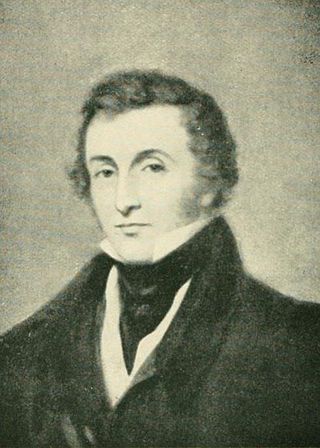
Major-General Joseph Ellison Portlock was born at Gosport and was a British geologist and soldier, the only son of Nathaniel Portlock, and a captain in the Royal Navy.

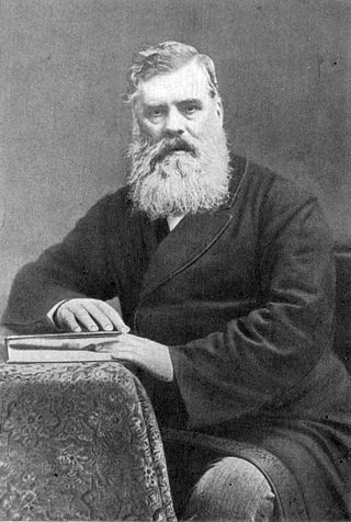
William Thompson was an Irish naturalist celebrated for his founding studies of the natural history of Ireland, especially in ornithology and marine biology. Thompson published numerous notes on the distribution, breeding, eggs, habitat, song, plumage, behaviour, nesting and food of birds. These formed the basis of his four-volume The Natural History of Ireland, and were much used by contemporary and later authors such as Francis Orpen Morris.
Thomas Oldham was an Anglo-Irish geologist.

John O'Donovan, from Atateemore, in the parish of Kilcolumb, County Kilkenny, and educated at Hunt's Academy, Waterford, was an Irish language scholar from Ireland.

Petalodus is an extinct genus of cartilaginous fish from the Pennsylvanian to the Permian, known from subtriangular to rhomboidal teeth. The genus was named by Richard Owen in 1840 and the type species is Petalodus hastingsii. The only dubious species within this genus is P. securiger.
William Reeves was an Irish antiquarian and the Church of Ireland Bishop of Down, Connor and Dromore from 1886 until his death. He was the last private keeper of the Book of Armagh and at the time of his death was President of the Royal Irish Academy.

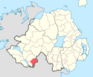
The North West Liberties of Londonderry is a barony in County Londonderry, Northern Ireland. It is bordered by two other baronies in Northern Ireland: Tirkeeran to the east, across Lough Foyle, and Strabane Lower to the south. It also borders two baronies in County Donegal in the Republic of Ireland. It borders Raphoe North, to the south-west; and Inishowen West to the north.
Clankelly is a barony in County Fermanagh, Northern Ireland. It is the only barony in County Fermanagh not connected to Lough Erne. It is bordered by two other baronies in Northern Ireland: Coole to the south-west; and Magherastephana to the north-west. It also borders two baronies in the Republic of Ireland: Monaghan to the north-east; and Dartree to the south-east.
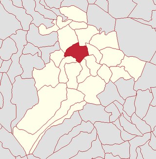
Calmore is a townland lying within the civil parish of Kilcronaghan, County Londonderry, Northern Ireland. It lies in the north-west of the parish, and is bounded by the townlands of; Granny, Moneyshanere, Moyesset, and Tobermore. It was apportioned to the Drapers company as well as Crown freeholds.

Clooney is a townland lying within the civil parish of Kilcronaghan, County Londonderry, Northern Ireland. It lies in north-east of the parish and is bounded in the north by the Moyola River as well as the parish of Termoneeny. It is bounded by the following townlands; Ballynahone Beg, Ballynahone More, Gortamney, Moyesset, and Tobermore. It was apportioned to the Drapers company as well as freeholds.

Cullyleenan is a townland in the Parish of Tomregan, Barony of Tullyhaw, County Cavan, Ireland.

Gleninagh or Glaninagh is a civil parish in County Clare, Ireland. It lies in the extreme northwest of the Burren, on the south of the mouth of Galway Bay. It is known for the well-preserved L-plan Gleninagh Castle, a 16th-century tower house. The parish also contains the lighthouse on Black Head.

Occidens is an extinct genus of stem tetrapod from the Early Carboniferous (Tournaisian) Altagoan Formation of Northern Ireland. It is known from a single type species, Occidens portlocki, named in 2004 on the basis of a left lower jaw described by British geologist Joseph Ellison Portlock in 1843.
O'Rourke's Castle is a ruined castle in Ireland. It was situated in the centre of Leitrim Village c. 30m from the N bank of the Ballinamore and Ballyconnell canal, which at this point is a canalised stream, and c. 400m from its junction with the River Shannon.
John Graham (1774–1844) was a Church of Ireland clergyman, a senior officer of the Orange Order, and a prolific author of poetic and historical works. He opposed Catholic Emancipation and was for more than two decades a prominent champion of the Protestant cause in Ireland.
The Burn Dale is a burn or small river in the east of County Donegal in Ulster, the northern province in Ireland. The burn is also known in English as the Dale Burn, the Burn Deele, the Burndale River, the Deele River or the River Deele. In the Ulster Scots dialect, a 'burn' is a stream or small river.
References
Sources
- Andrews, John Harwood (2002). "Topography Ancient and Modern". A Paper Landscape: The Ordnance Survey in Nineteenth-century Ireland. Four Courts Press. pp. 144–179. ISBN 978-1-85182-664-3.
- Mitchell, Brian (1996). "The Ordnance Survey Memoirs: A Source for Emigration in the 1830s". History Ireland. 4 (4): 13–17. ISSN 0791-8224. JSTOR 27724396 . Retrieved 13 April 2020.
- Nolan, William (1997). "Ordnance Survey Letters by John O'Donovan and Eugene Curry, 1839: Introduction". Clare County Library. Retrieved 13 April 2020.
- "Ordnance Survey of Ireland Archive". Royal Irish Academy. 7 September 2015. Retrieved 13 April 2020.
Citations
- ↑ Portlock, Joseph Ellison (1843). Report on the Geology of the County of Londonderry, and of Parts of Tyrone and Fermanagh. A. Milliken. Retrieved 13 April 2020.
- ↑ Memoir of the City and North Western Liberties of Londonderry — Parish of Templemore. Dublin: Hodges. 1837. Retrieved 13 April 2020.
- ↑ Report of the Commissioners appointed to inquire into the facts relating to the ordnance memoir of Ireland. Parliamentary Papers. Vol. HC 1844 XXX (527). London: HMSO. 1844. Retrieved 13 April 2020.
- ↑ "Ordnance Survey of Ireland: Letters". Ask About Ireland. Retrieved 13 April 2020.
- ↑ Murphy, Meadhbh (24 September 2024). "OS200: Spotlight on the Ordnance Survey Memoirs". Royal Irish Academy. Retrieved 15 January 2025.