Orient, Washington | |
|---|---|
 Orient School | |
 Orient  Orient | |
| Coordinates: 48°52′00″N118°12′21″W / 48.86667°N 118.20583°W | |
| Country | United States |
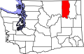
| State | Washington |
| County | Ferry |
| Area | |
• Total | 0.43 sq mi (1.1 km2) |
| • Land | 0.43 sq mi (1.1 km2) |
| Elevation | 1,473 ft (449 m) |
| Population (2014)estimate | |
• Total | 113 |
| • Density | 262/sq mi (101/km2) |
| Time zone | UTC-8 (Pacific (PST)) |
| • Summer (DST) | UTC-7 (PDT) |
| ZIP code | 99160 |
| Area code | 509 |
| GNIS feature ID | 2586743 [1] |
Orient is a small census designated place [1] in northeastern Ferry County, Washington, United States. The Kettle River flows to the east of the town and marks the border with Stevens County. A BNSF rail line runs through the town alongside U.S. Route 395. The population at the 2010 census was 115. [2]